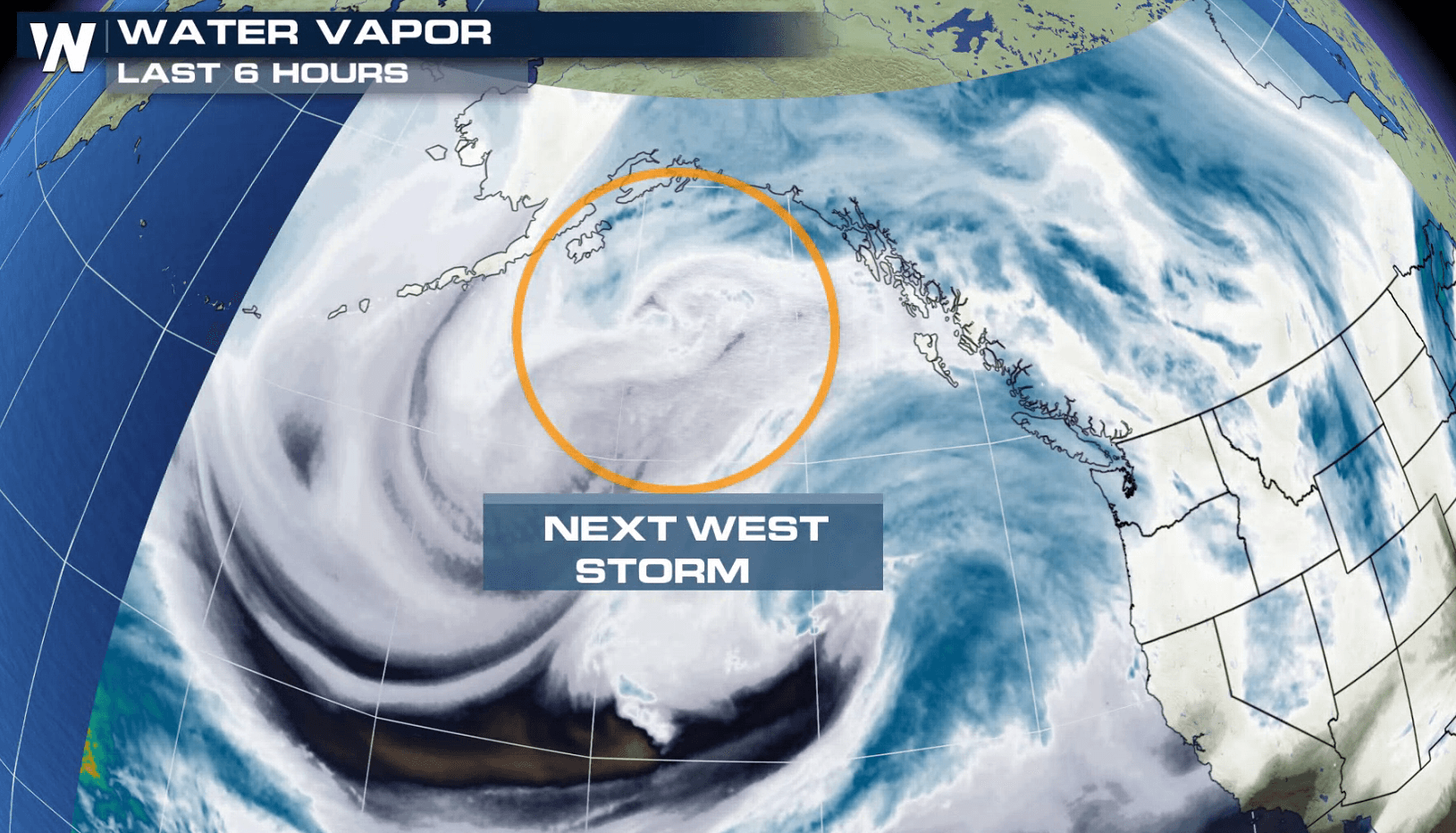
Another System Ready to Move into the West
Special Stories
22 Jan 2018 5:03 PM
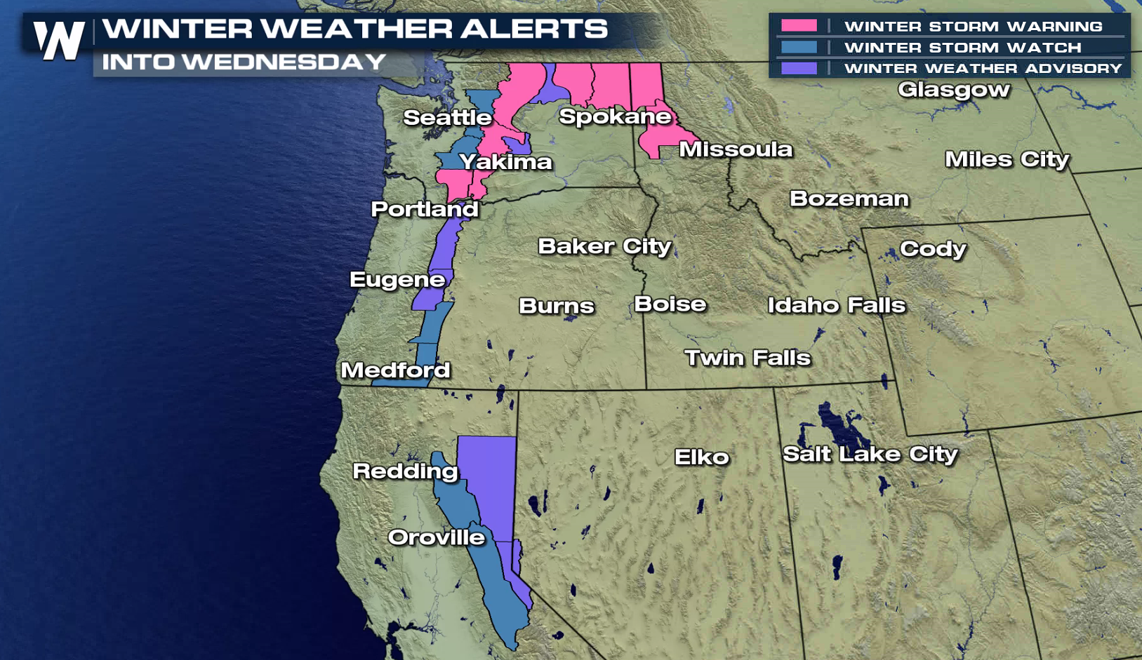
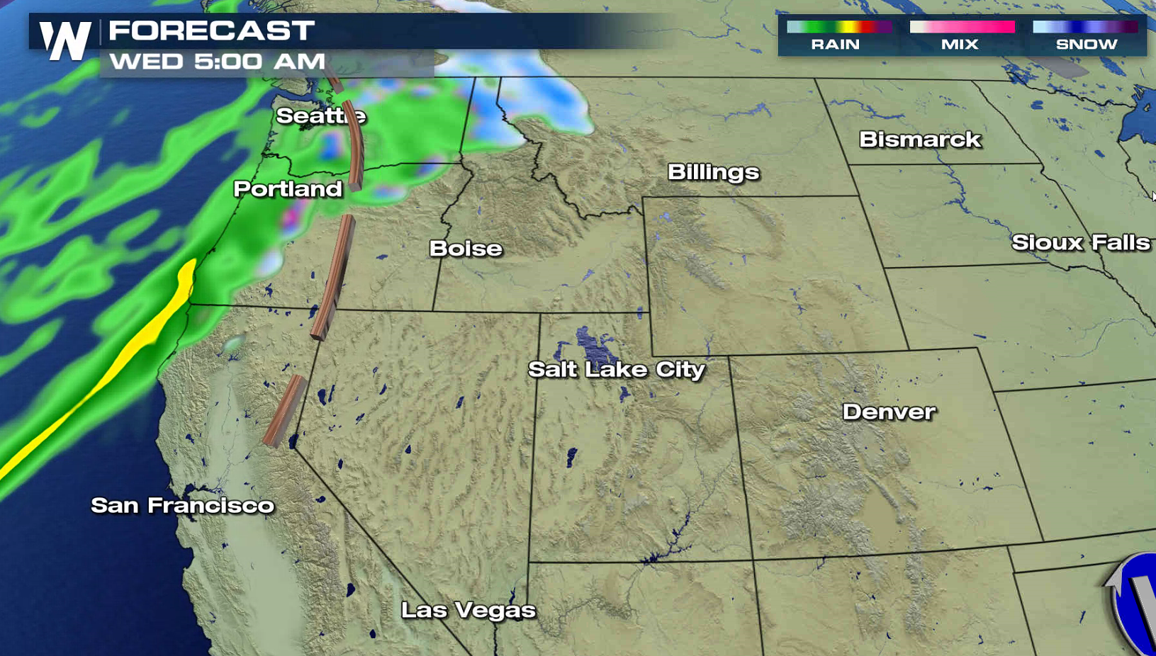
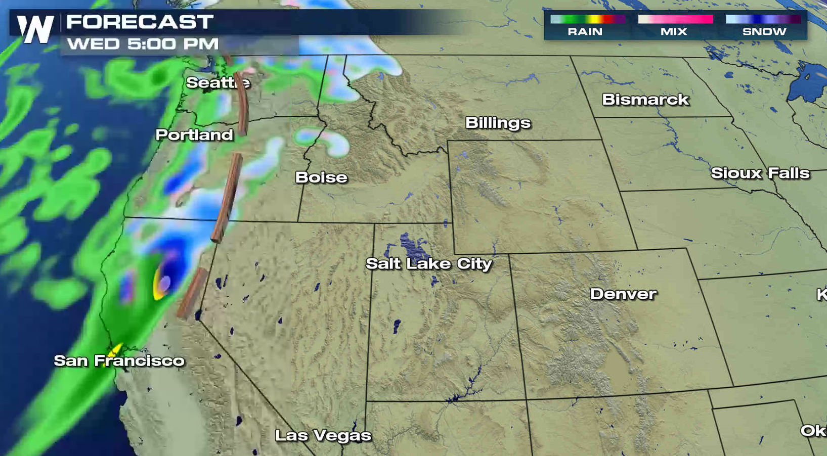
As a intense low dumps big snows and produces blizzard conditions in the Plains, another system is ready to move into the nation. Winter storm alerts have already been issued for the Cascades and Sierra Nevada. 1 to 2 feet of snow is possible in most of the higher elevations, with several feet possible over the highest peaks. Wind gusts of 40 to 60 mph are possible, which will create blowing and drifting snow and white out conditions.
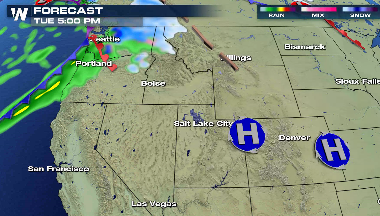
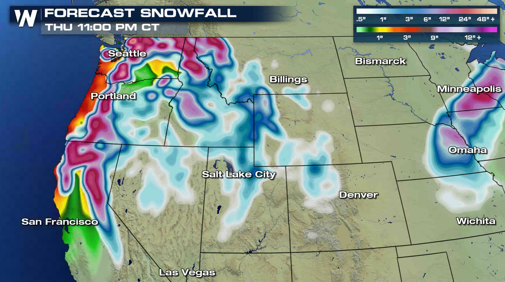 The storm system will slide into the Pacific Northwest on Tuesday, bringing the first wave of snow. The snow will spread into the southern Cascades and Sierra Nevada by Wednesday. Travel will be difficult as the snow becomes heavy.
 For WeatherNation: Meteorologist Mace Michaels
The storm system will slide into the Pacific Northwest on Tuesday, bringing the first wave of snow. The snow will spread into the southern Cascades and Sierra Nevada by Wednesday. Travel will be difficult as the snow becomes heavy.
For WeatherNation: Meteorologist Mace MichaelsAll Weather News
More
Weekend Forecast: More Severe Weather in the Plains
We are looking at the threat of another sever
25 Apr 2024 1:20 AM

Record Warmth to Weekend Snow in the Four Corners
Snow is in the forecast for Denver, which cou
25 Apr 2024 1:20 AM
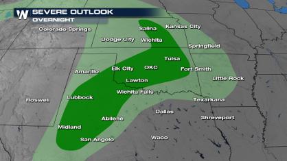
Overnight Storms in Texas and Oklahoma
The plains are experiencing an ongoing threat
25 Apr 2024 1:10 AM
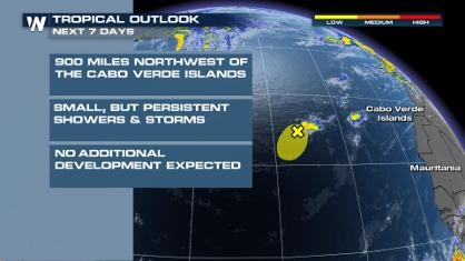
Tropical Update: Early Area of Interest in the Atlantic
The National Hurricane Center has issued a tr
25 Apr 2024 12:30 AM

National Park Week: Get Out and Explore
National Park Week started Saturday, April 20
25 Apr 2024 12:20 AM

NOAA Debuts "HeatRisk" Tool Nationwide
More people die from heat every year than ALL
24 Apr 2024 7:40 PM