High Plains Severe Weather Risk to Start The Week
Special Stories
16 Jul 2018 11:36 AM
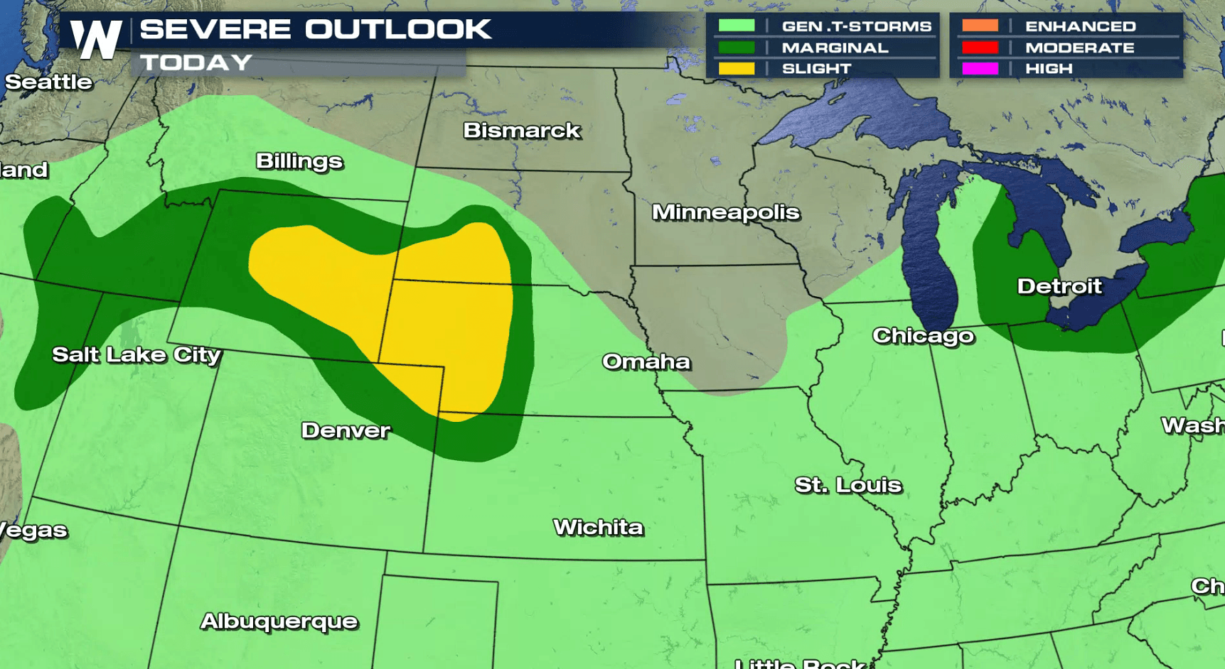
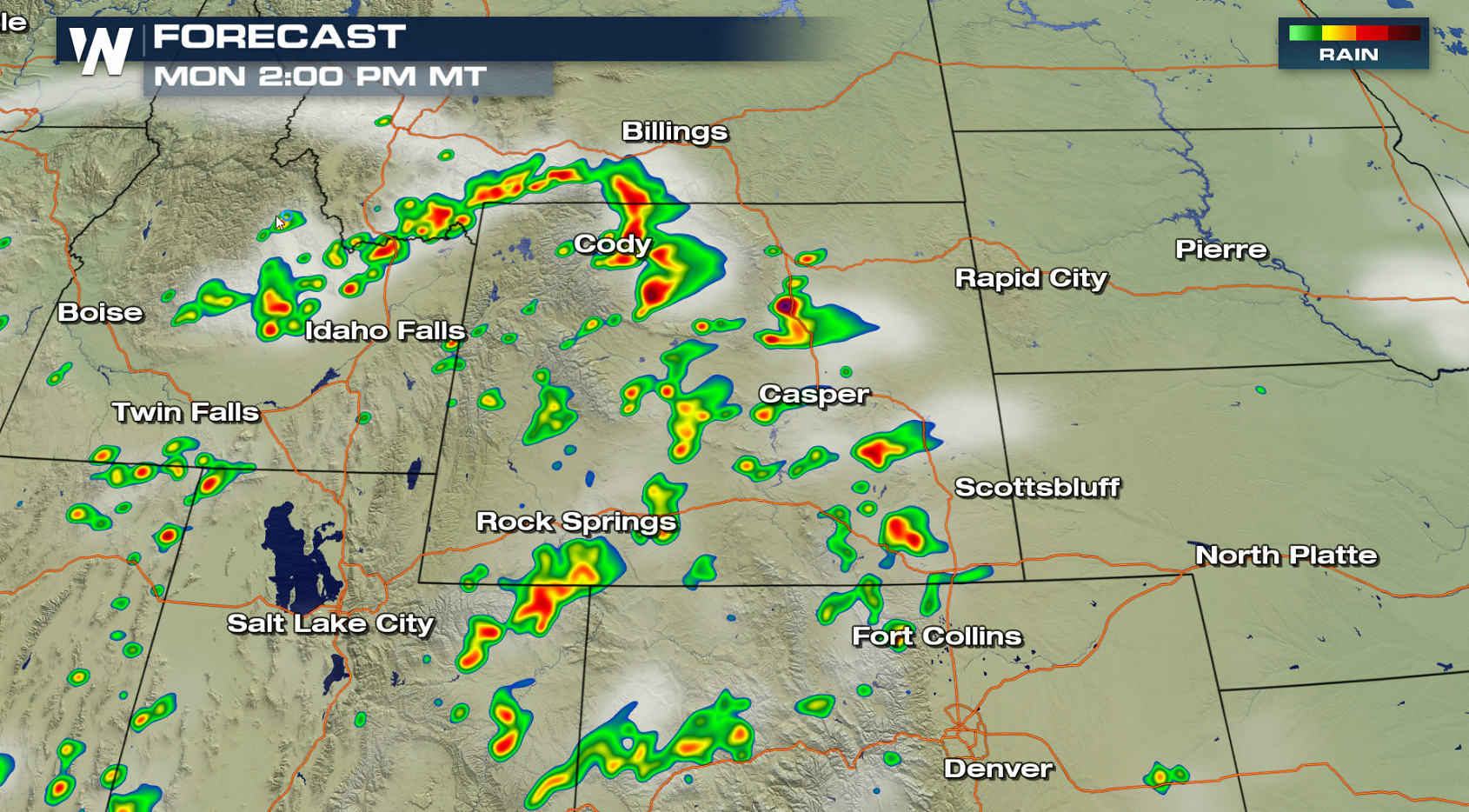
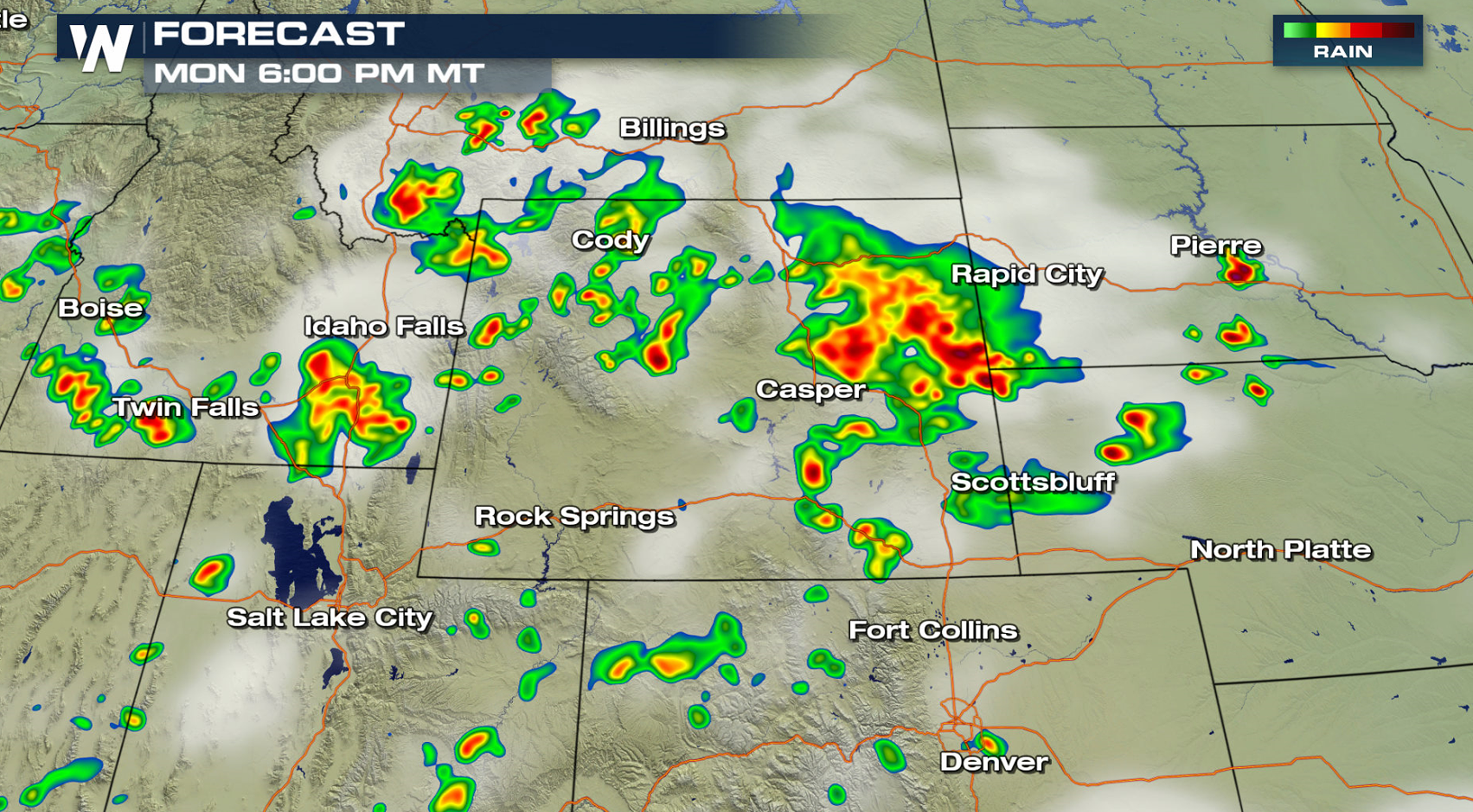
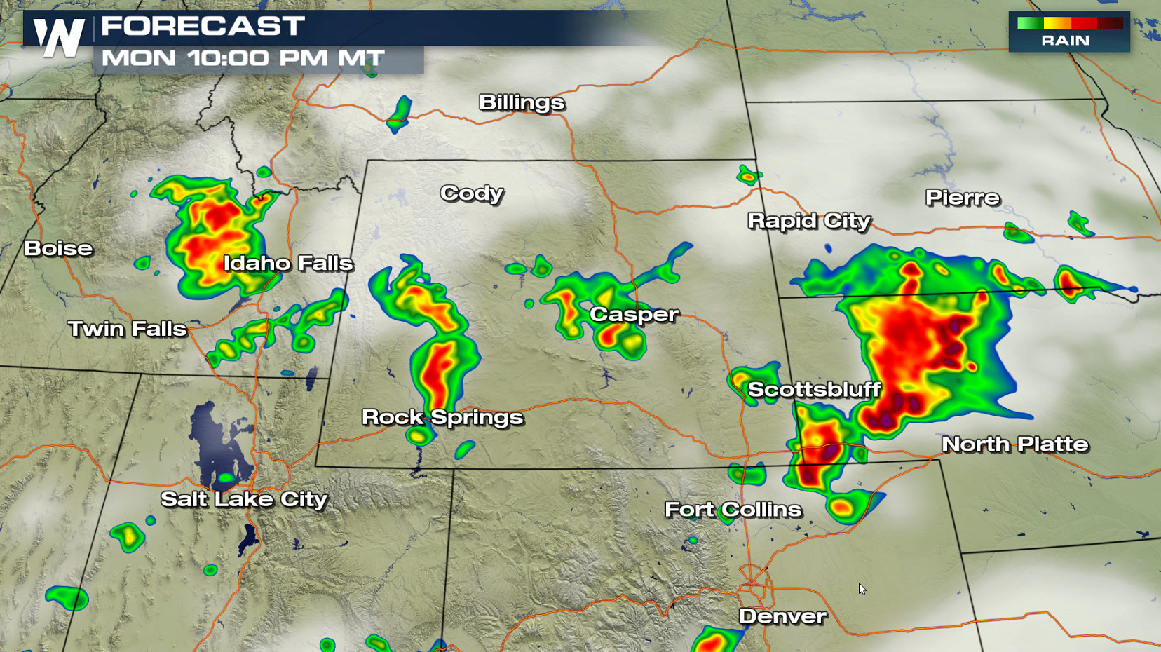
A storm system pushing out of the High Plains will bring a chance for severe thunderstorms later this afternoon and evening (Monday). A slight risk for severe thunderstorms extends from Wyoming to South Dakota and Kansas. Large hail and strong wind gusts are the biggest threats, with a low chance for a tornado.
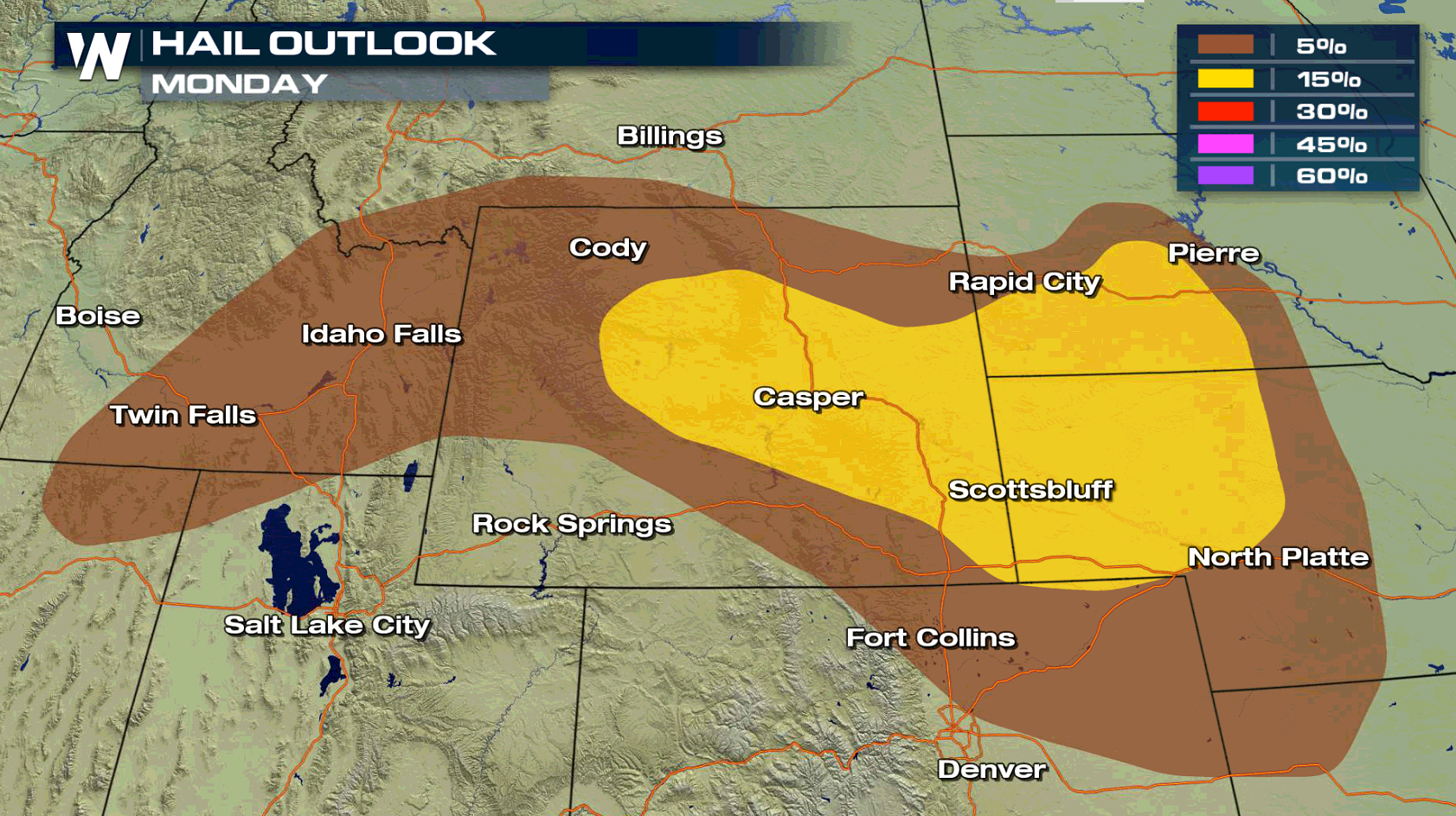
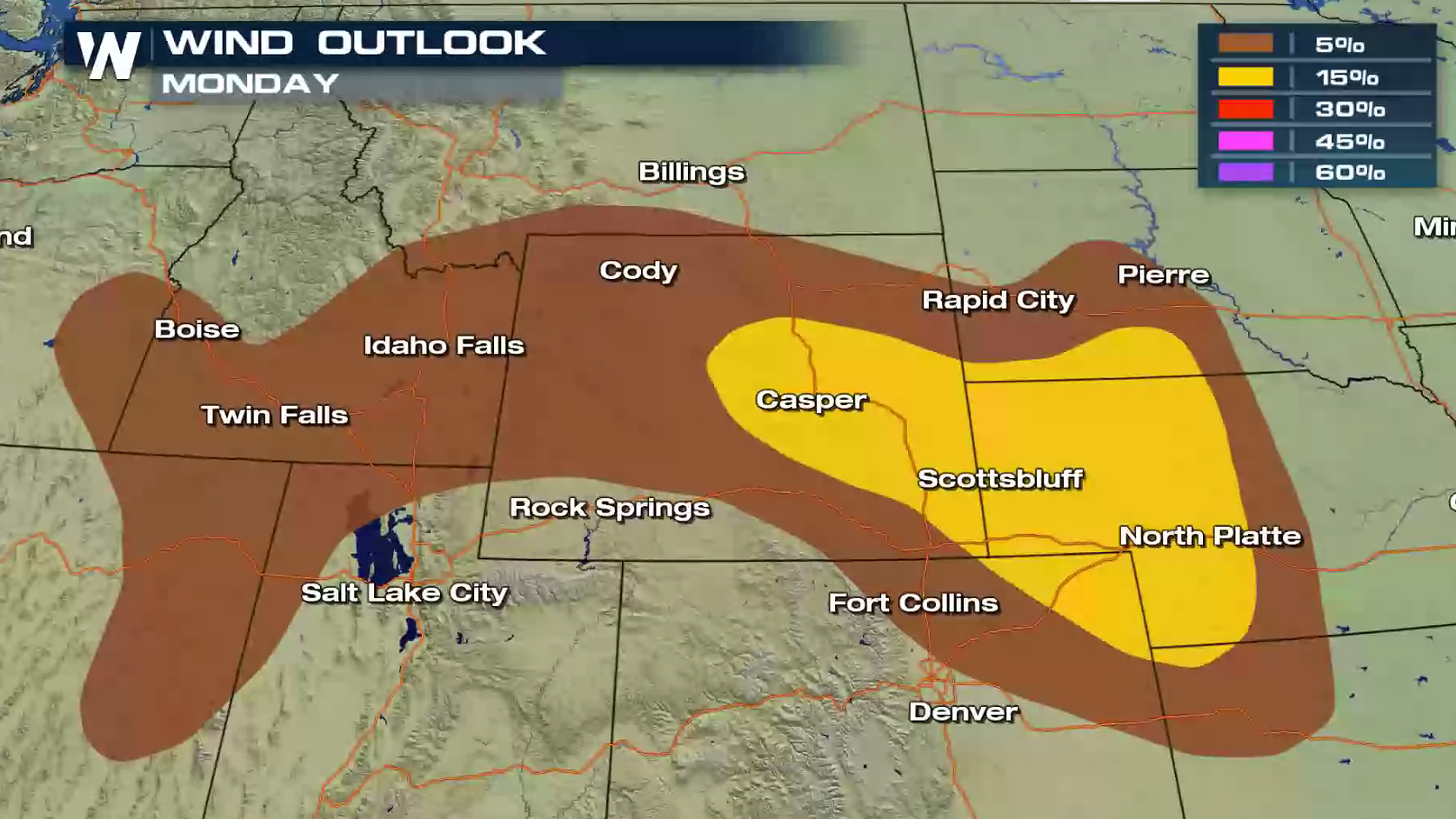
 A few storms will pop-up throughout the afternoon, with storm coverage becoming more widespread in the later afternoon and evening. Intensity will increase as well, as heat and humidity continues to build throughout the day.
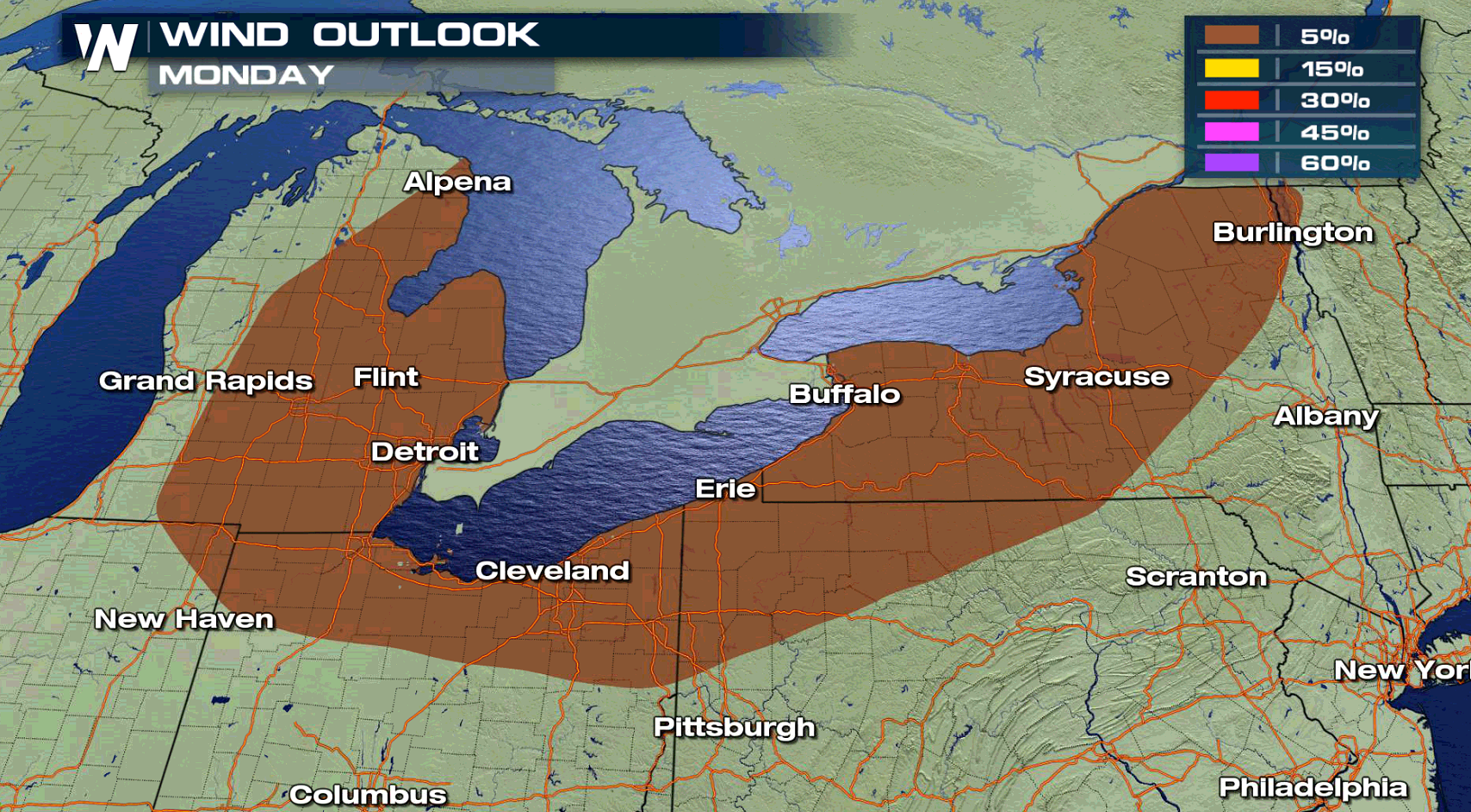
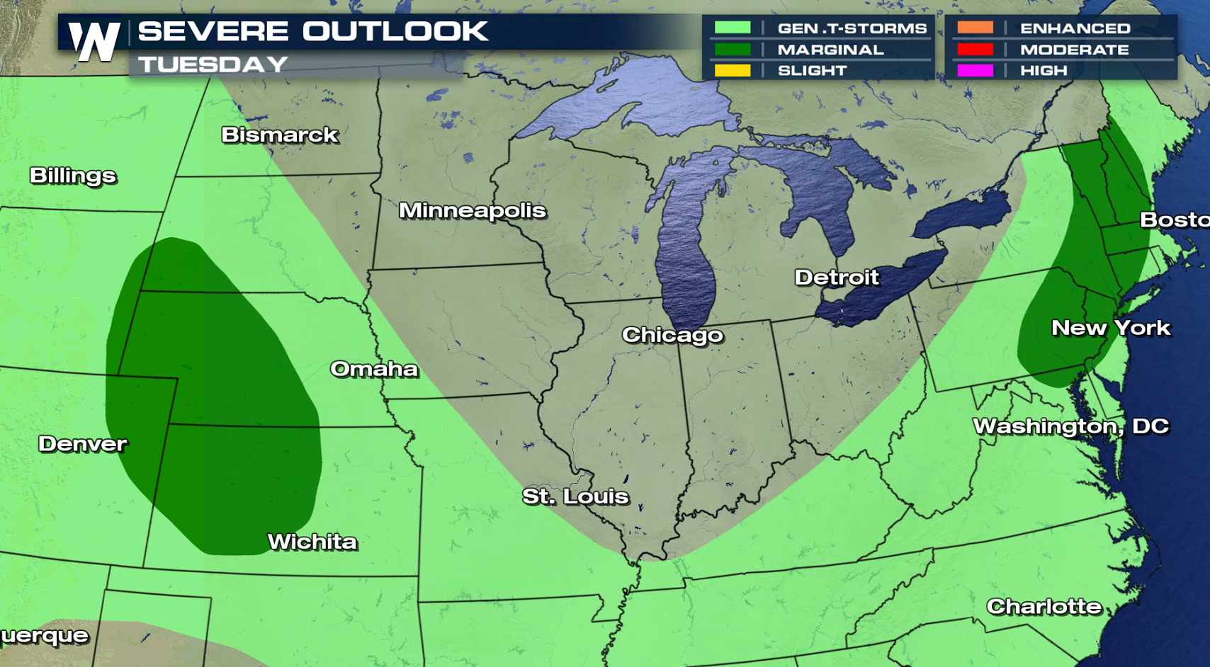
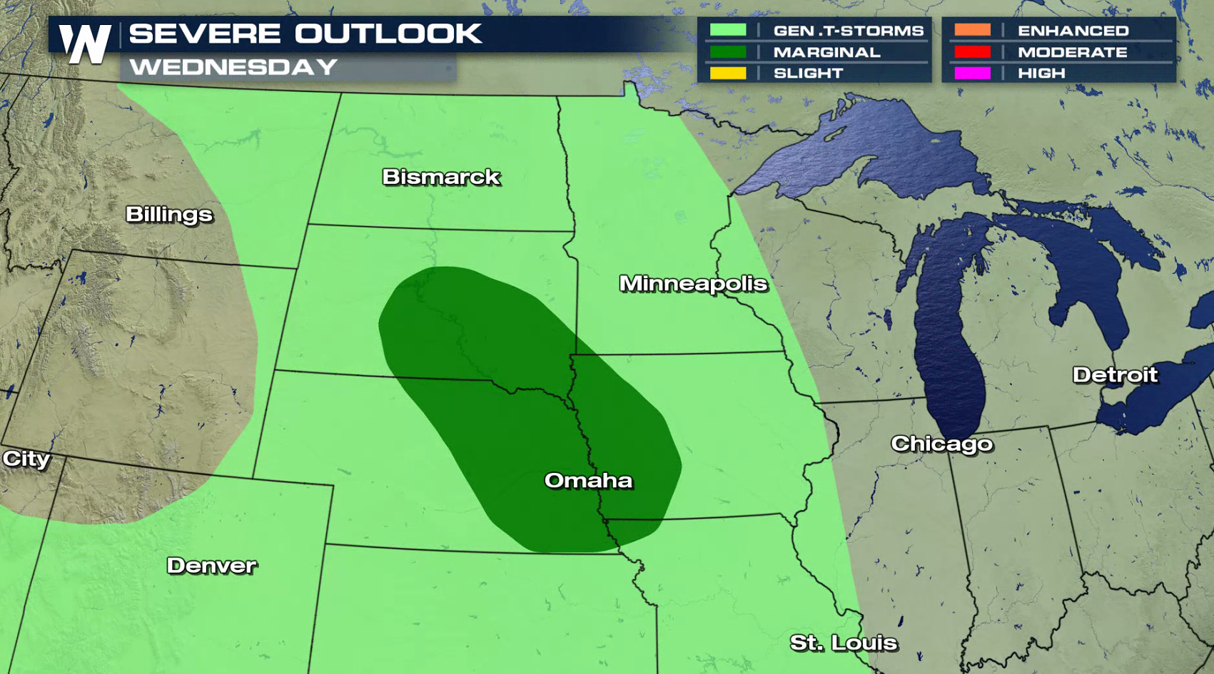
 The risk for severe thunderstorms diminishes for Tuesday and Wednesday, with a marginal risk posted both days from the Storm Prediction Center. The Northeast and Plains are the areas of concern.
 For WeatherNation: Meteorologist Mace Michaels
A few storms will pop-up throughout the afternoon, with storm coverage becoming more widespread in the later afternoon and evening. Intensity will increase as well, as heat and humidity continues to build throughout the day.
The risk for severe thunderstorms diminishes for Tuesday and Wednesday, with a marginal risk posted both days from the Storm Prediction Center. The Northeast and Plains are the areas of concern.
For WeatherNation: Meteorologist Mace Michaels
All Weather News
More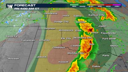
Significant Storm Threat Today, Friday
The spring season often means rounds of stron
25 Apr 2024 1:55 PM
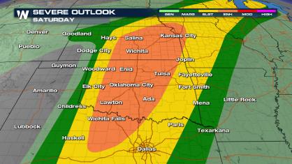
Weekend Forecast: More Severe Weather
We are looking at the threat of another sever
25 Apr 2024 1:50 PM

National Park Week: Get Out and Explore
National Park Week started Saturday, April 20
25 Apr 2024 1:45 PM
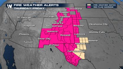
Critical Fire Risk in West Texas, New Mexico
A critical fire risk is in place for west Tex
25 Apr 2024 1:40 PM

NOAA Debuts "HeatRisk" Tool Nationwide
More people die from heat every year than ALL
25 Apr 2024 1:35 PM

Double Trouble: Cicadas Take to the Skies this Spring
It’s the soundtrack to the summer. Nature’s n
25 Apr 2024 1:25 PM

Record Warmth to Weekend Snow in the Four Corners
Snow is in the forecast for Denver, which cou
25 Apr 2024 1:20 AM