New Snow Squall Warnings Now Available Nationwide
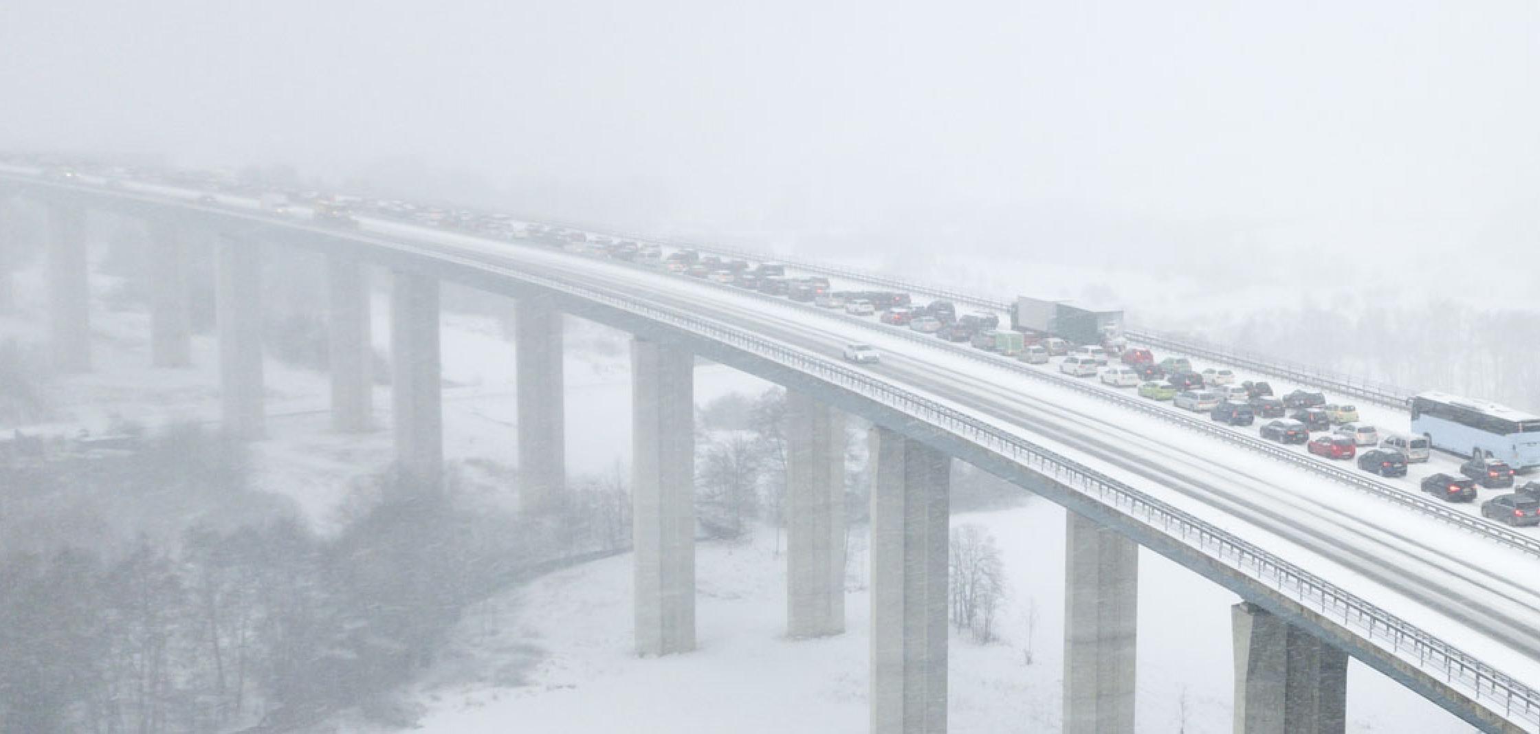
[NOAA] Imagine driving down a busy highway in winter: The weather is clear and you are going the speed limit. Suddenly, traffic is enveloped by white-out conditions with little to no visibility and strong, gusty winds. As you slow down, you see a chain-reaction of vehicles swerving, colliding into each other in the distance like amusement park bumper cars.
Lucky for you, you just survived a snow squall.
Snow squalls can easily cause large highway pileups — capable of multiple fatalities — due to their brief but heavy snowfall, low or no visibility, and slick road surfaces. Preventing these often deadly car crashes is the motivation behind NOAA’s new Snow Squall Warnings.
https://twitter.com/stevesilberman/status/534738598361182208After successful testing of Snow Squall Warnings in five National Weather Service forecast offices around the Great Lakes last winter, the product is now available nationwide and issued when conditions warrant.
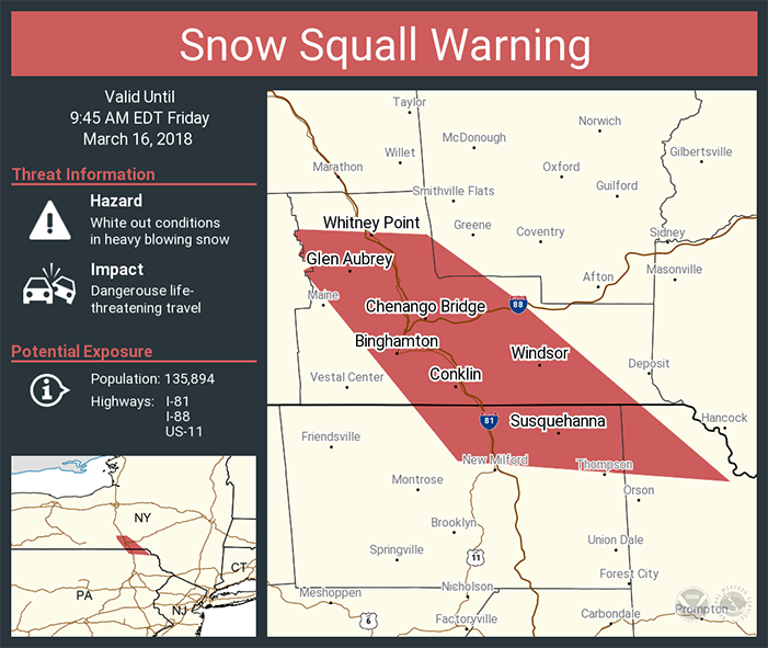
[Example of a social media graphic used by the National Weather Service when a Snow Squall Warning is issued.]
Snowstorm vs. snow squall: What’s the difference?
Incoming major snowstorms are predicted days ahead giving emergency managers time to preposition resources and urge the public to prepare and take shelter.
But, snow squalls are different: They move in and move on or fizzle out quickly, and typically last less than an hour. The sudden white-out conditions combined with falling temperatures produces icy roads in just a few minutes. Squalls can occur where there is no large-scale winter storm in progress and might only produce minor accumulations.
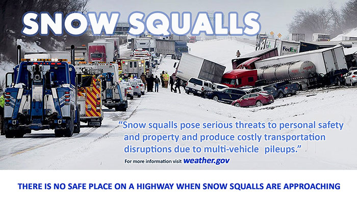
If a snow squall warning is issued for your area, your best bet is to avoid or delay motor travel until the squall passes through your location. There truly is no safe place on the highway during a snow squall, but if you are already in transit and cannot exit the road in time, drive very slowly and allow plenty of distance between you and the car in front of you.
https://twitter.com/KBRphotos/status/796806638296506369Snow squall forecasts: Why now?
NOAA’s new GOES-16 satellite, positioned as GOES-EAST, recent improvements in Doppler radar, increased supercomputing capacity and more accurate and detailed weather models are helping NOAA forecasters more quickly identify snow squalls and other localized short-term weather events — such as thunderstorms and tornadoes — as they are developing.
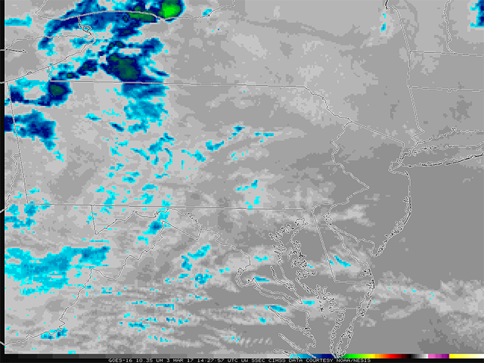
[This infrared satellite imagery from GOES East, shows the cloud top temperatures. The cool colors indicate colder cloud tops and highlight areas where snow squalls would be more intense.]
Edited for WeatherNation by Meteorologist Mace Michaels