Rounds of Thunderstorms Across the High Plains

As upper-level troughing persists across the Pacific Northwest, strong jet stream winds will continue to overspread the Northern Rockies into the High Plains.
These winds provide lift and shear, and with sufficient atmospheric instability, thunderstorm development is expected each afternoon through at least the first part of next week. For the rest of Saturday, the SPC has highlighted these areas in a Slight Risk (see above).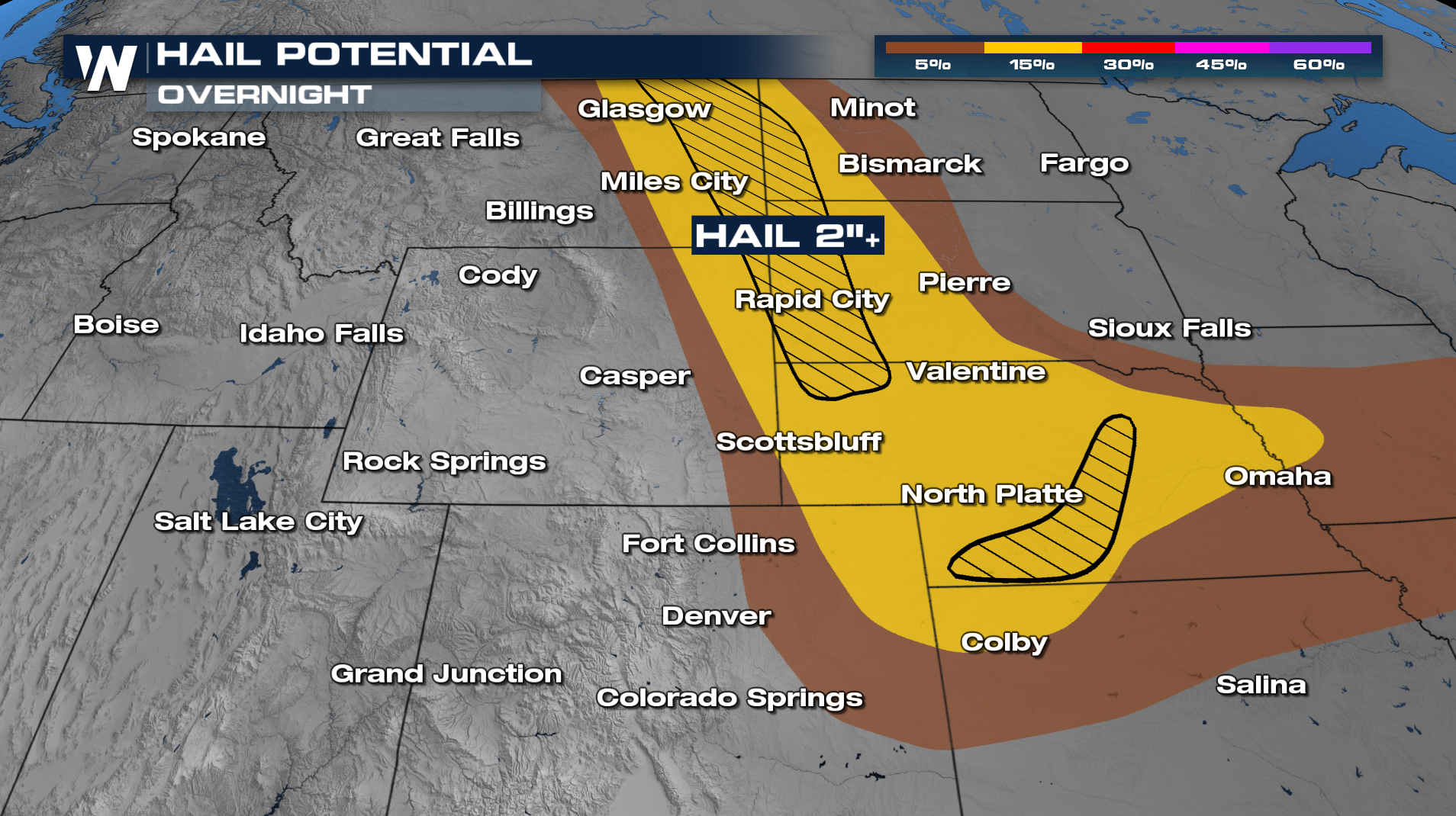
One of the main hazards will be larger than golf ball-sized hail (≥ 2"), and an elevated threat for tornadoes across western Nebraska. On Saturday, several reports of teacups and softballs fell in Nebraska from severe storms.
Thunderstorms are forecasted to become widespread through the rest of Saturday evening, moving out of Colorado, Wyoming, and Montana and onto the Great Plains overnight. Sunday and Monday have similar setups.
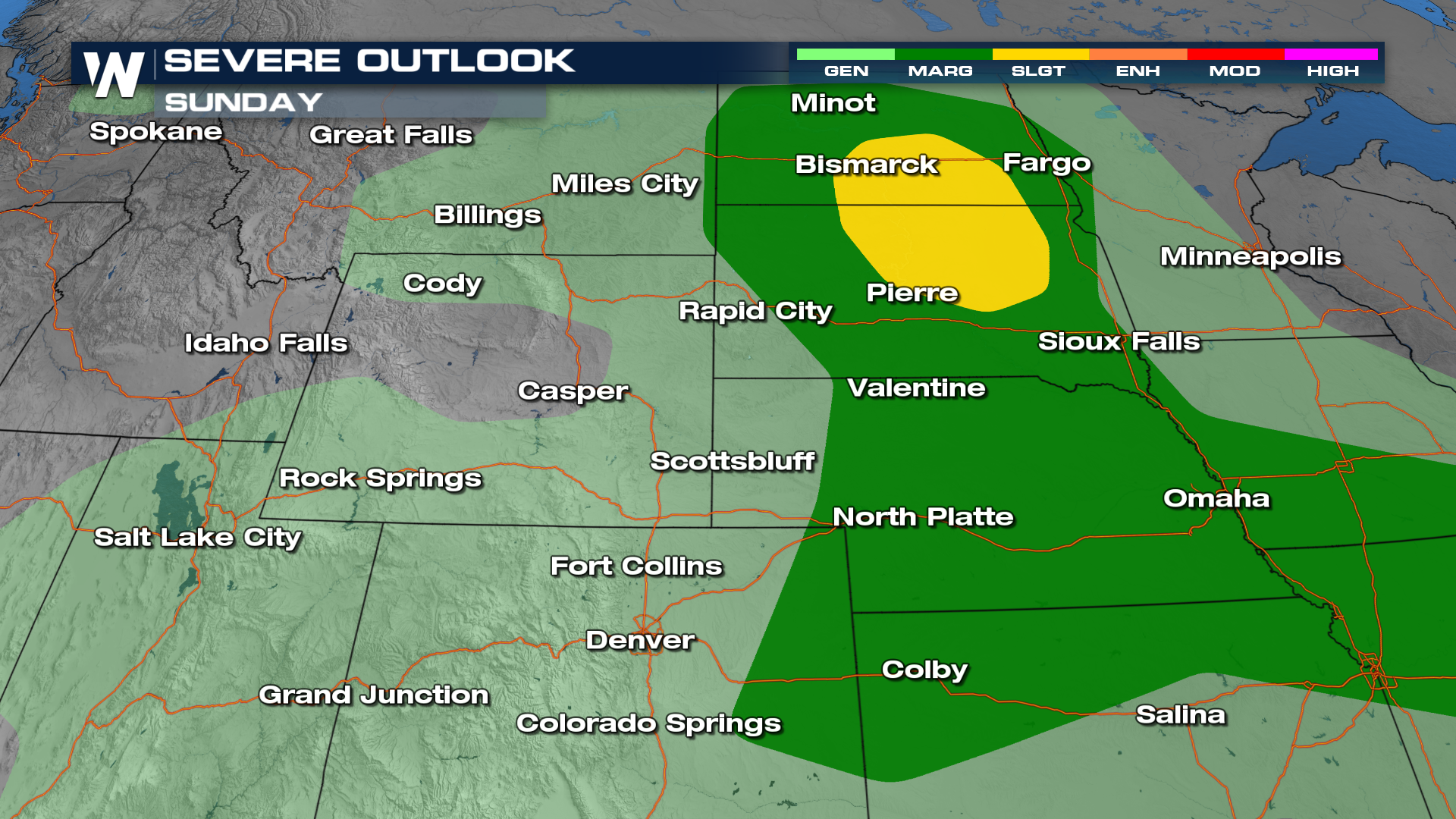
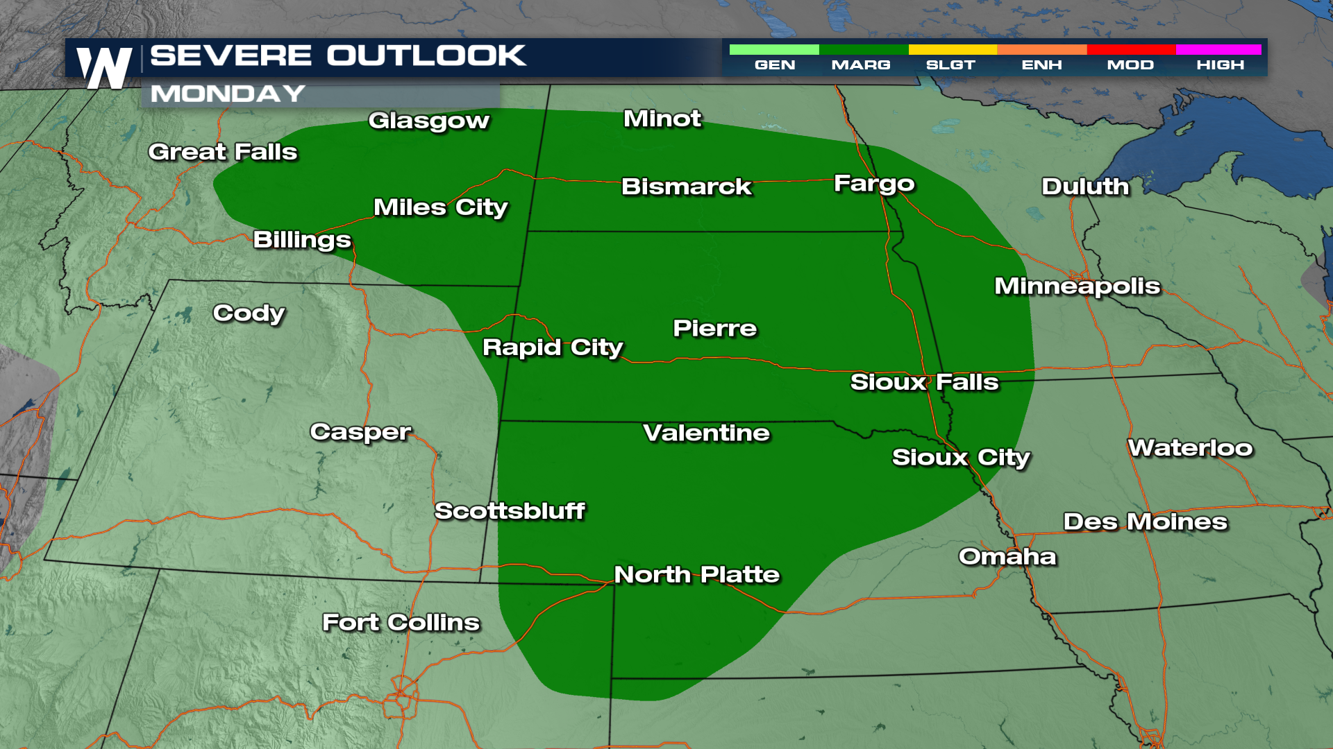
Sunday and Monday have both been highlighted by the Storm Prediction Center for at least the possibility of isolated severe thunderstorms.


