Severe Weather Potential in the Mid Atlantic
Special Stories
15 Mar 2019 10:45 AM
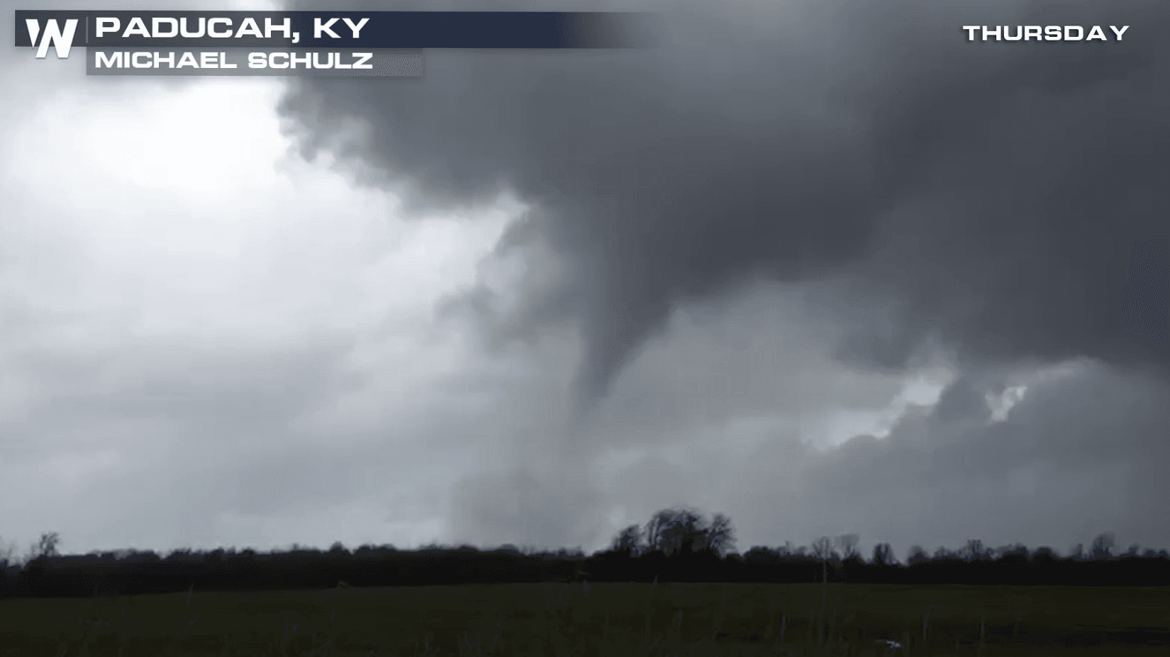
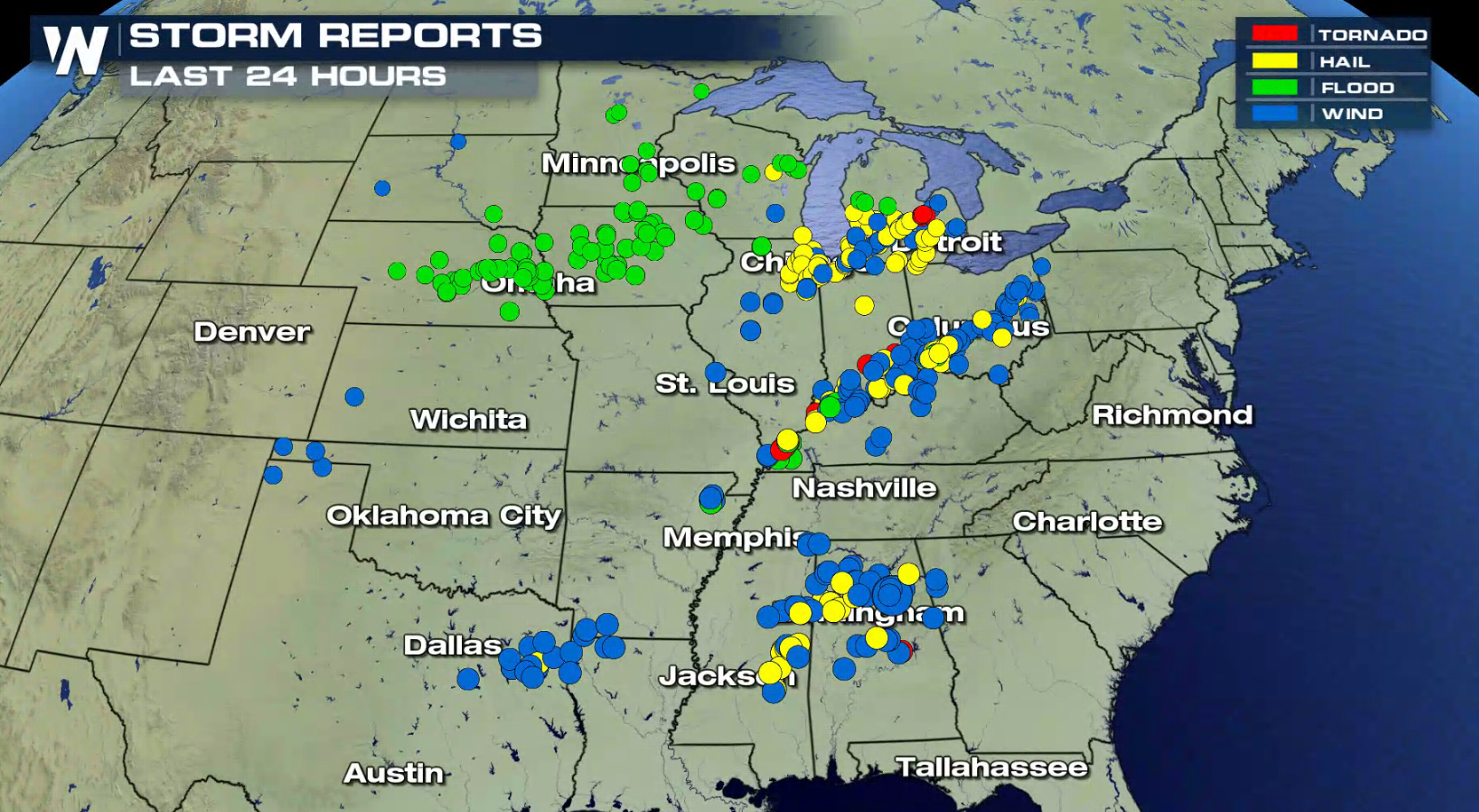
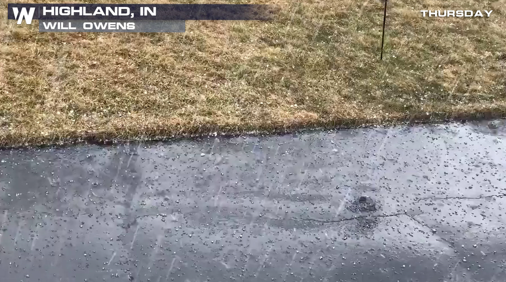
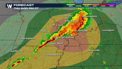
Thursday was very active for severe thunderstorms in the Great Lakes, Ohio Valley, and the Southeast. There were numerous reports of large hail and strong winds, with several tornadoes producing damage.

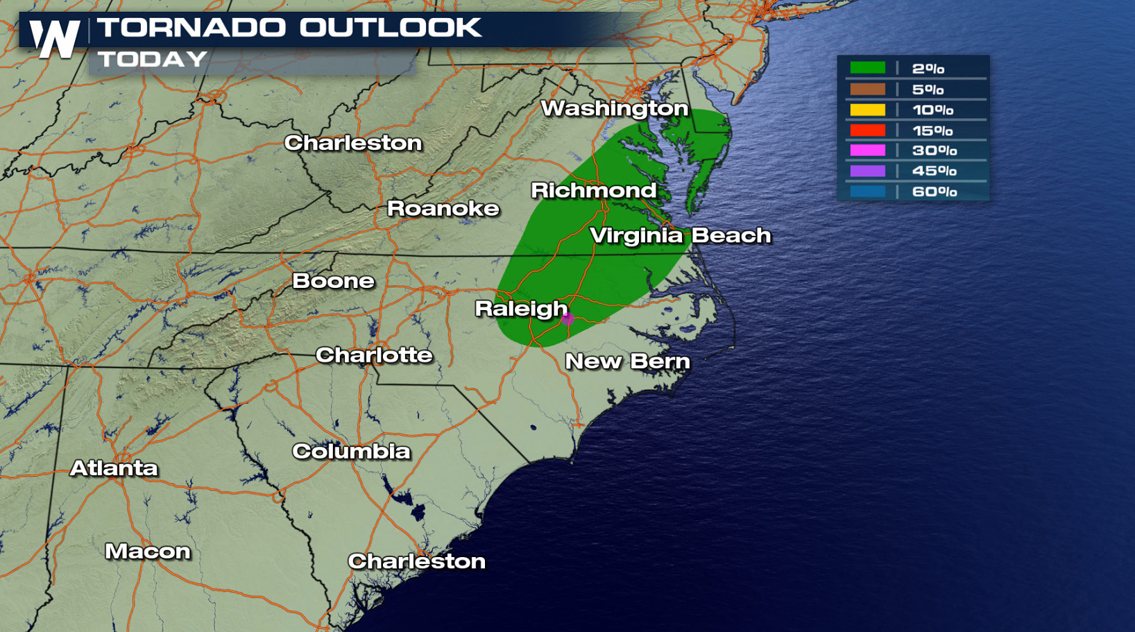
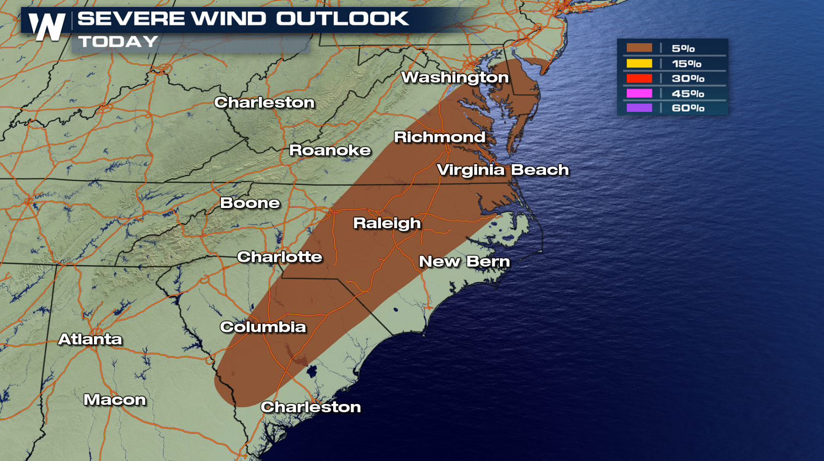
 The Storm Prediction Center has outlined an area from the Jersey Shore southward to Georgia for the potential of severe weather today (Friday). Strong, damaging wind gusts are the biggest threat, with the low chance for a tornado.
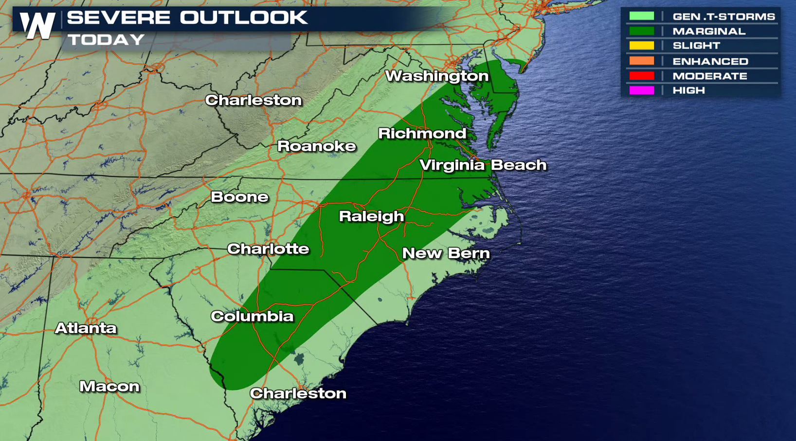
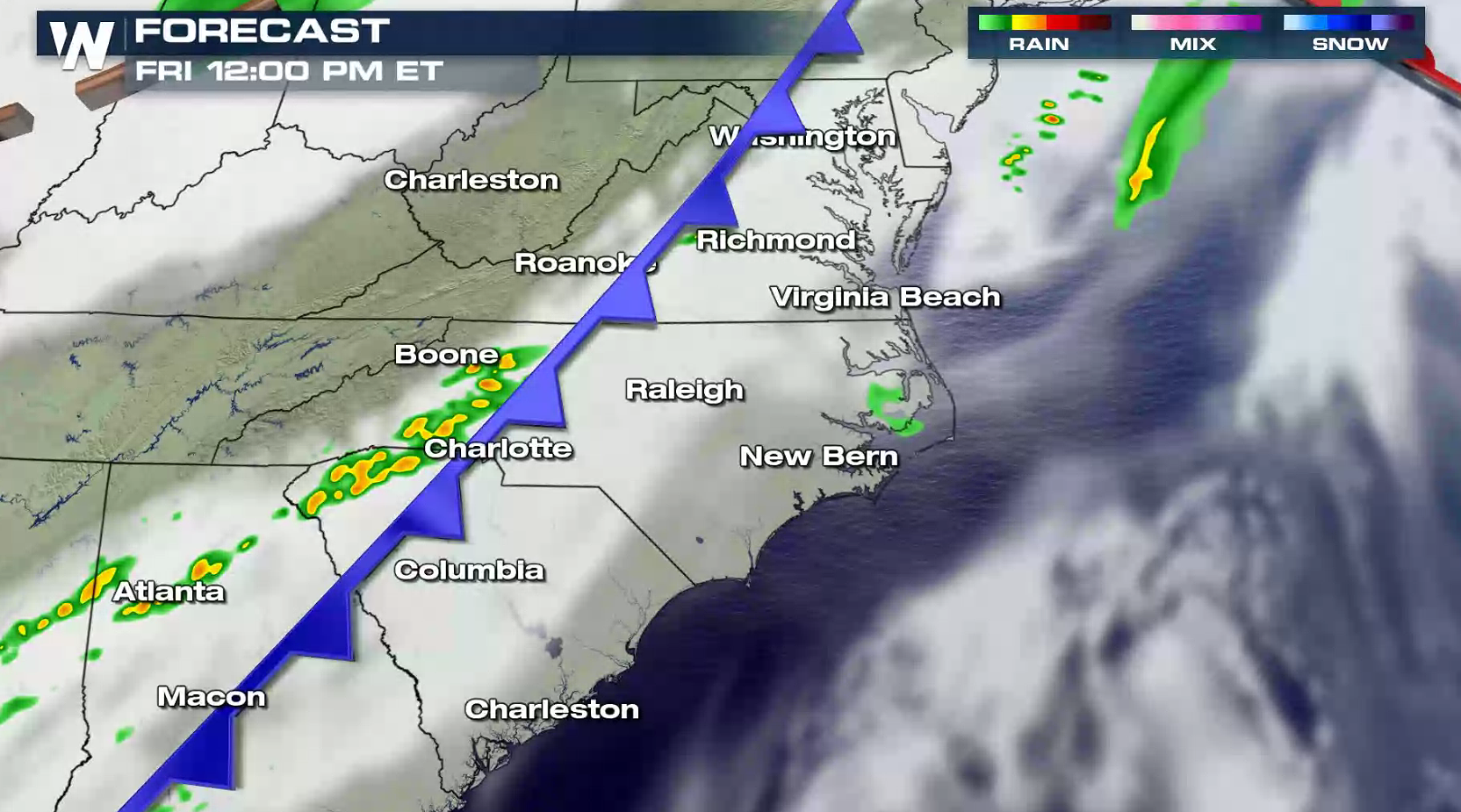
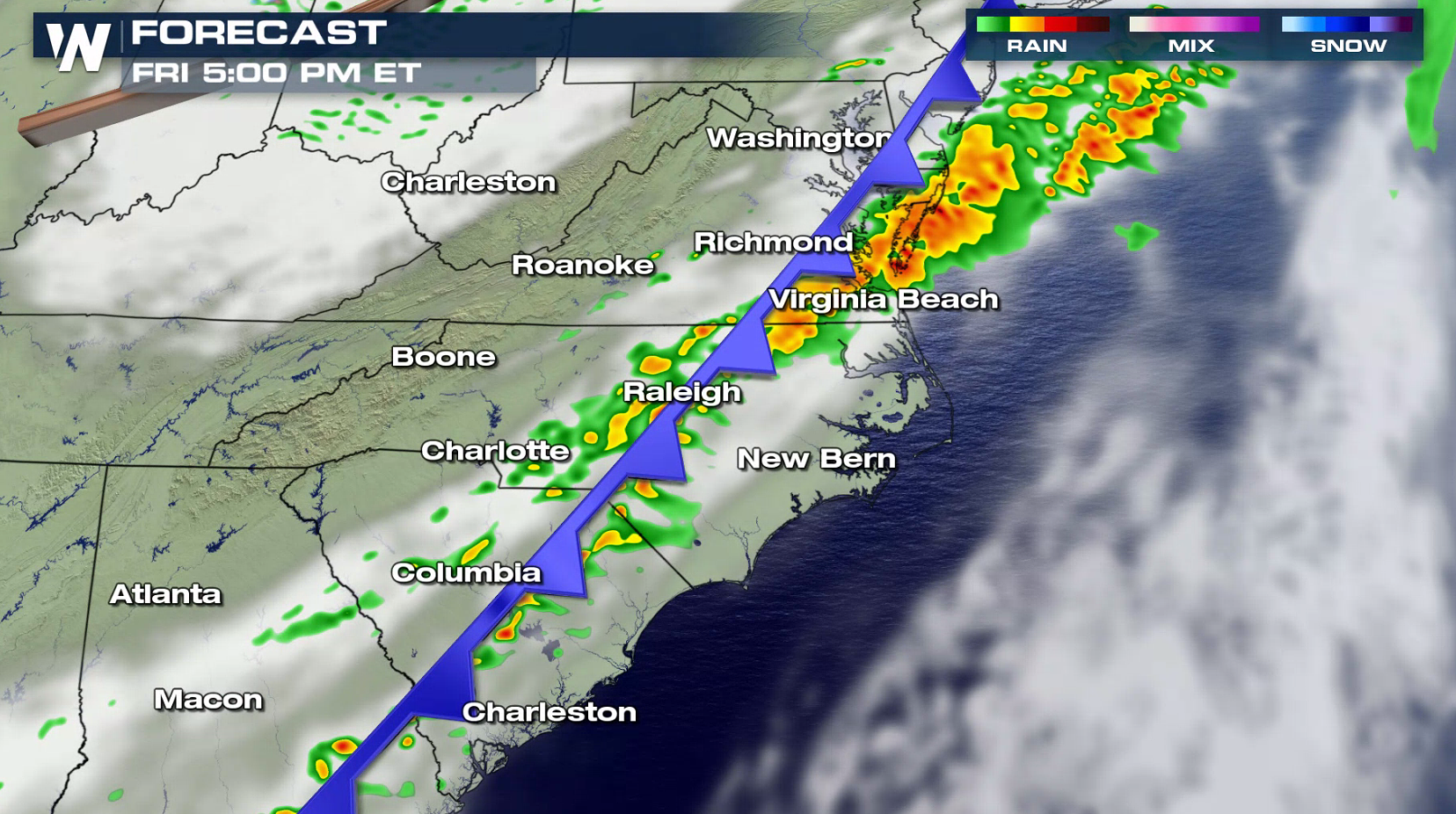
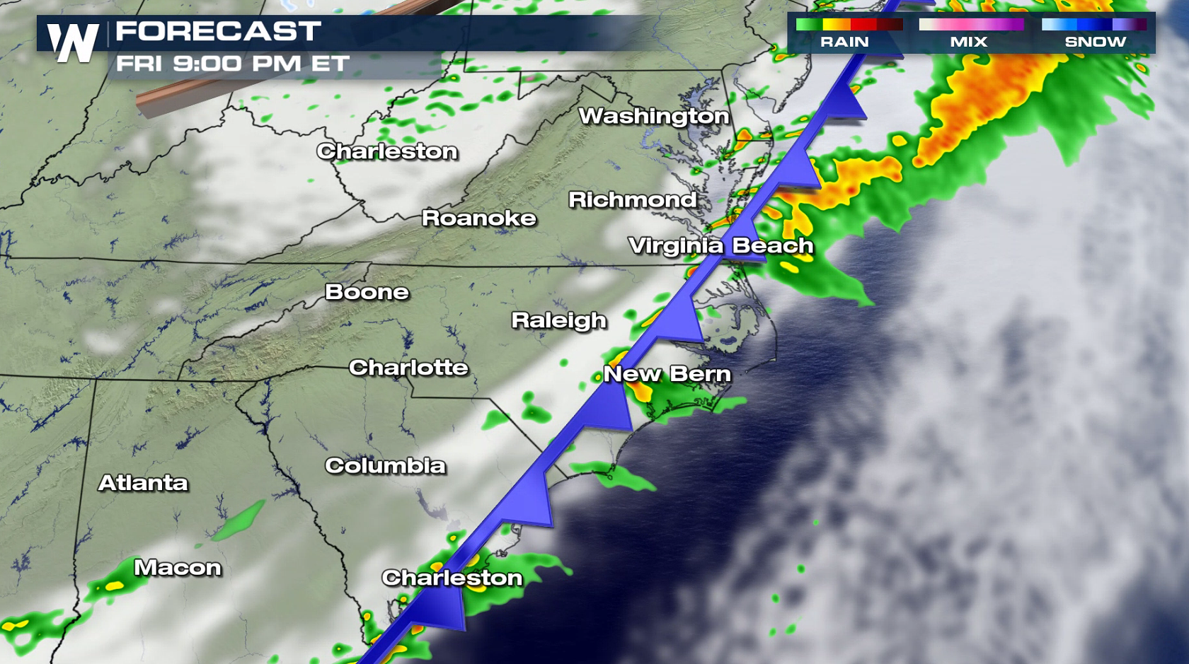
 A cold front will push eastward through the Middle Atlantic and Southeast this afternoon (Friday) and tonight. A few severe storms are possible in the late afternoon and evening from near Chesapeake Bay to Charleston, South Carolina. The system will move offshore into Saturday morning, bringing an end to the severe threat.
 For WeatherNation: Meteorologist Mace Michaels
The Storm Prediction Center has outlined an area from the Jersey Shore southward to Georgia for the potential of severe weather today (Friday). Strong, damaging wind gusts are the biggest threat, with the low chance for a tornado.
A cold front will push eastward through the Middle Atlantic and Southeast this afternoon (Friday) and tonight. A few severe storms are possible in the late afternoon and evening from near Chesapeake Bay to Charleston, South Carolina. The system will move offshore into Saturday morning, bringing an end to the severe threat.
For WeatherNation: Meteorologist Mace MichaelsAll Weather News
More
Severe Weather Strikes Again Starting Overnight
It's been an active past few days with severe
18 Apr 2024 1:30 AM
Potential Record Heat Along the Gulf Coast
Summer-like temperatures are expected across
18 Apr 2024 1:10 AM
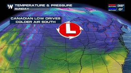
Blast of Cold Air Arrives in the Central U.S. this Weekend
If you have been enjoying the Spring warmth i
17 Apr 2024 7:45 PM

Double Trouble: Cicadas Take to the Skies this Spring
It’s the soundtrack to the summer. Nature’s n
17 Apr 2024 7:30 PM

Spring Snow in the Rocky Mountain States
Snow is falling in the northern and central R
17 Apr 2024 8:50 AM