Sunday Severe Weather Threats
Special Stories
19 May 2018 8:13 PM
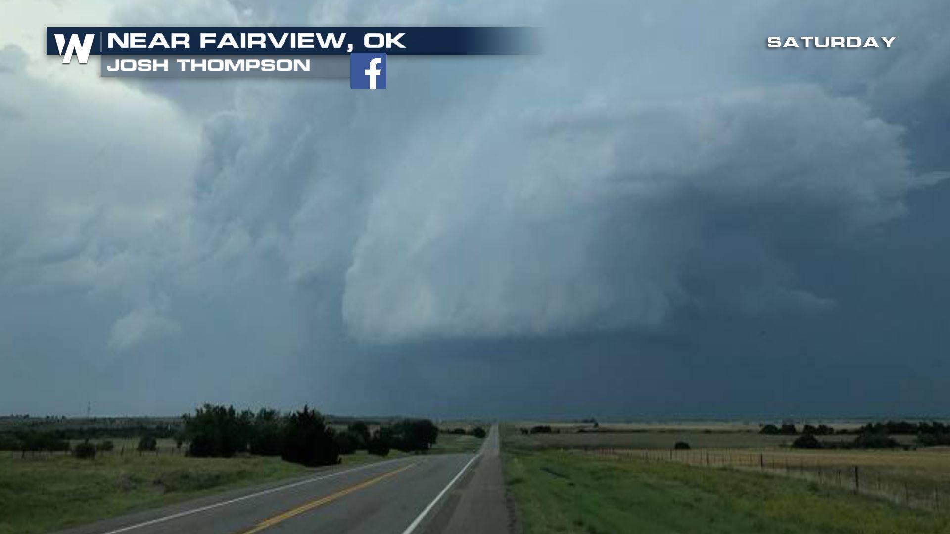
We certainly saw our share of severe weather on Saturday. Hail, damaging straight line winds, and even tornadoes. Much of the action took place in the mid-section of the country.
On Saturday afternoon, there was a tornado warning for this storm near Pawhuska, Oklahoma. A scary site indeed. A brief touchdown was reported by a storm chaser just west of Pawhuska on Highway 60.
https://www.facebook.com/WeatherNation/videos/10156514011999874/
Winds from the same storm complex took down a tree, which unfortunately demolished a camper. Luckily, no reports of any injuries here.
https://www.facebook.com/WeatherNation/photos/a.134470819873.130649.129524519873/10156513761054874/?type=3
And it was hailing Hen Eggs in Rogersville, Missouri. Well, correction, hail the size of hen eggs! But that's no laughing matter. Hail that size can do some serious damage. The hail in this video was a bit smaller, about quarter sized.
https://www.facebook.com/WeatherNation/videos/10156513921569874/
And it appears that we are not done with severe weather threats this weekend. In fact, we'll see a risk of severe storms on both Sunday and Monday.
On Sunday, the biggest severe threat will be across the Midwest, and portions of the Ohio Valley. Areas shaded in yellow will be in a "Slight" risk area, which is a 15 percent chance of severe storms. St. Louis, Louisville, and Indianapolis are all included in this area. Areas shaded in green will be in a "Marginal" risk area, which is a 5 percent chance of severe storms. Springfield, Peoria, and Columbus are all included in this area. The main threat will be damaging hail, and to a slightly lesser extent, strong straight line winds. Atmospheric shear will be relatively weak, so tornado threats should remain rather low.
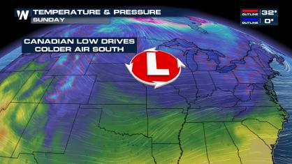
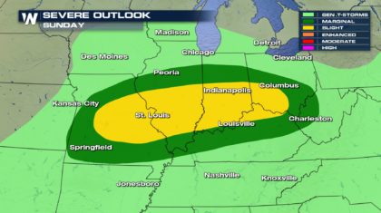 The trigger for storms will be a frontal zone stretched across the region, anchored by low pressure in Illinois. As you can see, the severe weather threat basically lines up with the front. Most of the severe weather should stay along and just to the south of the front.
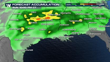
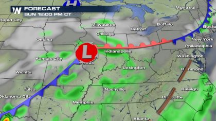 That same front extends all the way down into Texas. This could also fire off some strong storms in that region Sunday afternoon.
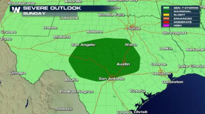
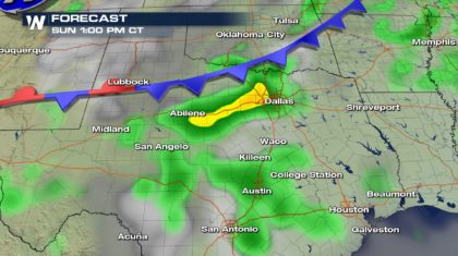 There will be a "Marginal" risk of severe storms in an area from San Angelo over to Waco, and down through Austin and San Antonio. The main threat will be hail producing storms. Some strong wind gusts are also possible.
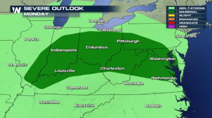
 Then on Monday, the same front will linger across the Ohio Valley, and extend eastward to the mid-Atlantic coast.
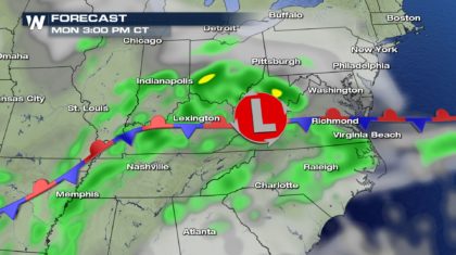 This will allow severe storms to fire from Indiana, eastward through Virginia. We could see severe weather in Washington D.C., Baltimore, and Richmond. Pittsburgh will also be in play for severe weather chances. The area will be under a "Marginal" risk on Monday. The primary threats will be damaging wind and hail.
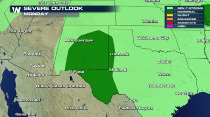
 And just like on Sunday, the very same front will linger across northern Texas, serving to ignite another round of strong to severe storms.
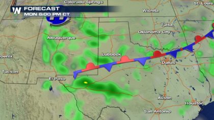 The "Marginal" risk shifts westward a bit, into New Mexico. The main threats will be high winds and hail. Tornado risk remains extremely low in this area.
 So as always, stay weather aware, and stay tuned to WeatherNation TV for the very latest severe weather information.
For WeatherNation: Meteorologist Matt Monroe
So as always, stay weather aware, and stay tuned to WeatherNation TV for the very latest severe weather information.
For WeatherNation: Meteorologist Matt Monroe
The trigger for storms will be a frontal zone stretched across the region, anchored by low pressure in Illinois. As you can see, the severe weather threat basically lines up with the front. Most of the severe weather should stay along and just to the south of the front.
That same front extends all the way down into Texas. This could also fire off some strong storms in that region Sunday afternoon.
There will be a "Marginal" risk of severe storms in an area from San Angelo over to Waco, and down through Austin and San Antonio. The main threat will be hail producing storms. Some strong wind gusts are also possible.
Then on Monday, the same front will linger across the Ohio Valley, and extend eastward to the mid-Atlantic coast.
This will allow severe storms to fire from Indiana, eastward through Virginia. We could see severe weather in Washington D.C., Baltimore, and Richmond. Pittsburgh will also be in play for severe weather chances. The area will be under a "Marginal" risk on Monday. The primary threats will be damaging wind and hail.
And just like on Sunday, the very same front will linger across northern Texas, serving to ignite another round of strong to severe storms.
The "Marginal" risk shifts westward a bit, into New Mexico. The main threats will be high winds and hail. Tornado risk remains extremely low in this area.
So as always, stay weather aware, and stay tuned to WeatherNation TV for the very latest severe weather information.
For WeatherNation: Meteorologist Matt Monroe
All Weather News
More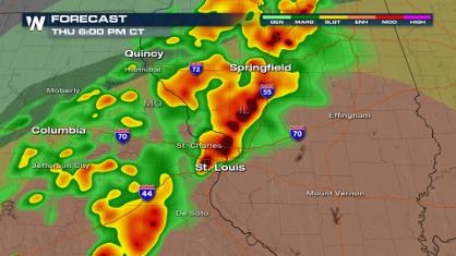
More Severe Weather from the Plains to Southeast
It has been a busy start to the week, as seve
18 Apr 2024 8:10 PM
Freezing Conditions Tonight in the Central U.S.
If you have been enjoying the Spring warmth i
18 Apr 2024 8:05 PM
Wet and Cool Weekend in the Deep South
We're looking at a wet end of the week for th
18 Apr 2024 8:00 PM
Record Heat Along the Gulf Coast Today
Summer-like temperatures are expected across
18 Apr 2024 7:55 PM

Double Trouble: Cicadas Take to the Skies this Spring
It’s the soundtrack to the summer. Nature’s n
18 Apr 2024 7:50 PM

National Park Week: Get Out and Explore
National Park Week starts April 20th and runs
18 Apr 2024 7:30 PM

Ef-2 Tornadoes Touch Down in Kansas, Iowa
Severe storms moved across the Midwest Tuesda
18 Apr 2024 1:00 PM