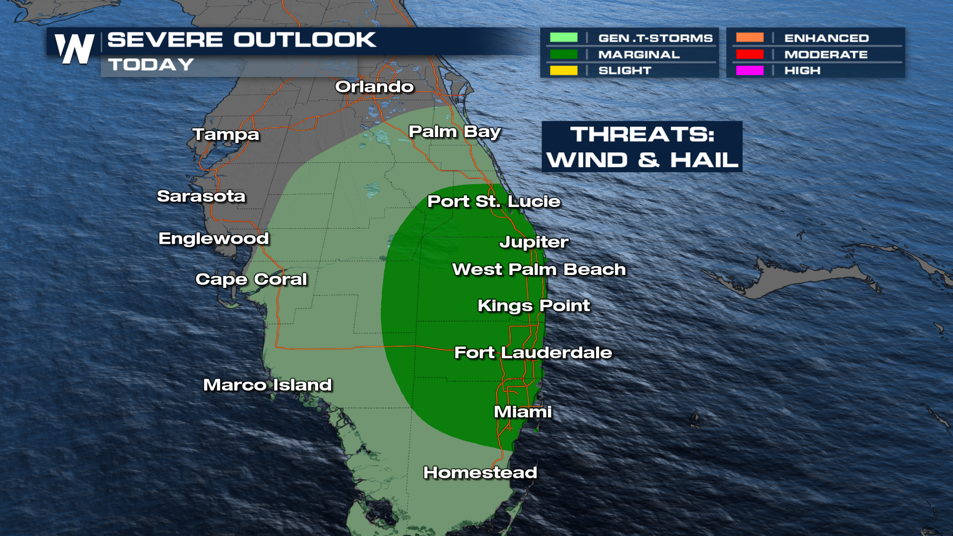
Isolated Storms in Florida Could Be Severe

A surface cold front moving south across Florida will continue to push scattered thunderstorms through the area. We may even acquire some supercell thunderstorms that could pose a risk of large hail and damaging winds.
Monday's SPC outlook is a MARGINAL (level 1 out of 5) risk. This is a low-end threat, but a slightly unstable environment could support storms capable of severe wind or hail in Southeast Florida.
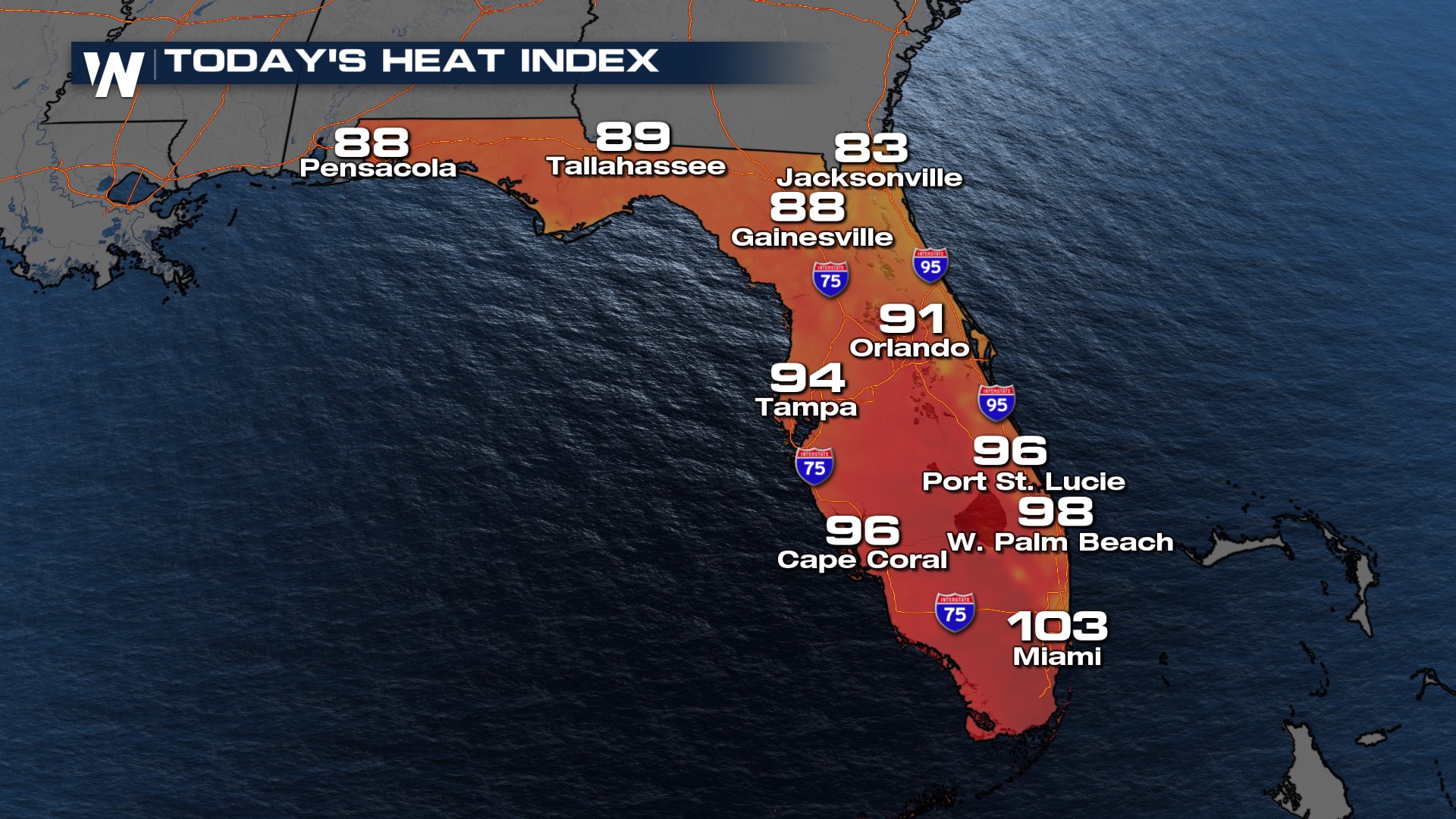
 The other factor in Florida will be hot temperatures thanks to the high moisture content of the air and a ridge of high pressure that keeps temperatures soaring into the 90s. It will feel more like the 100s today for many cities in South Florida.
 Could these storms affect a launch scheduled for Tuesday? Read more about that forecast HERE.