Active Weather Continues out West

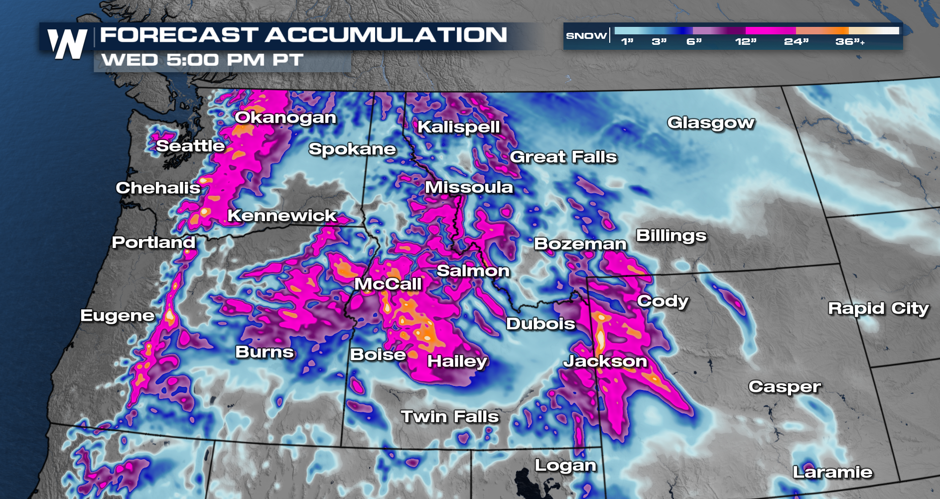
The conveyor belt of low pressures in the Pacific moving inland will continue over the next few days. Multiple rounds of rain and snow will move through over the next few days. The forecast will remain the same with lower elevations seeing heavy rain and the higher elevations continuing to get dumped on!
The heaviest snow will fall in the Cascades, Tetons, and Northern Rockies. The northern Sierra will see more impacts as the current storm track favors the Northwest.
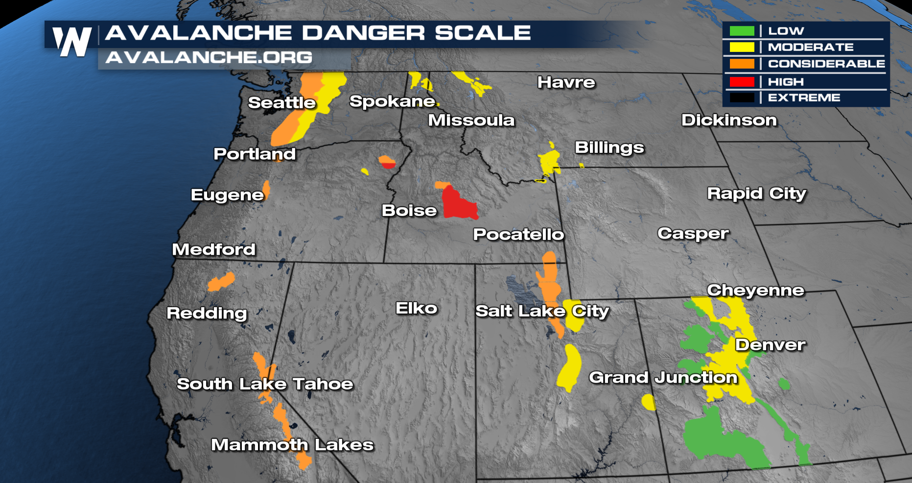
 Avalanche concerns will be elevated as we get a heavy snow pack on weaker layers and as the winds stay gusty in the higher terrain.
 Coastal areas will see the highest rainfall totals reaching upwards of 4 inches through Monday night. Northwest Washington will have rivers, creeks, and streams running swollen so this rain could cause some localized for the region.
 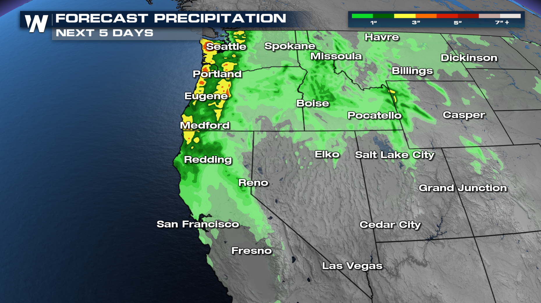 More on your Western Regional Forecast can be found :50 past the hour on WeatherNation.


