Weekend Tornado Rated EF-1 In Massachussetts

MASSACHUSETTS - On Saturday, strong storms in the Northeast produced a tornado. According to the National Weather Service in Boston, a storm survey team confirmed that an EF-1 tornado touched down in Paxton before tracking into Holden, MA. Winds were estimated between 86 and 110 mph. A final survey report will be released at a later time.
Drone footage captured in Holden, MA, shows the extent of the damage left behind after the storms moved through.
Additional storm damage, including numerous downed trees, was reported across New England.
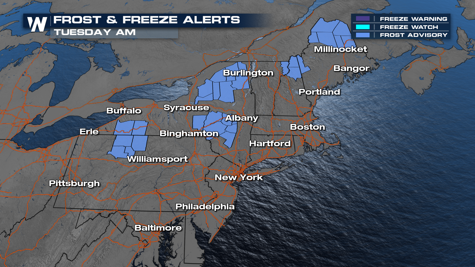
In the wake of the front, much cooler air has settled into the northeastern U.S. Frost advisories are in effect for Tuesday morning across parts of New York, Pennsylvania, and New England, with temperatures expected to dip into the upper 30s and low 40s.
 The cooler air mass continues to push south and east, bringing well-below-average temperatures to the eastern third of the country heading into the work week. Record lows are possible Tuesday morning from Tennessee to Massachusetts.
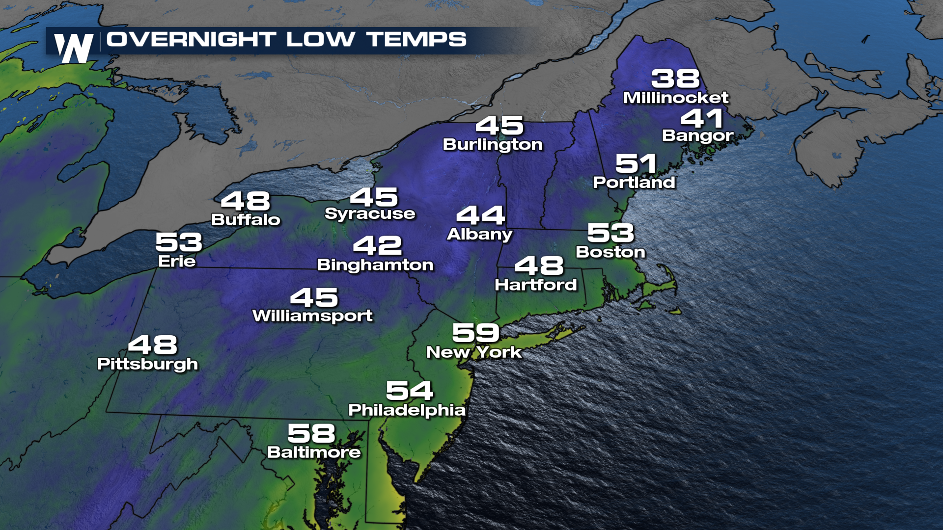 While overnight temperatures have bottomed out under clear skies, daytime sunshine has helped modify the cold air mass. Still, with the sun angle still high for early September, this chill, though not winter-like, feels especially sharp for the Midwest and Northeast. By mid-week, a low-pressure system along the coast could bring rain to New England.


