Another Severe Set-Up for the South
Special Stories
13 Mar 2019 5:38 AM
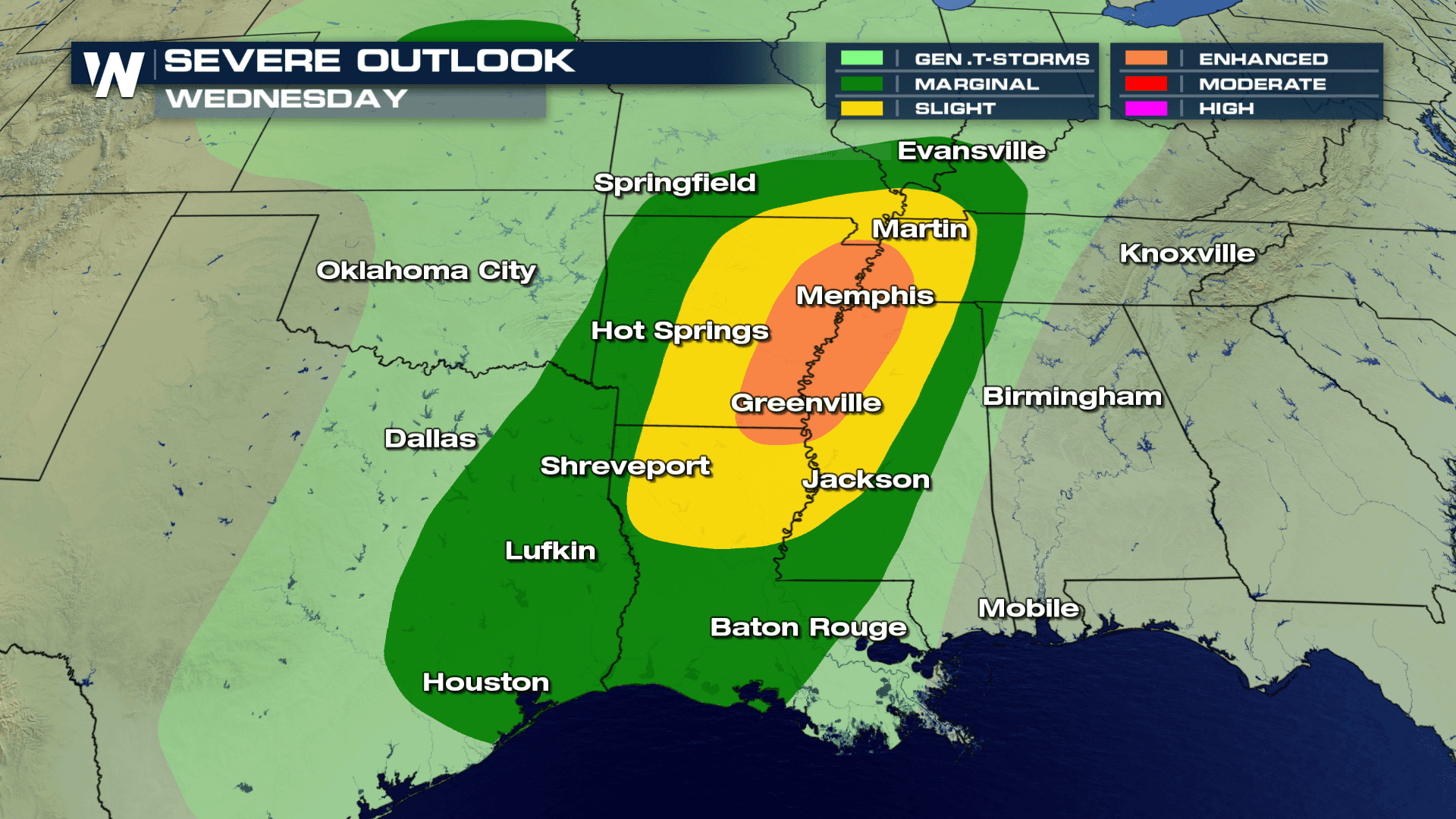
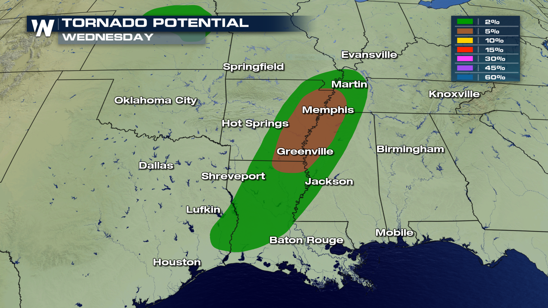
Another strong storm will swirl into the south today, likely producing severe weather with hail, wind, flooding and isolated tornadoes. Here are the areas for the highest probability of tornadic development on Wednesday afternoon. Per the SPC, cities from Greenville north to Memphis have the greatest threat of tornadoes Wednesday afternoon.
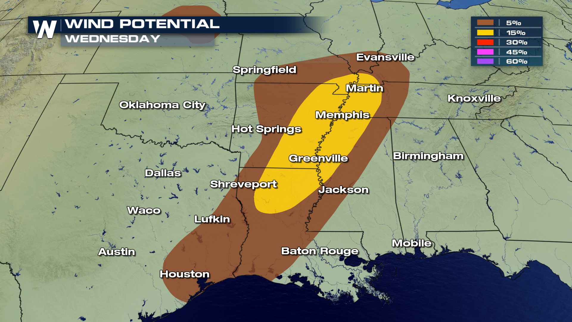
 The winds will also be an issue Wednesday afternoon as severe storms may generate gusts in excess of 50-60 MPH.
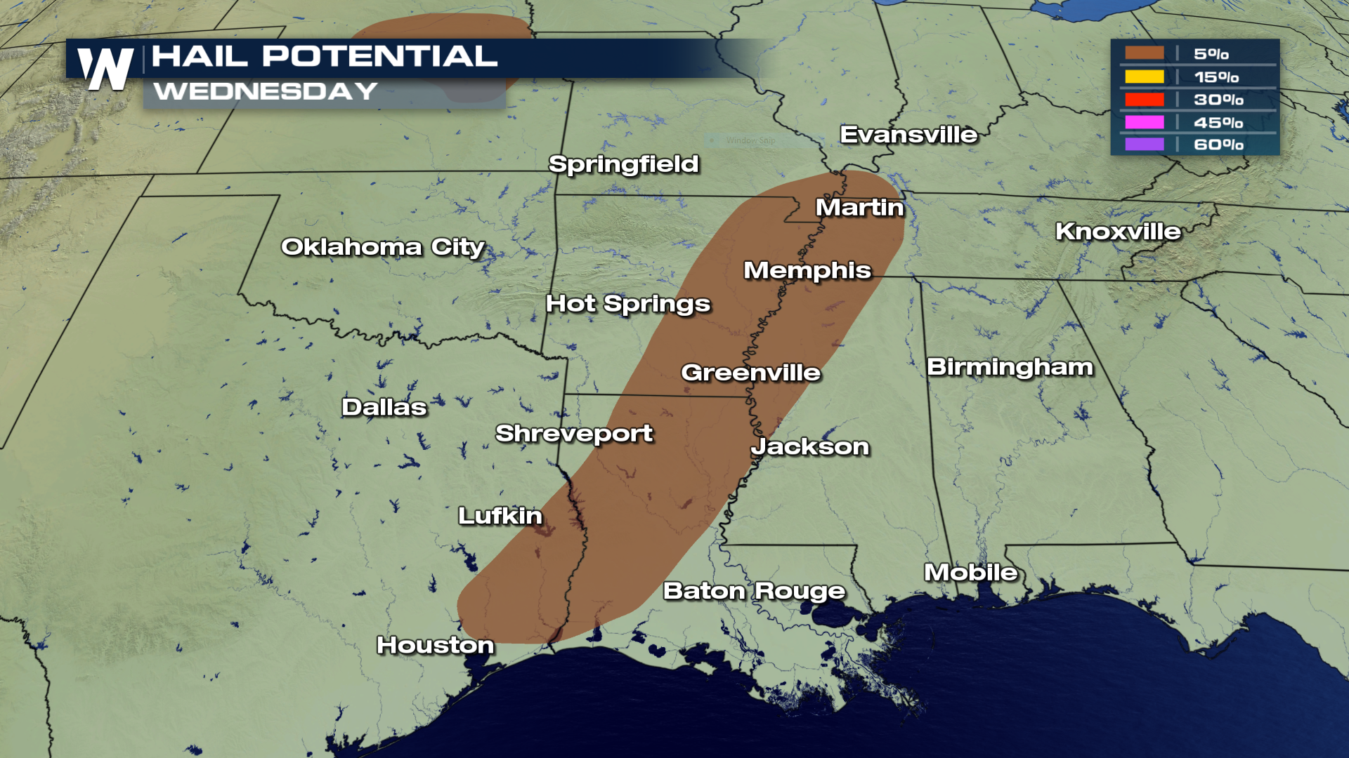
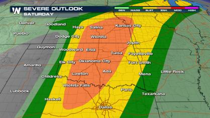
 Hail, possibly up to 1-2" in diameter is also in the forecast for Wednesday.
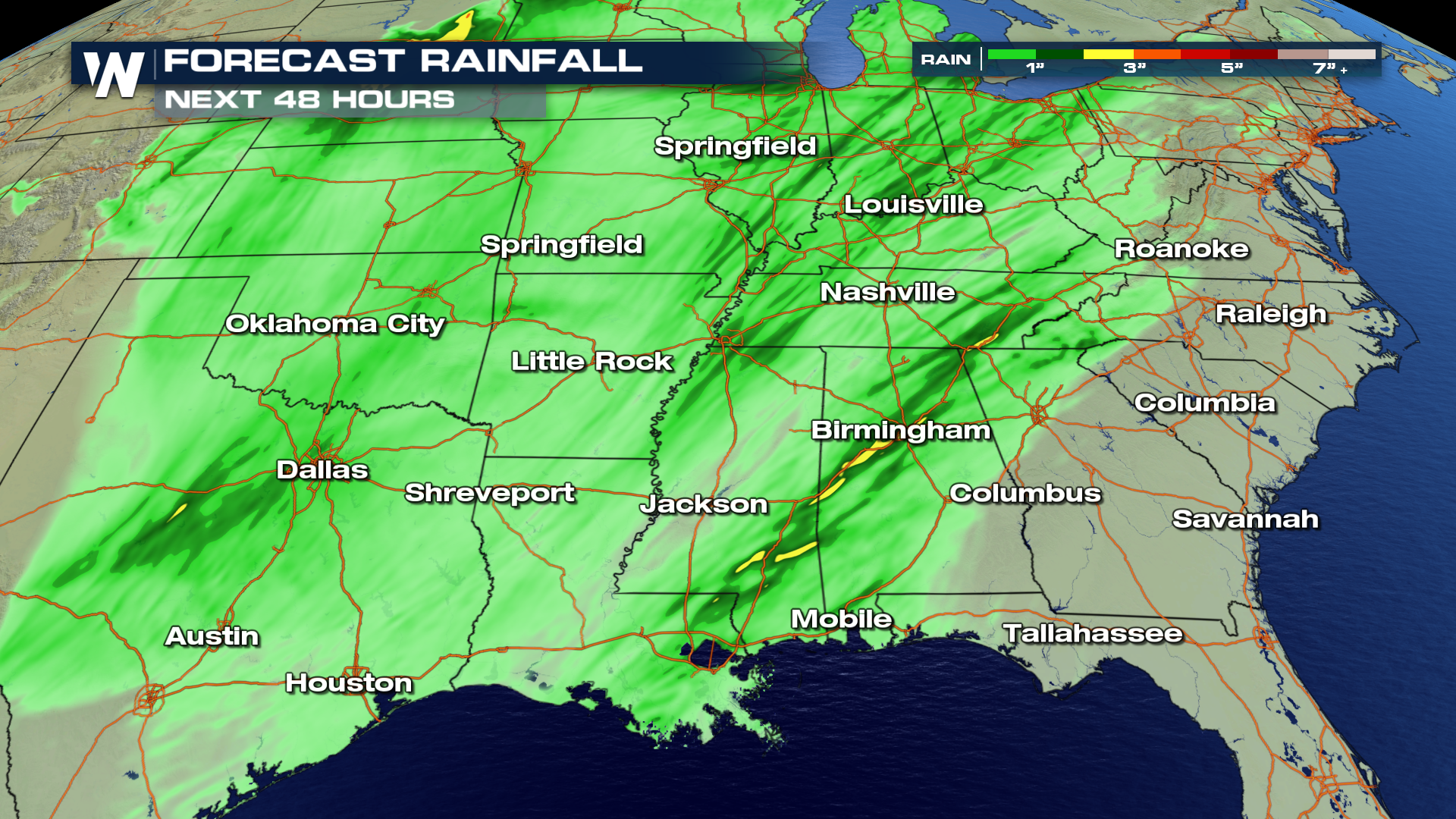
 As the storm moves through the area, expected rain totals will produce anywhere from 1 - 3"+ by Thursday. Areas shaded in yellow will likely see the largest accumulations.
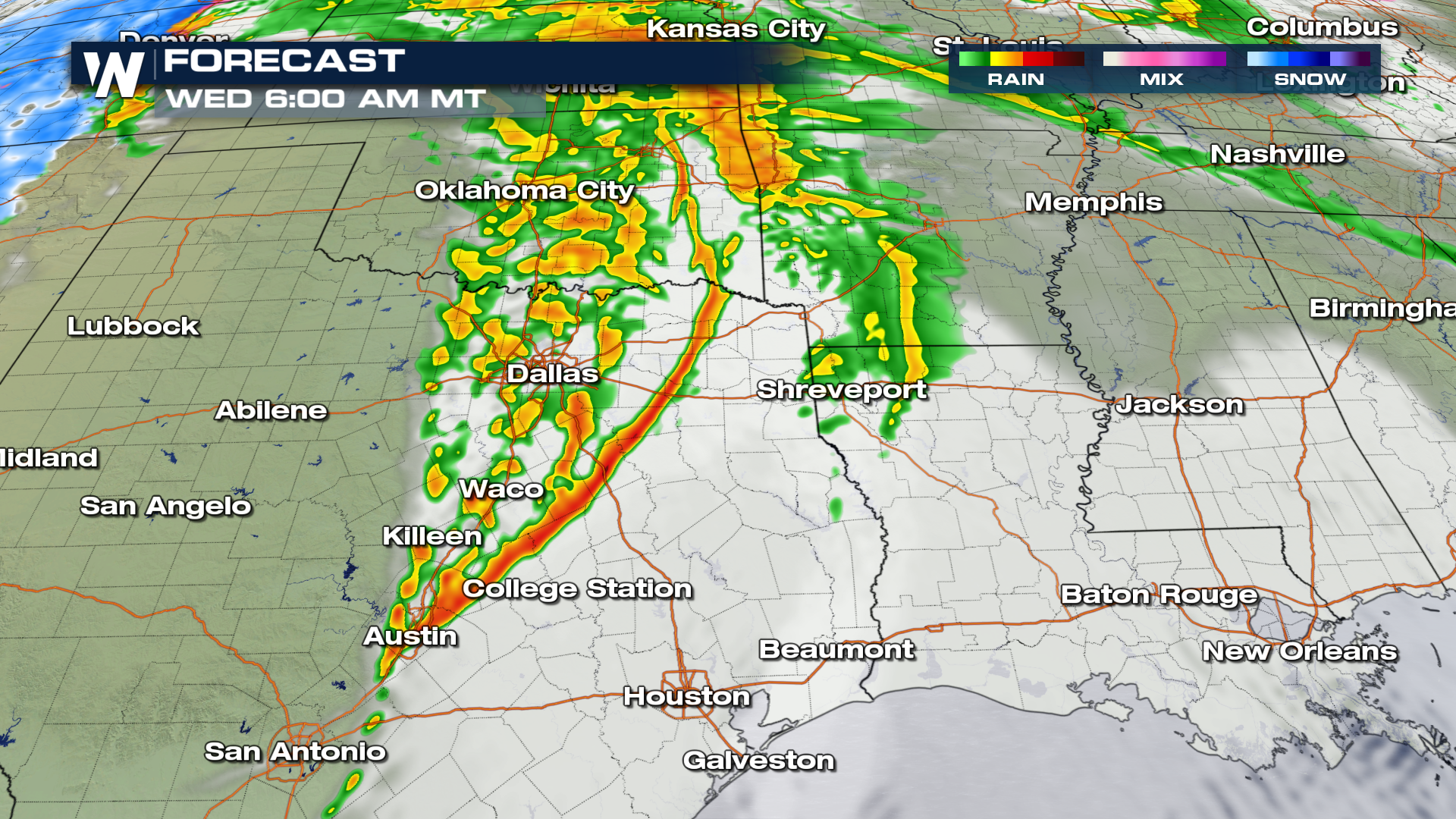
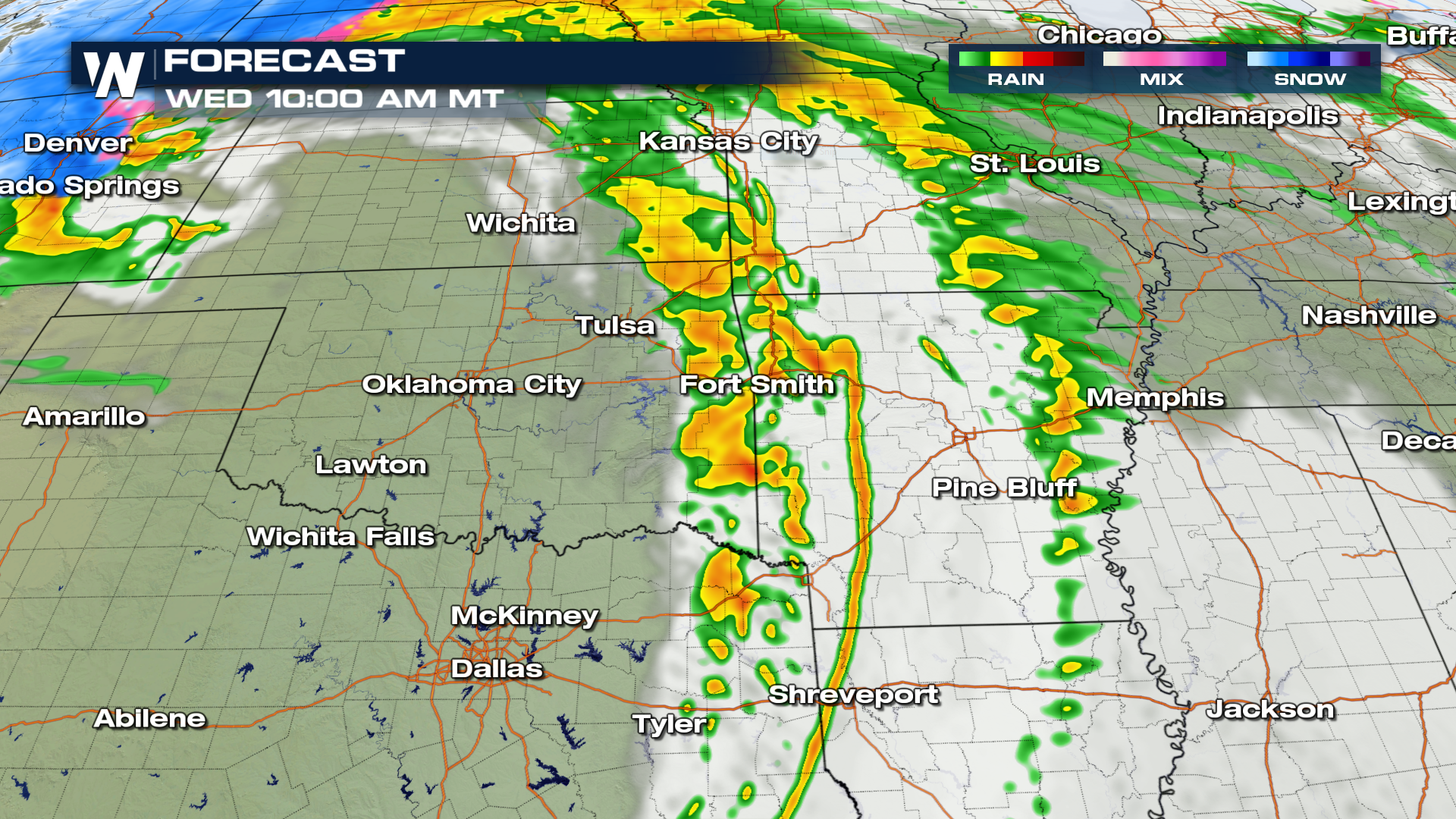
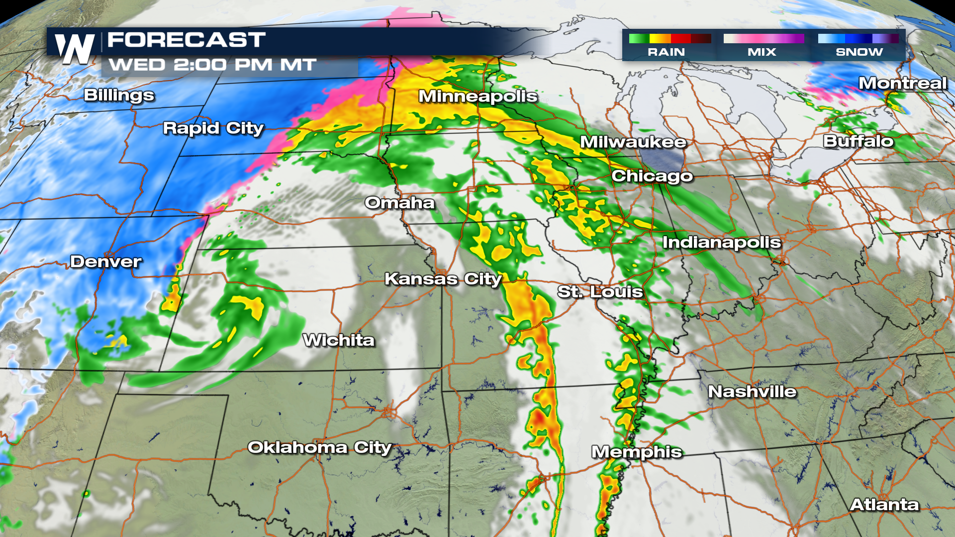
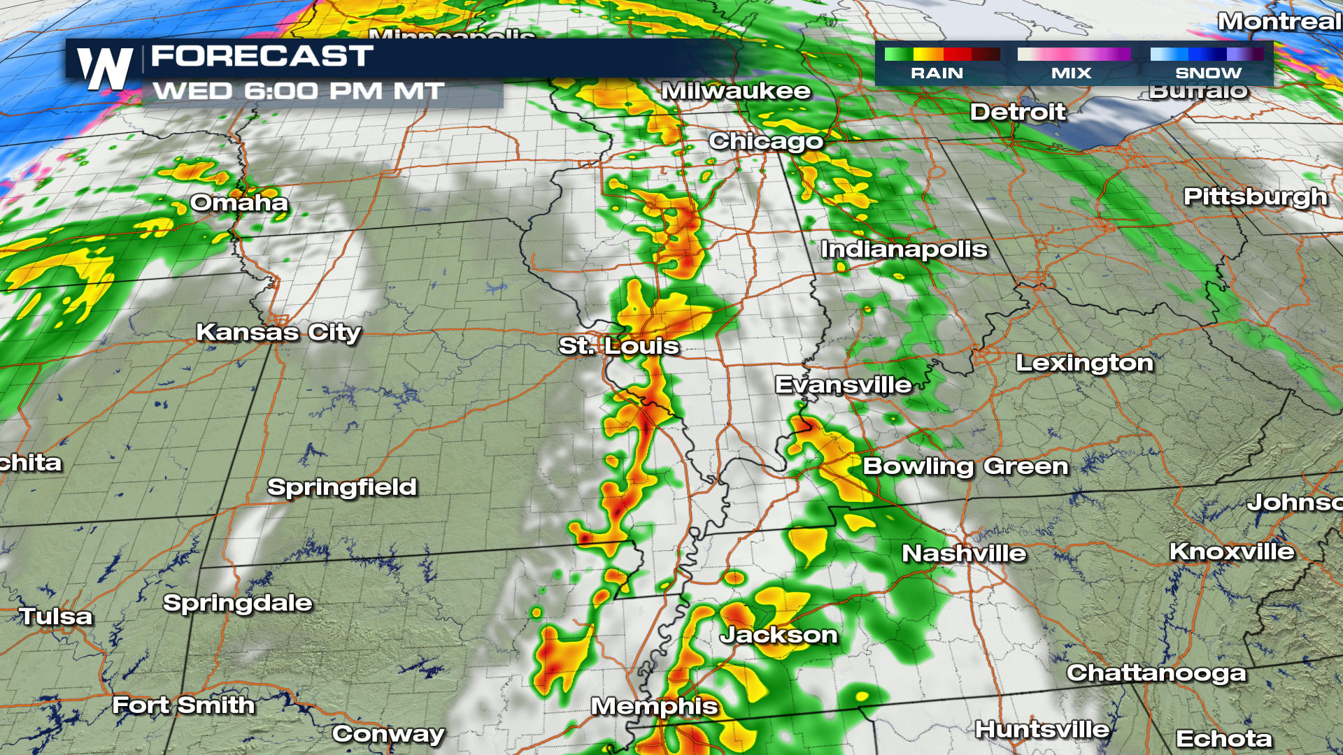
 Here is the expected movement throughout Wednesday afternoon and evening from 6 AM - 6 PM MST.
 For WeatherNation, I'm Meteorologist Greg Rule
The winds will also be an issue Wednesday afternoon as severe storms may generate gusts in excess of 50-60 MPH.
Hail, possibly up to 1-2" in diameter is also in the forecast for Wednesday.
As the storm moves through the area, expected rain totals will produce anywhere from 1 - 3"+ by Thursday. Areas shaded in yellow will likely see the largest accumulations.
Here is the expected movement throughout Wednesday afternoon and evening from 6 AM - 6 PM MST.
For WeatherNation, I'm Meteorologist Greg RuleAll Weather News
More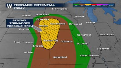
Spring Snow on the Horizon in Colorado
Snow is on the way for the mountains of Color
26 Apr 2024 3:00 AM
Weekend Forecast: More Severe Weather
We are looking at the threat of another sever
26 Apr 2024 2:45 AM
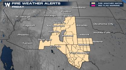
Critical Fire Risk in West Texas, New Mexico
A critical fire risk is in place for west Tex
26 Apr 2024 2:40 AM

National Park Week: Get Out and Explore
National Park Week started Saturday, April 20
25 Apr 2024 9:30 PM

NOAA Debuts "HeatRisk" Tool Nationwide
More people die from heat every year than ALL
25 Apr 2024 9:00 PM

Double Trouble: Cicadas Take to the Skies this Spring
It’s the soundtrack to the summer. Nature’s n
25 Apr 2024 8:45 PM