Hurricane John Resurrects in Mexico

Top Stories
26 Sep 2024 3:00 AM
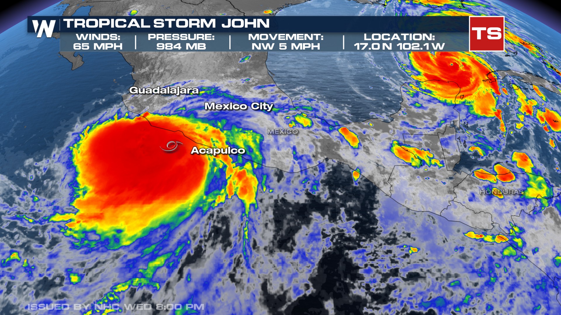
MEXICO - John officially made landfall as a category 3 hurricane with maximum sustained winds of 120 mph on September 23, 2024. This happened near the city of Marquelia, Mexico along the southern coast of Mexico. Pressure was as low as 959 mb.
As John interacted with the difficult topography of southern Mexico it became a remnant low earlier this week. Since then, John has meandered back into the open waters of the Pacific, restrengthened and is now back to tropical storm status.
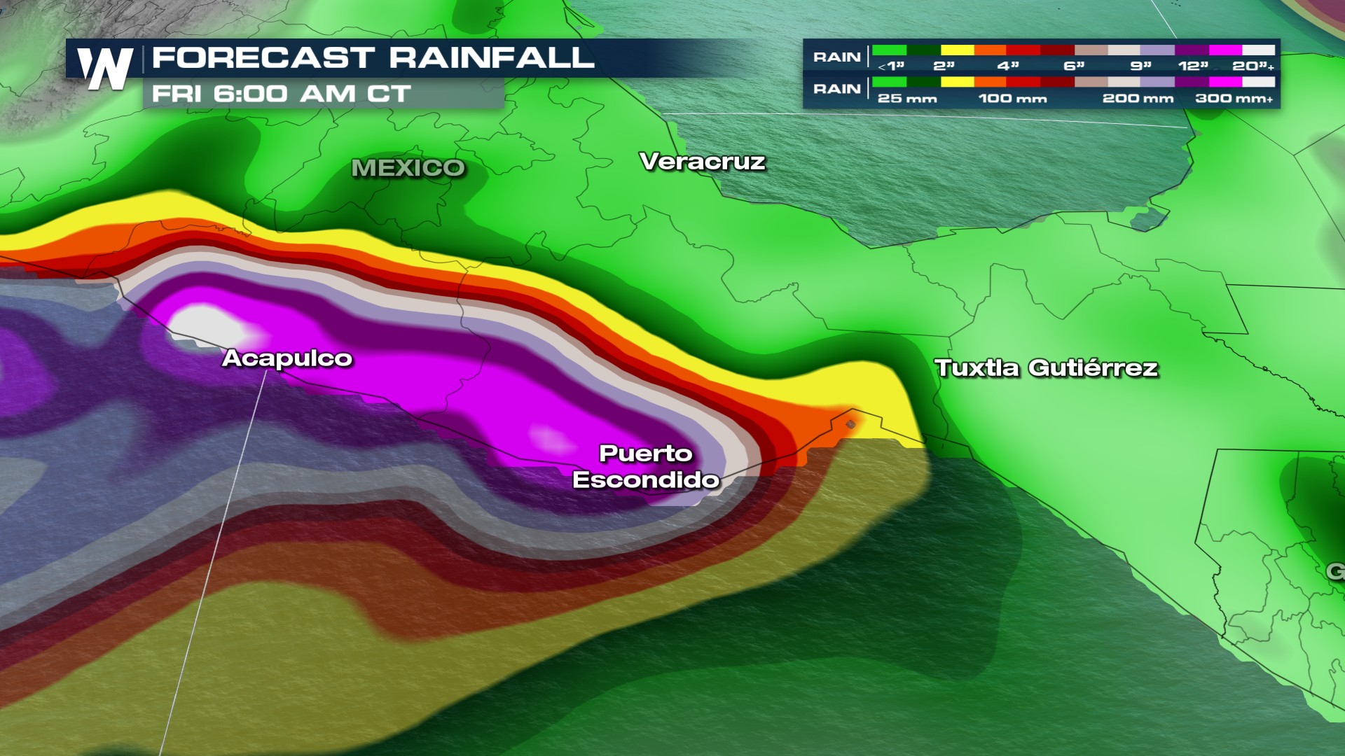
Forecasted rainfall totals could reach 6-12" with isolated totals near 15" across the coast and 10-20" with isolated totals near 30" near the Oaxaca coast to southeast Guerrero.
Stay with WeatherNation for the latest forecast on the tropics in the coming days.
All Weather News
More
Wildfire Outbreak in the Pacific Northwest
SPOKANE, WA - On Saturday, August 1st, the Ol
3 Aug 2026 1:55 AM

More Storms for the East Through Monday
A low-pressure system that moved through the
3 Aug 2026 1:50 AM


After Reaching Category 5, Genevieve Weakens in the Pacific
PacificGenevieve formed last Friday south of
3 Aug 2026 12:30 AM

Flooding, Severe Storms Target the Midwest Again
After an active week of storms across the nor
1 Aug 2026 1:40 AM

Flooding Risk Increases as Heavy Rain Targets the Tri-State Area
Tuesday, heavy rainfall moved across the Nort
30 Jul 2026 12:25 AM

Severe Weather: Energy From the Midwest Now in the Southeast
UPPER MIDWEST - Through Monday, dangerous tor
29 Jul 2026 10:30 PM