Daily Afternoon Thunderstorms Across the High Plains

Top Stories
25 Jul 2025 3:00 AM
Daily afternoon thunderstorms will remain in the forecast east of the Rocky Mountains and out onto the High Plains. With plenty of heat and moisture, severe thunderstorms will be possible.
Along with ample heat and moisture, strong upper-level winds will continue to overspread the area, both from an upper-low dipping down from Canada and along the periphery of the big heat dome across the central U.S. Friday's SPC risk includes the Dakotas for the threat of wind and hail. An isolated tornado threat is possible too.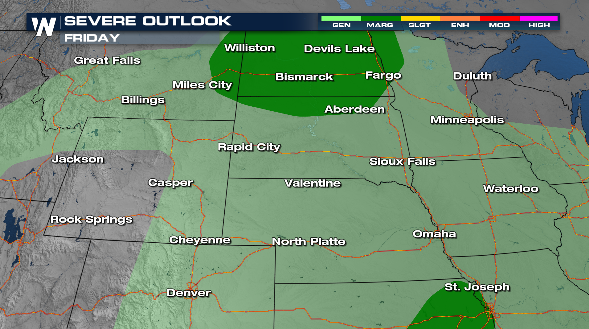
More severe storms will be possible across Montana on Saturday. With the repeated rounds of heavy rain, some flooding could be possible.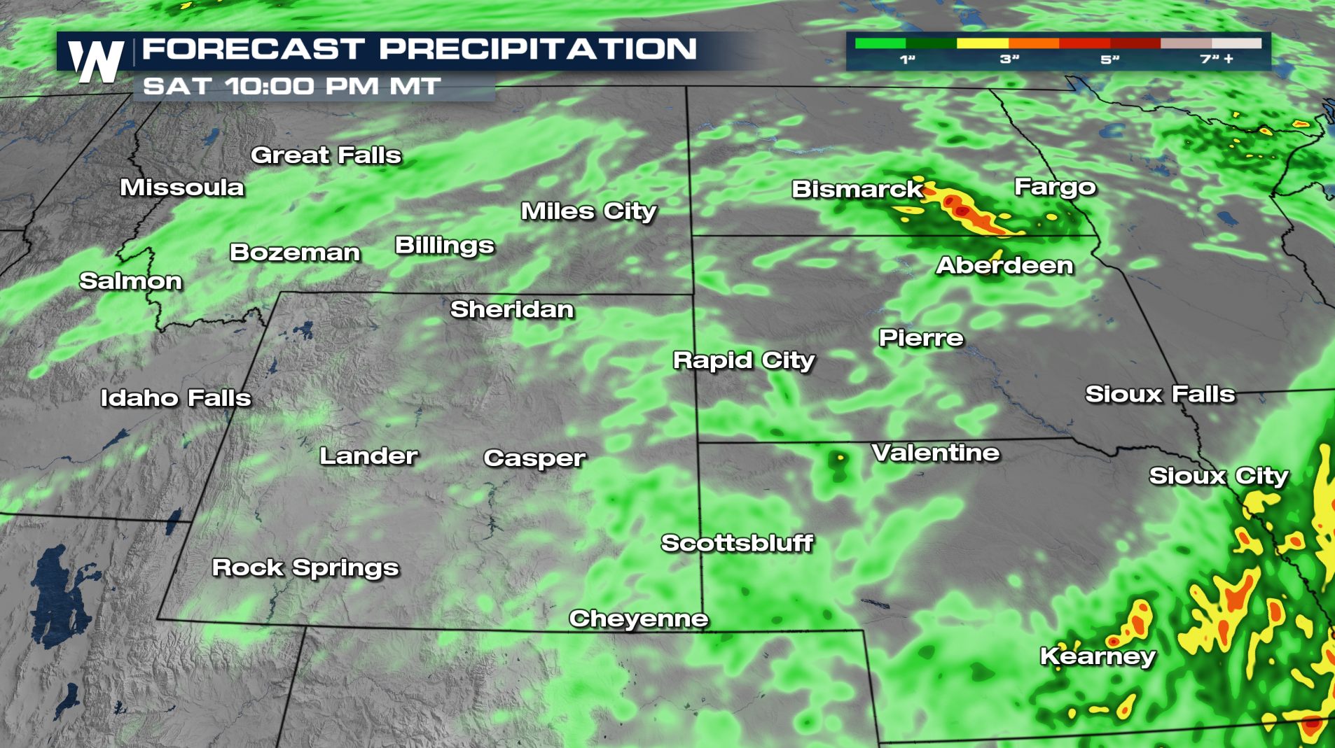
All Weather News
More
Fire Danger Plagues an Already Blistering West
It's been unbearably warm across the west for
26 Mar 2026 12:50 AM

More Records Obliterated - Heat Soars into Central U.S.
ABOVE - The month of March has been setting r
26 Mar 2026 12:35 AM

Sharp Front Sparks More Severe Chances Late Week
It's the season of swings! Baseball counts bu
26 Mar 2026 12:25 AM

Cherry Blossoms Expected to Peak in a Week
Top Image Credit: National Parks ServiceSprin
24 Mar 2026 9:50 AM

Pineapple Express Delivers Another Round of Rain
Heavy rainfall from moisture that inundated t
24 Mar 2026 9:45 AM

Powerful Kona Low Devastates Hawaii Over the Weekend
After record shattering rain and hurricane fo
23 Mar 2026 4:30 PM

Severe Storm Potential Heads East from the Ohio Valley to the Southeast
A series of systems moving across the Norther
23 Mar 2026 2:10 AM