Destructive Tornadoes, Hail From Multi-Day Severe Outbreak

Severe storms have finally moves offshore after multiple days of severe weather that lasted from Tuesday into Thursday morning.
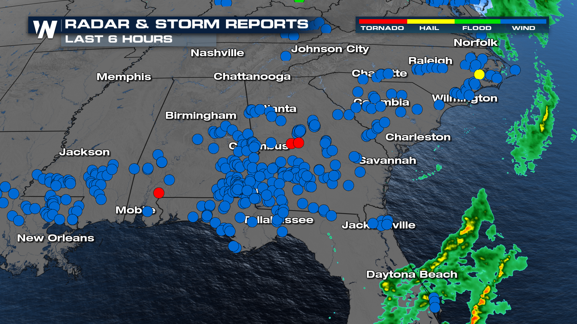
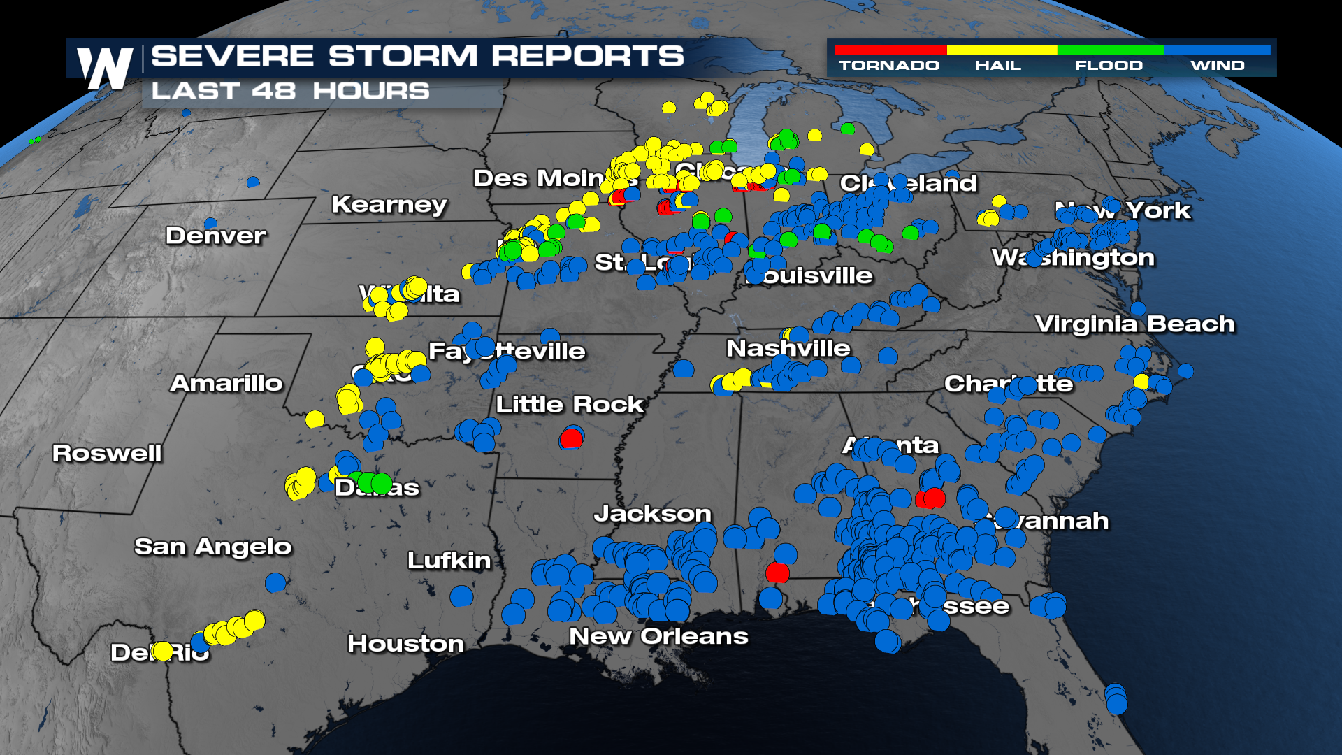
Things are finally quieting down from this multi-day severe weather outbreak, but not before 200+ severe wind reports, 150+ hail reports, and 30+ tornado reports to the Storm Prediction Center.
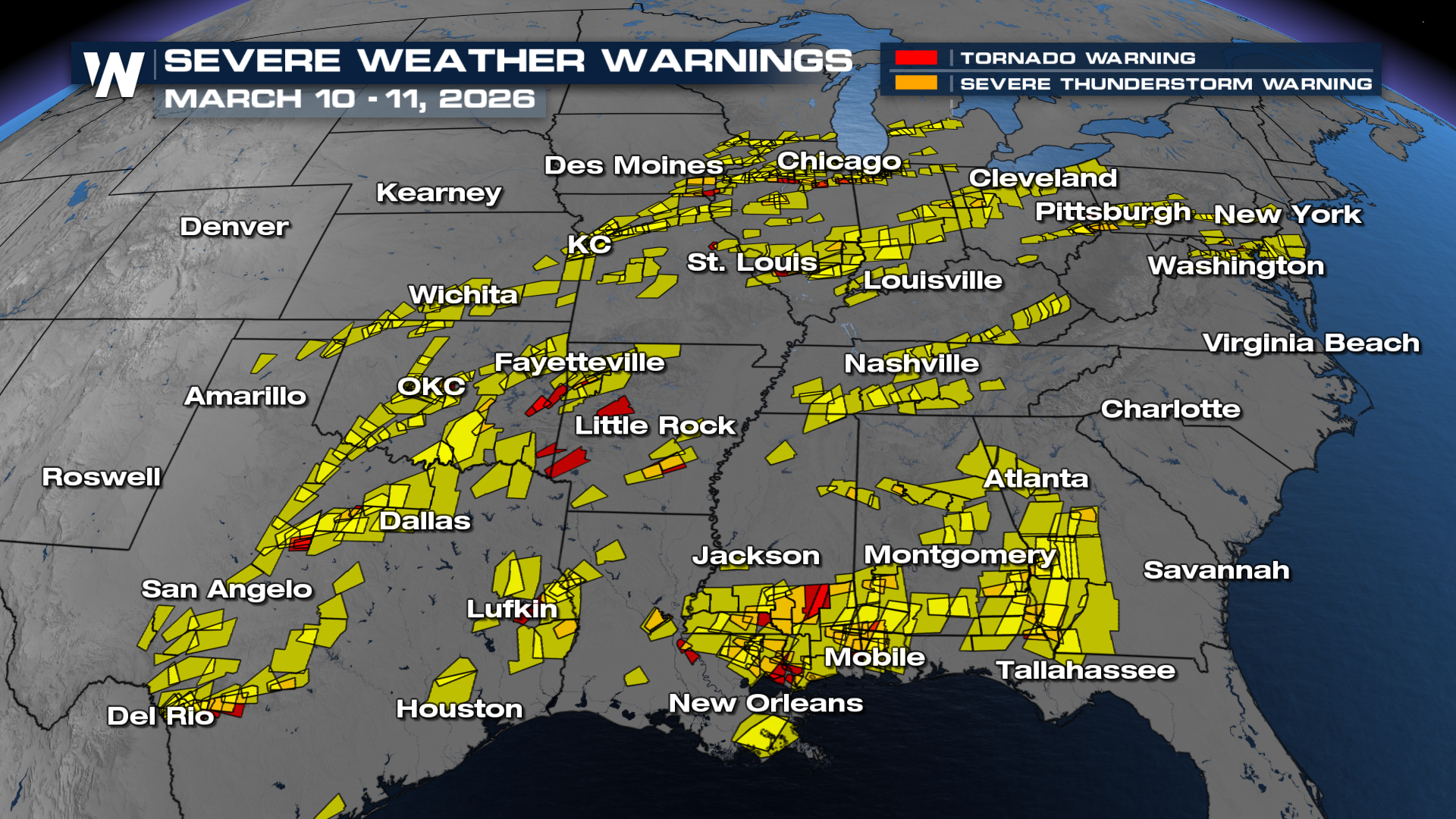
Tuesday, March 10, will go down as record-breaking for at least one state in the Midwest. After the Storm Prediction Center upgraded parts of Illinois and Indiana to a Moderate (Level 4/5) Risk, destructive severe storms ripped through the heart of the country. A large supercell on the ground for up to 45 minutes produced a large and dangerous tornado in the town of Kankakee, IL. The National Weather Service in Chicago has issued preliminary damage assessments rating this tornado as an EF-3 with max winds of 150mph. Our field crews were on the ground to capture it as it happened and to speak with the families impacted.
First responders worked tirelessly, picking up debris and searching for survivors in the aftermath. Loads of footage came out of this tornado, much of which was heartbreaking to see.
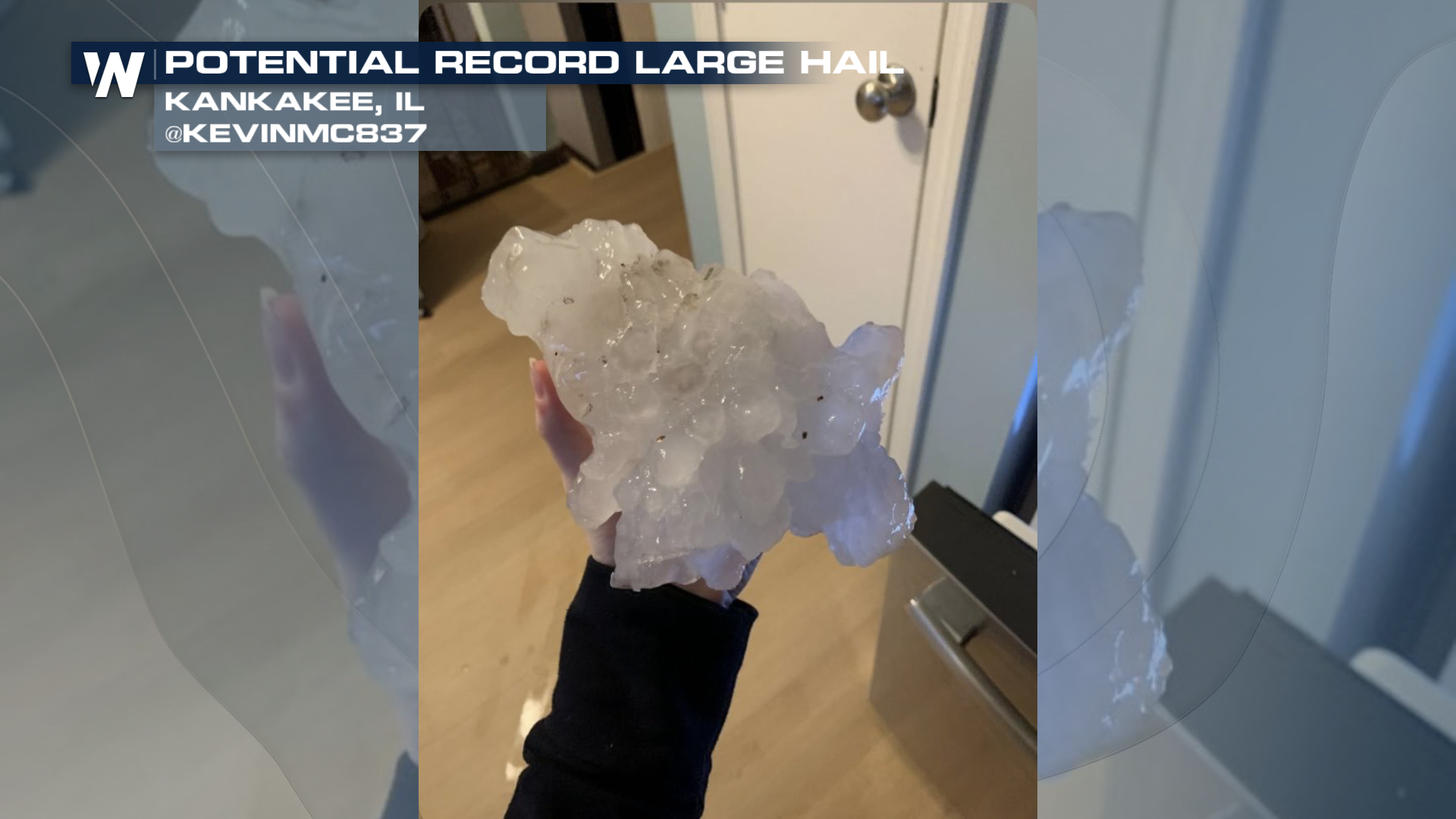
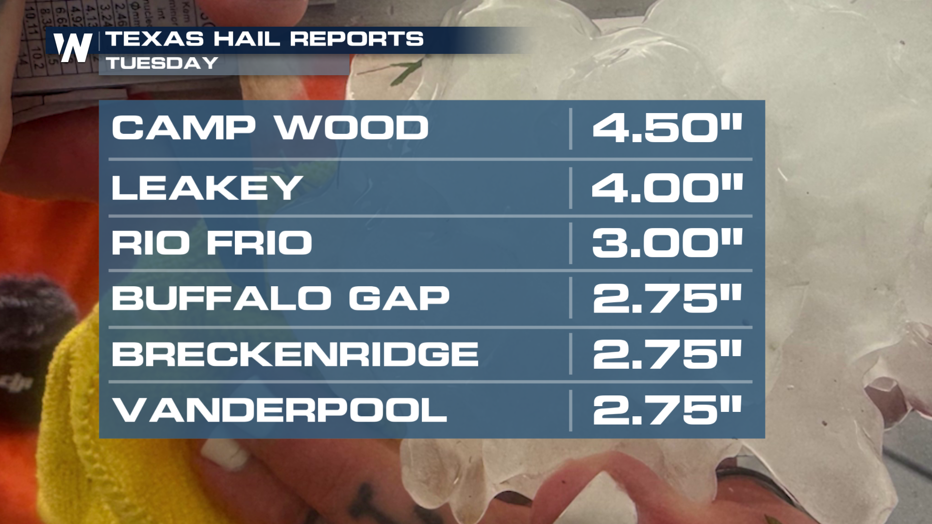
A highly unstable atmosphere led to strong updrafts, resulting in large hail during severe storms. Hailstones the size of softballs and larger were reported in Texas and Illinois.
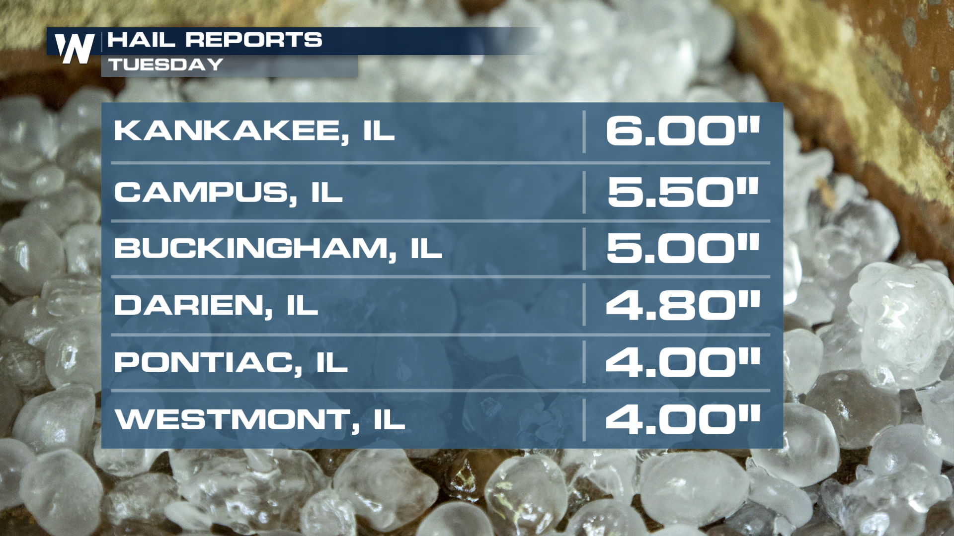
A hailstone from the Kankakee, IL supercell looks likely to be a state record, and could challenge national records for biggest hail. The photo posted by a Kankakee resident looks to be upwards of 7-8 inches in diameter! The stone will have to be examined to determine if it breaks the record set by hail from Vivian, South Dakota, in 2010 that measured 8 inches.