Catastrophic Flooding in the Texas Hill Country

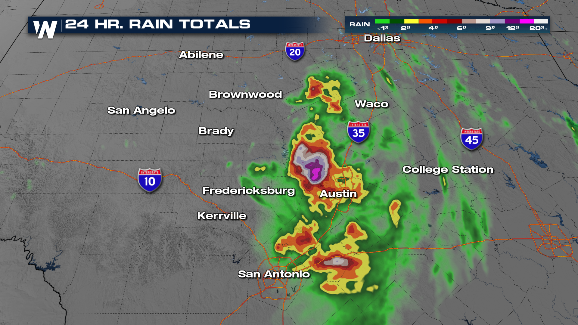
Multiple Flash Flood Emergencies were issued Friday morning and again Saturday morning as heavy rainfall moved through portions of the Texas Hill Country. Several locations accumulated over a foot of rainfall in a short amount of time, including San Angelo, which recorded almost 13" of rainfall. The yearly average of rainfall for San Angelo is around 21".
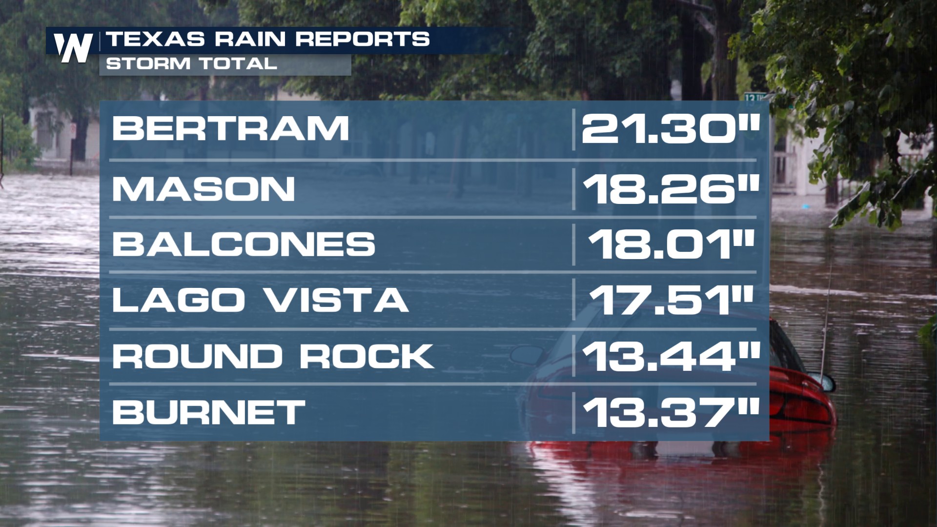
A second bullseye emerged near Round Rock, TX with over 20 inches of rain in Bertram, TX.
FRIDAY
As storms ignited Friday, they were largely anchored in the same position all night. Rainfall rates of 3-4 inches per hour started to pile up. Add into that the topography of the Texas Hill Country and we had a recipe for disaster.
All of the heavy rain that fell became focused into the Guadalupe River that runs through the area.
SATURDAY
Another nearly stationary cluster of storms developed overnight. Areas just west of Round Rock have already picked up more than 12 inches of rain since earlier this morning.
 As rivers rise again, please heed Flash Flood Warnings and get to higher ground as soon as they're issued.
WHAT HAPPENED?
A mesoscale convective vortex (MCV) was spinning around the area the past few mornings. That helps generate showers and storms - it's its own low-pressure system. That spun its way through a very moist airmass. But without any upper-level winds to help push these storms anywhere, it rained and rained over the same places for extended periods of time.


