Flash Flood & Tornado Risk Remain Elevated Overnight in Kansas & Missouri

news image
Top Stories
26 Jul 2025 3:20 AM

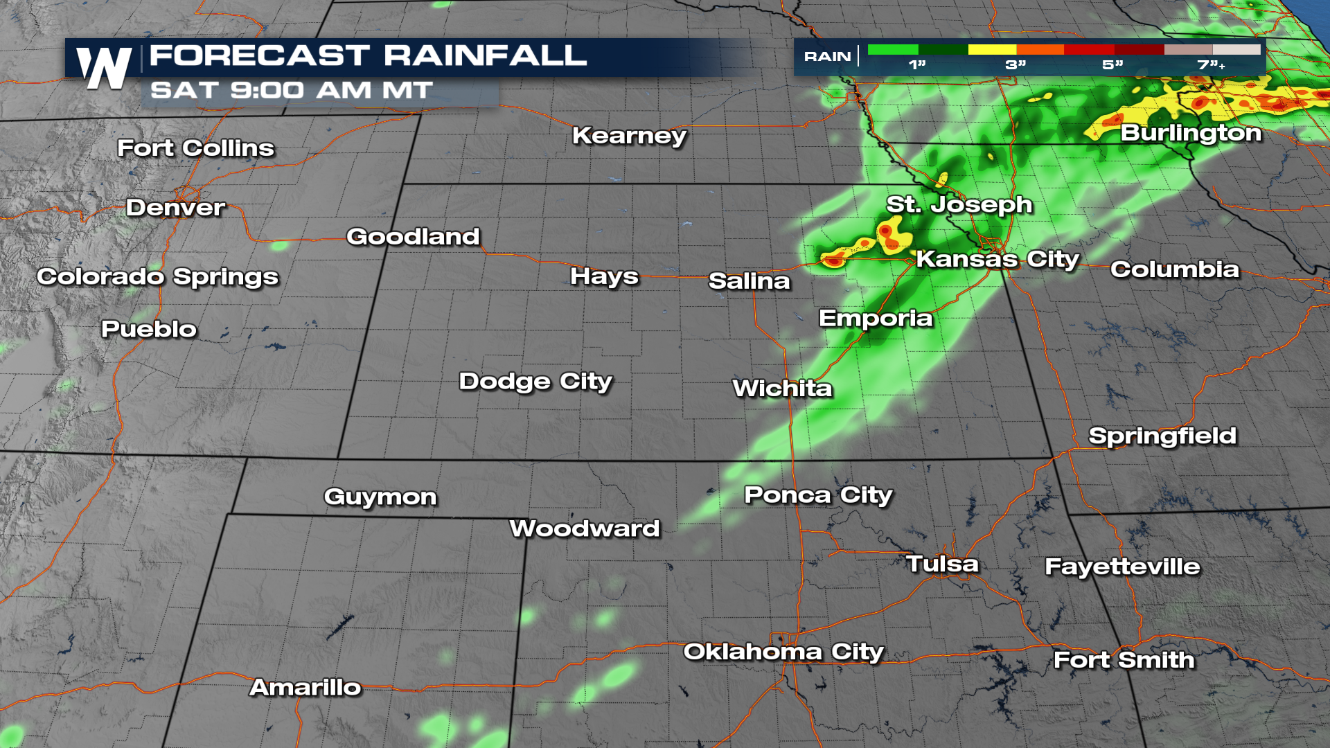
Rounds of rain have been rolling through the Plains and Midwest, leading to saturated soils. This has lead to a more significant flood potential into the early morning hours Saturday, before rain chances drop quickly through the rest of the weekend. A level 3 out of 4 risk (top of page) for flash flooding is in effect through early Saturday morning.

In addition to flooding, scattered damaging winds and hail are possible from thunderstorms in the Front Range of Colorado and near the low-pressure system from Oklahoma into Missouri.

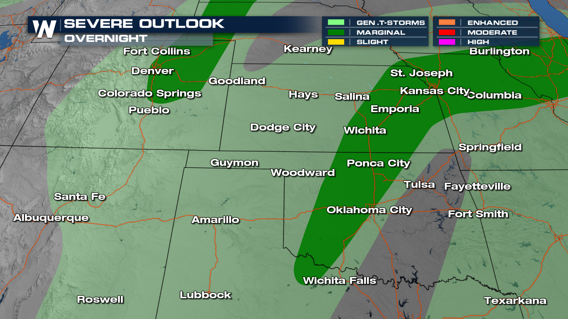
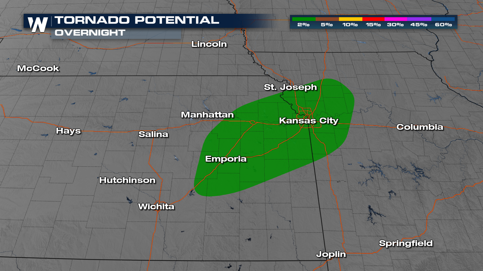
The low could help create enough turning motion to spur an isolated tornado.

Forecast

Storms will continue to rumble across the Kansas City area after midnight, with conditions settling down by daybreak.

Additional rainfall of 2-4 inches will be possible, particularly in stronger storms.

All Weather News
More
Extreme Cold to Impact Millions this Weekend

Extreme Cold to Impact Millions this Weekend

A sharp surge of Arctic air has spilled into

8 Feb 2026 3:30 AM
Rain and Snow Return to California on Sunday

Rain and Snow Return to California on Sunday

California has not had significant precipitat

8 Feb 2026 3:20 AM
Big Game Forecast

Big Game Forecast

The championship of the National Football Lea

8 Feb 2026 3:10 AM
Record Heat Moves from West to Midwest

Record Heat Moves from West to Midwest

As troughing sets in across the Pacific, high

8 Feb 2026 3:00 AM
Heavy Snow Lingers in New England Saturday

Heavy Snow Lingers in New England Saturday

Snow blew through much of the Northeastern Un

7 Feb 2026 8:00 PM
California Snow Pack Drops After Dry January

California Snow Pack Drops After Dry January

Following a surge of wet storm systems in Dec

7 Feb 2026 9:55 AM
Another Cold Night for Residents of the Southeast

Another Cold Night for Residents of the Southeast

Following a historic winter storm last weeken

6 Feb 2026 3:15 AM