Stormy Pattern Continues for West Coast

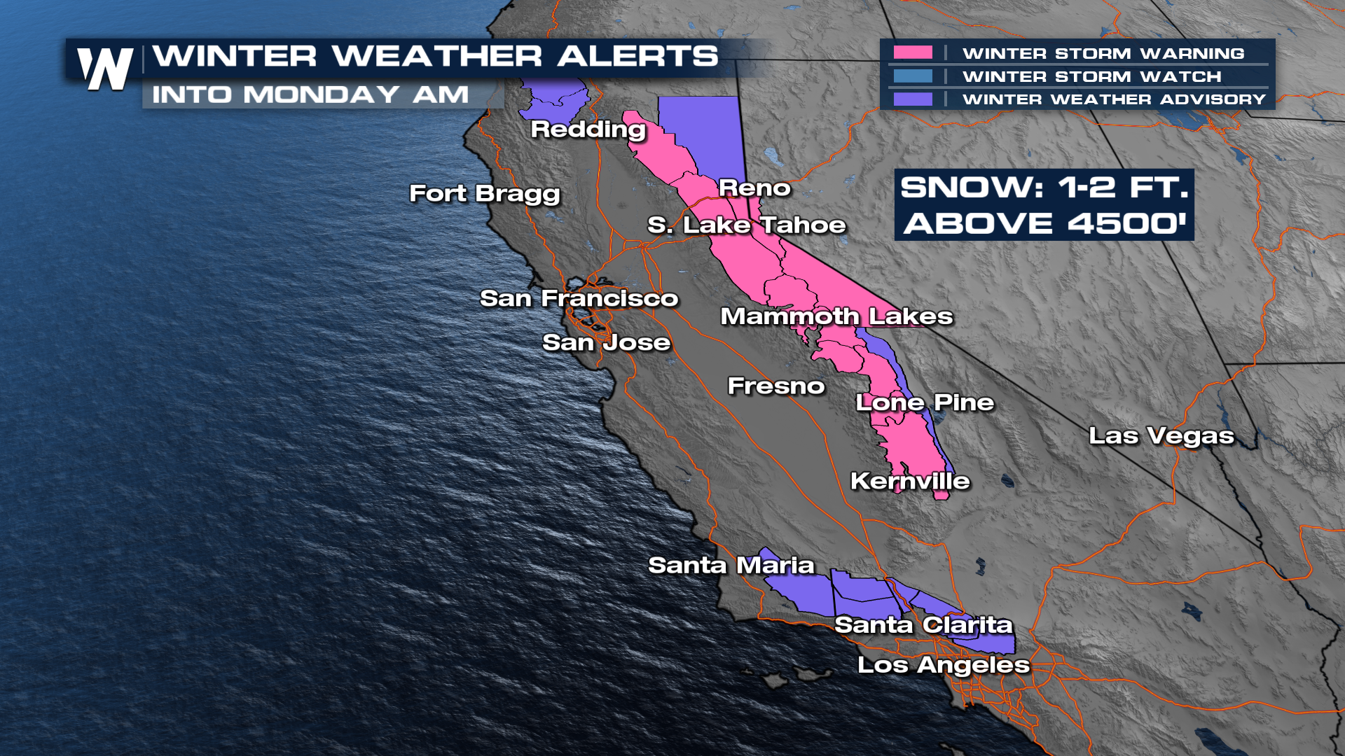
A series of storms is lining up to impact the West Coast, bringing days of wet and unsettled weather to parts of California and the Rockies. Gusty winds will also accompany the system at times, adding to the overall impact. As of now, isolated severe storms are expected in the Bay Area. In the higher elevations, snowfall is expected. 1-2 feet of snowfall is possible for the Sierra Nevada mountains. Winter weather alerts are already in place.
Higher elevations will see a different side of this system, with colder air allowing snow to fall across the mountains. Snow levels are expected to drop enough for accumulating snow in the Sierra Nevada, where totals could become significant. Winter Storm Advisories and Warnings have been issued for portions of the Sierra Nevada and higher terrains in Southern California through tonight for a couple of feet of snowfall in the higher elevations, mostly above 4500 feet. This could create hazardous travel conditions in mountain passes, with slick roads and reduced visibility due to falling snow and wind.
A stronger cold front moves in tonight, and it will drag down some cooler air to support heavy snow chances in the Sierra. Travel could be a little dicey on Interstate 80. Southern California will also get in on the precipitation.
Rainfall totals are expected to build quickly as each wave moves through. Several inches of rain could fall in parts of California and Oregon, with the heaviest amounts likely in coastal areas and higher terrain. Totals may surpass a foot in the high country and at the peaks of the mountains, but the Donner Pass will be a slick one to travel over.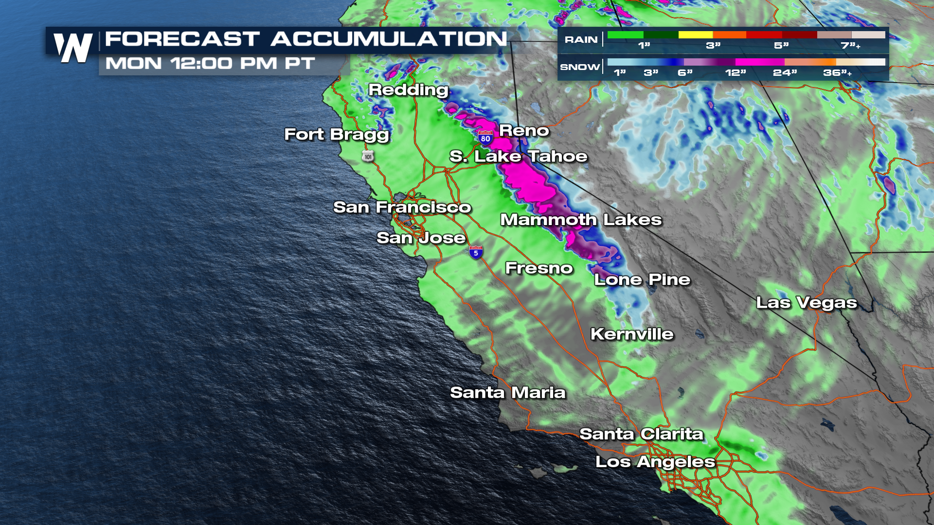
The unsettled pattern is expected to continue into early next week, meaning the West Coast will not see much of a break from the active weather anytime soon. As these systems push inland, they may also help trigger additional weather impacts farther east, extending the reach of this stormy stretch beyond the coastline.
Four Corners Moisture
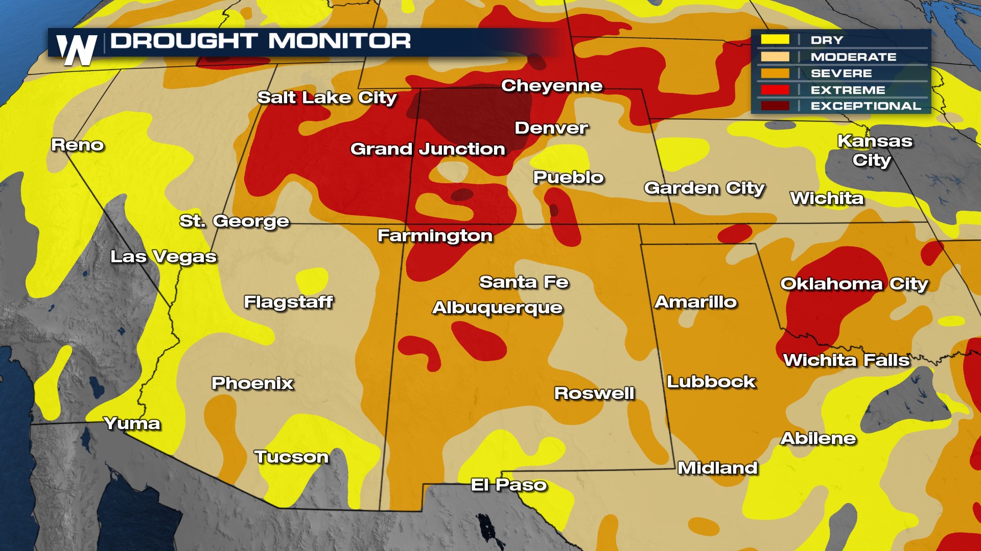
Here is a closer look at the incoming rain, thunderstorms, and snow for the Intermountain West. A few showers and storms may sneak into portions of New Mexico and Arizona, but the majority of the moisture looks to happen in Colorado, Utah, Wyoming, and Montana. This moisture picks up over the next few afternoons, which is great news for the drought.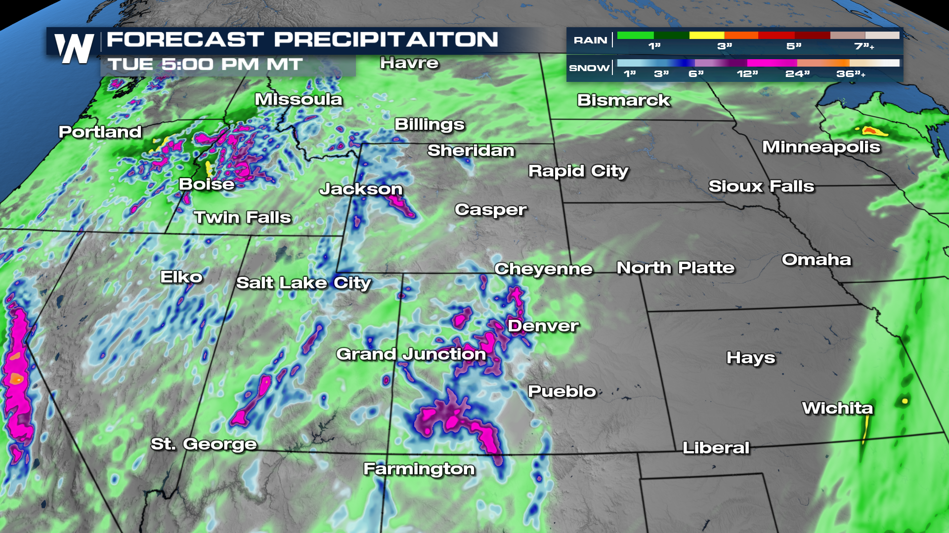
Drought conditions have intensified to extreme and exceptional levels out west due to a lack of moisture, especially across the northern Four Corners. Any moisture to make it this way will be beneficial to the area.
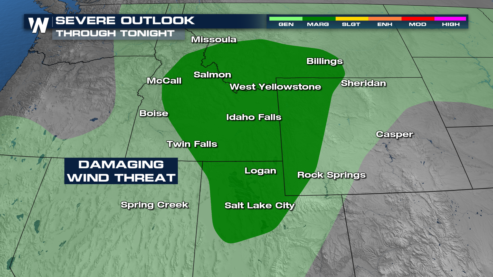
 However, some of that moisture might come with some strong winds. Montana, Wyoming, Idaho and Utah are all in a marginal risk for severe storms Sunday.