Heavy Rain Chances Return to Florida

Thanks to Humberto, Imelda has moved away from Florida and will bring impacts to Bermuda. In the coming days, we are monitoring an area of low pressure to develop under the big high pressure ridge across the Northeast and Upper Midwest. As a result, deep tropical moisture returns to Florida and the Atlantic and produce showers and thunderstorms. The onshore pattern of the winds will bring daily chances of thunderstorms.
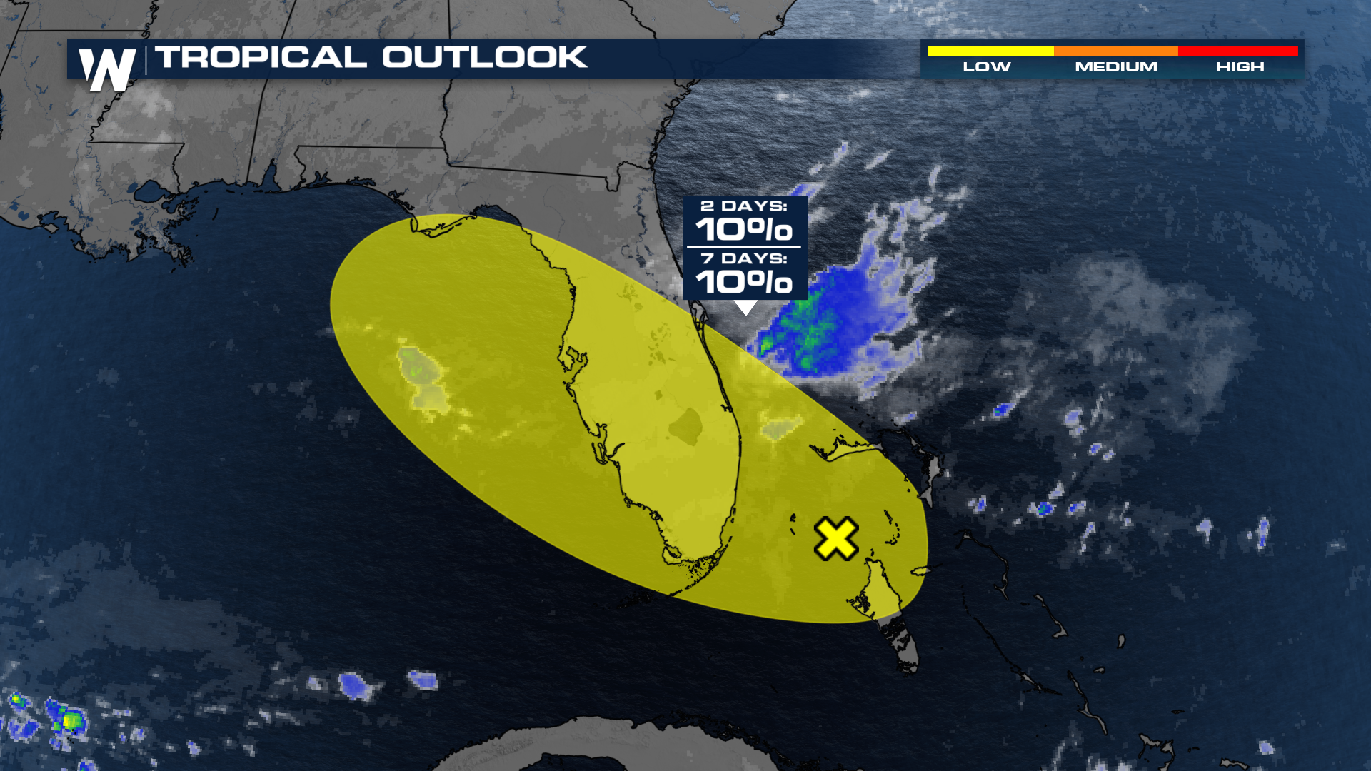
This, coupled with a potential developing low out in the Bahamas, is likely to bring heavy downpours to the east coast of Florida. An excess of tropical moisture left behind by Imelda and Humberto, will do the state of Florida no favors.
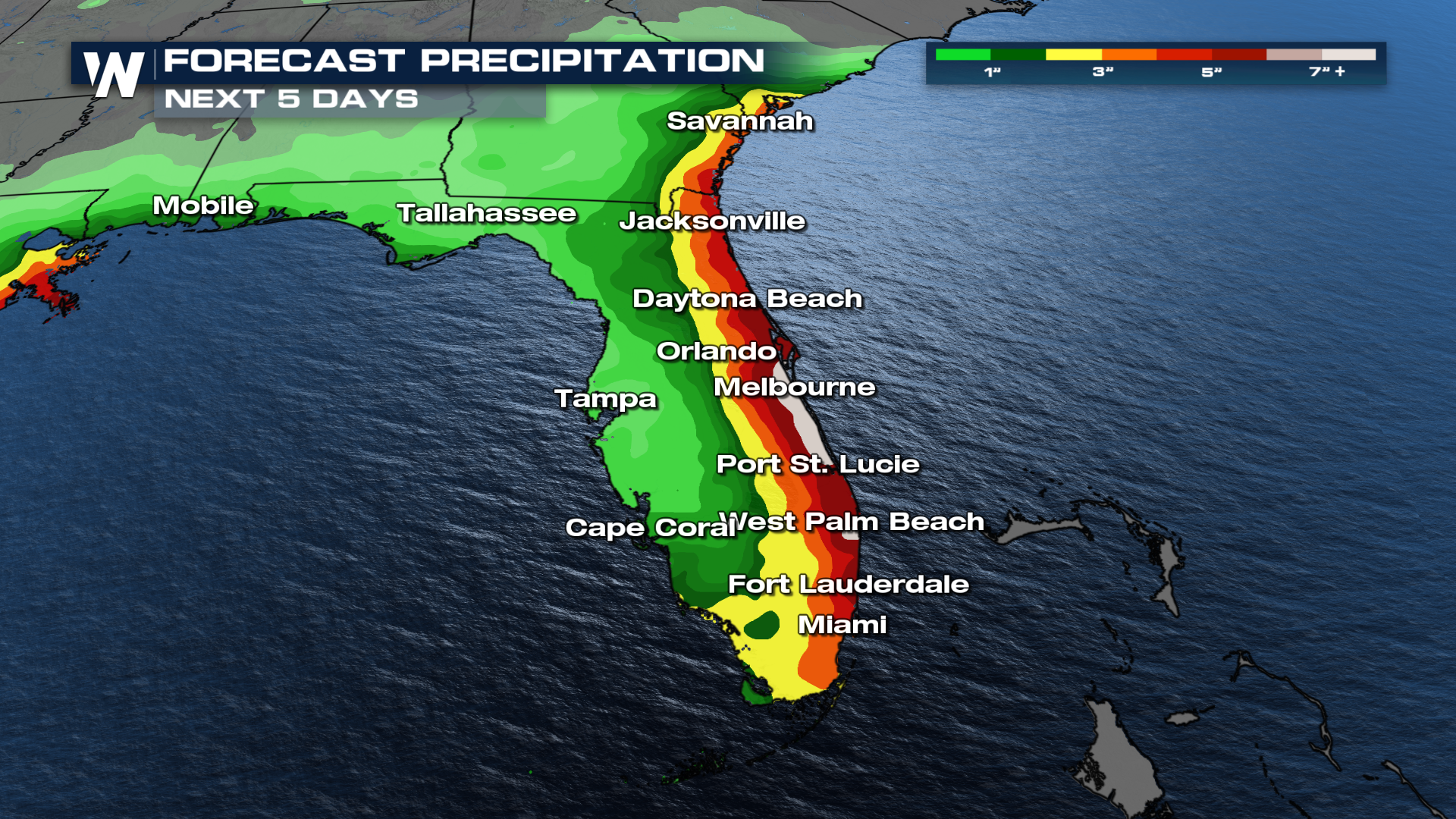
This influx of tropical moisture will farm enough energy for these thunderstorms to tap into. As a result, over the next five days, the forecast calls for about 3-5 inches of rain with isolated heavier totals along the Atlantic Coast sea board. Some flooding will be possible with the ground pretty saturated as of late.
As for that low out in the Bahamas, the National Hurricane Center has given this system low chances for some tropical development over the next 2-7 days. Regardless of any further development, we're still likely to see coastal impacts and heavy rain throughout this weekend.