Hurricane Season Starts in the Eastern Pacific
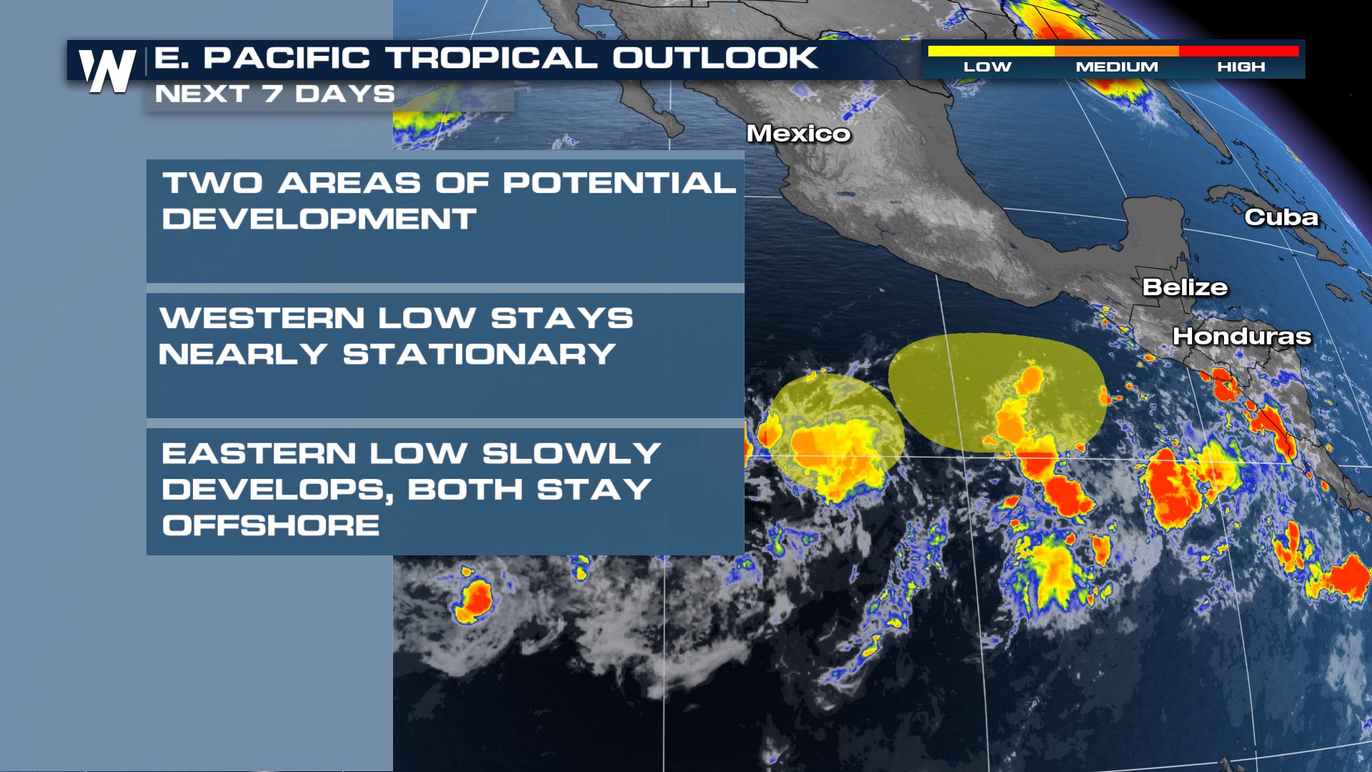
Eastern Pacific Hurricane Season began May 15th and we already have an area of interest in the Eastern Pacific Ocean. There are two areas of potential development in the eastern Pacific that could become tropical. The low-pressure system closer to the Mexico coastline could become a tropical depression this weekend as north/northwest parallels the Mexico coastline. If this becomes strong enough to be a tropical storm (winds 39+ mph) then the first name on the list is Aletta. The second area has a lower potential for development as it barely moves over the next few days and merges with the system to the east.
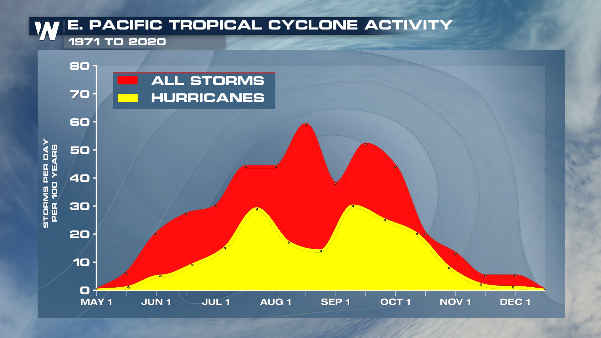
 Eastern Pacific Hurricane season has two peaks, one in early August and another in mid-September. This year we will be transitioning into a La Nina pattern which typically spells below-average hurricane activity in the eastern Pacific. This follows the busy 2023 Hurricane Season that brought Hurricane Otis, a category 5 storm that hit Acapulco, and Hurricane Hilary into the Southwest U.S. along with Hurricane Dora which contributed to strong winds and deadly wildfires on the Hawaiian Island of Maui.
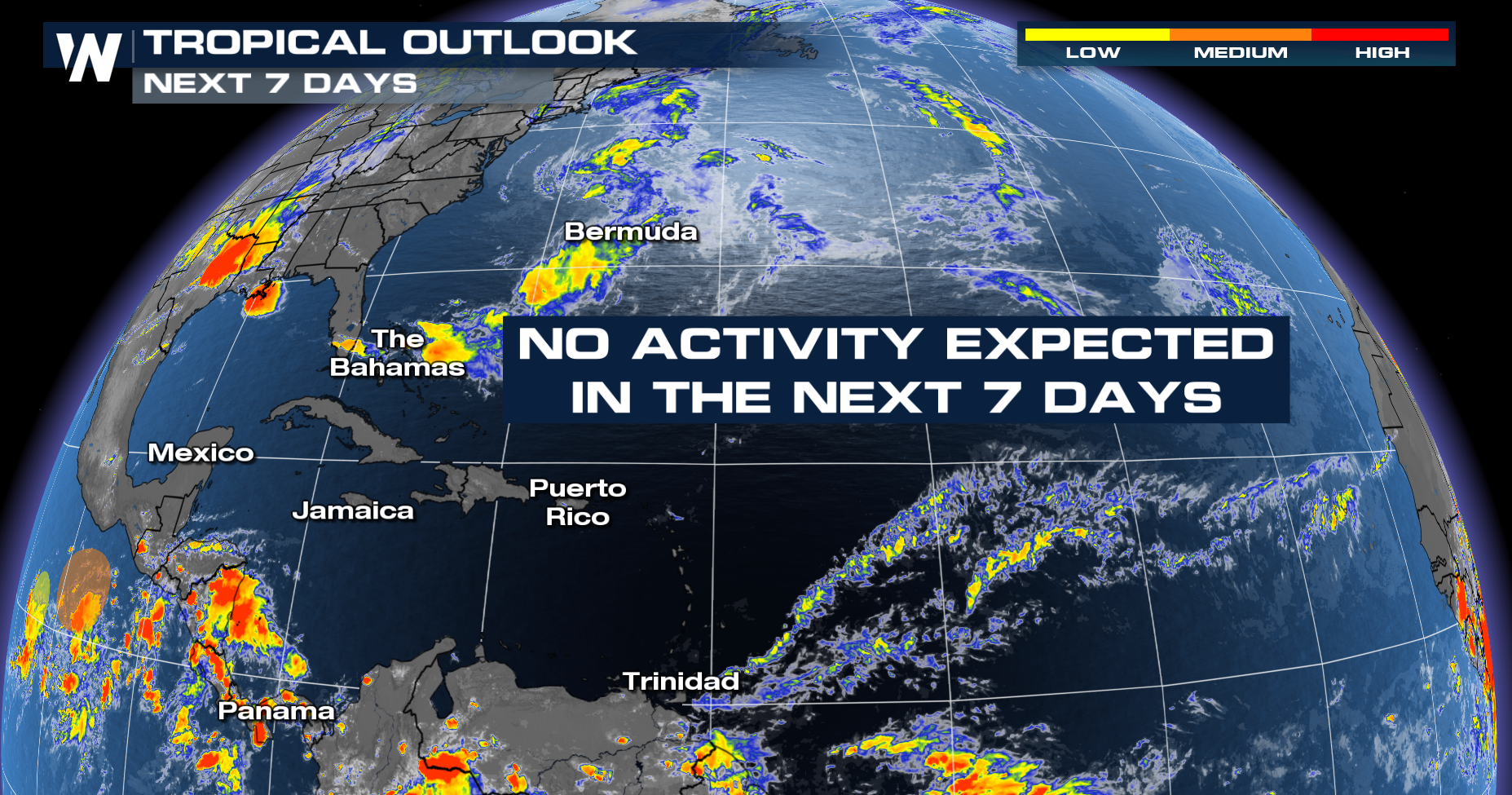
 Meanwhile, there is no tropical development in the Atlantic, which is not uncommon for May. Atlantic Hurricane season starts on May 1 and runs through November 30th. The peak of Atlantic Hurricane season is early September when the waters are at their warmest and there are typically waves of energy off the coast of Africa that can develop into tropical systems.
 This year is expected to be an above-average hurricane season in the Atlantic due to a transition to La Nina conditions. La Nina results in lowered wind shear (turning of wind with height) over the Atlantic reducing the amount that upper-level winds can tear apart hurricanes. Still, it only takes one hurricane to impact you and we highly recommend preparing ahead of time.