More Active Weather for the Southern Plains
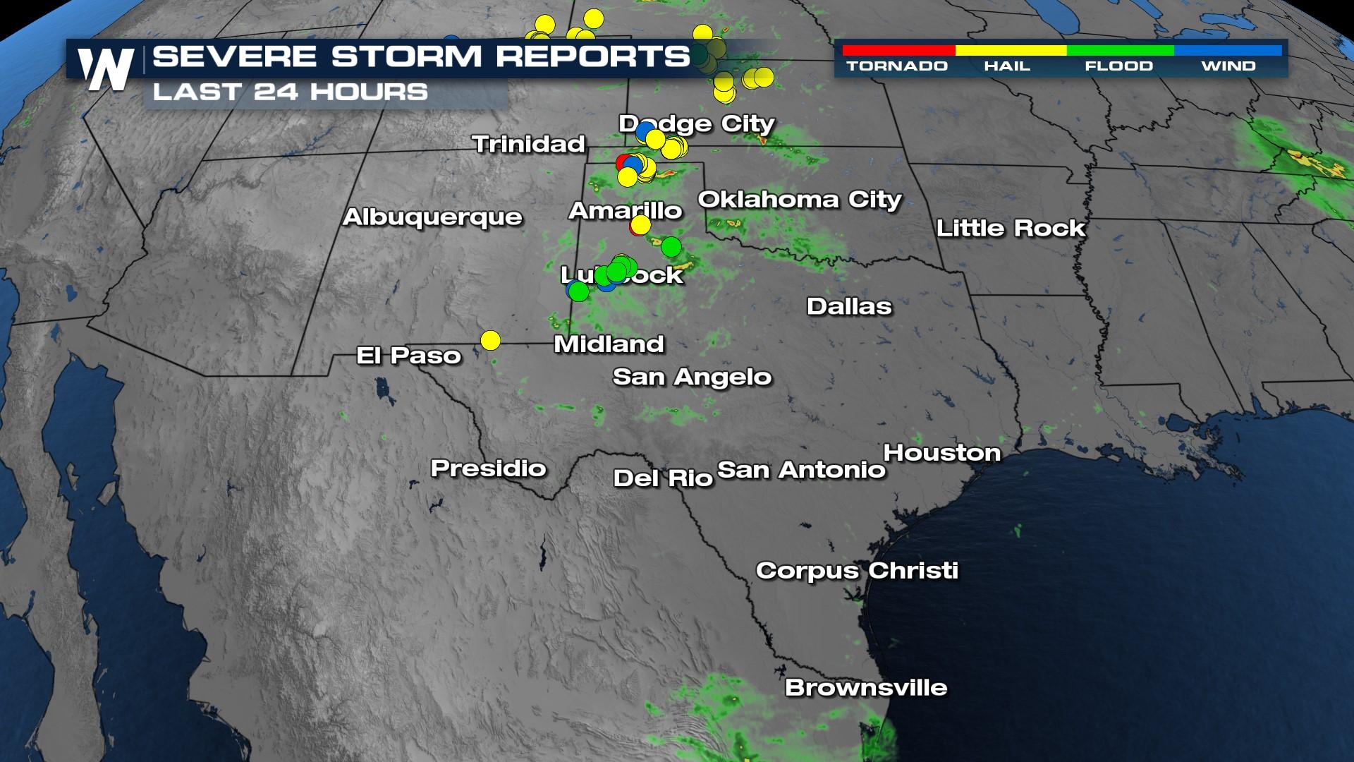
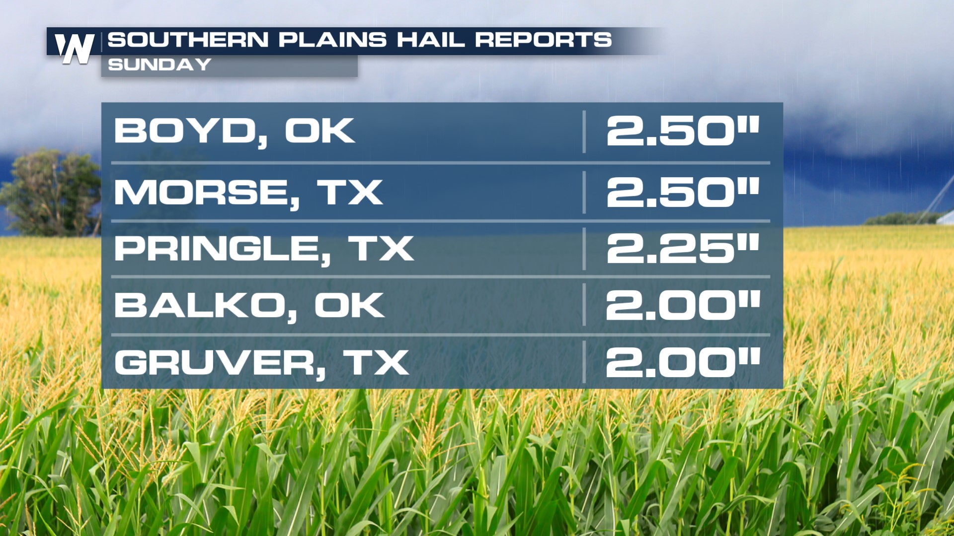
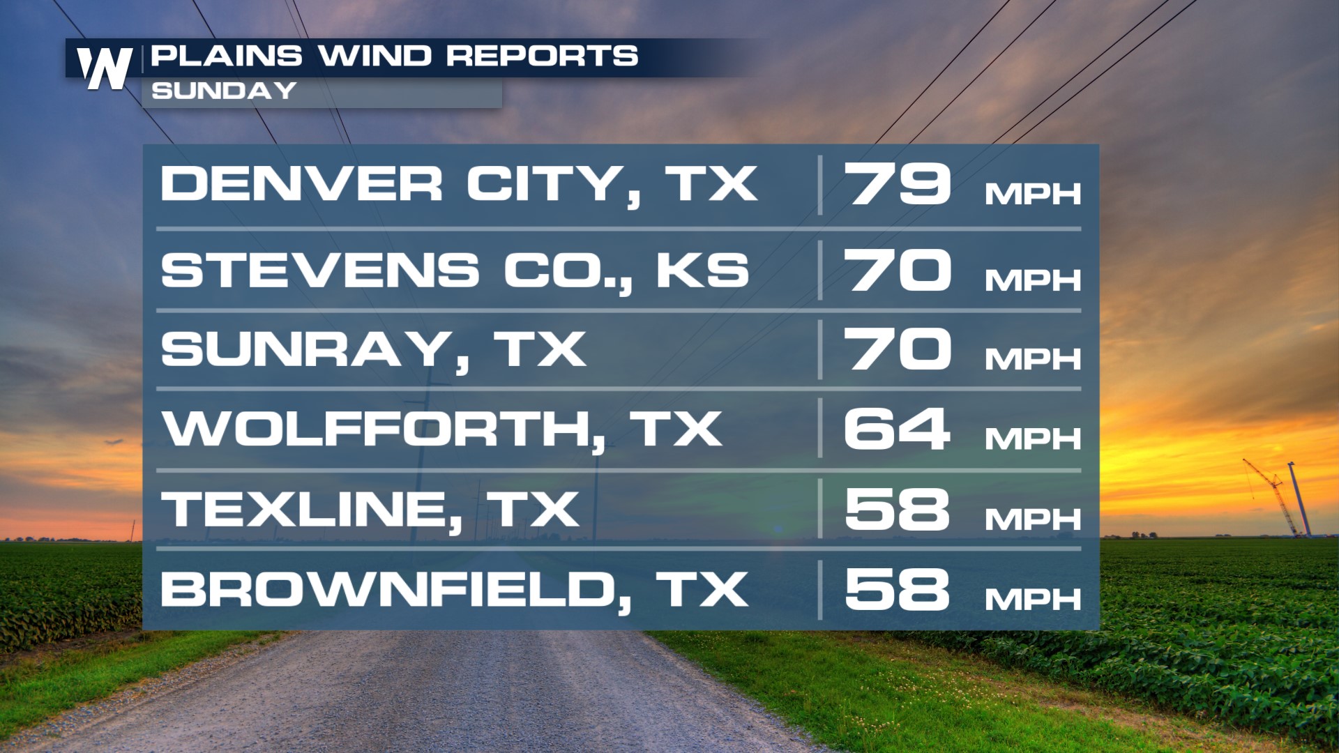
Scattered thunderstorms are expected to ignite this afternoon once again for some of the same cities that have already been impacted by heavy rain and severe storms. Below, are some reports taken from Sunday that include very large hail and very strong winds.
Severe Outlook
The Storm Prediction Center has issued a marginal outlook for areas south of San Antonio, TX. The rest of the state is under a general thunderstorm risk. Large hail and gusty winds will be the primary threats with any severe thunderstorm for south Texas.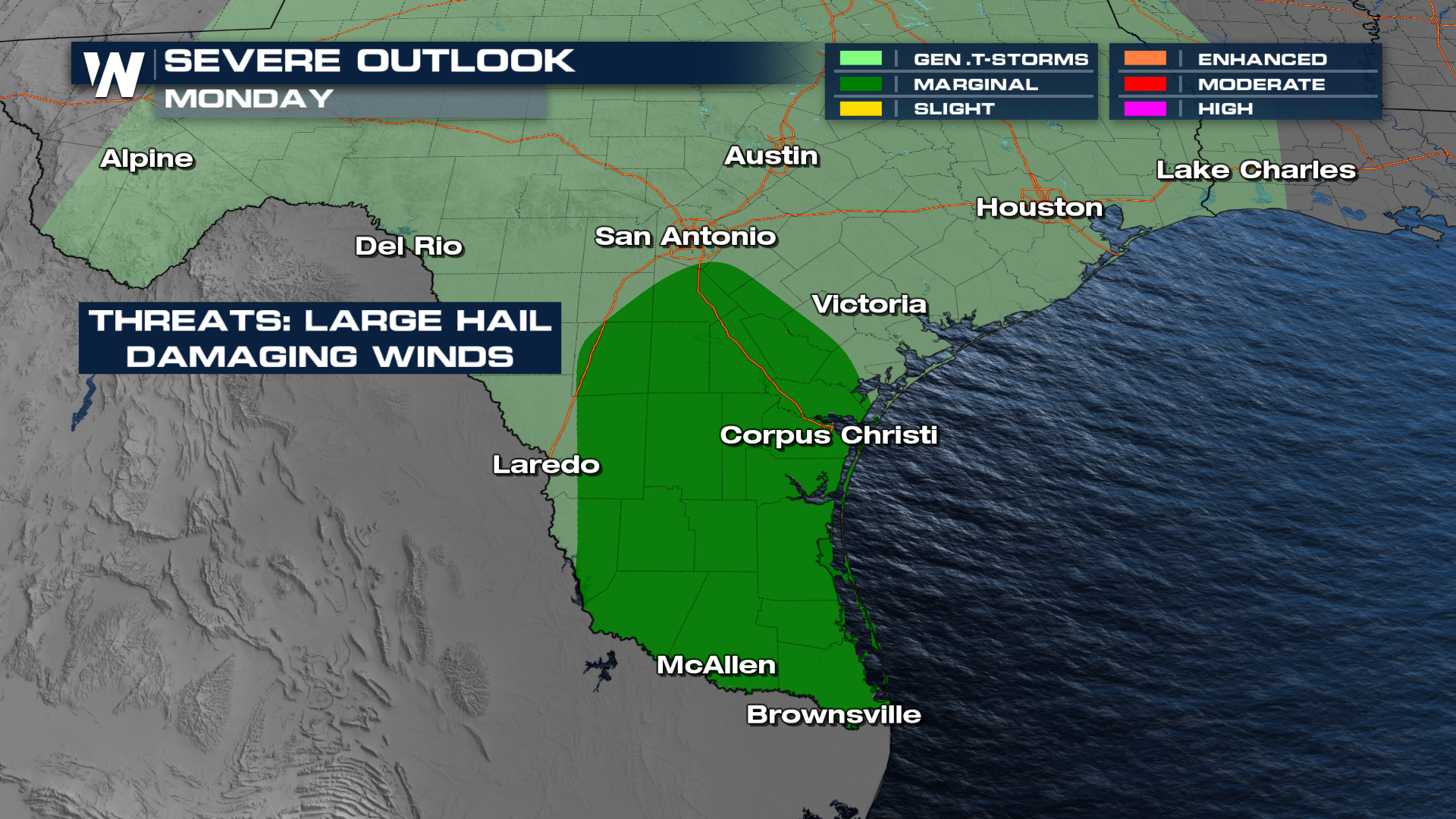
Forecast Timing
This afternoon, further storms will be possible. Notice that the storms ignite during the peak heating, t-storms will be anticipated until the sun sets, then the storms will settle down.
Flood Potential
Heavy rain has fallen over the past few days across much of the southern Plains. With further rainfall expected, flash flooding is possible. The Weather Prediction Center has issued a Slight Risk of excessive rainfall on Monday.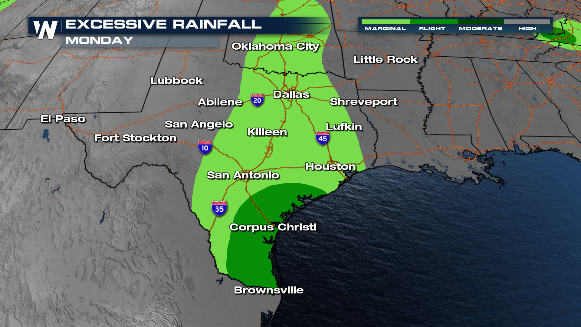 Localized rainfall totals from storms have had a tendency to trigger flash flood warnings. These have been very slow-moving storms.
 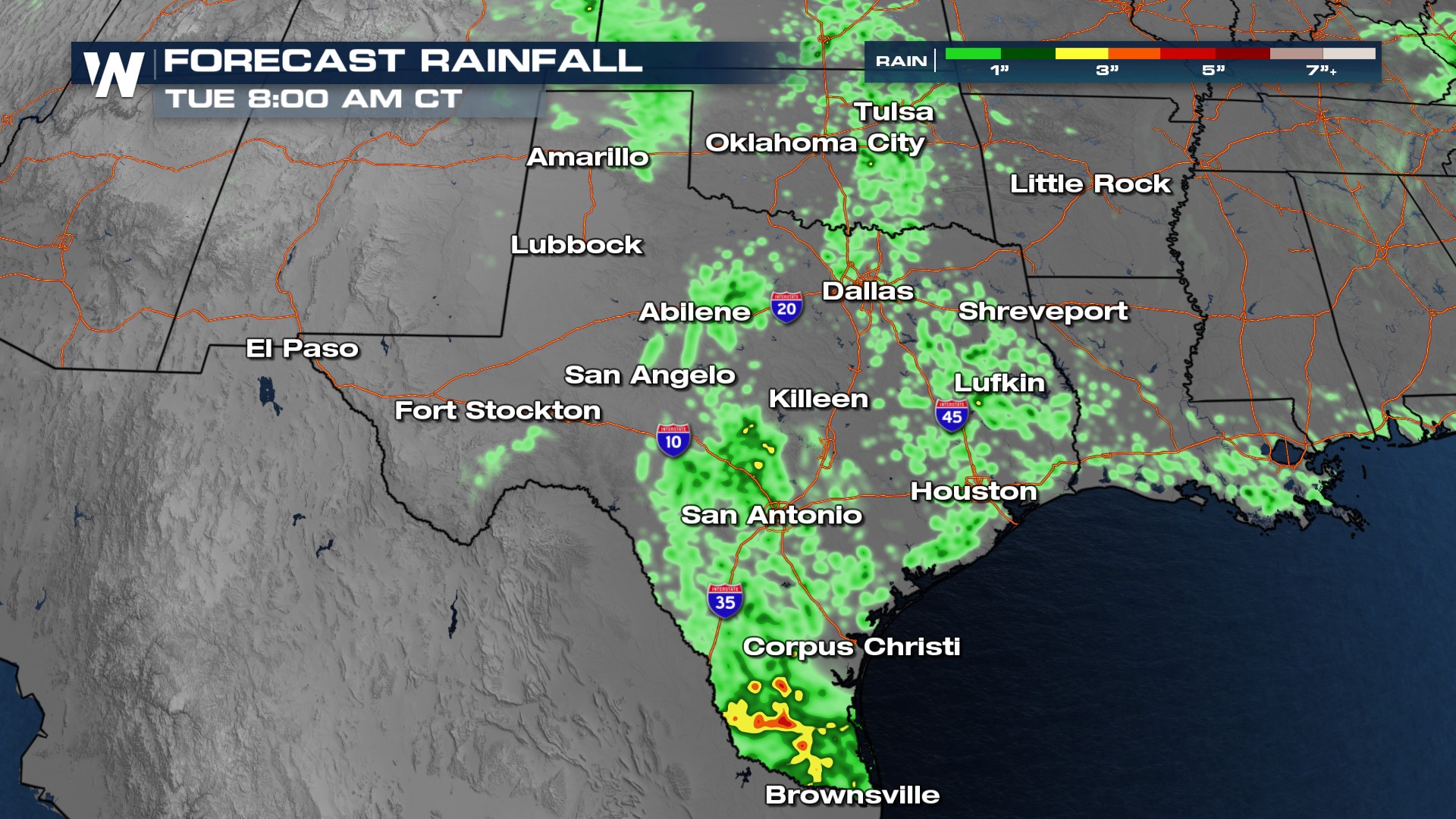 For more on the storm threat, join WeatherNation for the latest forecast always streaming 24/7.


