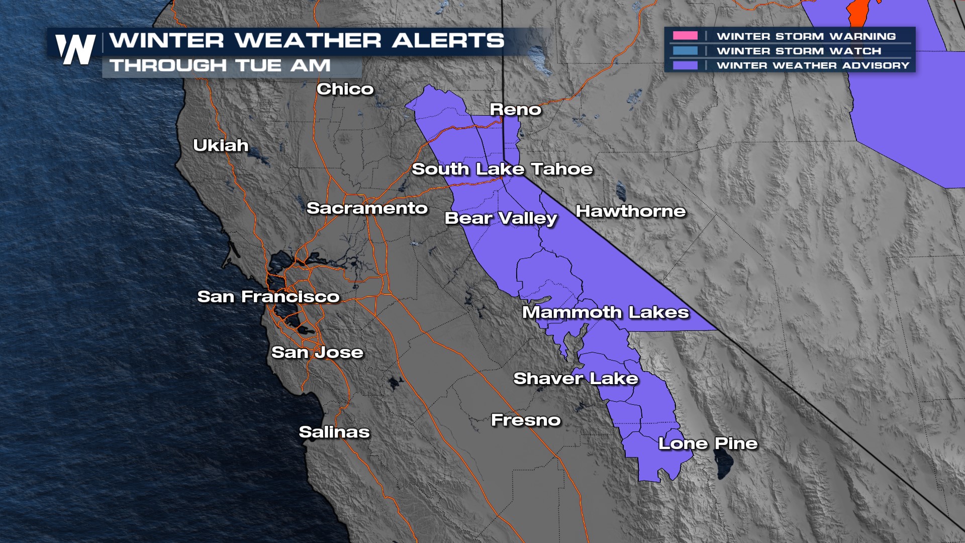
More Snow for the Sierra Nevada
A little more snow is on the way for the Sierra Nevada mountains. It won't be our biggest snowmaker, by any means, but every little bit helps! Some lucky mountain peaks can see up to a foot of snow, but it won't be widespread (see above).
Winter weather advisories are issued from the Tahoe National Forest to Sequoia National Park, not far from Mt. Whitney. Travel is expected to be very difficult along mountain passes. Winds can gust up to 55 mph, which will blow the snow around and reduce visibility even more.

The timing of this snowfall looks to start in the overnight hours tonight and linger into Monday. Southern California could get clipped by some scattered rain showers throughout the day on Monday, too.
The Sierra Nevada mountains are finally catching up to where they should be for snowpack this time of year. The northern Sierras are closing in to be exactly on track for what's average. However, the farther south you go, the less snowpack is seen with only 78% of the snowpack where it should be.

The good news is, that scenes like this gorgeous one out of Heavenly Ski Resort, near Lake Tahoe, are common up and down the spine of the Sierras.
Stay with WeatherNation as we hone in on more details to your forecast.