Severe Weather Outbreak In Southern Plains

Top Stories
9 Jun 2025 3:20 AM
TIMING
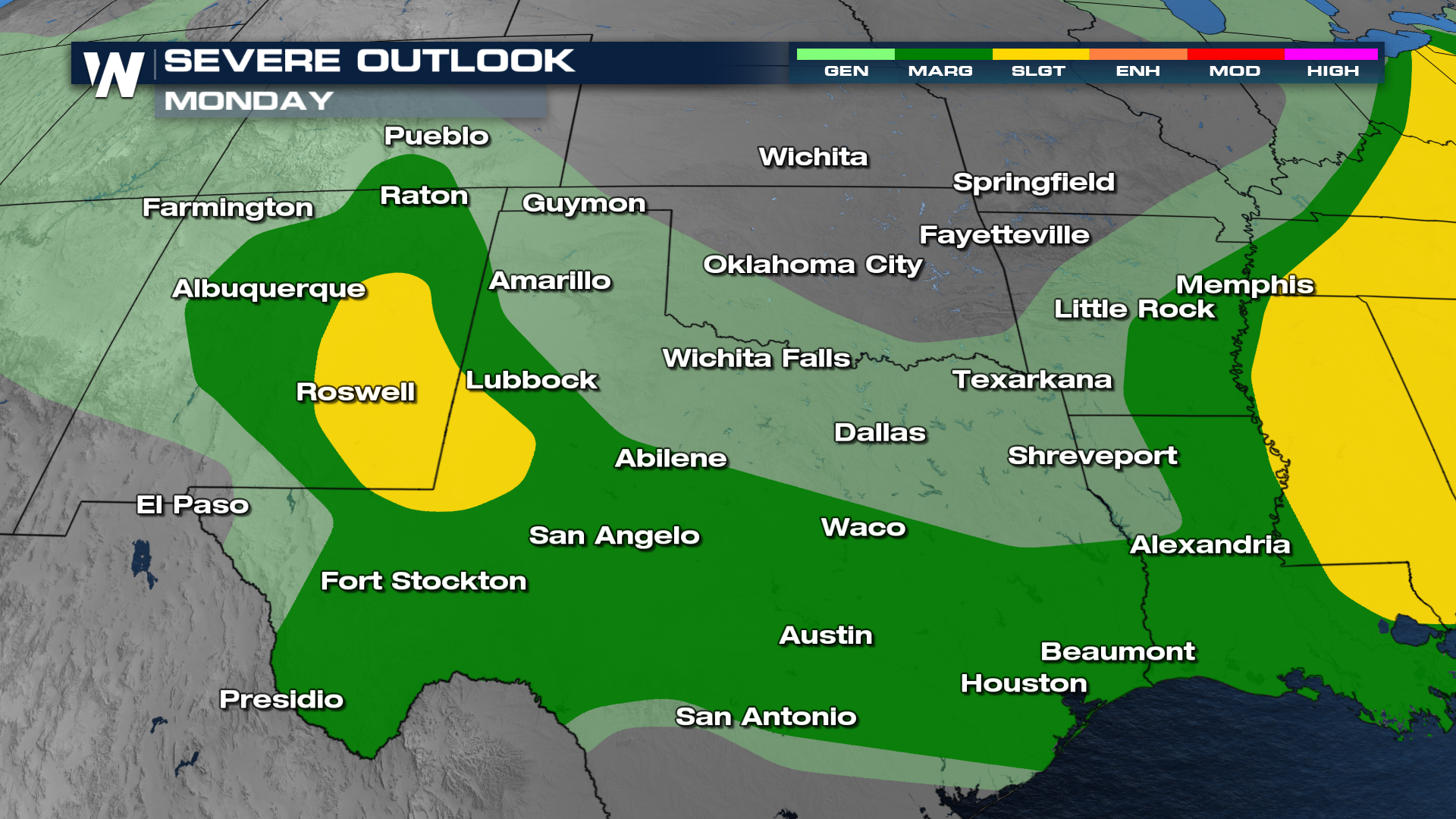
Storms will move through overnight, impacting cities like Dallas. Expect more storms to develop on Monday, following the cold front.
With significant winds upwards of 80-100 mph possible, it's important to understand what a derecho is. WHAT IS A DERECHO? Meteorologist Patrick explains:
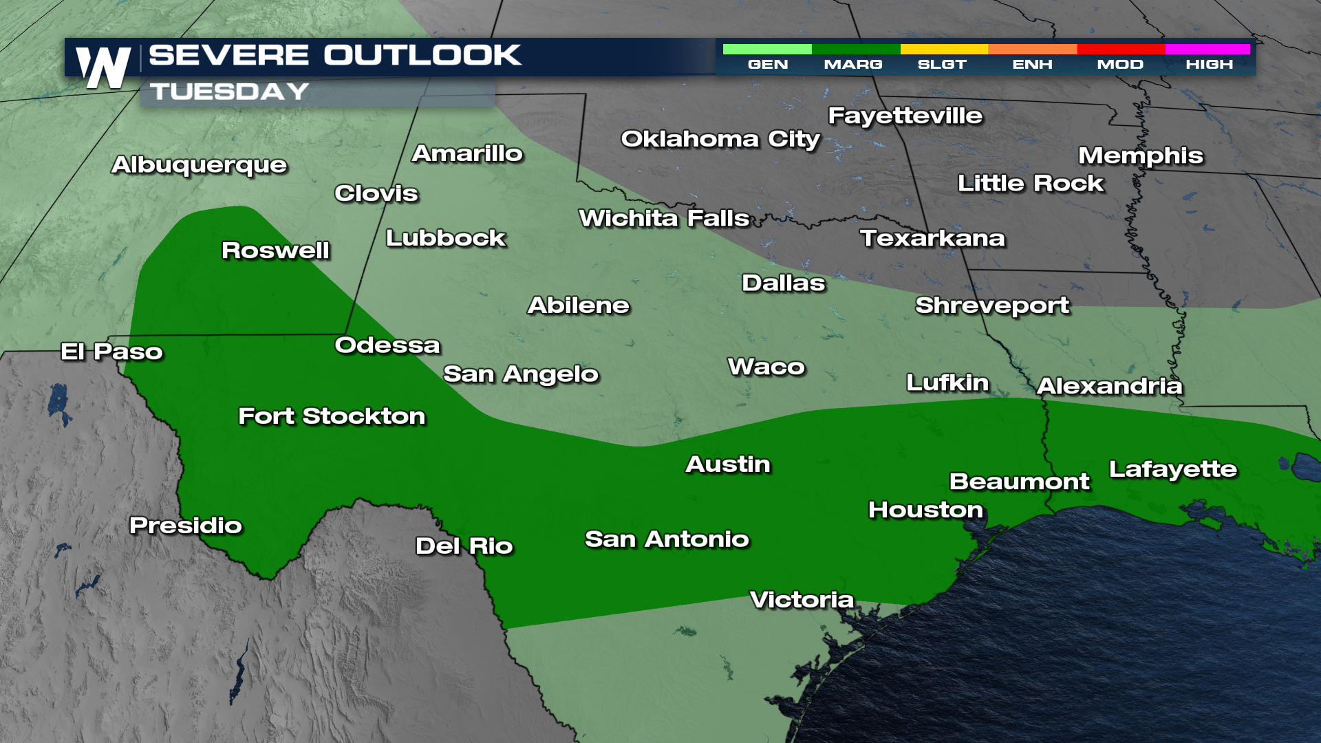
Severe Weather Outlook - Monday & Tuesday
Energy from the cold front will drop south on Monday, shifting the higher severe weather threat to the east.
 Tune in at :30 past the hour for the latest forecast in the Southern Plains.
All Weather News
More
Rounds of Storms: Northern Plains to the Great Lakes
The summer pattern across the Midwest has yet
15 Aug 2025 9:10 PM


Monsoonal Moisture Returns to the Southwest
The heat dome that affected the southwest for
15 Aug 2025 8:55 PM

The 2017 Megaflash: The World's Longest Lightning
Title Image Provided By: NOAA/Cooperative Ins
15 Aug 2025 8:30 AM

Several Megafires Burning in the West, More Dry T-Storms Possible
Numerous wildfires continue to burn across th
15 Aug 2025 7:30 AM

Coast to Coast Heat With Some Relief & Storms
The long-range temperature trend towards the
14 Aug 2025 3:15 AM

Perseid Meteor Shower Peaks This Week - How to Watch
Get a blanket and find some dark skies! One o
13 Aug 2025 9:30 AM