NOAA Annual Spring Hazardous Weather Testbed Underway
Special Stories
16 May 2018 8:21 AM
[Shelf cloud from Monday over Reston, VA. Credit: Emily Arnold via Storyful]
From NSSL
Through the end of the month, NOAA’s Hazardous Weather Testbed (HWT) Experimental Forecast Program is focused on one topic — using cutting-edge computer models to improve predictions of hazardous weather from one hour to several hours to several days in advance.
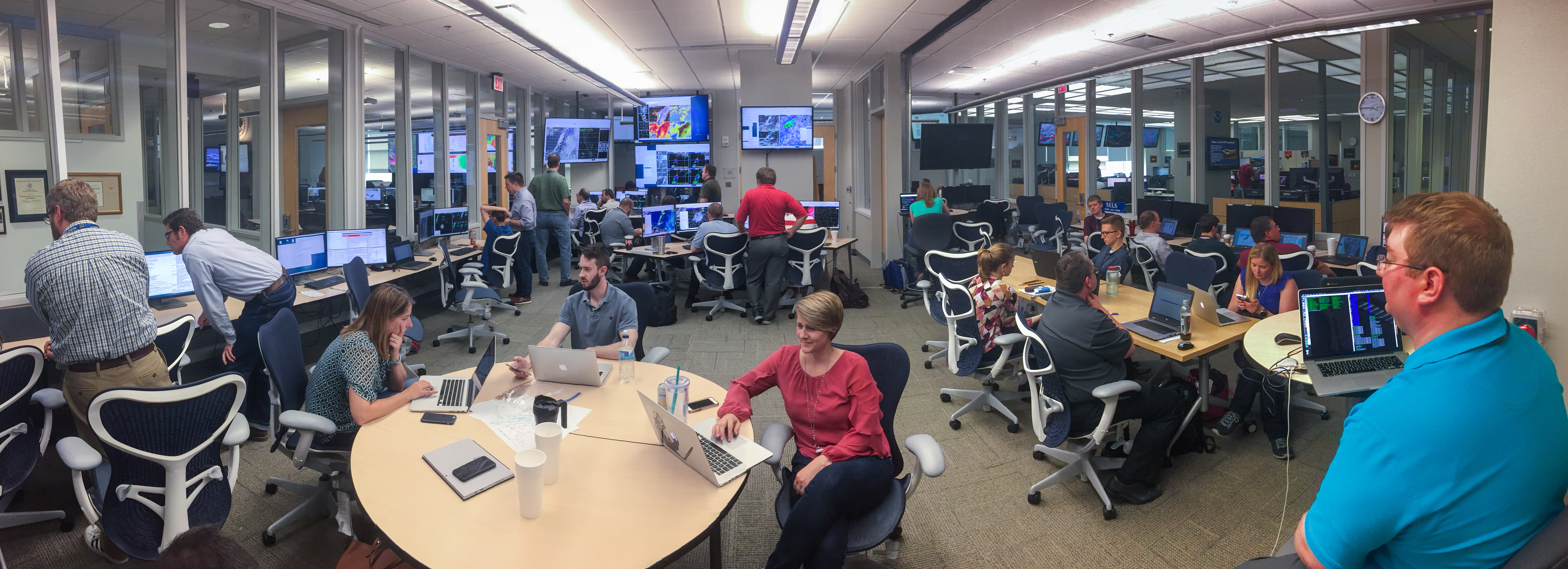
The aim of such an experiment is to support NOAA’s goal of more accurate severe weather warnings and forecasts. The HWT started on April 30 and will continue to June 1. Researchers and forecasters will work together to examine and evaluate a variety of model output daily in the HWT, exploring a variety of different models and forecast guidance throughout the week. Forecast and research meteorologists create experimental forecasts, interact with new technologies, provide feedback to the researchers, and decipher the best use of tools in simulated real-time forecasting environments.
“Driving what we do is being able to work with forecasters to get their input,” said Adam Clark, project lead and researcher with the NOAA National Severe Storms Laboratory. “To design a system that is useful, you have to get feedback from the end user, which is forecasters.”
 [The NOAA Hazardous Weather Testbed is a joint project of the National Weather Service and the National Severe Storms Laboratory. The HWT provides a conceptual framework and a physical space to foster collaboration between research and operations to test and evaluate emerging technologies and science for NWS operations. The HWT was borne from the “Spring Program” which, for the last decade, has been used to test and evaluate new forecast models, techniques, and products to support NWS Storm Prediction Center forecast operations.]
Better Tools for Forecasting Dangerous Weather
The experimental forecast models used in the NOAA Hazardous Weather Testbed become more refined each year as technology improves. Ultimately, the NOAA National Weather Service incorporates insights and improvements from the HWT into their operations.
One of the tools being tested is NSSL’s experimental high-resolution, on-demand and frequently updating ensemble forecast system product called NSSL Experimental Warn-on-Forecast System for ensembles, or NEWS-e. Each day, researchers focus their attention on the area with the highest risk for severe weather based on the forecast from NOAA’s Storm Prediction Center. NEWS-e runs in that area and frequently assimilates radar and satellite data to provide specific forecasts of when and where severe weather is most likely on a short time scale — up to three hours in advance.
https://www.youtube.com/watch?v=vvRY7q-_ssY
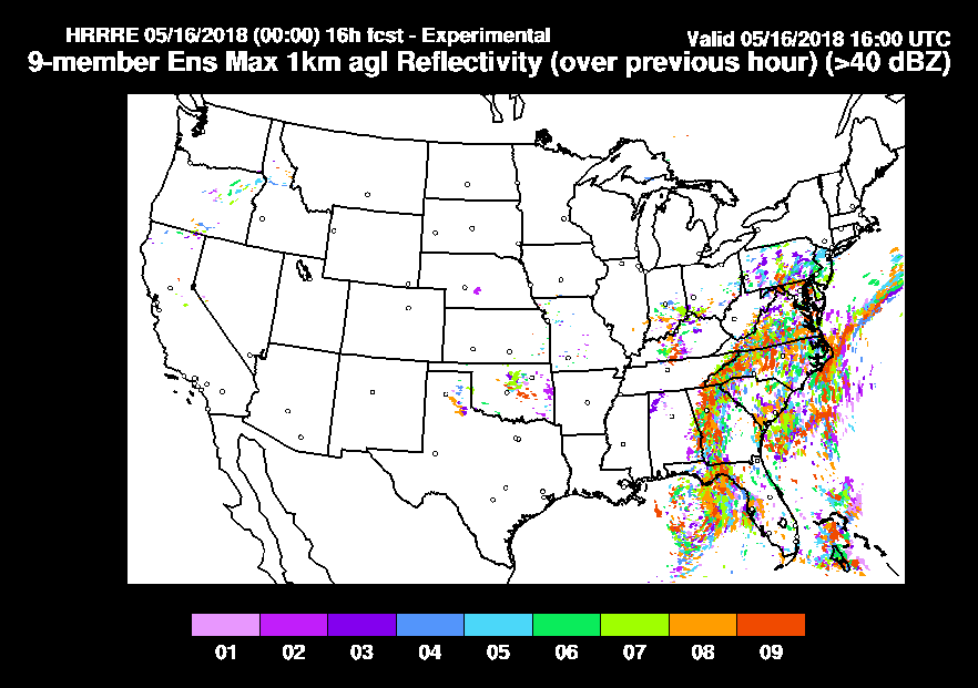
Another tool being tested is the High-Resolution Rapid Refresh Ensemble, or HRRRE, a prediction system developed by the Global Systems Division of NOAA’s Earth Systems Research Laboratory. HRRRE brings in a variety of weather data to produce multiple forecasts, each with a slightly different starting point, to generate hourly snapshots of possible hazardous weather. Each forecast outcome includes the degree of certainty or uncertainty of the hazard occurring. For example, numerous HRRRE snapshot forecasts predicting that a severe storm will form at a specific place and time will provide users more confidence in that forecast. HRRRE predictions provide the starting point for NSSL’s NEWS-e as well.
Utilizing both products in NOAA’s HWT allows forecasters to evaluate the ability of such tools to highlight severe weather hazards, including low-level rotation resulting in tornadoes.
 [HRRRE output estimating highest likelihood of radar intensity]
Collaboration is Key
During its 20 year history, researchers have evaluated a variety of weather models during the annual Spring Forecasting Experiment.
To better compare different models created by various developers, NSSL researchers created the experimental Community Leveraged Unified Ensemble, or CLUE, a large collaborative effort providing common guidelines to optimize high resolution models. Before, each model, including the HRRRE, operated using different measurements and standards. CLUE provides one set of guidelines for all to operate in the HWT.
The guidelines include using the same parameters to run models, operating on the same resolution, and providing the same display. Such a framework allows each model to be more easily understood on a level field.
 [The NOAA HWT Experimental Forecast Program (EFP) is focused on the use of computer models of the atmosphere to improve predictions of hazardous and convective weather events from a few hours to a week in advance, and over several counties to the continental U.S. The EFP supports the NWS goal to increase lead-time and accuracy for weather and water warnings and forecasts. The NOAA HWT EFP Spring Experiment is a yearly project that investigates the use of convection-allowing model forecasts as guidance for the prediction of hazardous convective weather.]
“That way we are able to control as many variables as we can so we can say more about why the different systems work they way they do,” Clark said. “It’s like comparing apples to apples rather than apples to oranges.”
The testbed is operated by the NOAA National Severe Storms Laboratory and the NOAA National Weather Service.
Edited for WeatherNation by Meteorologist Mace Michaels
 [The NOAA Hazardous Weather Testbed is a joint project of the National Weather Service and the National Severe Storms Laboratory. The HWT provides a conceptual framework and a physical space to foster collaboration between research and operations to test and evaluate emerging technologies and science for NWS operations. The HWT was borne from the “Spring Program” which, for the last decade, has been used to test and evaluate new forecast models, techniques, and products to support NWS Storm Prediction Center forecast operations.]
Better Tools for Forecasting Dangerous Weather
The experimental forecast models used in the NOAA Hazardous Weather Testbed become more refined each year as technology improves. Ultimately, the NOAA National Weather Service incorporates insights and improvements from the HWT into their operations.
One of the tools being tested is NSSL’s experimental high-resolution, on-demand and frequently updating ensemble forecast system product called NSSL Experimental Warn-on-Forecast System for ensembles, or NEWS-e. Each day, researchers focus their attention on the area with the highest risk for severe weather based on the forecast from NOAA’s Storm Prediction Center. NEWS-e runs in that area and frequently assimilates radar and satellite data to provide specific forecasts of when and where severe weather is most likely on a short time scale — up to three hours in advance.
https://www.youtube.com/watch?v=vvRY7q-_ssY
Another tool being tested is the High-Resolution Rapid Refresh Ensemble, or HRRRE, a prediction system developed by the Global Systems Division of NOAA’s Earth Systems Research Laboratory. HRRRE brings in a variety of weather data to produce multiple forecasts, each with a slightly different starting point, to generate hourly snapshots of possible hazardous weather. Each forecast outcome includes the degree of certainty or uncertainty of the hazard occurring. For example, numerous HRRRE snapshot forecasts predicting that a severe storm will form at a specific place and time will provide users more confidence in that forecast. HRRRE predictions provide the starting point for NSSL’s NEWS-e as well.
Utilizing both products in NOAA’s HWT allows forecasters to evaluate the ability of such tools to highlight severe weather hazards, including low-level rotation resulting in tornadoes.
 [HRRRE output estimating highest likelihood of radar intensity]
Collaboration is Key
During its 20 year history, researchers have evaluated a variety of weather models during the annual Spring Forecasting Experiment.
To better compare different models created by various developers, NSSL researchers created the experimental Community Leveraged Unified Ensemble, or CLUE, a large collaborative effort providing common guidelines to optimize high resolution models. Before, each model, including the HRRRE, operated using different measurements and standards. CLUE provides one set of guidelines for all to operate in the HWT.
The guidelines include using the same parameters to run models, operating on the same resolution, and providing the same display. Such a framework allows each model to be more easily understood on a level field.
 [The NOAA HWT Experimental Forecast Program (EFP) is focused on the use of computer models of the atmosphere to improve predictions of hazardous and convective weather events from a few hours to a week in advance, and over several counties to the continental U.S. The EFP supports the NWS goal to increase lead-time and accuracy for weather and water warnings and forecasts. The NOAA HWT EFP Spring Experiment is a yearly project that investigates the use of convection-allowing model forecasts as guidance for the prediction of hazardous convective weather.]
“That way we are able to control as many variables as we can so we can say more about why the different systems work they way they do,” Clark said. “It’s like comparing apples to apples rather than apples to oranges.”
The testbed is operated by the NOAA National Severe Storms Laboratory and the NOAA National Weather Service.
Edited for WeatherNation by Meteorologist Mace Michaels
[The NOAA HWT Experimental Forecast Program (EFP) is focused on the use of computer models of the atmosphere to improve predictions of hazardous and convective weather events from a few hours to a week in advance, and over several counties to the continental U.S. The EFP supports the NWS goal to increase lead-time and accuracy for weather and water warnings and forecasts. The NOAA HWT EFP Spring Experiment is a yearly project that investigates the use of convection-allowing model forecasts as guidance for the prediction of hazardous convective weather.]
“That way we are able to control as many variables as we can so we can say more about why the different systems work they way they do,” Clark said. “It’s like comparing apples to apples rather than apples to oranges.”
The testbed is operated by the NOAA National Severe Storms Laboratory and the NOAA National Weather Service.
Edited for WeatherNation by Meteorologist Mace MichaelsAll Weather News
More