NOAA Releases 2023 Atlantic Hurricane Season Outlook
The National Oceanic and Atmospheric Administration (NOAA) has released their 2023 Atlantic Hurricane Season Outlook. Every year a team of scientists develops an initial forecast of the number of named storms, hurricanes and major hurricanes based on climatological patterns and sea surface temperatures. Remember, the season outlook only refers to the potential number of storms, not where and who they impact. It only takes one storm to hit where you are, even in a below average season.
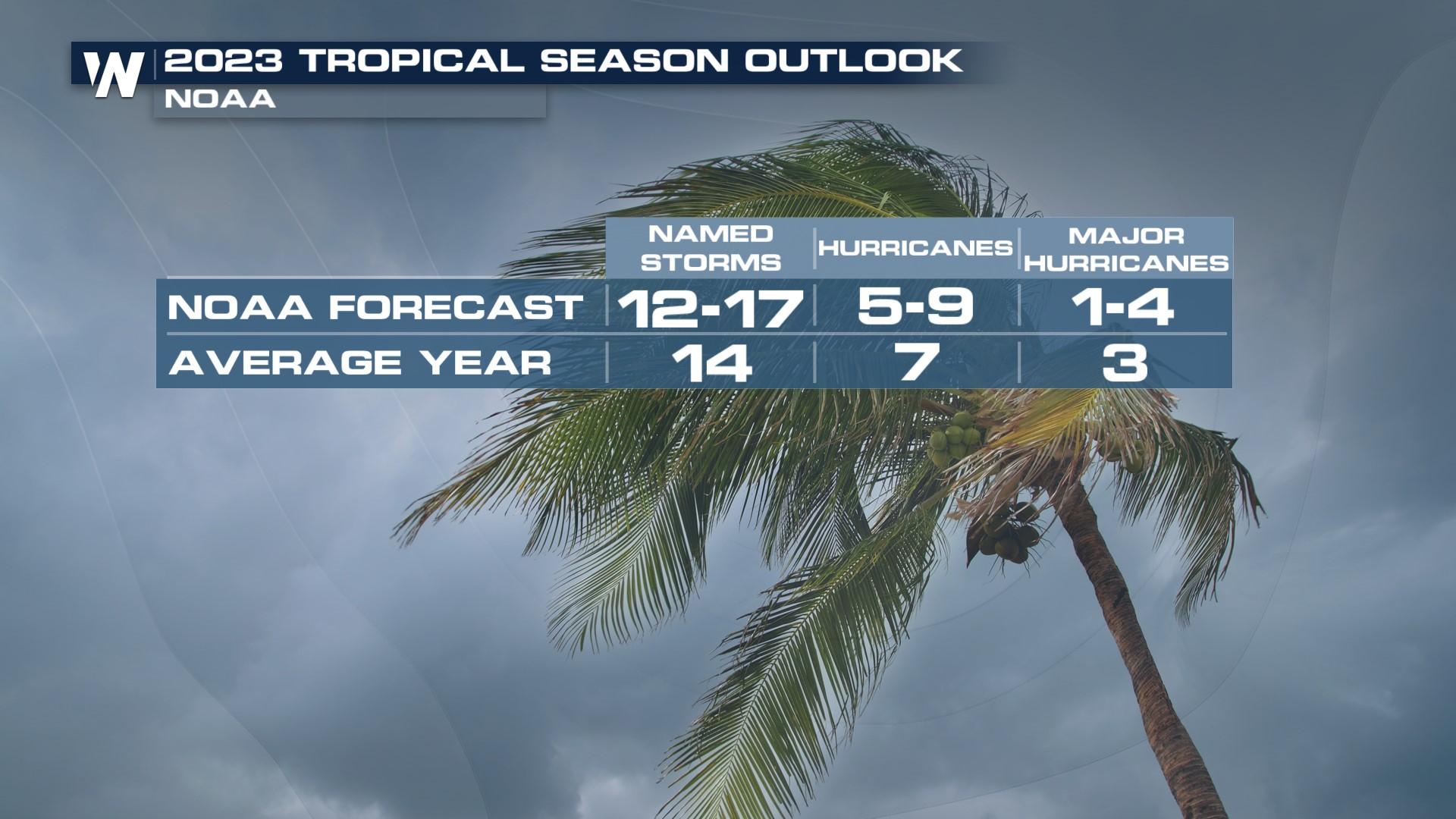
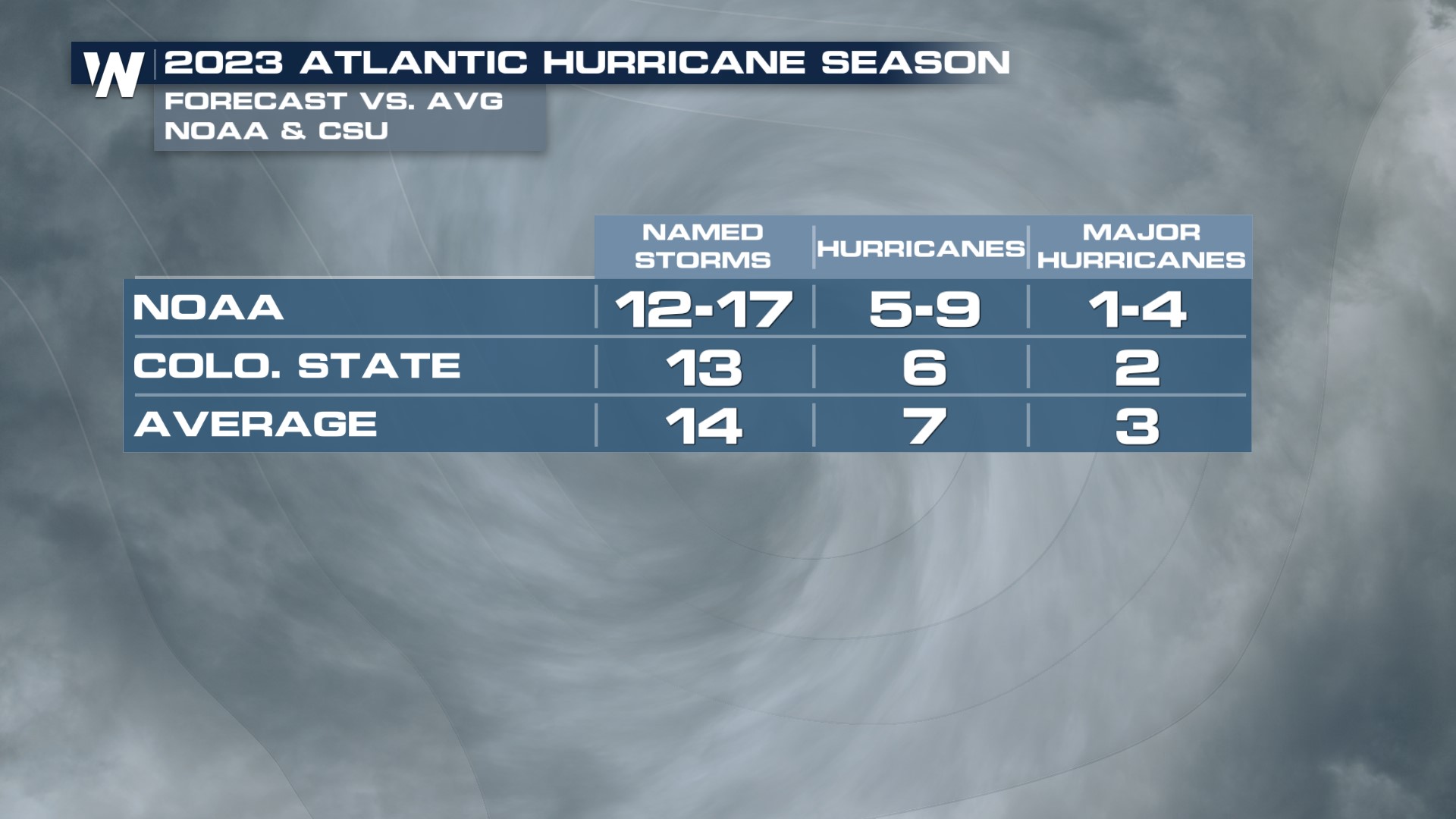
In 2023, NOAA is calling for 12-17 named storms, 5-9 hurricanes and 1-4 major hurricanes (CAT 3+). Additionally, there is a 40% chance of a normal season, with 30% chance of both an above average or below average season.
In an average season, we typically see 14 named storms, 7 hurricanes and 3 major hurricanes, making the initial 2023 forecast near normal. Scientists at Colorado State University released their forecast earlier in the Spring, calling for a slightly below average season for 2023.
 One of the major drivers of the forecast is the fact that we are in an ENSO neutral state transitioning to an El Nino by fall. ENSO is the relationship between the atmospheric and ocean temperatures in the equatorial pacific ocean. The last three years (2020-2022) we were in a La Nina pattern, which is characterized by cooler than average ocean temperatures and typically leads to a more active Atlantic Hurricane Season. El Nino patterns typically lend themselves to below average hurricane seasons in the Atlantic Basin.
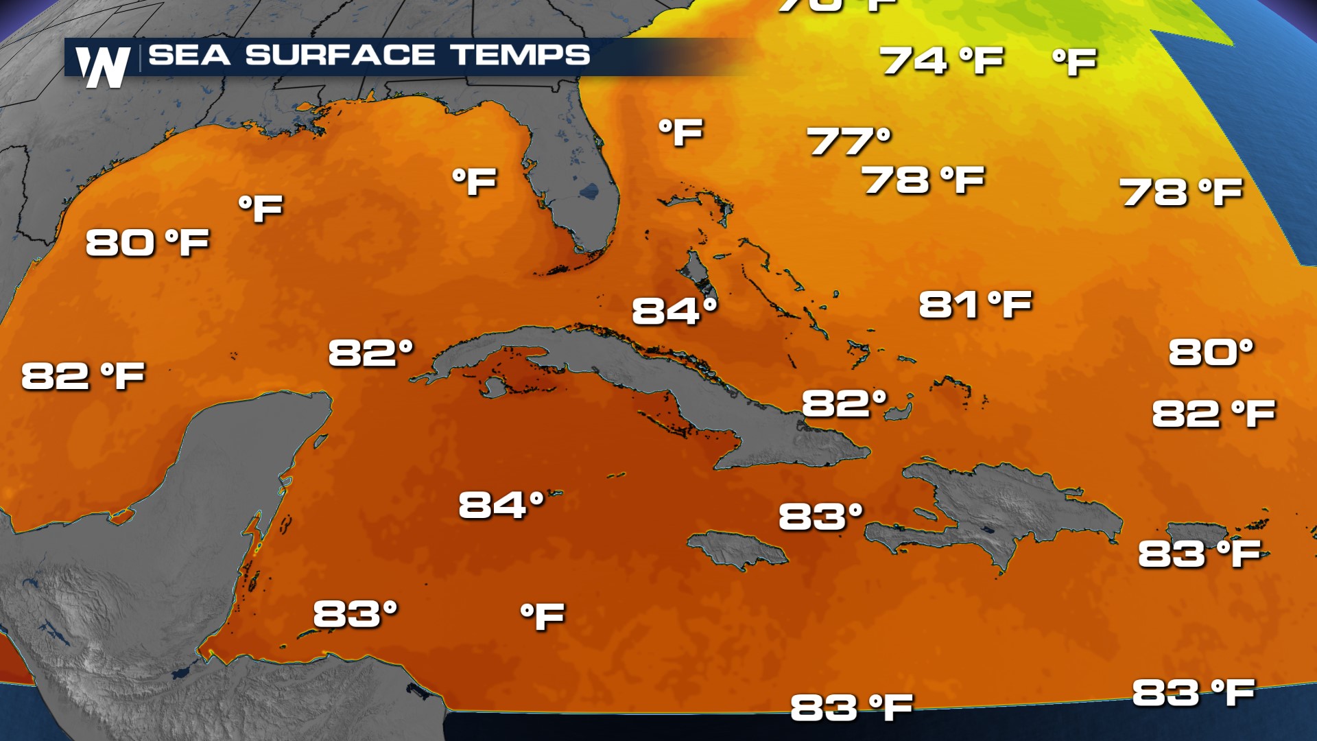
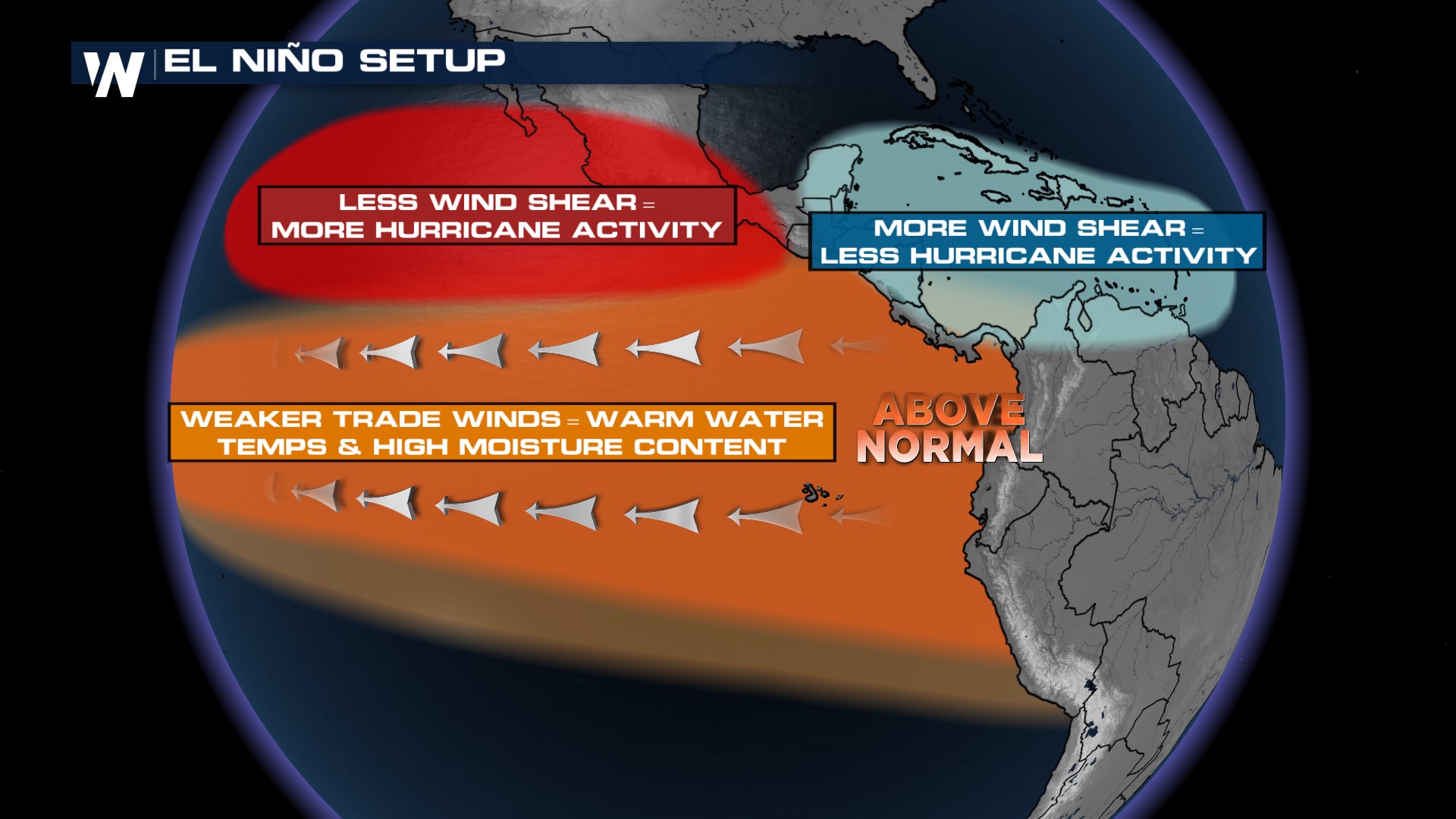 The other forecast factor is sea surface temperatures (SST). Warmer SSTs are favored for tropical development because of the heat and moisture release they can provide, fueling thunderstorm development within a tropical system. There is a balance between the El Nino pattern and sea surface temperatures and their impact on the forecast.
 NOAA also is releasing a new hurricane model this year, which has shown a 15% improvement to forecast track and intensity compared to previous models. It also will be better at forecasting rapid intensification. This is in addition to a new storm surge model and 7 day outlooks for tropical weather. Atlantic Hurricane Season begins on June 1. For the latest in tropical systems and the threats, join WeatherNation for the forecast throughout the season.


