NOAA Targets January to Declare GOES-17 Operational
Special Stories
10 Dec 2018 3:21 PM
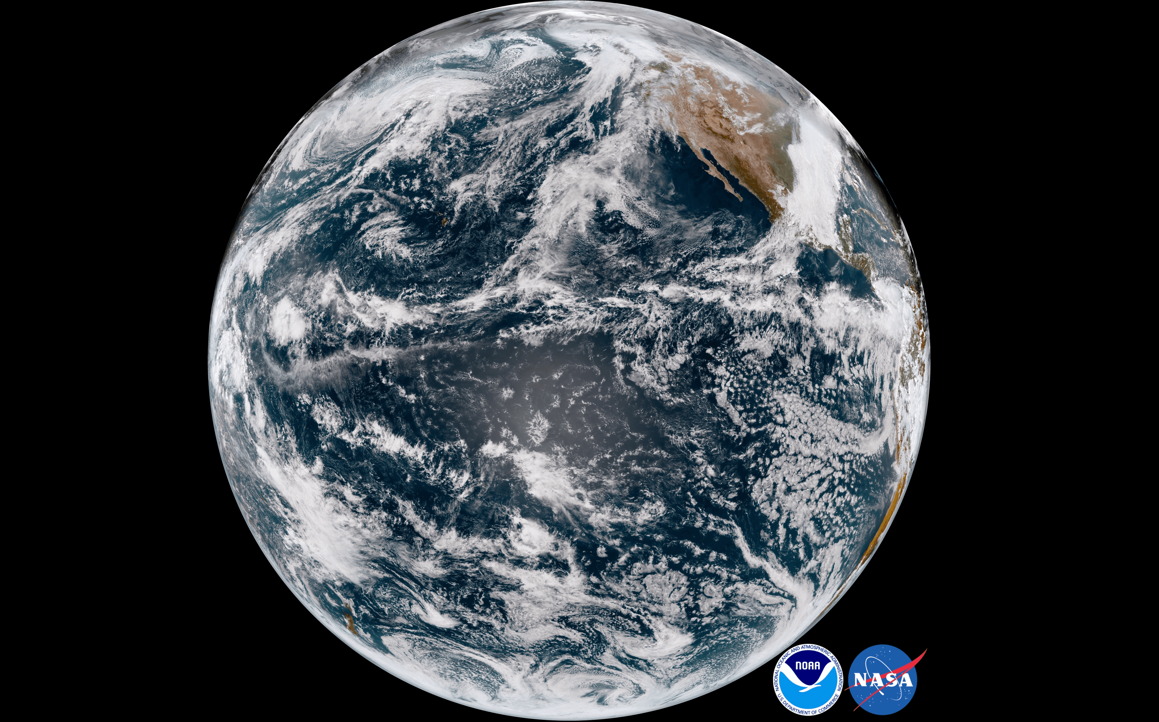
[On Nov. 13, at 4 p.m. ET, GOES-17 captured this GeoColor view of the Earth from its new orbital position over the Pacific Ocean.]
[NOAA] On November 20, technicians observed an error from NOAA’s GOES-17 Advanced Baseline Imager (ABI) – unrelated to the ongoing issues with the loop heat pipe – that resulted in degraded infrared imagery.
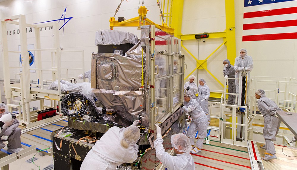 [GOES ABI install in Lockheed Martin clean room before launch. From NOAA]
The technicians determined that a recent update to software that controls the ABI cryocooler system (which pumps heat away from the instrument’s detectors to cool them to their required operating temperatures) caused a memory error. Automated safety checks onboard detected the error and initiated shutdown of the cryocooler, according to procedure.
The cryocooler operation is restored now, with no additional degraded imagery as a result of the error. In August, NOAA released GOES-17 Advanced Baseline Imager (ABI) “beta” level data and imagery—data which are still preliminary and not yet fully ready for use–to forecasters and scientific partners
[GOES ABI install in Lockheed Martin clean room before launch. From NOAA]
The technicians determined that a recent update to software that controls the ABI cryocooler system (which pumps heat away from the instrument’s detectors to cool them to their required operating temperatures) caused a memory error. Automated safety checks onboard detected the error and initiated shutdown of the cryocooler, according to procedure.
The cryocooler operation is restored now, with no additional degraded imagery as a result of the error. In August, NOAA released GOES-17 Advanced Baseline Imager (ABI) “beta” level data and imagery—data which are still preliminary and not yet fully ready for use–to forecasters and scientific partners
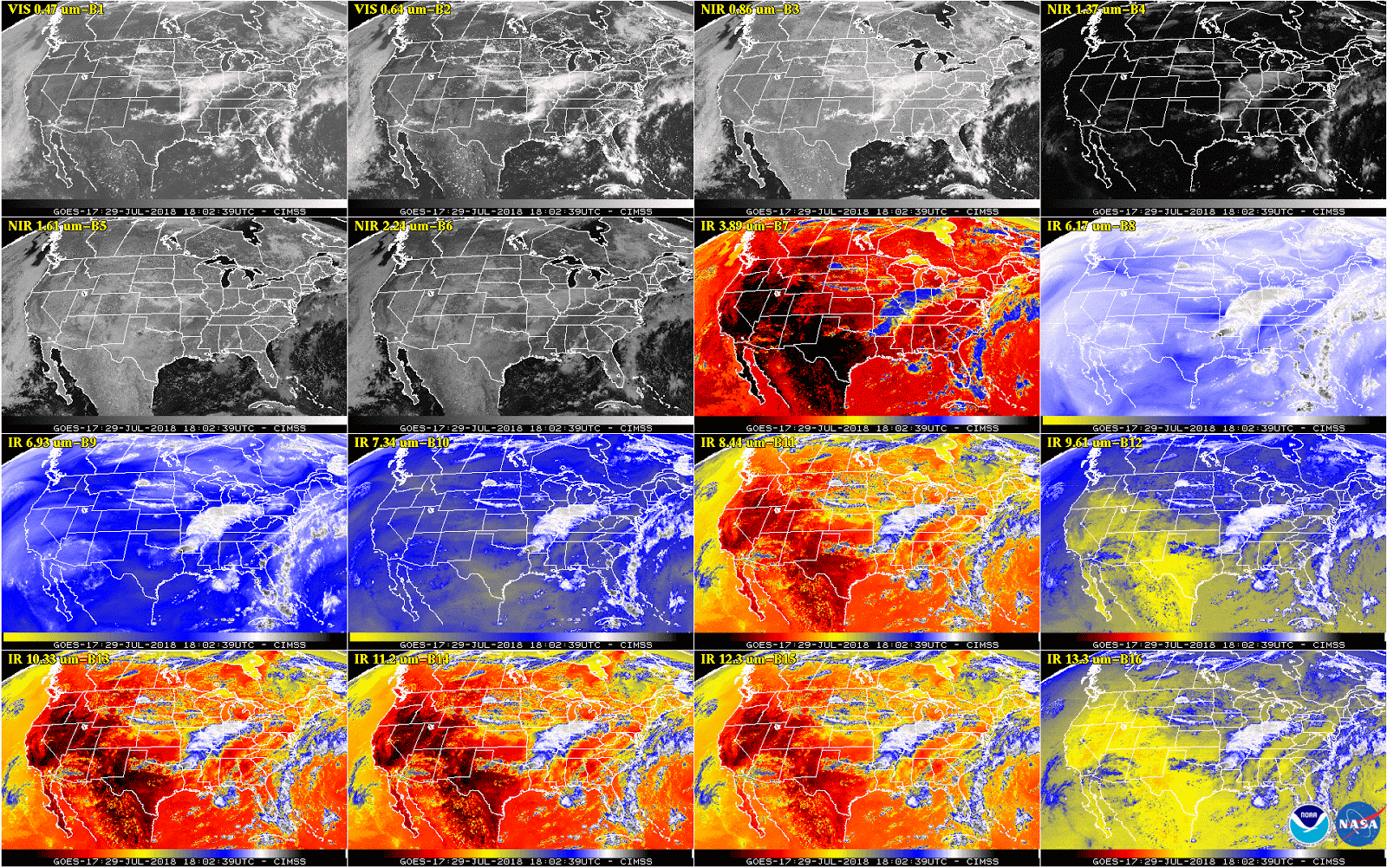 [This 16-panel image shows a snapshot of the continental U.S. and surrounding oceans from each of the Advanced Baseline Imager channels on July 29. This imagery was captured between the instrument’s “cool” and “warm” season, when all 16 channels are available 24 hours per day. During the instrument’s “warm” seasons, varied data outages are expected for 9 of the channels during nighttime hours. The ABI’s increased channels provide three times more spectral information than the previous GOES imager. Credit: NOAA/NASA]
Engineers are testing a permanent software solution that should conclude in January. Once the fix is confirmed, NOAA will declare GOES-17 the new GOES West satellite.
Edited for WeatherNation by Meteorologist Mace Michaels
[This 16-panel image shows a snapshot of the continental U.S. and surrounding oceans from each of the Advanced Baseline Imager channels on July 29. This imagery was captured between the instrument’s “cool” and “warm” season, when all 16 channels are available 24 hours per day. During the instrument’s “warm” seasons, varied data outages are expected for 9 of the channels during nighttime hours. The ABI’s increased channels provide three times more spectral information than the previous GOES imager. Credit: NOAA/NASA]
Engineers are testing a permanent software solution that should conclude in January. Once the fix is confirmed, NOAA will declare GOES-17 the new GOES West satellite.
Edited for WeatherNation by Meteorologist Mace Michaels
[GOES ABI install in Lockheed Martin clean room before launch. From NOAA]
The technicians determined that a recent update to software that controls the ABI cryocooler system (which pumps heat away from the instrument’s detectors to cool them to their required operating temperatures) caused a memory error. Automated safety checks onboard detected the error and initiated shutdown of the cryocooler, according to procedure.
The cryocooler operation is restored now, with no additional degraded imagery as a result of the error. In August, NOAA released GOES-17 Advanced Baseline Imager (ABI) “beta” level data and imagery—data which are still preliminary and not yet fully ready for use–to forecasters and scientific partners
[This 16-panel image shows a snapshot of the continental U.S. and surrounding oceans from each of the Advanced Baseline Imager channels on July 29. This imagery was captured between the instrument’s “cool” and “warm” season, when all 16 channels are available 24 hours per day. During the instrument’s “warm” seasons, varied data outages are expected for 9 of the channels during nighttime hours. The ABI’s increased channels provide three times more spectral information than the previous GOES imager. Credit: NOAA/NASA]
Engineers are testing a permanent software solution that should conclude in January. Once the fix is confirmed, NOAA will declare GOES-17 the new GOES West satellite.
Edited for WeatherNation by Meteorologist Mace MichaelsAll Weather News
More
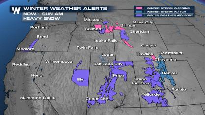
Spring Snow on the Horizon in Colorado
Snow is on the way for the mountains of Color
26 Apr 2024 12:10 PM
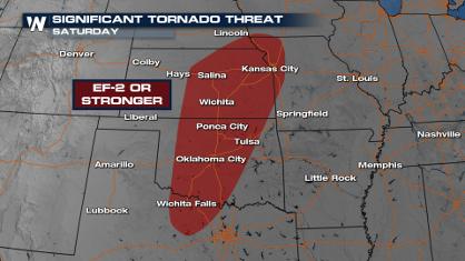
Weekend Forecast: More Severe Weather
With another severe weather outbreak underway
26 Apr 2024 7:50 AM
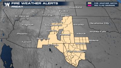
Critical Fire Risk in West Texas, New Mexico
A critical fire risk is in place for west Tex
26 Apr 2024 2:40 AM

National Park Week: Get Out and Explore
National Park Week started Saturday, April 20
25 Apr 2024 9:30 PM

NOAA Debuts "HeatRisk" Tool Nationwide
More people die from heat every year than ALL
25 Apr 2024 9:00 PM

Double Trouble: Cicadas Take to the Skies this Spring
It’s the soundtrack to the summer. Nature’s n
25 Apr 2024 8:45 PM