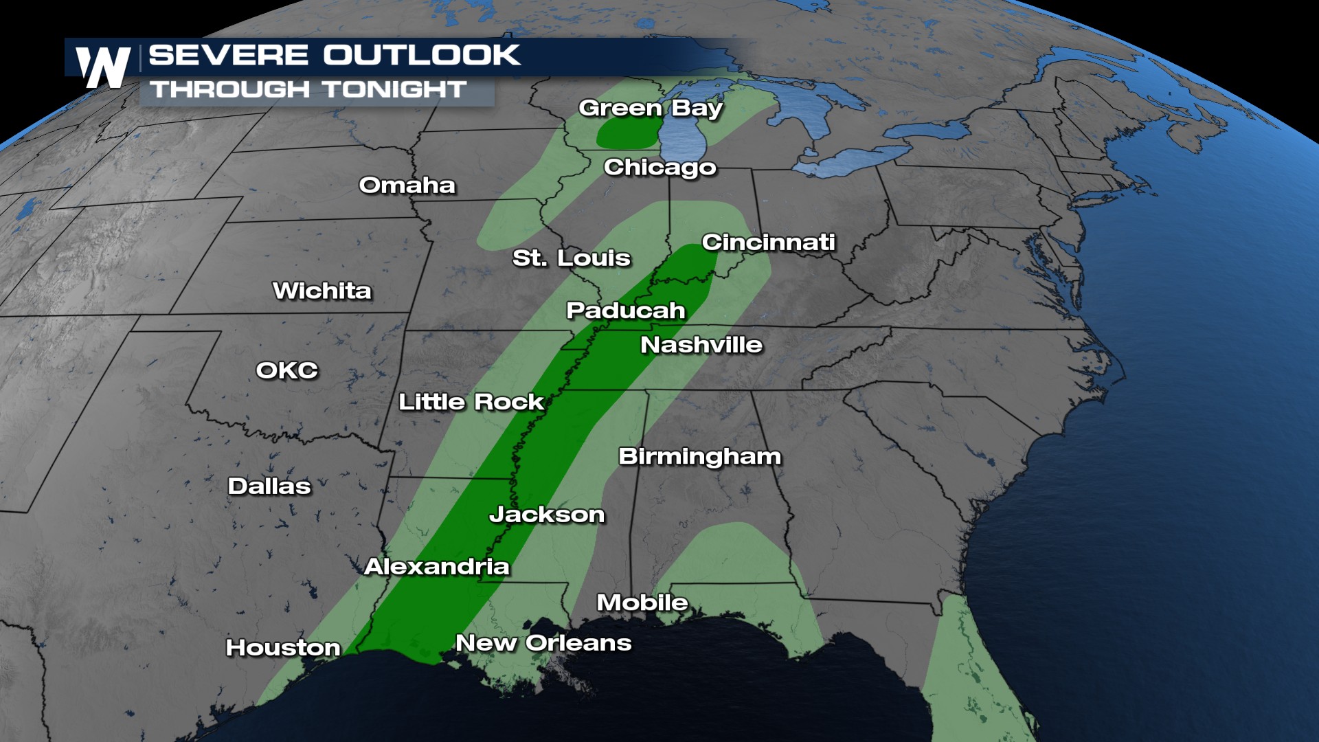
Marginal Risk for Severe Weather from Louisiana to Wisconsin

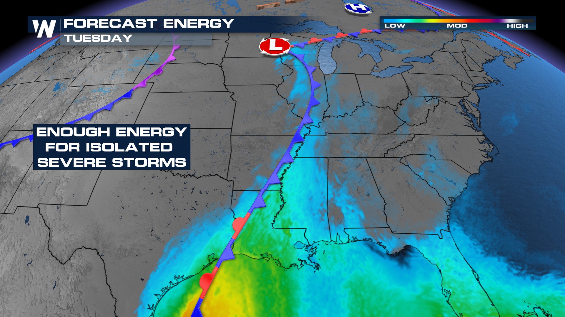
It's been an active stretch of severe weather coming out of the weekend and kicking off the week. Monday's enhanced risk (level 3 out of 5) of severe storms led to numerous tornado warnings, continuing the theme from this weekend. The system is slowly moving eastward through tomorrow.
RELATED ARTICLE: Weekend Storm Surveys
 Deep South
Parts of Louisiana have been downgraded back to a MARGINAL risk for severe storms today (level 1 out of 5). This includes cities such as Alexandria, Memphis, and Evansville.
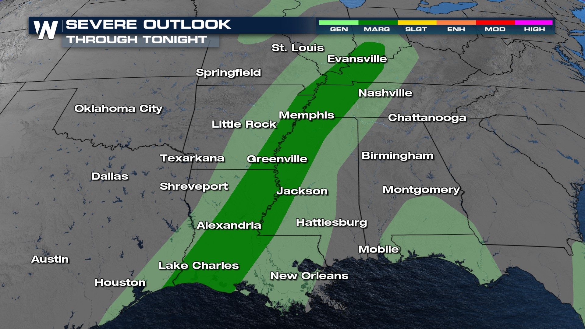
While the ingredients won't be as potent as they were the past few days, damaging winds, large hail, and a tornado or two will be possible. The atmosphere appears to be just unstable enough to keep the threat around today.
 The widespread nature of this morning's storms has been dwindling across the South, with models forecasting additional storms possible across these areas, but not quite as intense as this morning and yesterday.
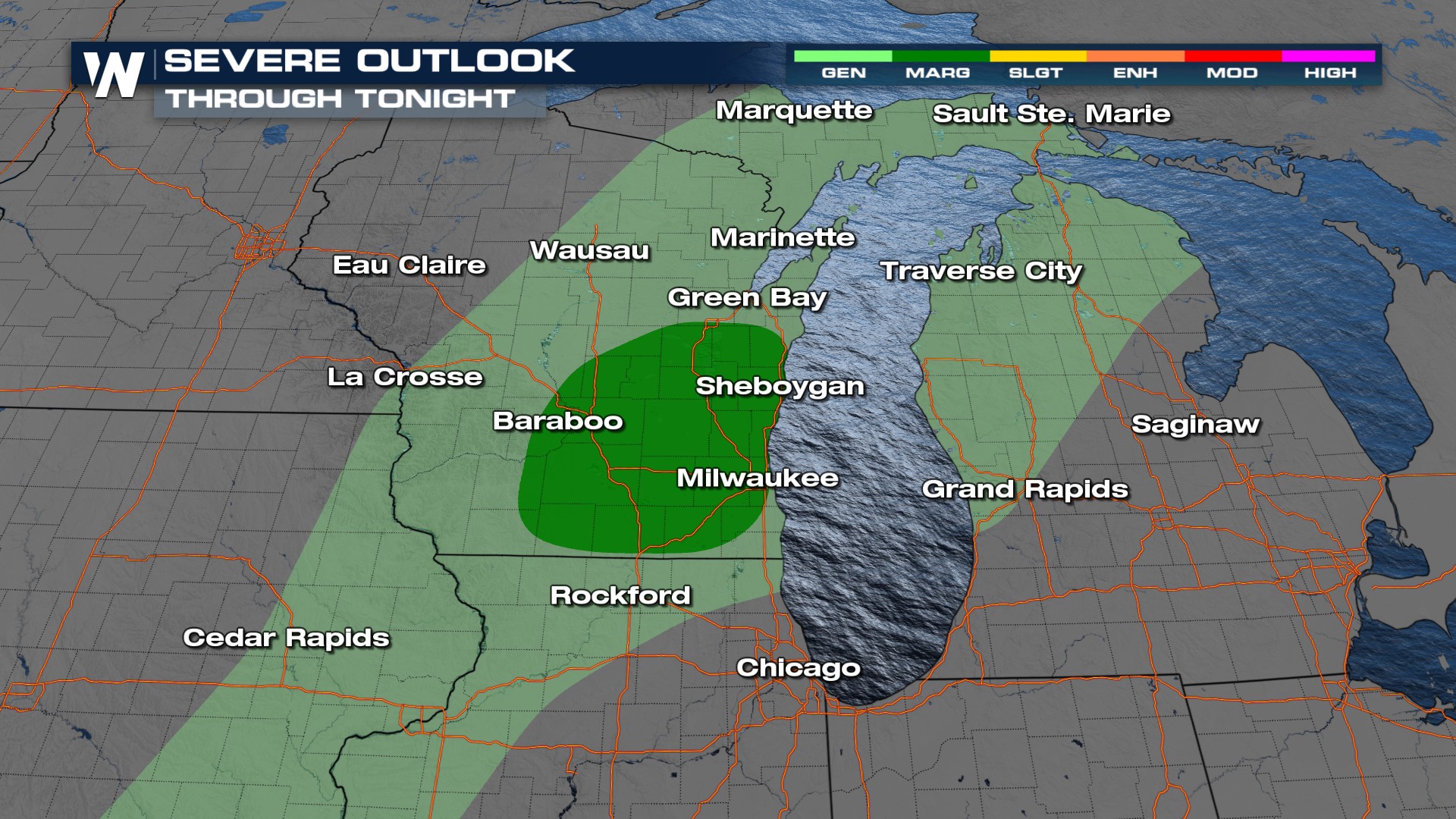
WISCONSIN
With limited instability, the wind shear this far north will have to do most of the lifting. The window of opportunity for these storms will be more narrow: from the early afternoon until about sunset.
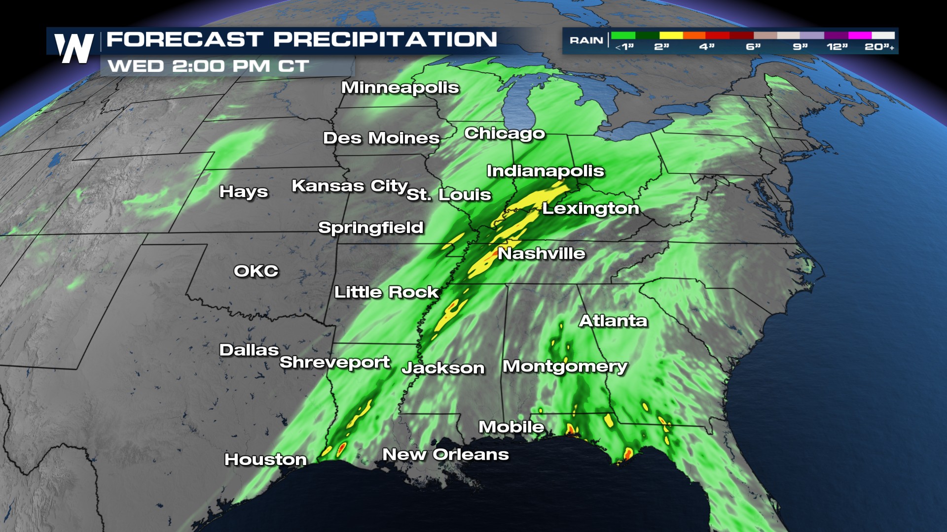
With many rounds of storms, rainfall totals have surpassed 6-7 inches already, with a few more inches possible. Flash flooding becomes easier to develop with such saturated soils in place.
Stay weather aware as the severe weather and flooding threat remain elevated through the weekend. The Central Regional Forecast airs at :30 past the hour or get it anytime through the WeatherNation app.


