Overnight Storms for the Northeast

A cold front will bring the chance for strong and severe storms across the Northeast, especially for areas along the coast. Here is the latest forecast.
The severe risk will be isolated for large hail and damaging winds, but cities like Hartford and Baltimore could be in the path.
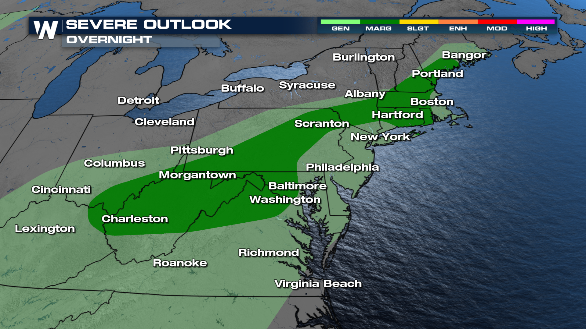
Tonight, the threat of severe weather continues in parts of the Northeast and Mid Atlantic states. Storms are capable of producing large hail and damaging winds. Earlier, there was a report of hen egg sized hail that fell in Zanesville, OH. Thunderstorms should weaken and dissipate as the cold front clears the region around midnight! Temperatures will drop behind the front. However, the slightly cooler and drier air doesn't last for long!!
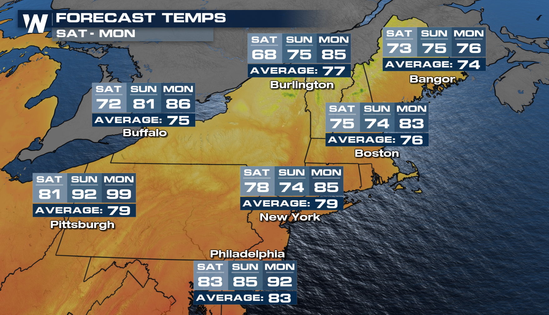
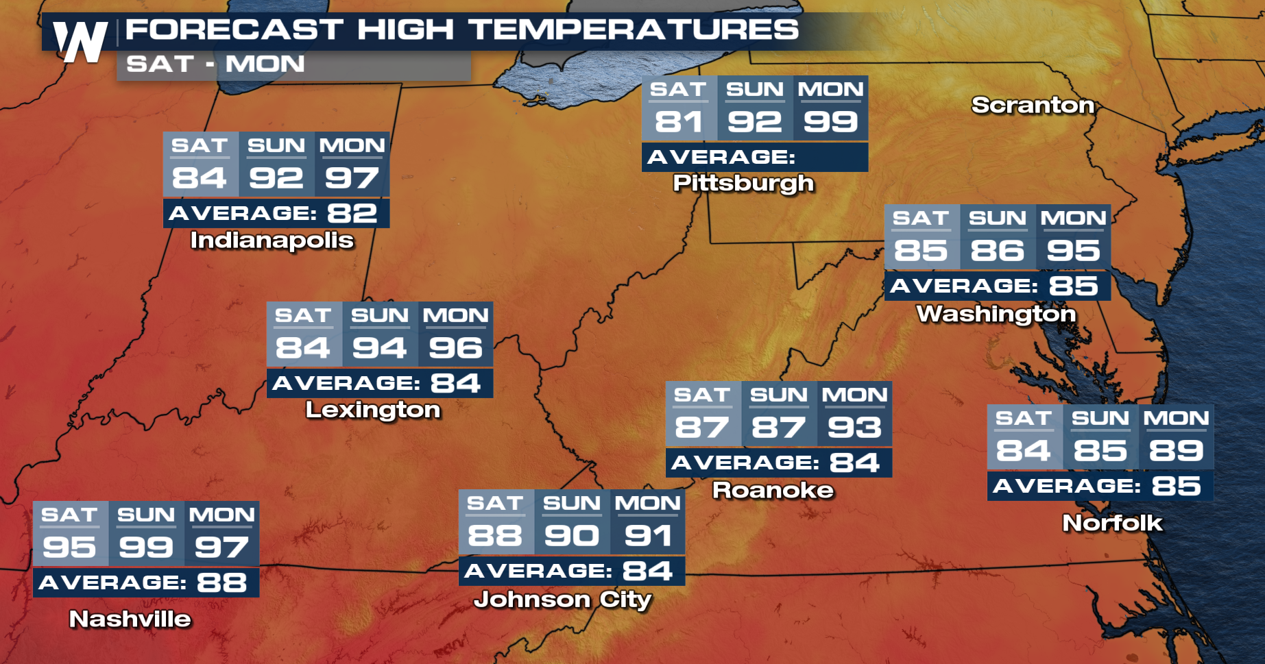
The ridge will sit and spin over the southeast into the weekend and early next week, keeping temperatures toasty and rain chances minimal. Be prepared for numerous days of high-temperature records from the Midwest to the Northeast. This weekend will feature nearly 100° across the Southeast!


