Record Warmth & Tornadoes to a Blizzard in Upper Midwest

A powerful frontal system is sweeping across the central U.S. this week, kicking up strong winds and producing a severe weather threat and snow in the mountains. Blizzard warnings continue in North Dakota through the end of the day Tuesday as winds will gust upwards of 40 mph in combination with snowfall.
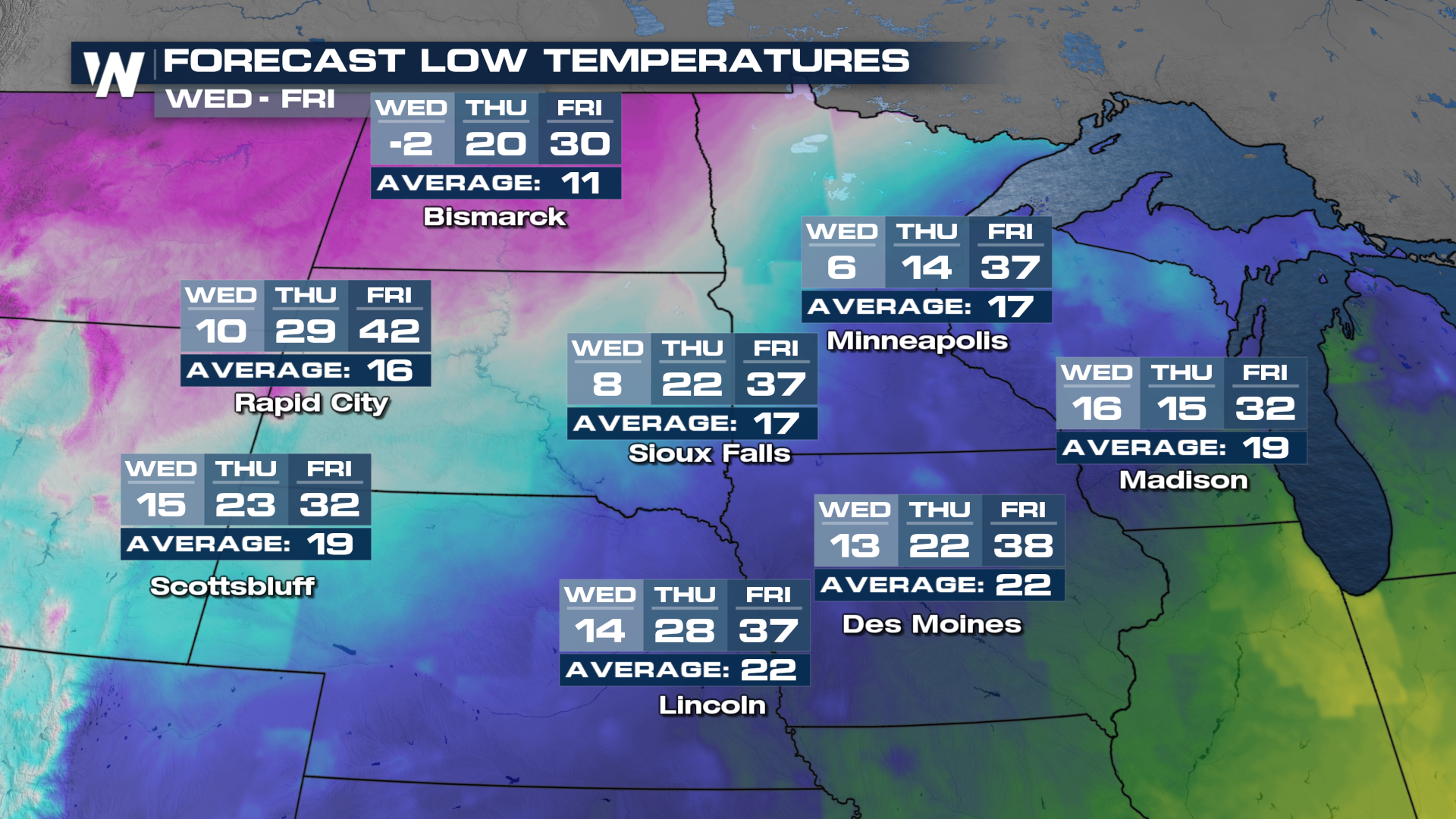
This dynamic system has also produced over 40° temperature drops for high temperatures in less than 48 hours - we quickly went from the 50s and 60s to highs in the teens and single digits with wind chills as low as -20° for the Dakotas.
Snow will quickly follow any severe threat in the Great Lakes and Midwest overnight, with lake effect the main attraction behind the front to strat Wednesday. Just as quickly as snow moves in, it will clear the area Wednesday morning, but the cold temps linger until the week's end. Snow may have a hard time sticking to a lot of the ground due to the 50s and 60s that just occurred the last few days in the Upper Midwest, but elevated surfaces like bridges and decks will become icy.
Over the next few days, our low temperatures will be chilly with low temps in the teens and single digits. Highs will struggle into the 20s and 30s. Be sure to bundle up and don't let the recent warmth fool you into how cold it is about to get. Mother Nature is here to remind us that it is still winter!