Dangerous Storms Moving Across the Upper Midwest Overnight

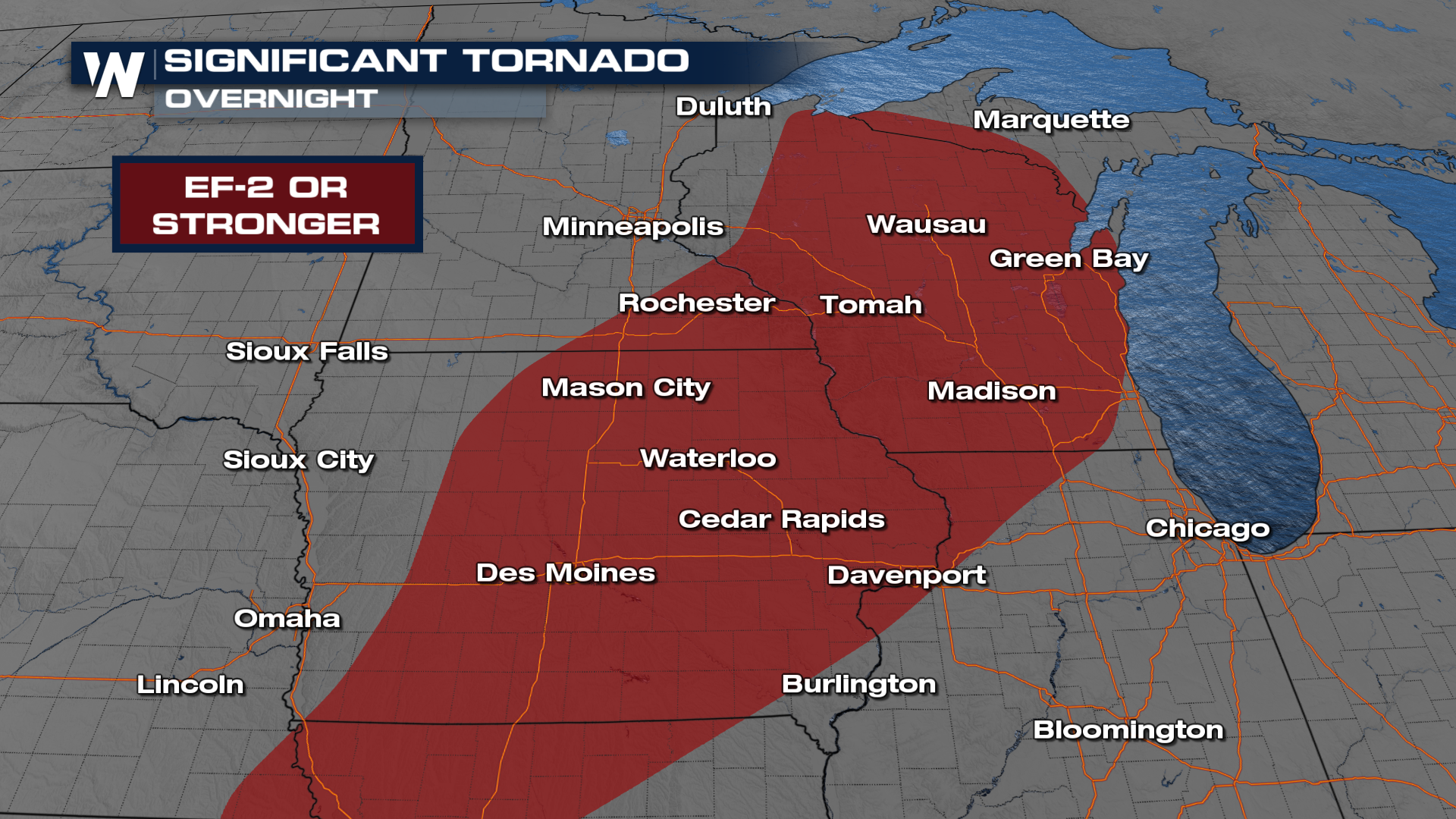
A strong area of low pressure has emerged from the Rockies, which has prompted a MODERATE (level 4 out of 5) risk overnight. EF-2+ intensity tornadoes and 2-inch diameter hail (or larger) are possible.
CAUGHT ON CAMERA: Our field correspondent Erik Fox was in the Sand Hills of Nebraska, where a storm cycled for hours on Sunday night, producing the spotting of a tornado.
Overnight - Hazards and Timing
The Storm Prediction Center has issued a MODERATE (level 4 out of 5) risk for severe storms in portions of the Upper Midwest and Upper Mississippi Valley. Multiple corridors of severe thunderstorms remain possible.
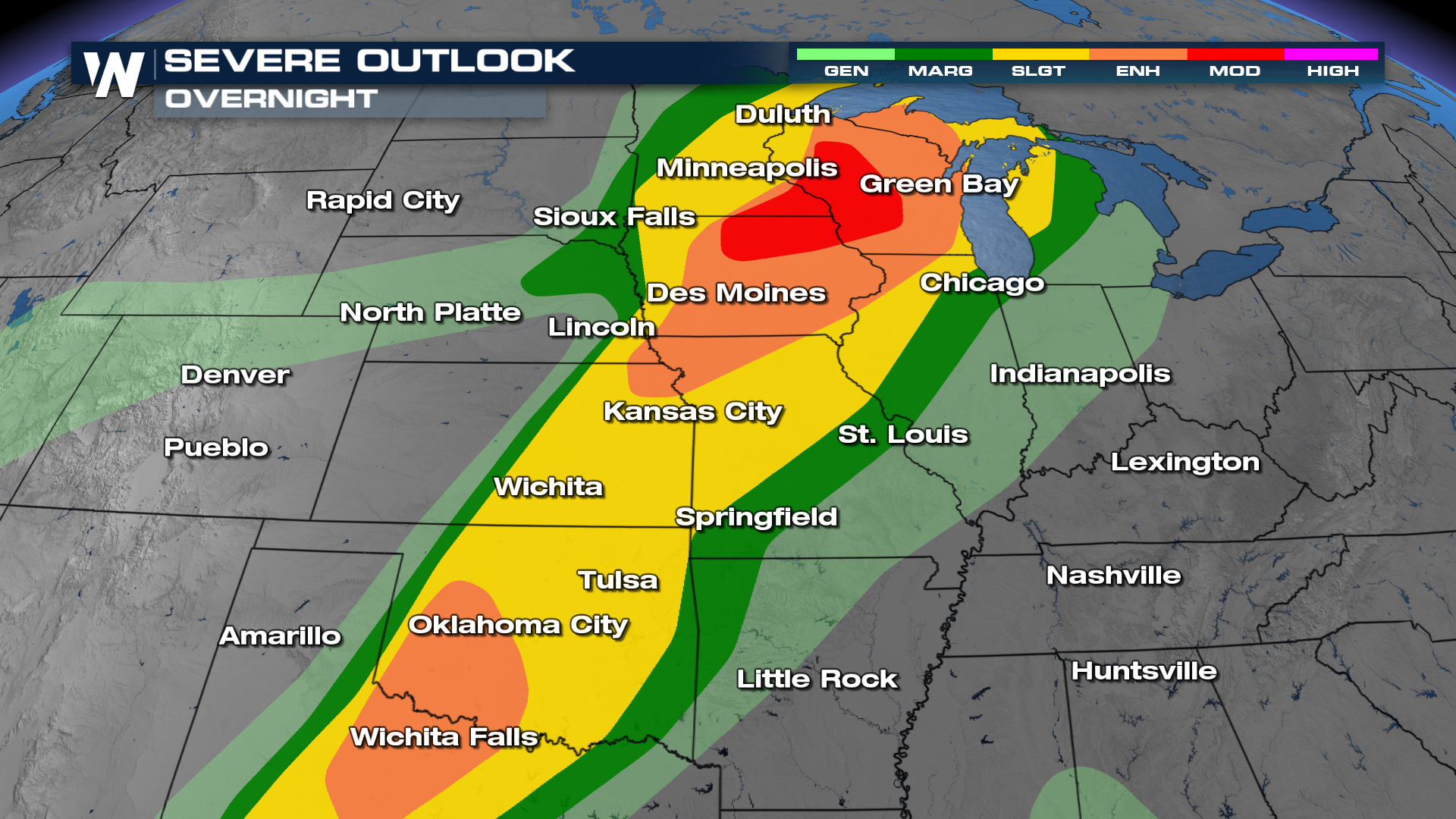
Strong winds and massive hail remain possible, but the tornado threat will also be quite high for portions of the Upper-Midwest, thanks to increased wind shear near the upper-level low. This includes the potential for significant tornadoes in the Upper-Midwest, meaning we could see violent tornadoes that last for a long duration. These tornadoes should be taken very seriously, as they'll have the potential to produce winds over 110 mph (EF-2 or greater).
Storms have developed and will continue into the overnight hours.. Multiple corridors of severe thunderstorms are expected.
Tuesday - Hazards and Timing
Scattered severe storms will continue to move east on Tuesday along the front, with severe storms possible from Vermont to Texas! There are two areas of an ENHANCED risk (level 3 out of 5) on Tuesday. Portions of the northeast, including Pittsburgh, PA and western New York, as well as west Texas and into Texoma.
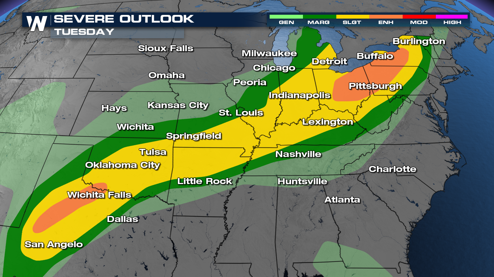
There is still a bit of uncertainty on the forecast for Tuesday morning, pending how overnight convection from Monday behaves. The most likely scenario will be storms continuing along the same boundary throughout the day, and as the atmosphere becomes more unstable during peak heating, thunderstorms will become more dangerous.
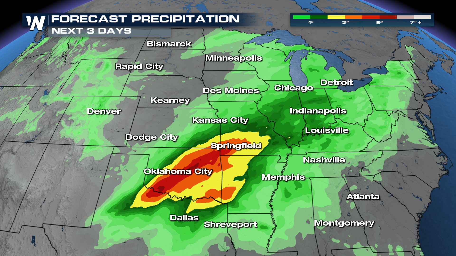
Flooding
Heavy rain will accompany storms, with isolated flash flooding possible. Before storms hit, review your severe weather preparedness, including knowing where to go in case of a tornado or flood.