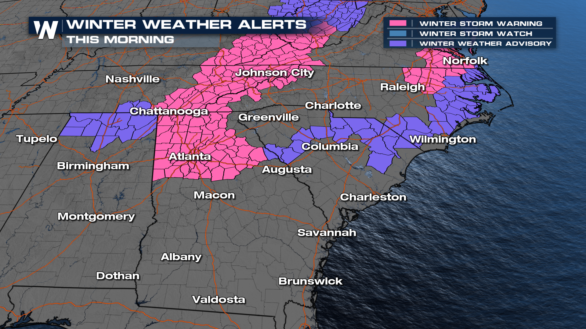
Snow and Ice Impacts to the Deep South and Mid Atlantic

A winter storm moved through the deep South on Friday from Arkansas to the Carolinas impacts were felt. Saturday morning the system races to the East. However, there are freeze fog warnings in place and also the threat for black ice. Plan on slick roads and travel difficulties, as Winter weather alerts continue linger across the Mid-South and Eastern U.S. early Saturday. Plan on slick roads and travel difficulties.
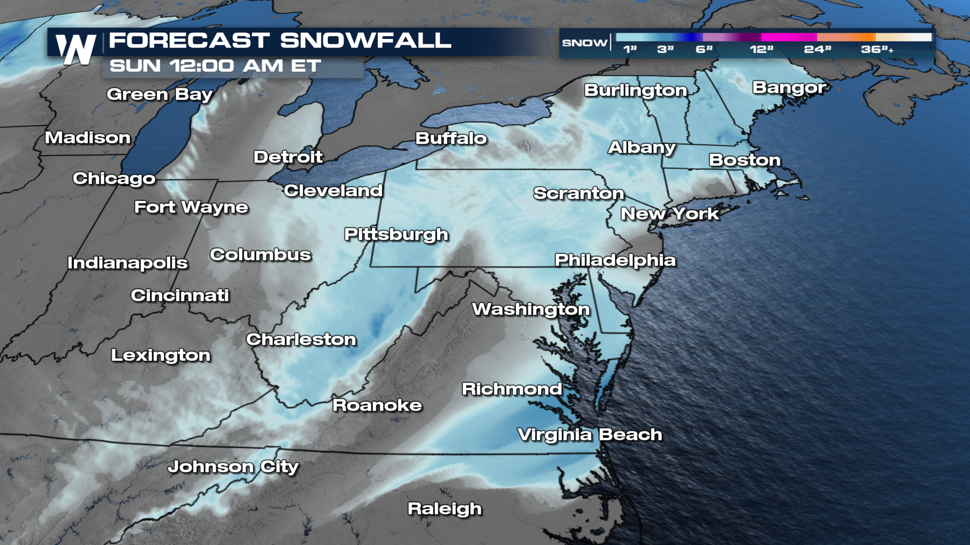
 The heaviest of the snow will move from west to east northeast into Saturday morning. I-20 will be the main dividing line between the wintry precipitation and rain. Additional 3" or more accumulations are possible in the higher elevations of the southern Appalachians and north of the center of low pressure as it tracks east. A few spots farther south could see flurries with chilly morning temperatures along the cold front. For the most part, when everyone wakes up on Saturday morning, the low will have moved out and any remaining precipitation will be rain.
 An additional 0.10" to 0.25" of ice is possible in the changeover zone. Anyone looking to hit the roads Saturday morning should proceed with caution as snow and ice will still hamper travel.
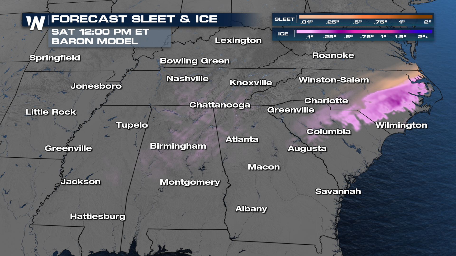 Here's a look and how the timing of the storms will move through the eastern U.S. into Saturday:


