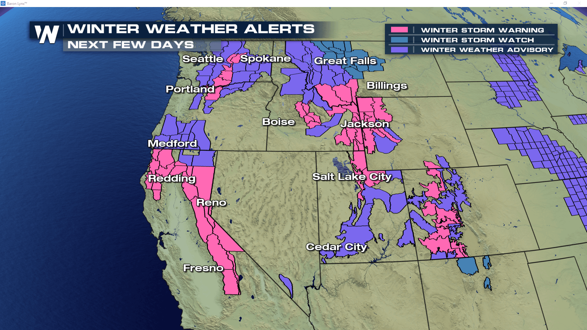
Snow To Continue In the West
Special Stories
14 Feb 2019 11:42 AM
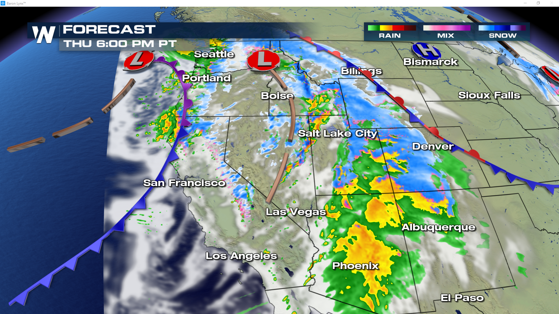
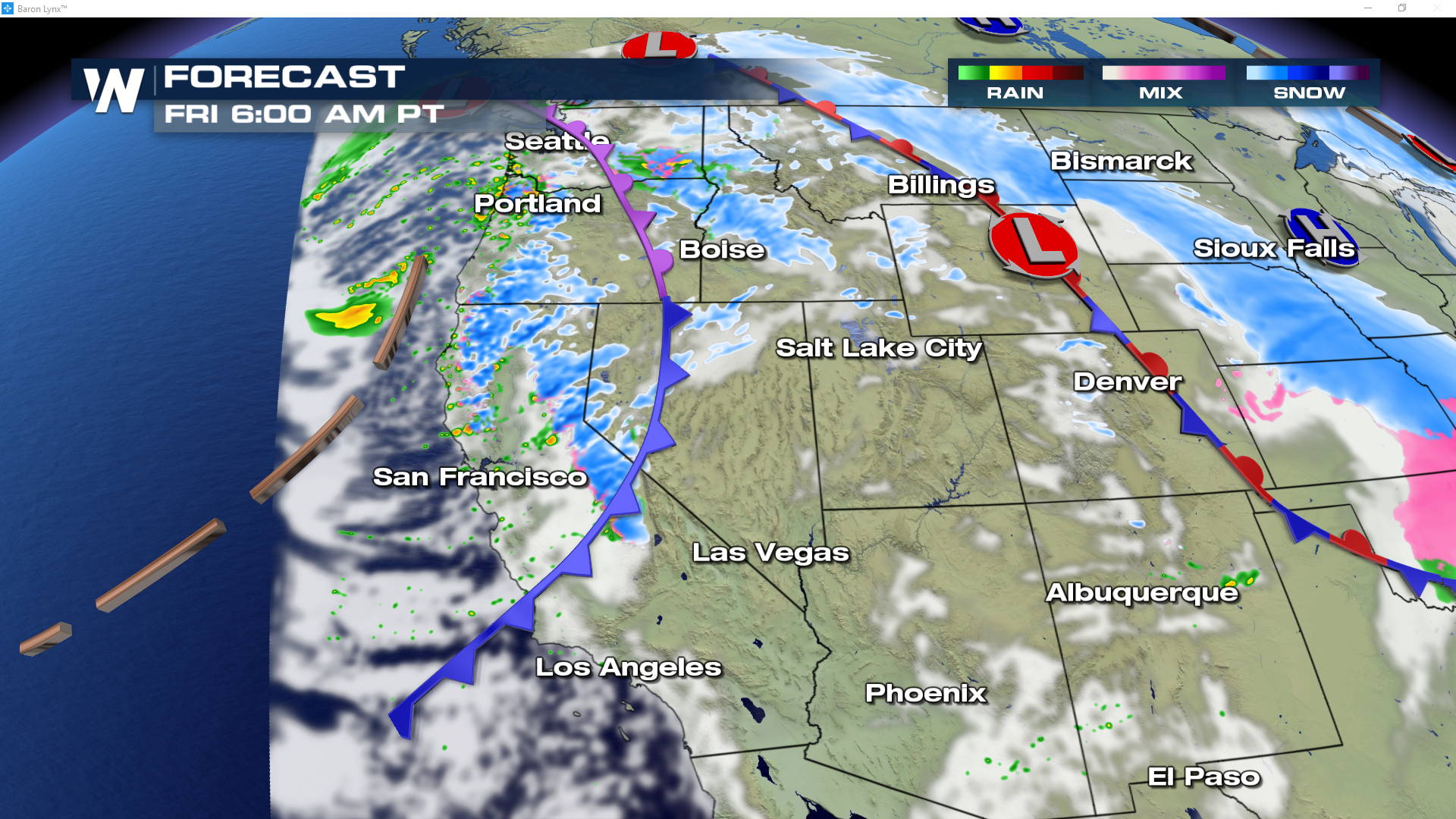
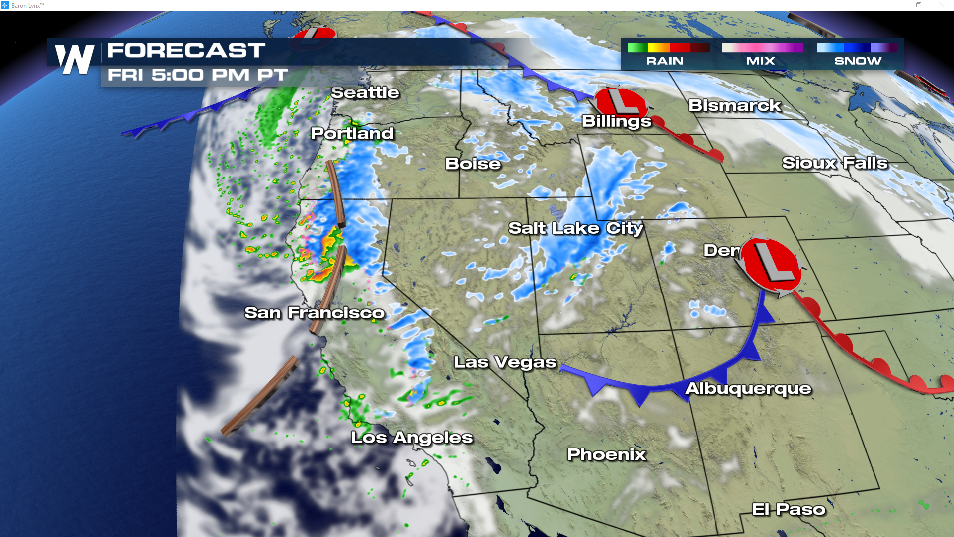
The west will continue to see accumulating snow through the weekend and into early next week, as waves of energy sweep through the region. Seen below are two areas of active weather that are forecast at 6 PM Thursday evening. Heavy snow will continue to fly through the inter-mountain west as a strong cold front likely drops up to 12" for the Colorado Rockies. As this system ejects east, round number two moves into the Pacific Northwest.
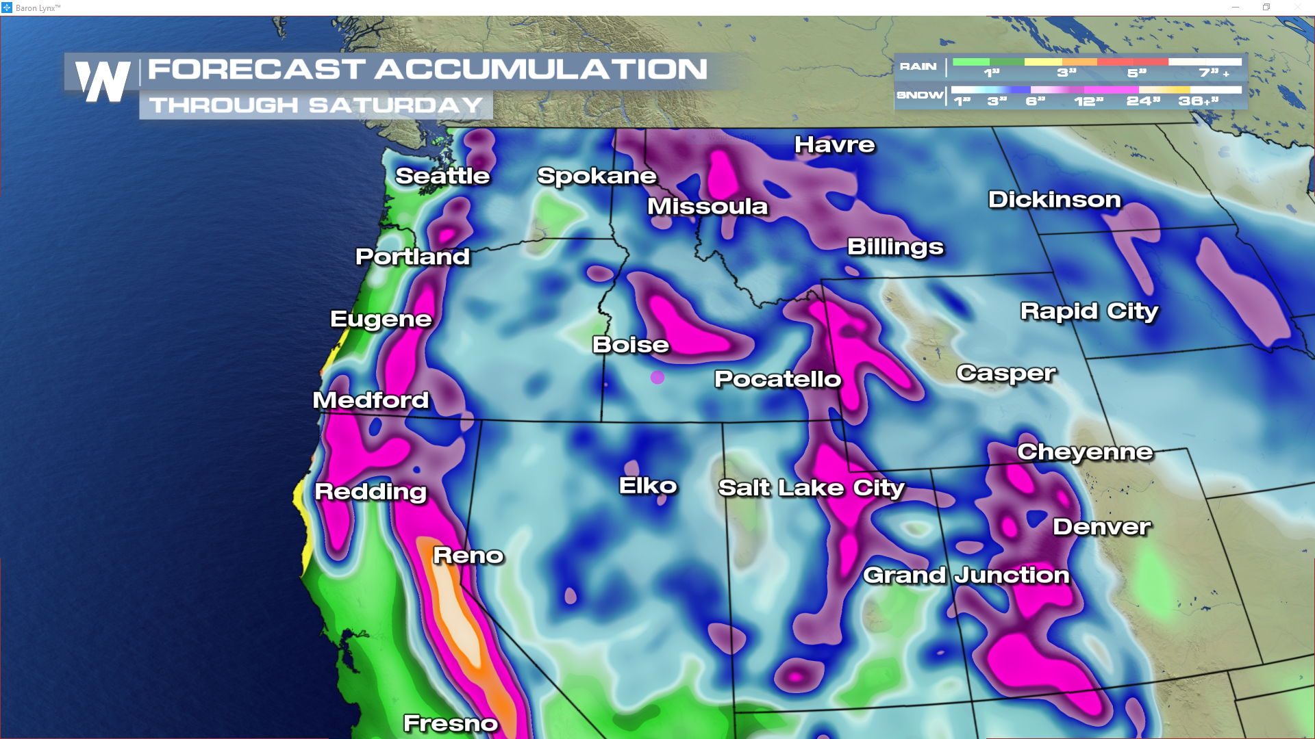
 Here are some expected snowfall totals through Saturday afternoon. The Sierra's will be the big winner with over 3'! Close behind will be both the Colorado Rockies' and the Wasatch Range in Utah with upwards of 2 feet of powder. Ski resorts will be loving these conditions over the next few days!
 For WeatherNation, I'm Meteorologist Greg Rule
Here are some expected snowfall totals through Saturday afternoon. The Sierra's will be the big winner with over 3'! Close behind will be both the Colorado Rockies' and the Wasatch Range in Utah with upwards of 2 feet of powder. Ski resorts will be loving these conditions over the next few days!
For WeatherNation, I'm Meteorologist Greg Rule
All Weather News
More
Active Pattern: Northern Plains to the Great Lakes
Waves of energy will continuing diving east o
13 Aug 2025 3:00 AM

Erin Forecast to Become a Hurricane
Tropical Storm ErinTropical Storm Erin was an
13 Aug 2025 12:35 AM

Perseid Meteor Shower Peaks Tonight - How to Watch
Get a blanket and find some dark skies! One o
13 Aug 2025 12:30 AM


Coast to Coast Heat With Some Relief
The long-range temperature trend towards the
13 Aug 2025 12:20 AM

Over a Foot of Rain Falls in Southwest Florida
Flash flooding continues to hit the Southeast
12 Aug 2025 1:40 AM

Strong Storms Across the Plains Monday night
A Marginal threat for strong and severe storm
12 Aug 2025 1:40 AM