Spring Outlook: Warm in the Northern U.S., Wet in the Southeast

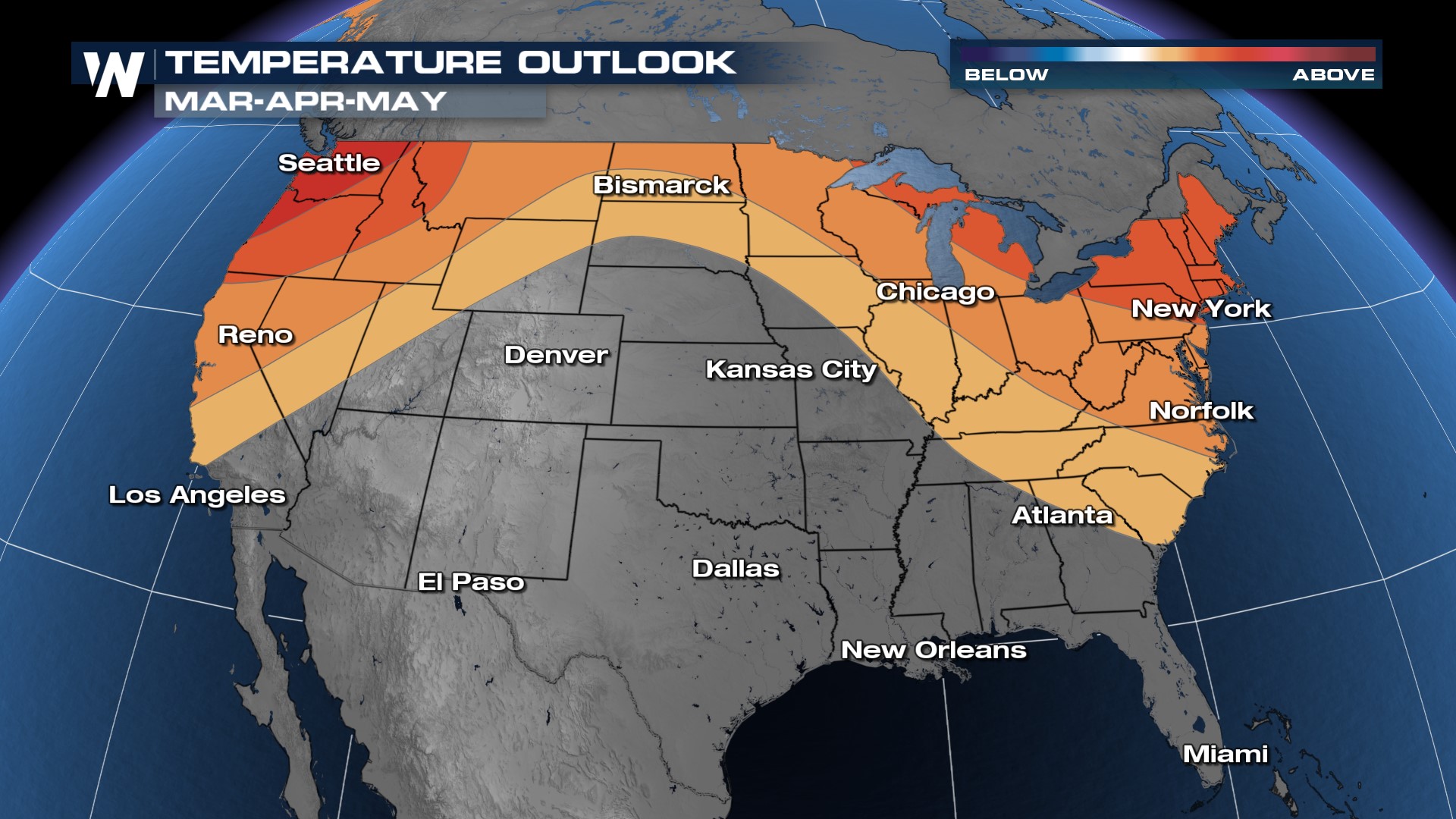
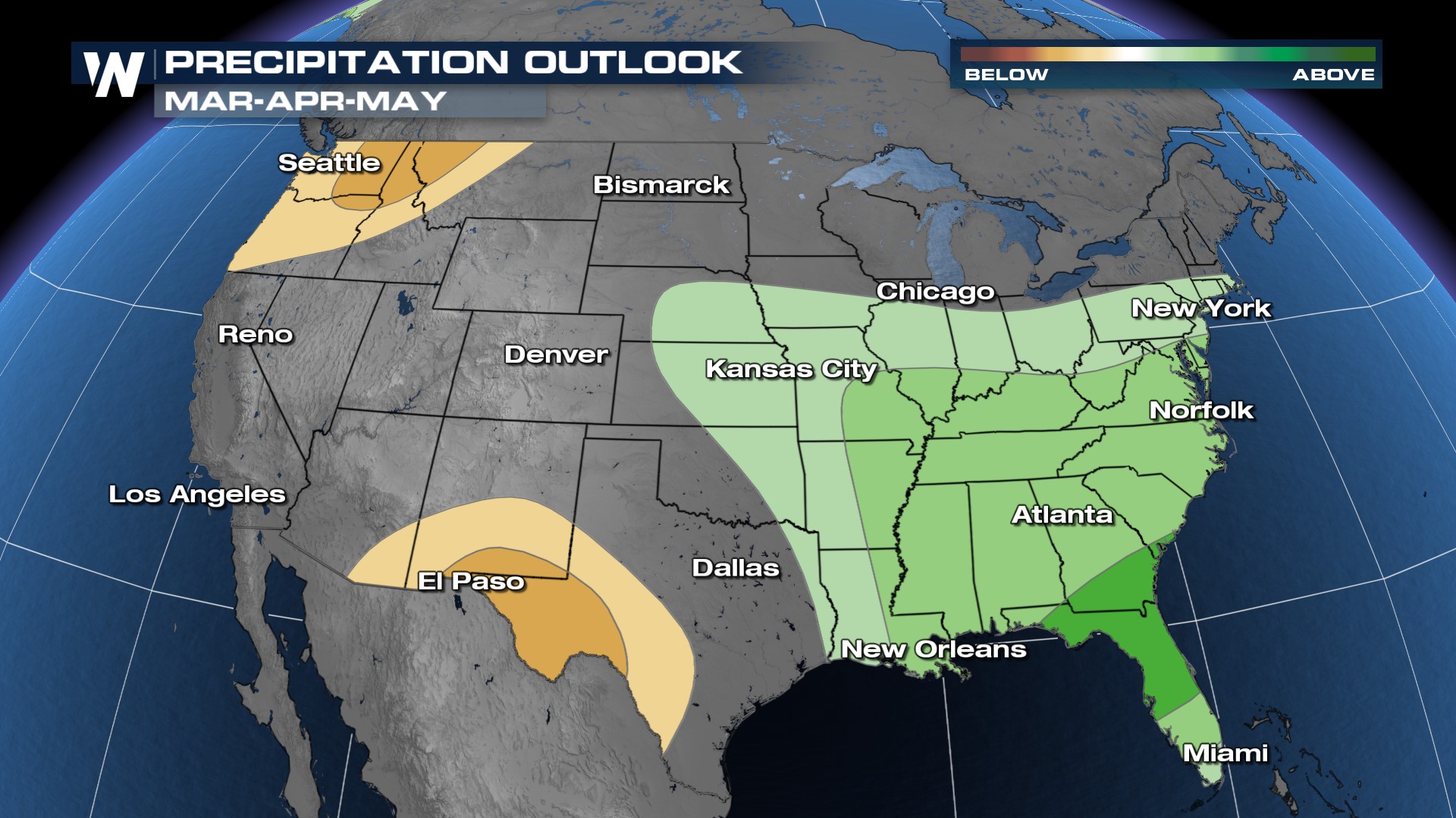
The Climate Prediction Center [CPC] has issued its Spring outlook including March, April, and May. It calls for confidence in warmer-than-average conditions for the northern tier of the country, including the Pacific Northwest and New England (below). There is also confidence in above-average precipitation for the Southeast U.S. and Ohio Valley, from the Midwest, and Mid-Atlantic to the Deep South with the highest confidence around central and northern Florida along with southern Georgia (above).
 The Spring Outlooks issued by the CPC also indicate confidence in below-average precipitation for the Pacific Northwest, which in combination with above-average temperatures could lead to an expansion of drought conditions. There is also confidence in below-average precipitation around the Big Bend of Texas, a region that is suffering from severe drought.
 To interpret these outlooks, look at the darkest colors as an indication of confidence. Darker shades indicate higher confidence in the forecast and aren't an indication of how much more above average a region could be in precipitation or temperature. The outlooks are developed based on climatological patterns with the influence of the Spring 2024 outlook mainly coming from a transition from El Niño into ENSO Neutral.
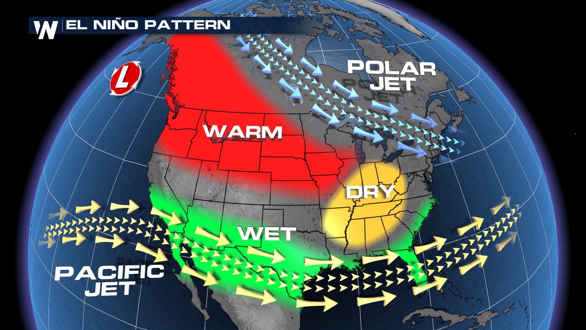
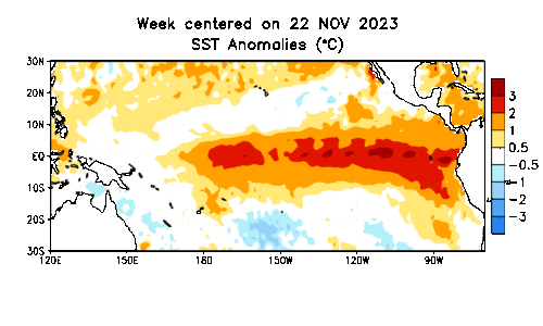
El Niño is a large-scale pattern and interaction between sea surface temperatures in the equatorial Pacific and the atmosphere. El Niño is characterized by warmer than average sea surface temperatures but scientists have started to notice a shift back towards average with forecast models anticipating La Nina, or cooler than average sea surface temperatures to take hold by Fall 2024. Impacts from El Niño and La Niña are most pronounced during the winter months and also have impacts on hurricane activity.
In a typical El Nino pattern, the impacts are characterized by warmer than average temperatures in the northern 2/3 of the country (Plains to the PNW) and a wetter than average pattern for the southern tier of the country. Because ENSO Neutral isn't expected to develop until April and May, much of the Spring outlook is under the influence of an El Niño Pattern.