Cold Front Brought Significant Flooding to I-95

Top Stories
1 Aug 2025 3:00 AM
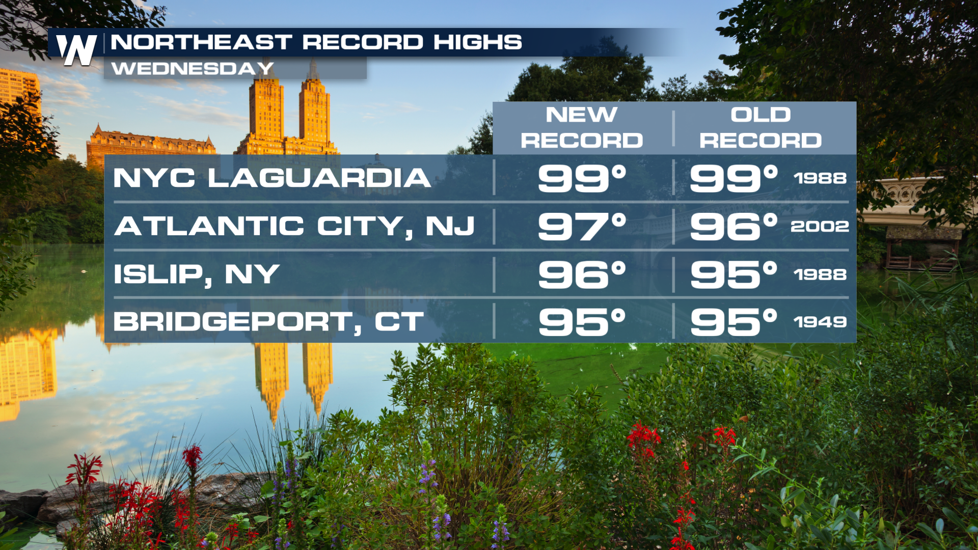
NORTHEAST - Record high temperatures broke in the northeast Wednesday afternoon, including Islip, LaGuardia, Atlantic City, and Bridgeport. Now, a cold front will tap into the high heat to create intense rainfall rates that could lead to significant flash flooding before cooler and drier conditions take over for the weekend.
 Flood Risk
Earlier, the Moderate Risk of flooding verified with numerous reports of flash floods from D.C. to New York City! Thankfully, the risk is going down for the overnight!
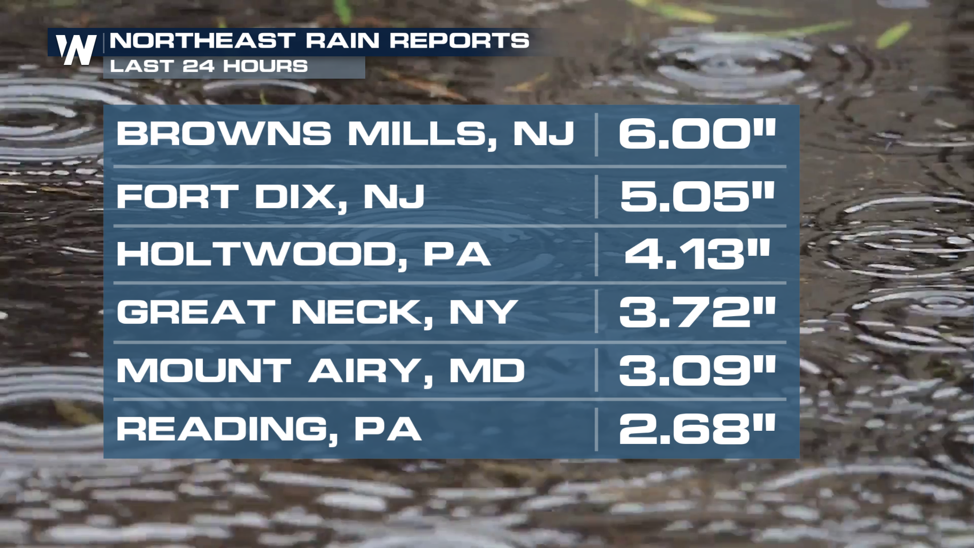
The remaining rainfall should less than an inch but a few isolated area could see some heavier totals.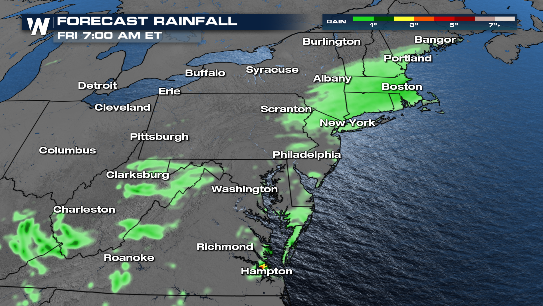
All Weather News
More
Heavy Rain, Severe Storms Loom For Texas & Gulf Coast
Several rounds of severe storms rocked the Lo
1 May 2026 1:00 PM

Cut-off Low Increases Rain and Snow Chances Out West
We have a rather wet pattern ahead for a lot
1 May 2026 11:00 AM

Rain or Shine? Your 152nd Kentucky Derby Forecast
Heading to Churchill Downs this Weekend?Derby
1 May 2026 10:00 AM

A Look Back at Moderate Risks This Week
MONDAYSevere storms erupted across the Midwes
1 May 2026 1:10 AM

Cooler Air Sweeps From the Plains to the Northeast
A trough of low pressure will keep things coo
1 May 2026 1:00 AM

Hail Pummels Missouri, Texas; Back for More Overnight
Severe storms have been numerous this week, a
30 Apr 2026 1:20 AM
