Tropical Development in the Caribbean This Week?
Top Stories
12 Jun 2018 2:13 PM
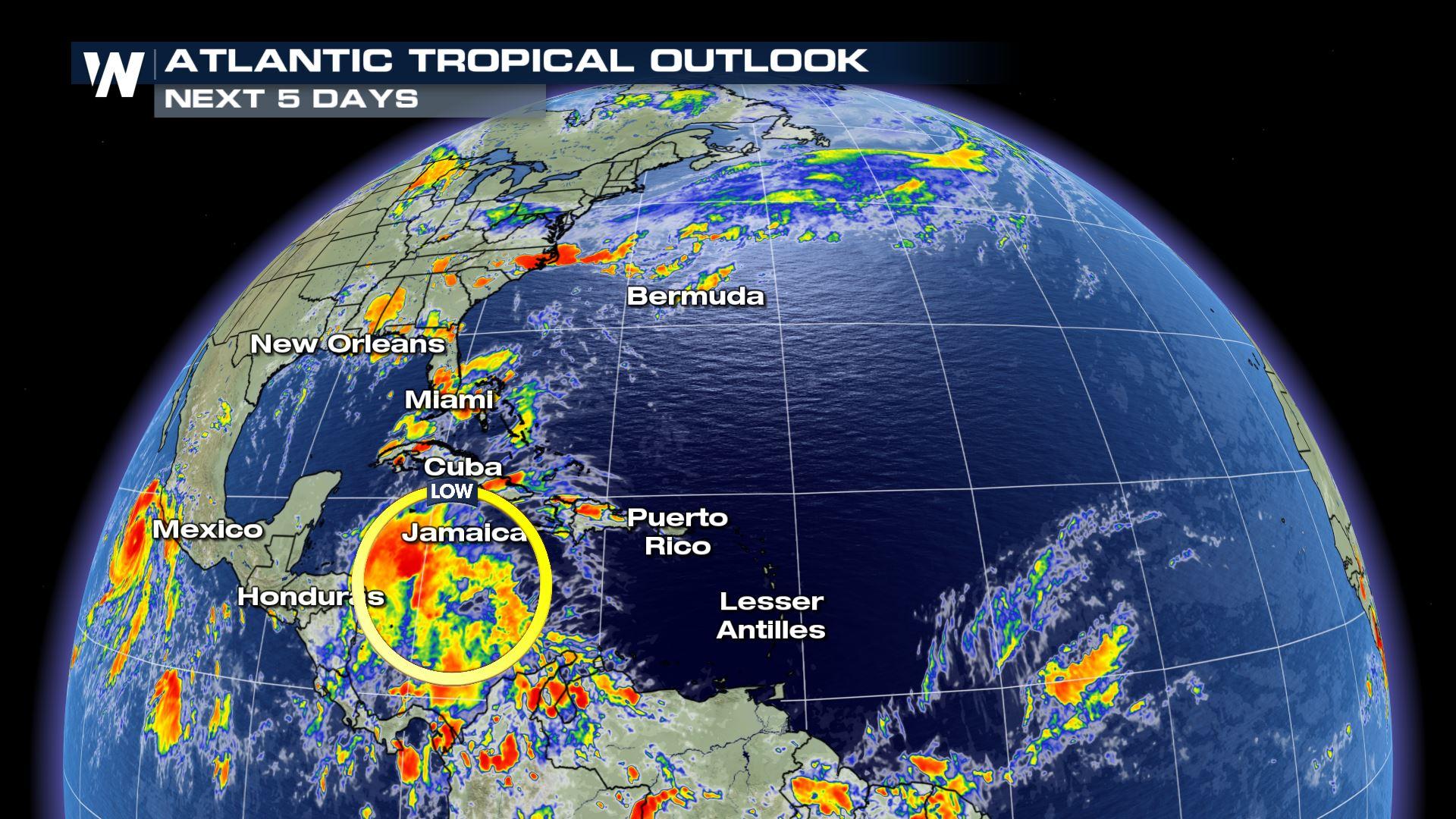
An area of low pressure in the Caribbean Sea is being monitored by the National Hurricane Center (NHC) for possible tropical development later this week, and as of Tuesday, there were still low odds of it becoming a storm.
As of Tuesday evening, the National Hurricane Center put only 20 percent odds on the cluster of showers and thunderstorms becoming a tropical system. The NHC isn't planning on sending in the hurricane hunters into the storm, also as of Tuesday evening.
Slow, gradual development is possible over the next few days as the tropical wave associated with the storminess drifts west-northwestward. The exact track, as tends to be the case in the early stages of a system's development, remains uncertain. Be sure to stay with WeatherNation for the latest on the storm's track and any possible changes to it.
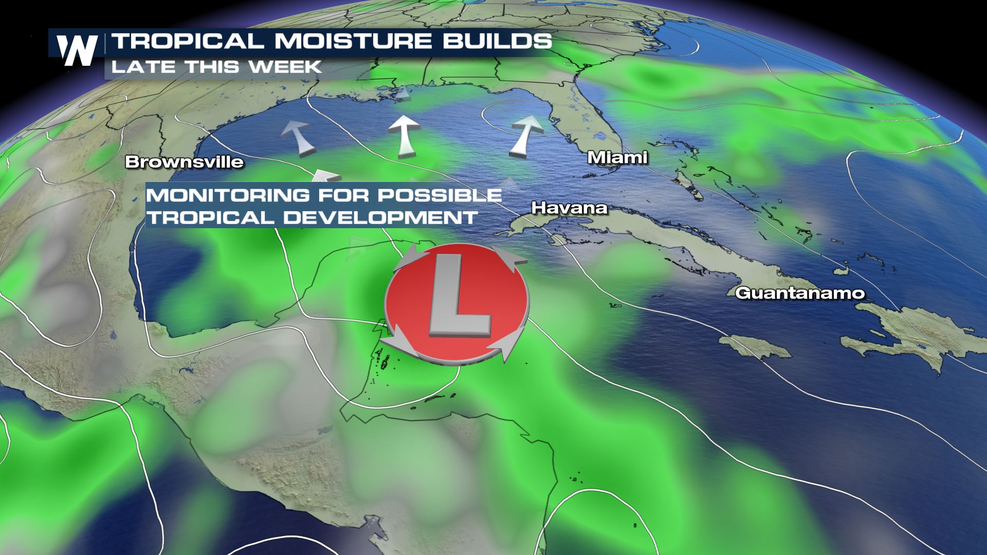 Just as was the case with Tropical Storm Alberto late last month, the main impact from this system will almost certainly be heavy rainfall, and the potential for flooding. The main areas that'll be impacted by this in the near-term will be Central America, and specifically the Yucatan Peninsula of Mexico, Belize, Guatemala and Honduras. As the storm moves into the Gulf of Mexico later this week and into the weekend, however, some development is possible, which could bring rain to different parts of Mexico and perhaps the Texas Gulf coast. Exact impacts and timing for these areas will change in the next few days, so stay up to date on the forecast. To repeat, heavy rain will be the main threat from this storm, regardless of where it goes.
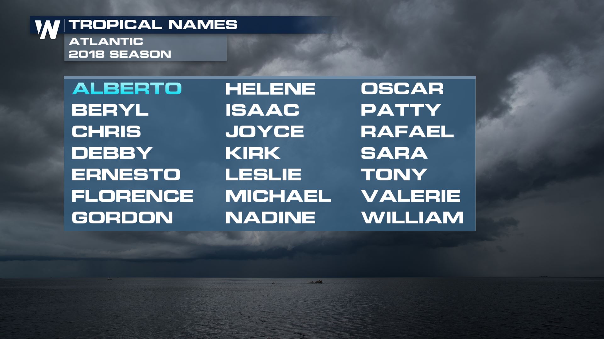
Should this system develop into a named storm - again, this still appears unlikely right now - it would be named Beryl, the second named storm of the Atlantic basin season.
Just as was the case with Tropical Storm Alberto late last month, the main impact from this system will almost certainly be heavy rainfall, and the potential for flooding. The main areas that'll be impacted by this in the near-term will be Central America, and specifically the Yucatan Peninsula of Mexico, Belize, Guatemala and Honduras. As the storm moves into the Gulf of Mexico later this week and into the weekend, however, some development is possible, which could bring rain to different parts of Mexico and perhaps the Texas Gulf coast. Exact impacts and timing for these areas will change in the next few days, so stay up to date on the forecast. To repeat, heavy rain will be the main threat from this storm, regardless of where it goes.
Should this system develop into a named storm - again, this still appears unlikely right now - it would be named Beryl, the second named storm of the Atlantic basin season.
 Stay with WeatherNation for the latest on the tropics and this system.
For WeatherNation: Meteorologist Chris Bianchi
Stay with WeatherNation for the latest on the tropics and this system.
For WeatherNation: Meteorologist Chris Bianchi
Just as was the case with Tropical Storm Alberto late last month, the main impact from this system will almost certainly be heavy rainfall, and the potential for flooding. The main areas that'll be impacted by this in the near-term will be Central America, and specifically the Yucatan Peninsula of Mexico, Belize, Guatemala and Honduras. As the storm moves into the Gulf of Mexico later this week and into the weekend, however, some development is possible, which could bring rain to different parts of Mexico and perhaps the Texas Gulf coast. Exact impacts and timing for these areas will change in the next few days, so stay up to date on the forecast. To repeat, heavy rain will be the main threat from this storm, regardless of where it goes.
Should this system develop into a named storm - again, this still appears unlikely right now - it would be named Beryl, the second named storm of the Atlantic basin season.
Stay with WeatherNation for the latest on the tropics and this system.
For WeatherNation: Meteorologist Chris BianchiAll Weather News
More
Fronts Continue To Spark Severe Weather Across the Plains
A cold front that brought record lows to the
18 Jul 2025 10:40 PM

Extreme Heat Impacts for the East Coast & South
Extreme heat continues to impact several area
18 Jul 2025 10:05 PM

Flooding Threat Remains Elevated in the East
A cold front pushing through the Eastern Seab
18 Jul 2025 9:10 PM

EF-2 Firenado from the Deer Creek Fire in Utah
A fire tornado was spotted near La Sal, Utah
18 Jul 2025 7:30 AM

Tropical System Brings Flood Risk to the Central Gulf
Time has run out for notable tropical develop
18 Jul 2025 3:05 AM

Heavy Rain, Flooding Threat Returns to Florida
Keep the rain boots handy in Florida - heavy
13 Jul 2025 12:50 PM

Severe Storm Risk Pushes into the Great Lakes, Ohio Valley
Friday was another busy day with severe weath
12 Jul 2025 8:00 PM