Northeast 20 Degrees Cooler; Next Cold Front Inbound

Top Stories
19 Aug 2025 1:30 AM
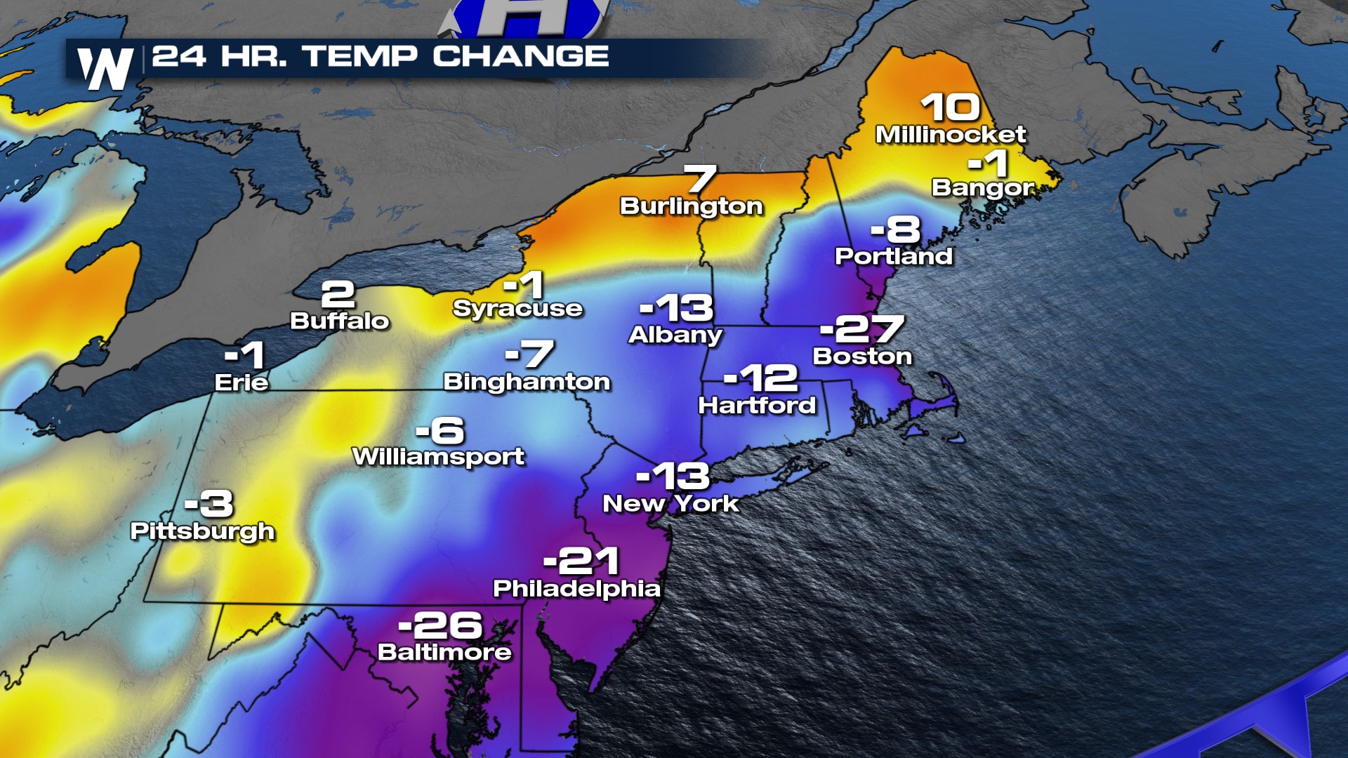
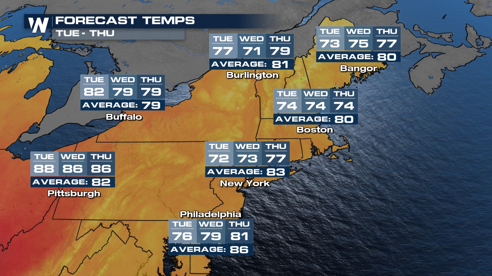
Temperatures in the Northeast are running 15-30 degrees cooler behind a cold front. And, temps stay in the 70s through Thursday!
 Timing
A few storms will linger into the overnight hours, but most will be dry as the front continues to move out.
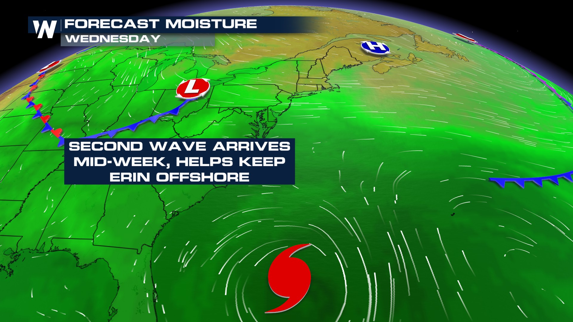
The next cold front will move into the focus by Tuesday and Wednesday. This front will give a helping hand at keeping Hurricane Erin away from the East Coast and force it back north of Bermuda!
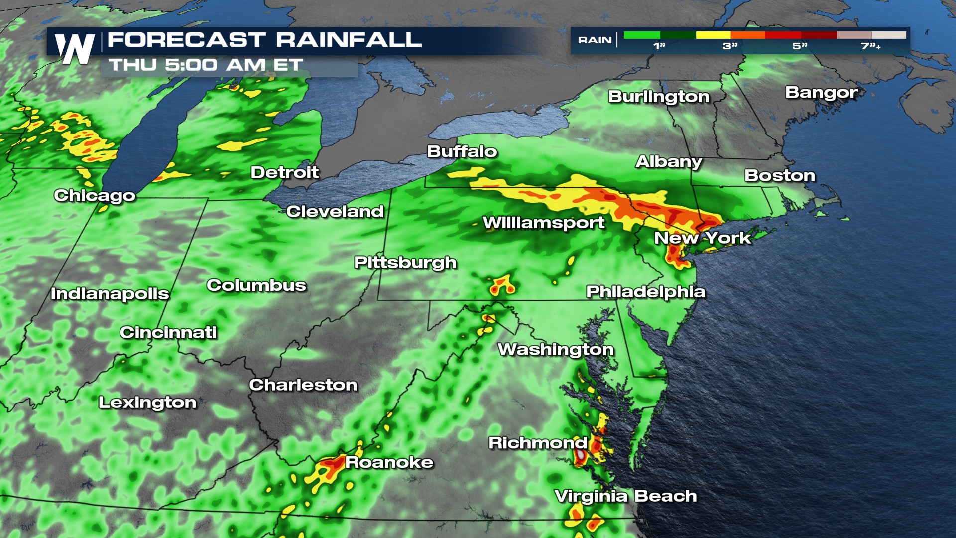
 The next cold front delivers pockets of heavy rain to the Northeast through Thursday morning.
All Weather News
More
Fire Danger Plagues an Already Blistering West
It's been unbearably warm across the west for
26 Mar 2026 12:50 AM

More Records Obliterated - Heat Soars into Central U.S.
ABOVE - The month of March has been setting r
26 Mar 2026 12:35 AM

Sharp Front Sparks More Severe Chances Late Week
It's the season of swings! Baseball counts bu
26 Mar 2026 12:25 AM

Cherry Blossoms Expected to Peak in a Week
Top Image Credit: National Parks ServiceSprin
24 Mar 2026 9:50 AM

Pineapple Express Delivers Another Round of Rain
Heavy rainfall from moisture that inundated t
24 Mar 2026 9:45 AM

Powerful Kona Low Devastates Hawaii Over the Weekend
After record shattering rain and hurricane fo
23 Mar 2026 4:30 PM

Severe Storm Potential Heads East from the Ohio Valley to the Southeast
A series of systems moving across the Norther
23 Mar 2026 2:10 AM