Updated March Forecast from the Climate Prediction Center
Special Stories
2 Mar 2018 10:39 AM
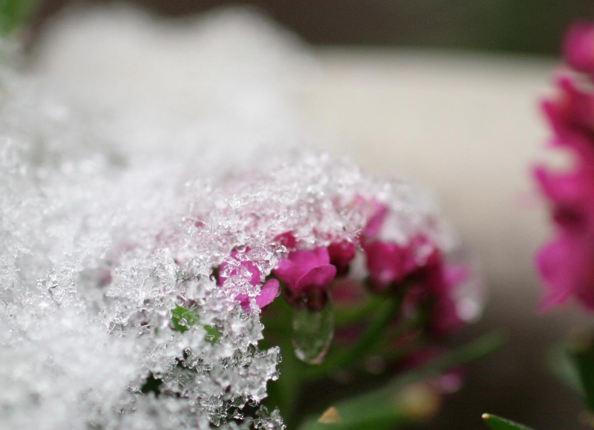
[Snow melting on flowers by joka2000, from CC BY 2.0]
Earlier this week, the Climate Prediction Center updated their March forecast. Some changes were made from the previous forecast issued in the middle of last month. The biggest changes were made to the precipitation forecast, with wetter than average conditions now expected along the West Coast, Upper Midwest, and Mississippi Valley. Below average precipitation is still expected near the Four Corners.
The temperature forecast only had a few minor position changes. The Great Lakes has been added to an area of warmer than normal temperatures, which stretches from the Northeast to Four Corners. A colder than normal month is still in the forecast for the Northwest and High Plains.
https://twitter.com/NWSCPC/status/968940430065831937
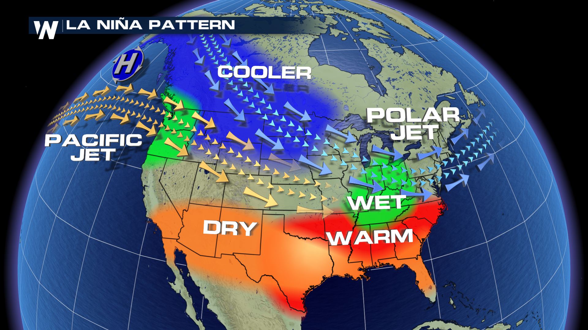
The Climate Prediction Center states that the changes were made "due to to short-term weather and subseasonal climate variability". They also mentioned that La Nina "remains in play". The Madden Julian Oscillation thunderstorms are also active over the Indian Ocean and will influence weather patterns to start the month, but forecast to weaken over the next week to ten days.
La Nina (translated from Spanish as “little girl”) is a natural ocean-atmospheric phenomenon marked by cooler-than-average sea surface temperatures in the central Pacific Ocean near the equator. It's the opposite of El Nino (“little boy”), which is when warmer than normal water temperatures are observed. You can read more about the MJO in this NOAA link.
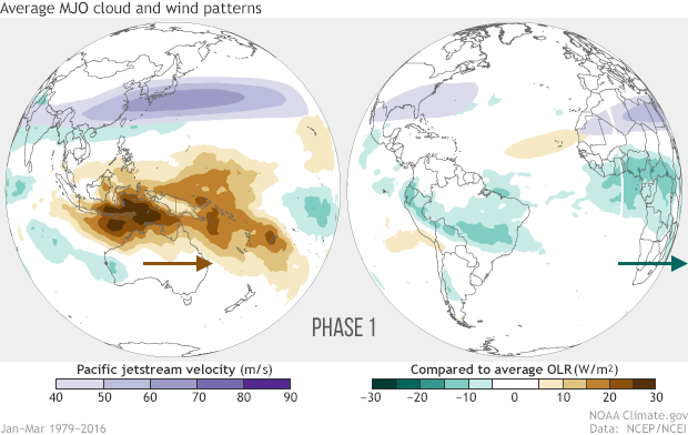 [Averages of all January–March MJO events from 1979–2016. Green shading shows below-average OLR (outgoing longwave radiation, or heat energy) values, indicating more clouds and rainfall, and brown shading identifies above-average OLR (drier and clearer skies than normal). The purple contours show the location and strength of the Pacific jet at the 200-hPa level (roughly 38,000 feet at that location). Note the eastward movement of the wet and dry areas. How far the Pacific jet extends past the international dateline also changes with the phase of the MJO. NOAA Climate animation adapted from original images provided by Carl Schreck.]
For WeatherNation by Meteorologist Mace Michaels
[Averages of all January–March MJO events from 1979–2016. Green shading shows below-average OLR (outgoing longwave radiation, or heat energy) values, indicating more clouds and rainfall, and brown shading identifies above-average OLR (drier and clearer skies than normal). The purple contours show the location and strength of the Pacific jet at the 200-hPa level (roughly 38,000 feet at that location). Note the eastward movement of the wet and dry areas. How far the Pacific jet extends past the international dateline also changes with the phase of the MJO. NOAA Climate animation adapted from original images provided by Carl Schreck.]
For WeatherNation by Meteorologist Mace MichaelsAll Weather News
More
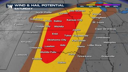
Weekend Forecast: More Severe Weather
With another severe weather outbreak underway
26 Apr 2024 2:20 PM
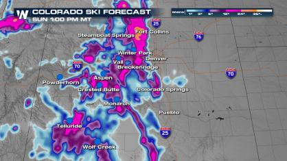
Spring Snow on the Horizon in Colorado
Snow is on the way for the mountains of Color
26 Apr 2024 2:15 PM
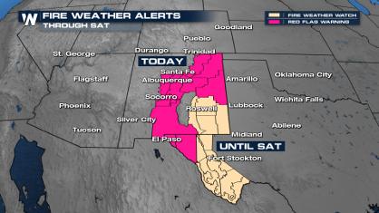
Critical Fire Risk in West Texas, New Mexico
A critical fire risk is in place for west Tex
26 Apr 2024 2:15 PM

National Park Week: Get Out and Explore
National Park Week started Saturday, April 20
26 Apr 2024 11:55 AM

NOAA Debuts "HeatRisk" Tool Nationwide
More people die from heat every year than ALL
25 Apr 2024 9:00 PM

Double Trouble: Cicadas Take to the Skies this Spring
It’s the soundtrack to the summer. Nature’s n
25 Apr 2024 8:45 PM