Wild Temp Swings & Snow for Colorado
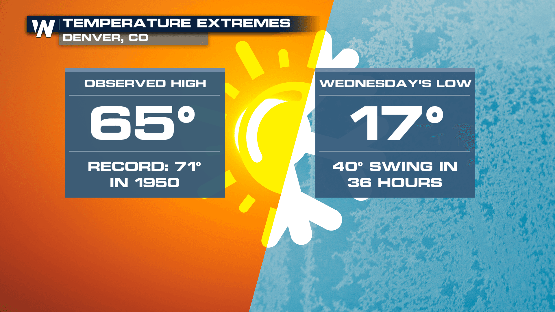
Colorado's Front Range is known for some pretty wild weather, and this week will be an example of that. We hit 65° on Monday afternoon and now temperatures plummet, to lows in the teens on Wednesday morning - a 40° temp swing in just about 36 hours! Not only will we see temperatures swing, but we will also see the front responsible for the cold air produce snow for the highest elevations. Over a foot has already fallen in Utah's mountains.
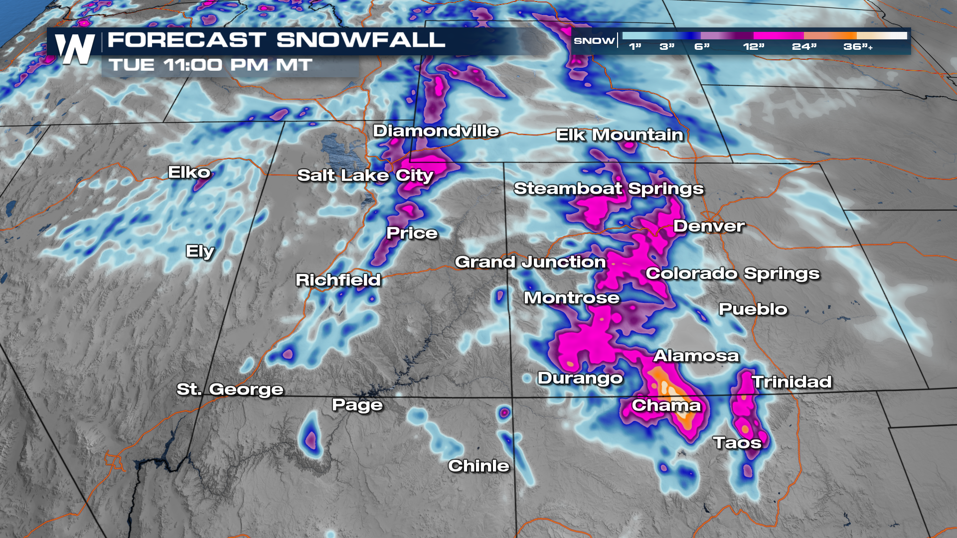 Storm totals upwards of a foot are likely for the Rockies of Colorado and the Wasatch Range of Utah with the highest totals in the San Juan mountains of Southwest Colorado where up to 2' could be possible. Winter alerts are in effect for this quick-moving system that will pack a punch.
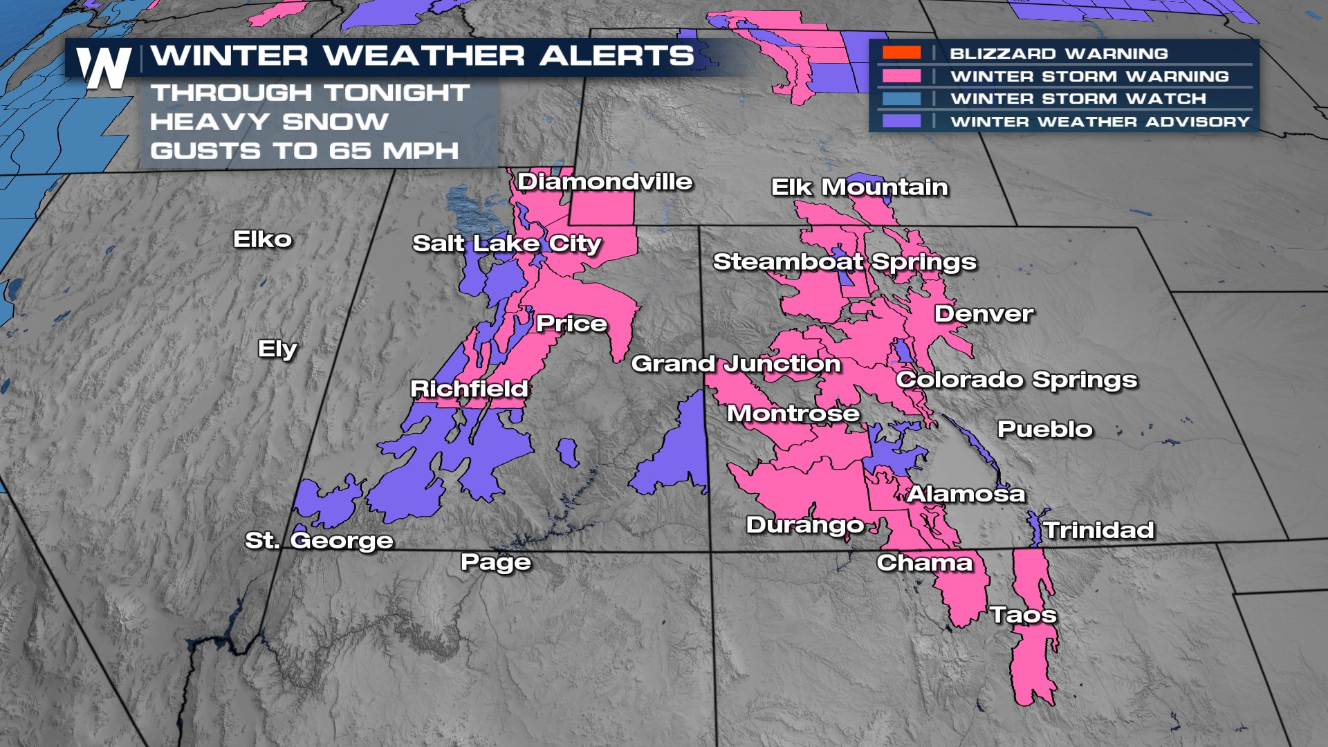 Though no widespread blizzard warnings are in effect we will see winds gust over 40 mph through Tuesday. Ahead of the moisture and for the Plains of New Mexico and Colorado this will prompt fire danger concerns. Meanwhile in the mountains, blowing snow will create big visibility problems and treacherous travel for I-70, I-80, and I-15.
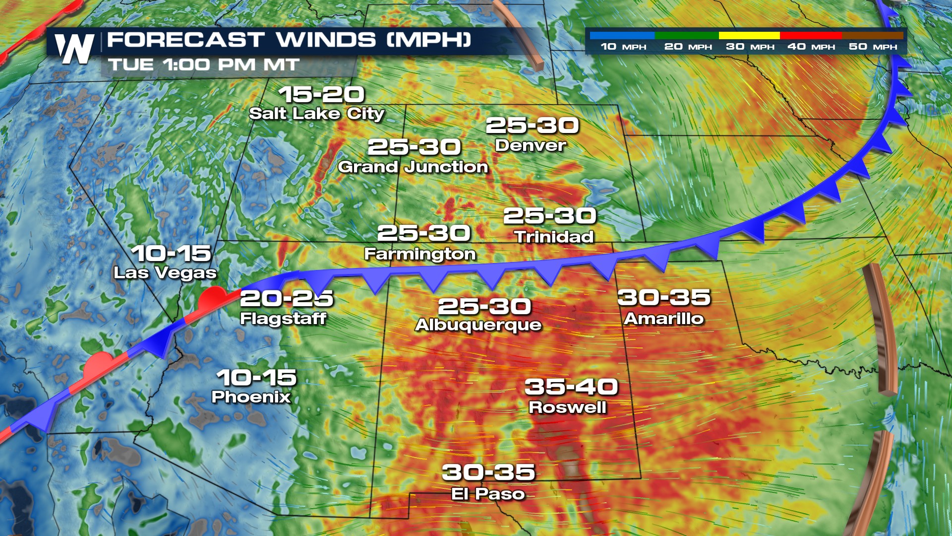 Snow continues through Tuesday morning as the front slides through the area. Our period of steadiest snow and wind will be for the first half of the day on Tuesday when we will see a few snow flurries in Denver and Colorado. Snow showers linger through the end of the day Tuesday for the highest elevations.


