Snow Hits Colorado & Utah Today
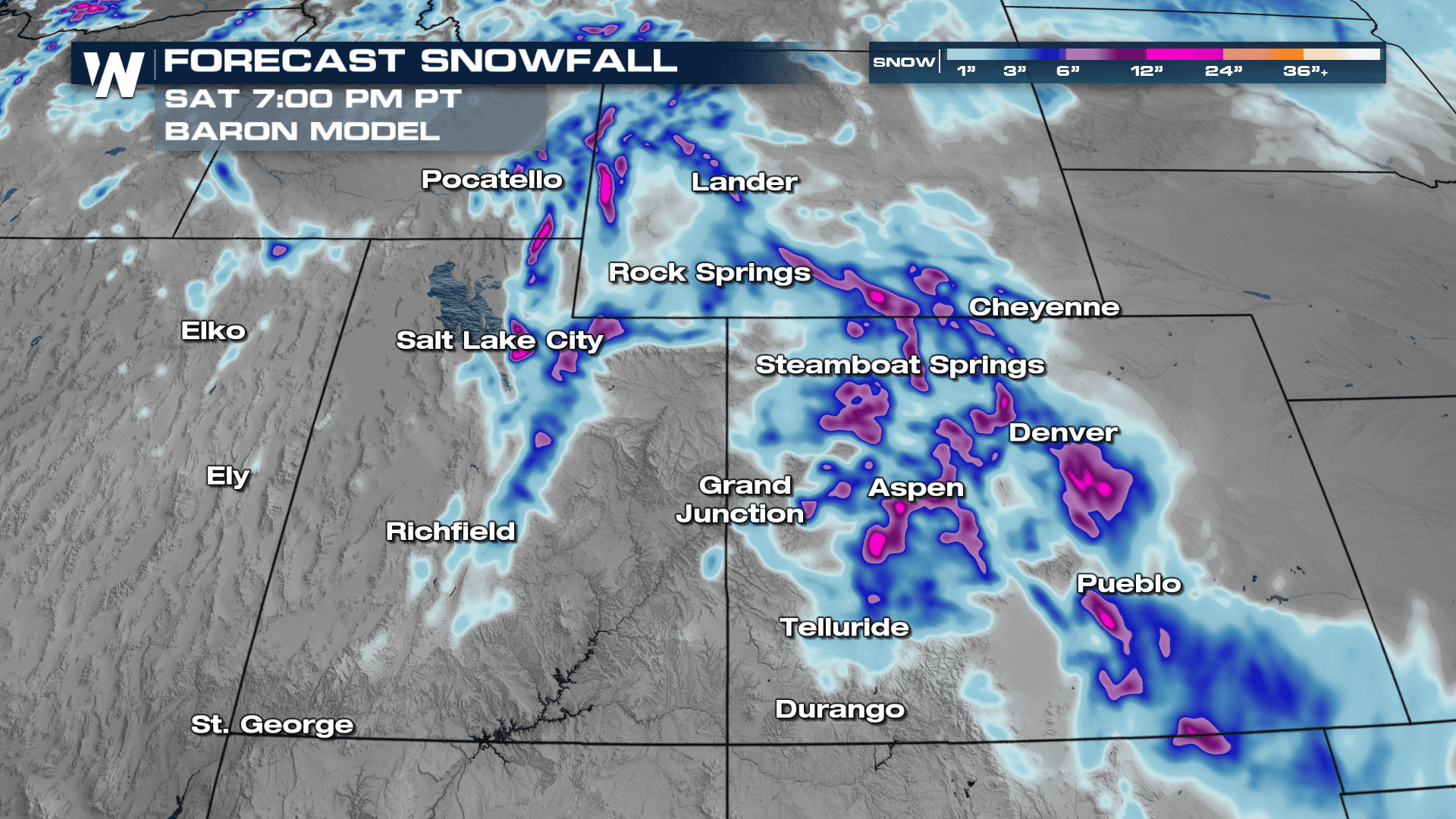
Steady rain for the northern California coast and mountain snowfall hit the region on Thursday but energy is now pushing east, impacting Utah, Colorado and Wyoming today. Snowfall rates of up to 1/2" per hour could be possible at times, reducing visibility and causing slick travel on I-80, I-70, and other mountain highways. Winter Weather Alerts are in effect for the region into Saturday morning although most snow tapers off by early evening Friday.
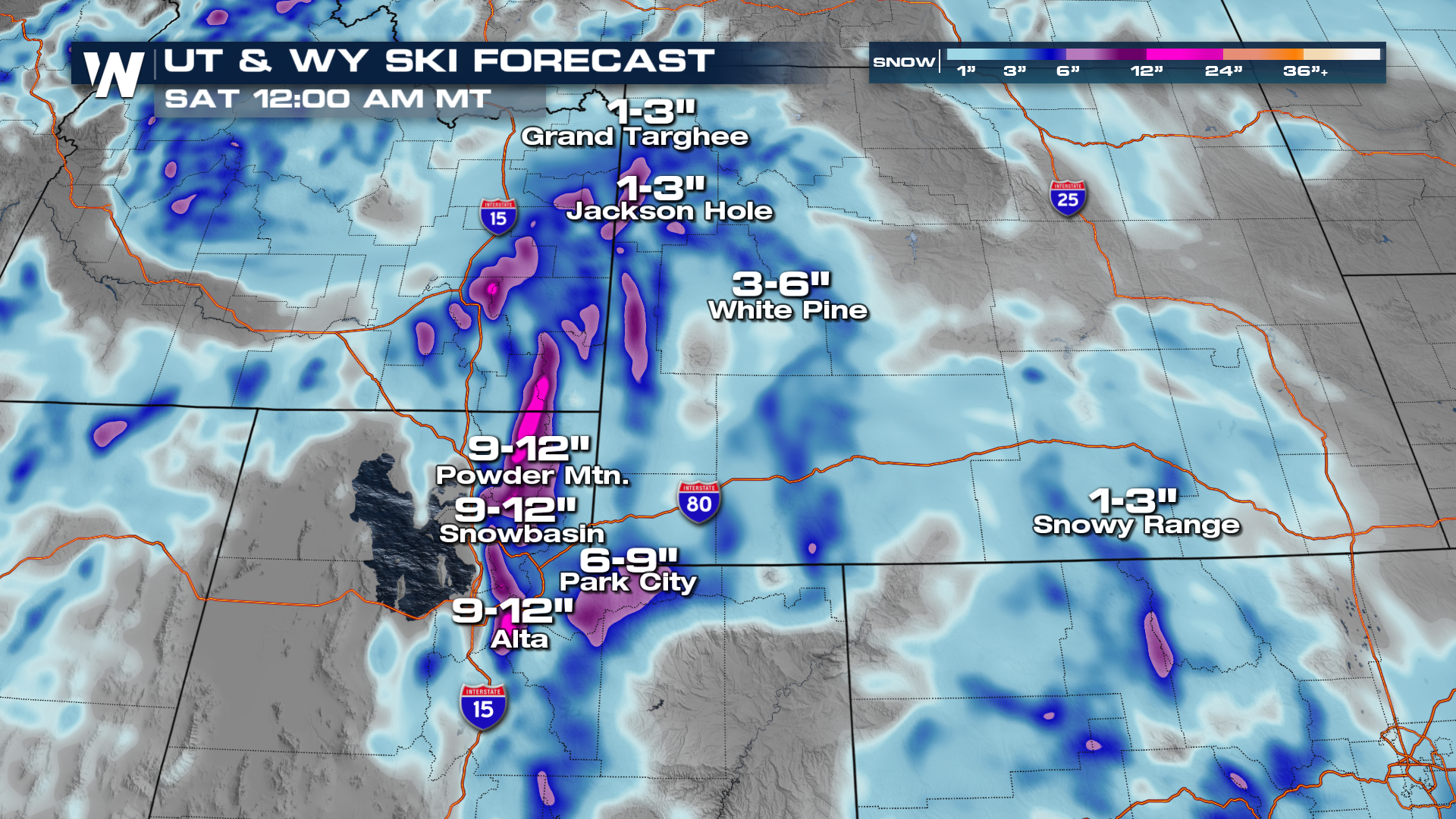
Snowfall accumulations will be most impressive through the Tetons of Wyoming, where upwards of half a foot of snow could be possible into the end of this workweek. Again, this is great for ski resorts but will make traveling tough!
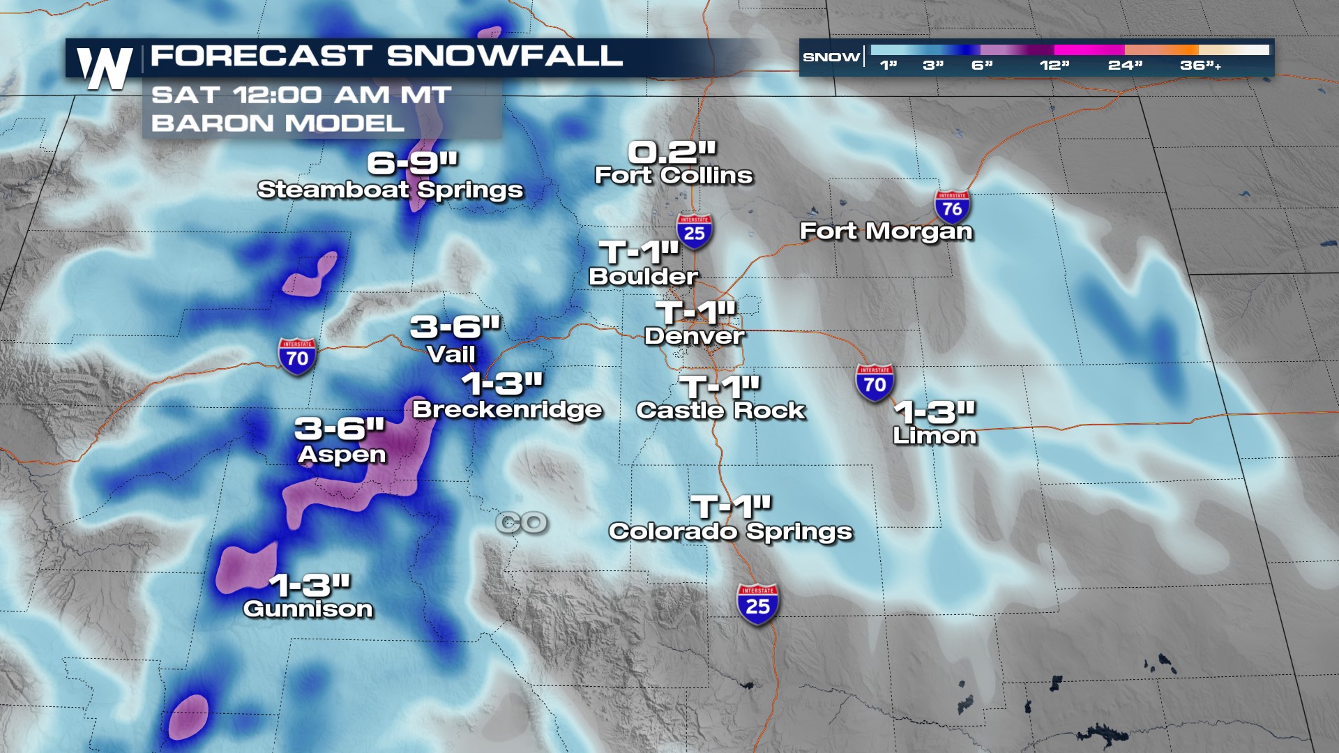
 The Centennial State's ski resorts will also see beneficial snow, with some of the highest amounts topping up to 9" in the Steamboat Springs area!