Josephine is Now Post-Tropical

SETUP
The National Hurricane Center was watching the coastal low that brought many impacts to the eastern U.S.. Josephine quickly became a subtropical storm. As quickly as this storm became subtropical, it changed to Post-Tropical. Here is a look at the latest information.
JOSEPHINE FORECAST
Josephine is no longer being monitored by the National Hurricane Center. This storm is post-tropical, and that means it is basically a low-pressure system in the Atlantic waters. The impacts will be diminishing through Friday morning along the Atlantic Seaboard.
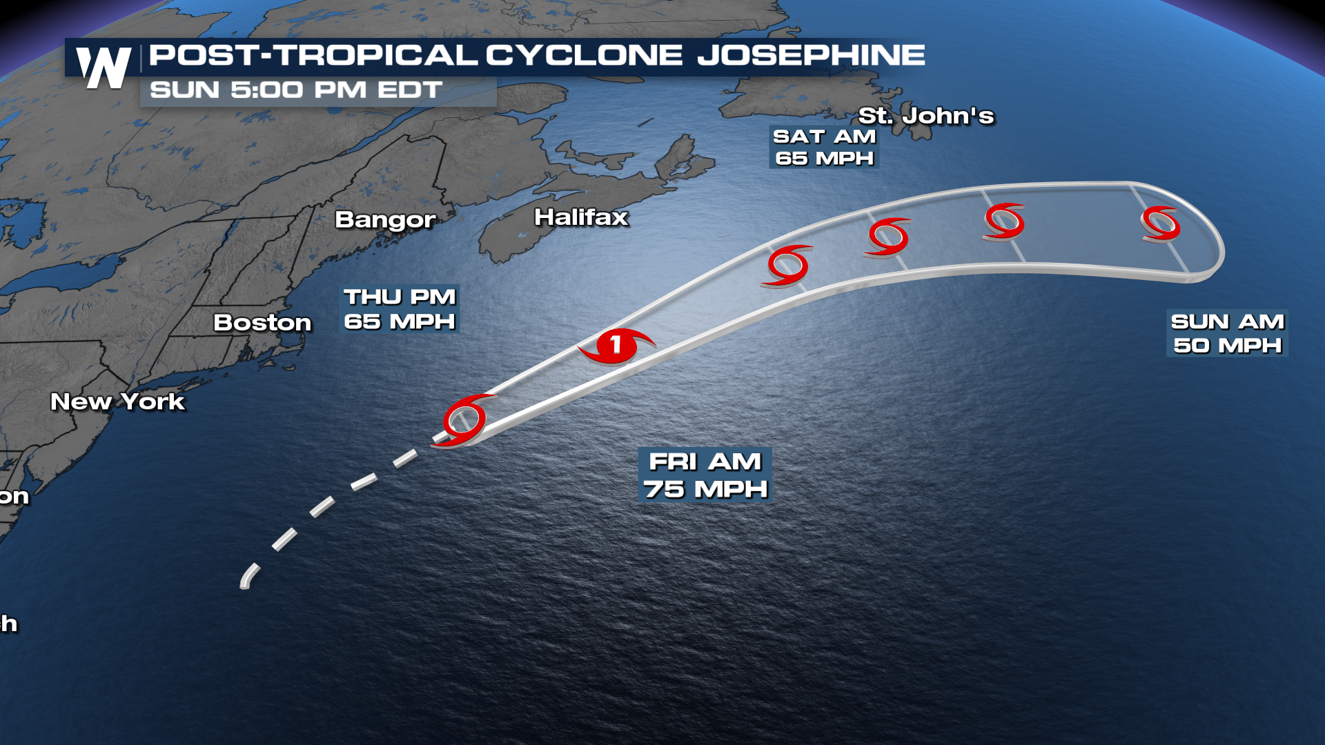
FORECAST WAVE HEIGHTS
Wave heights between 10-20 feet will be possible at times, making for dangerous conditions.
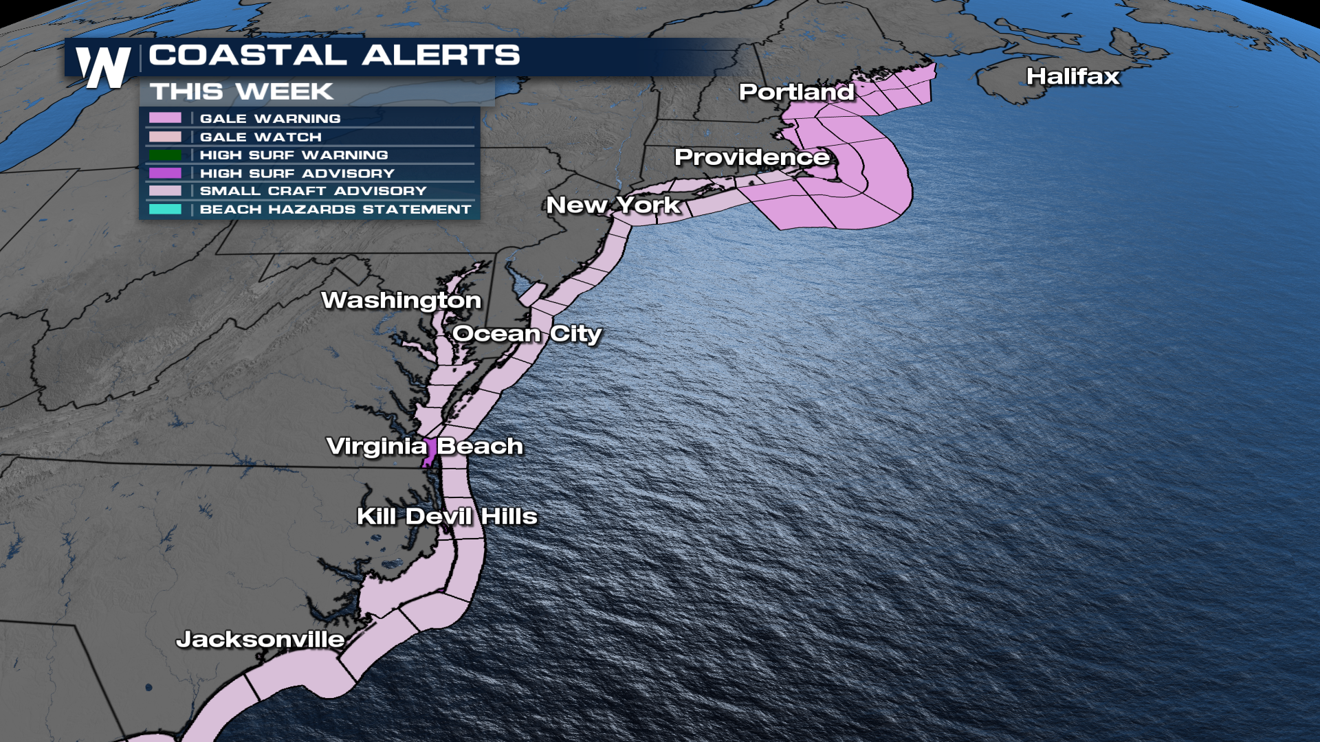
IMPACTS
High winds with Josephine will wear down many beaches along the eastern seaboard. What's of most concern are the beaches in North Carolina, which stick out farthest, and places like Virginia, which will have to endure days of breezy winds agitating the seas. Waves of 10-15 feet can be expected, which will help push a few feet of seawater onshore into normally dry stretches of the coast.
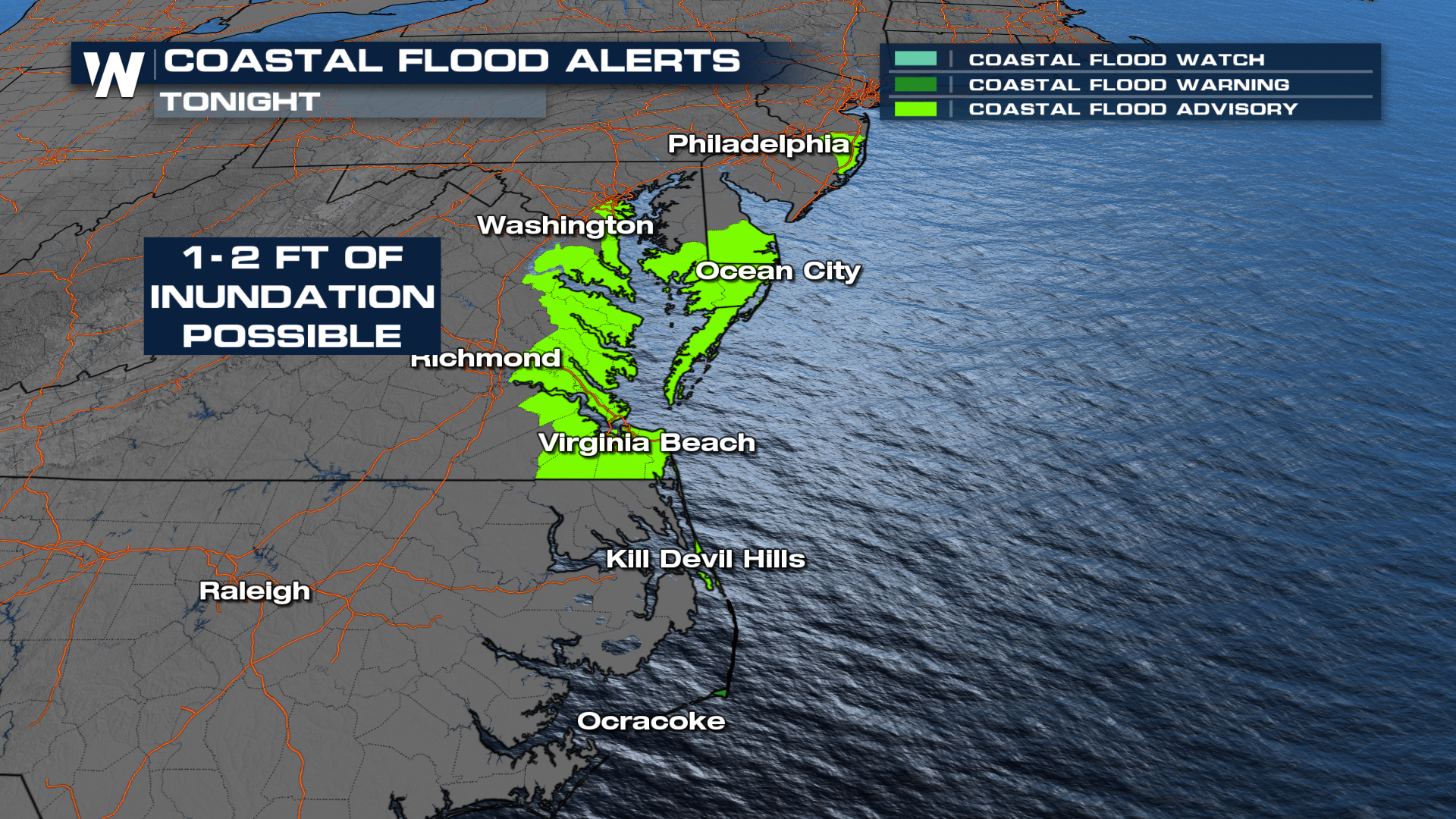 More updates on this evolving setup will be coming up all day and night on WeatherNation.


