The Sierras Stay Active with some Impressive Snow Totals

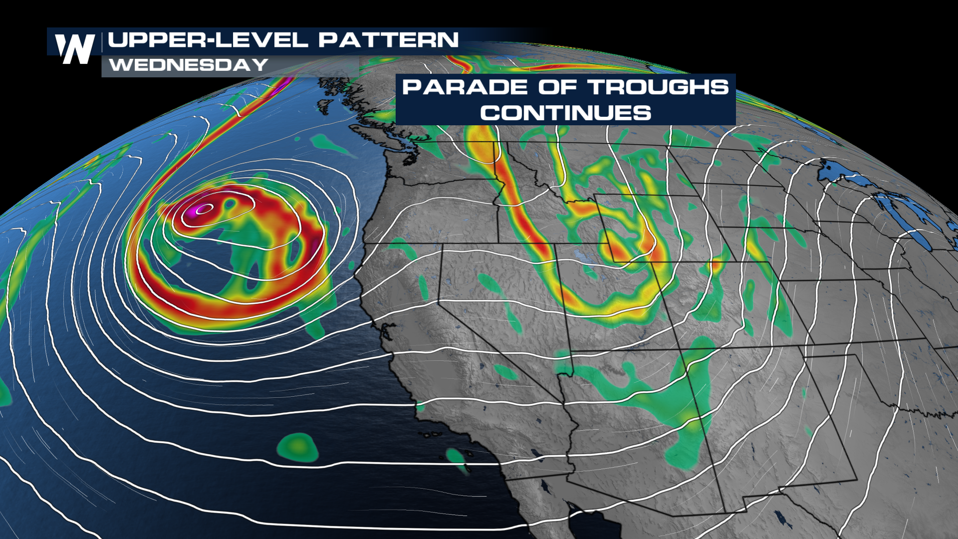
To say it's been active across the West Coast would be an understatement. Several waves will continue to bring more rain and more snow across California and the Rockies this week.
WHAT TO EXPECT
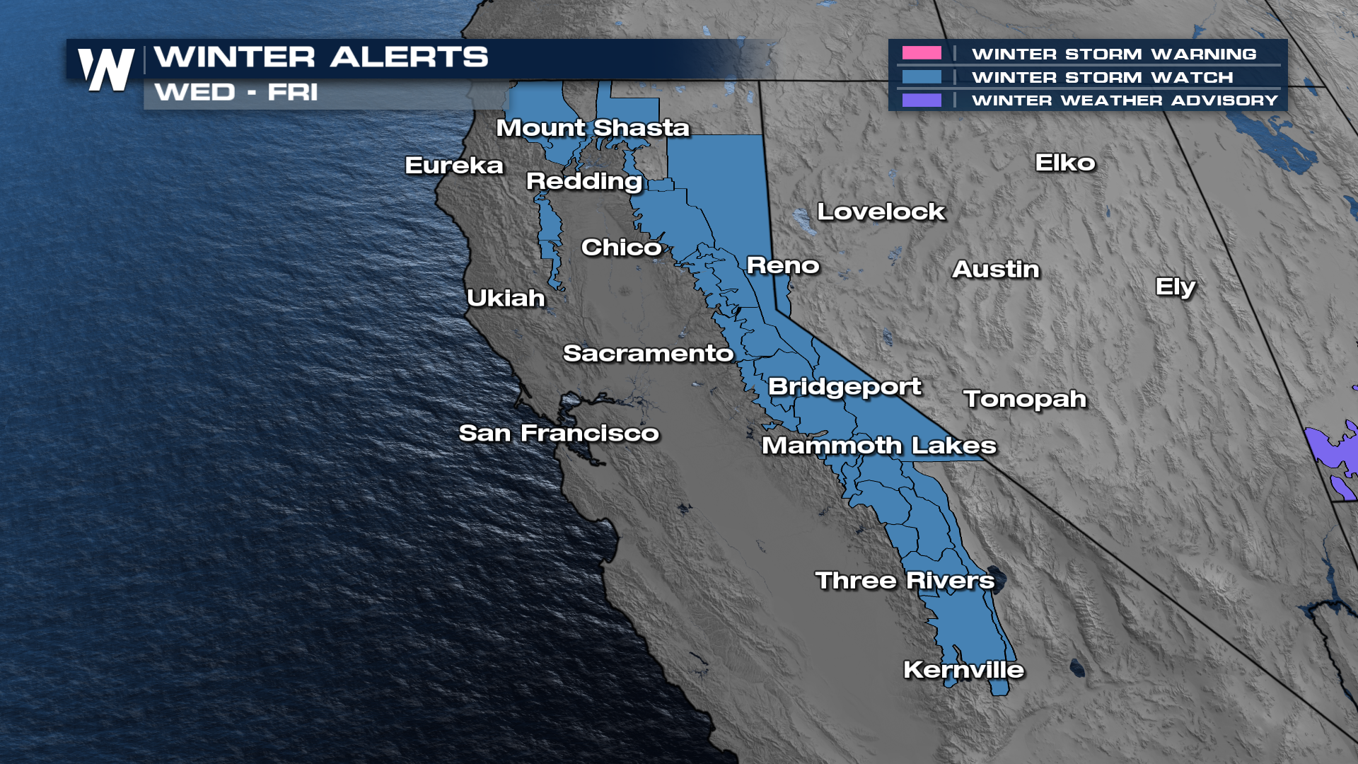
The highest totals are expected in the higher elevations. Winter Alerts have already been added for the mid week round of snow. This round will bring higher totals than the round that is happening now through early in the week.
TOTALS
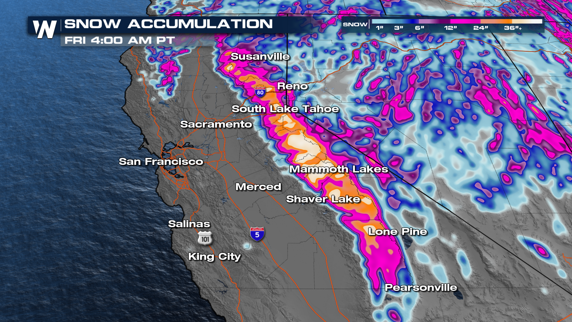
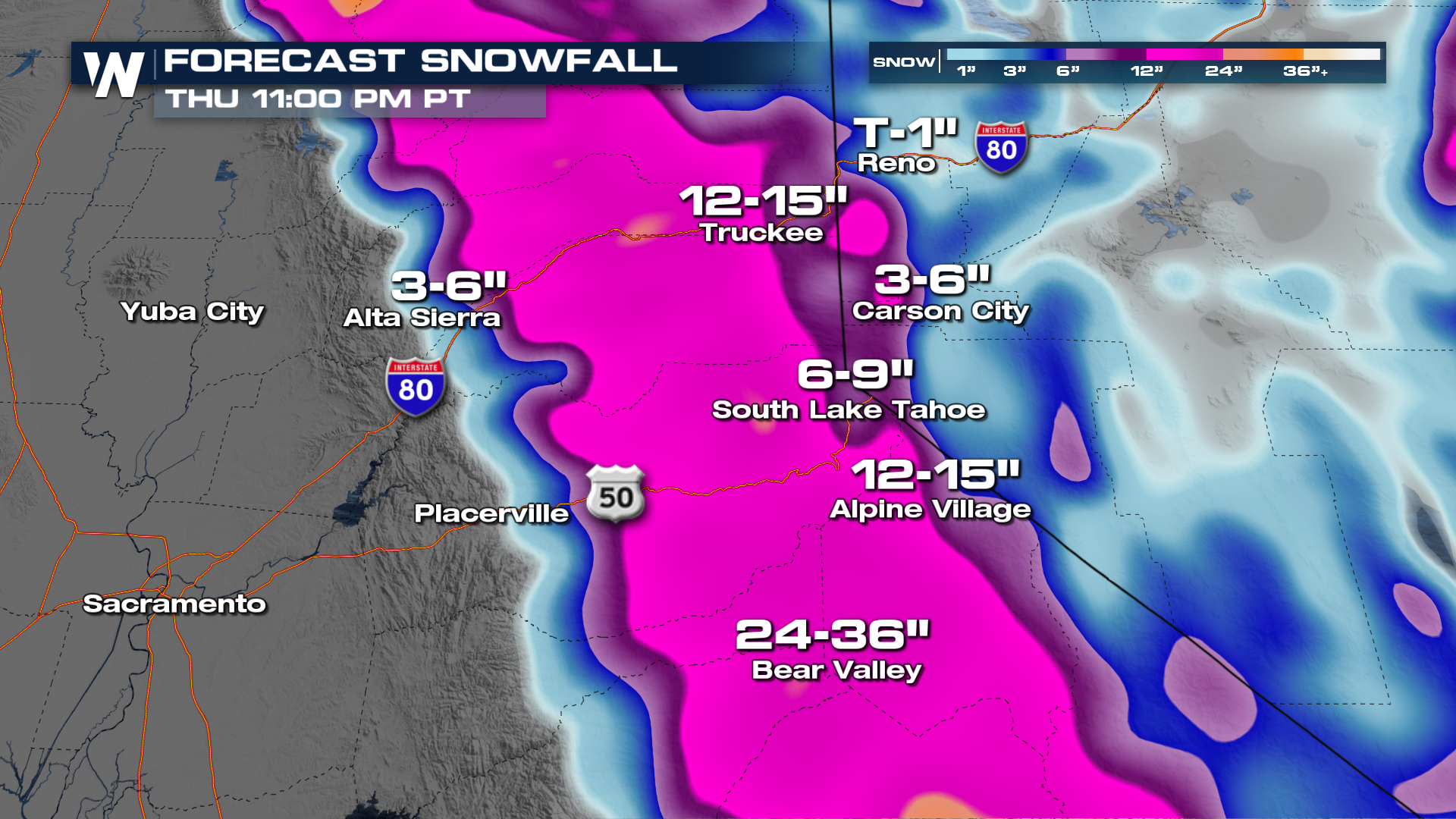
These troughs are expected to push onshore with tons of moisture and energy. Totals are expected to stay between 2 and 3 feet of snow across the Sierras! This will help out those ski resorts a ton. Bear Valley is forecast to pick up 2 to 3 feet on it's own!
TRAVEL IMPACTS
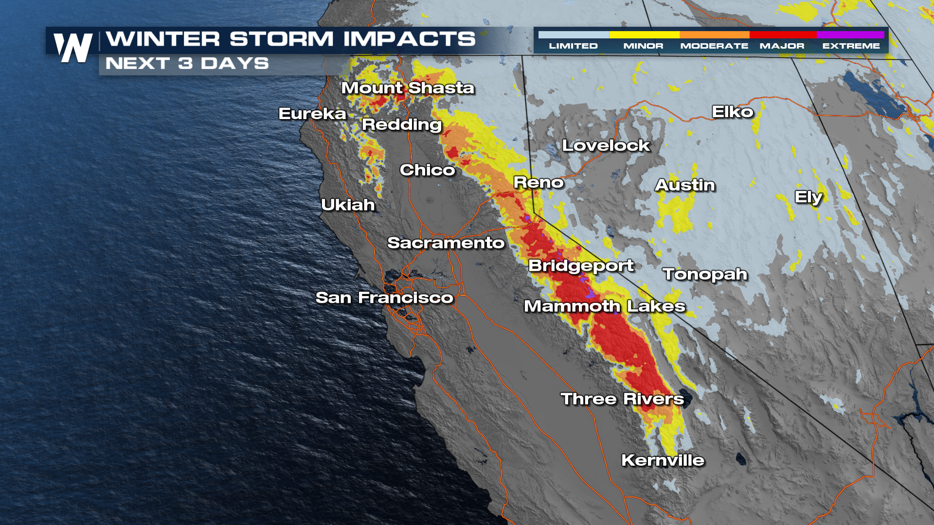
In most cases, travel through the Sierras will be rough this week. While we do get about a day in between waves, heavy snow buildup and icing will be a big concern through these passes. Might be safer to skip out on it this week if possible.
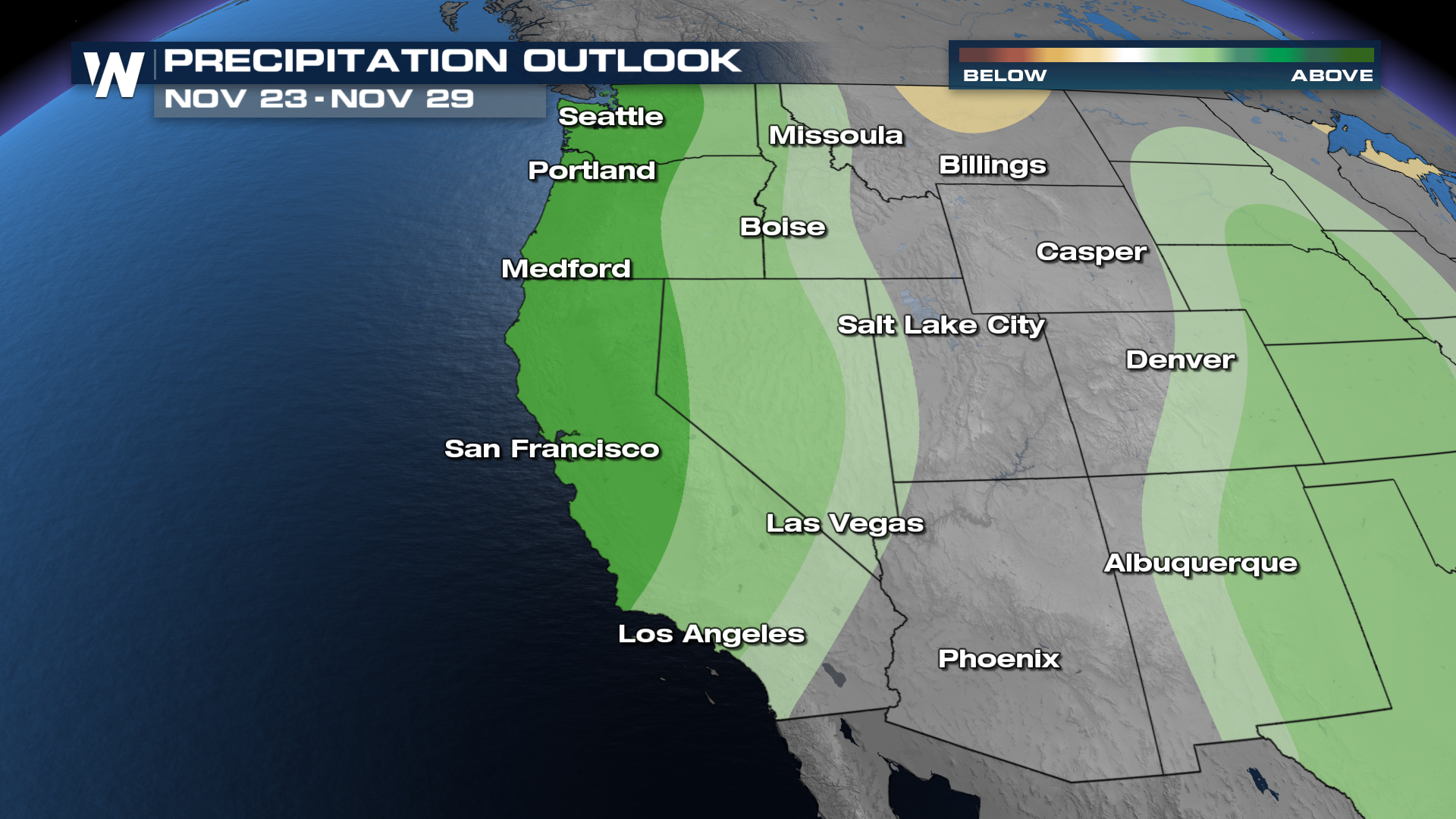
Looking ahead, the week of Thanksgiving is anticipated to have above average precipitation. Stay with us on WeatherNation for the latest on how your conditions will look once we get to the holiday weekend!