East Coast Snow? What We Know About the Late Week System

Ready for the first snow of the season? While a few flakes have come down in the usual spots this fall (northern Great Lakes & New England), a solid burst of measurable snow is possible toward the end of the week into next weekend. There's still a lot of time for big changes - so check bask in with us throughout the week.
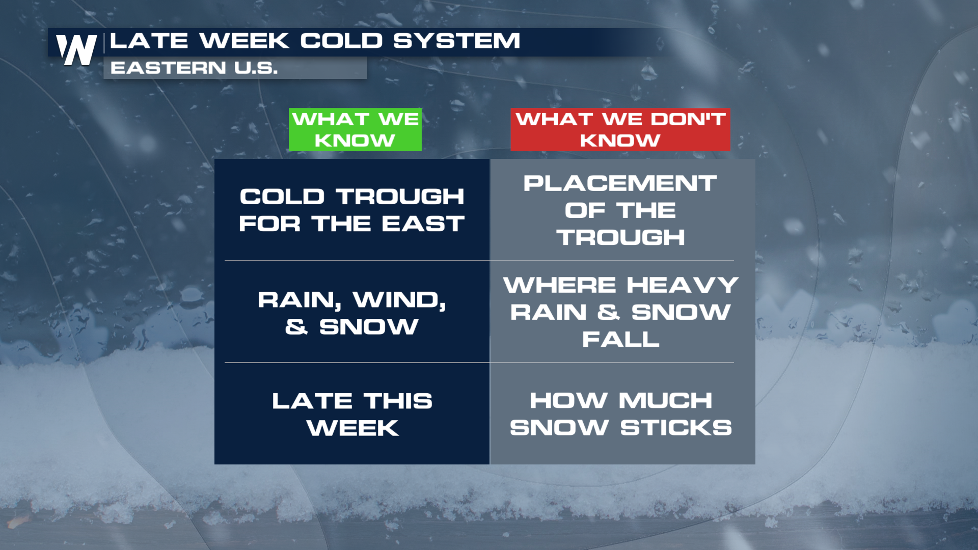 What We Know
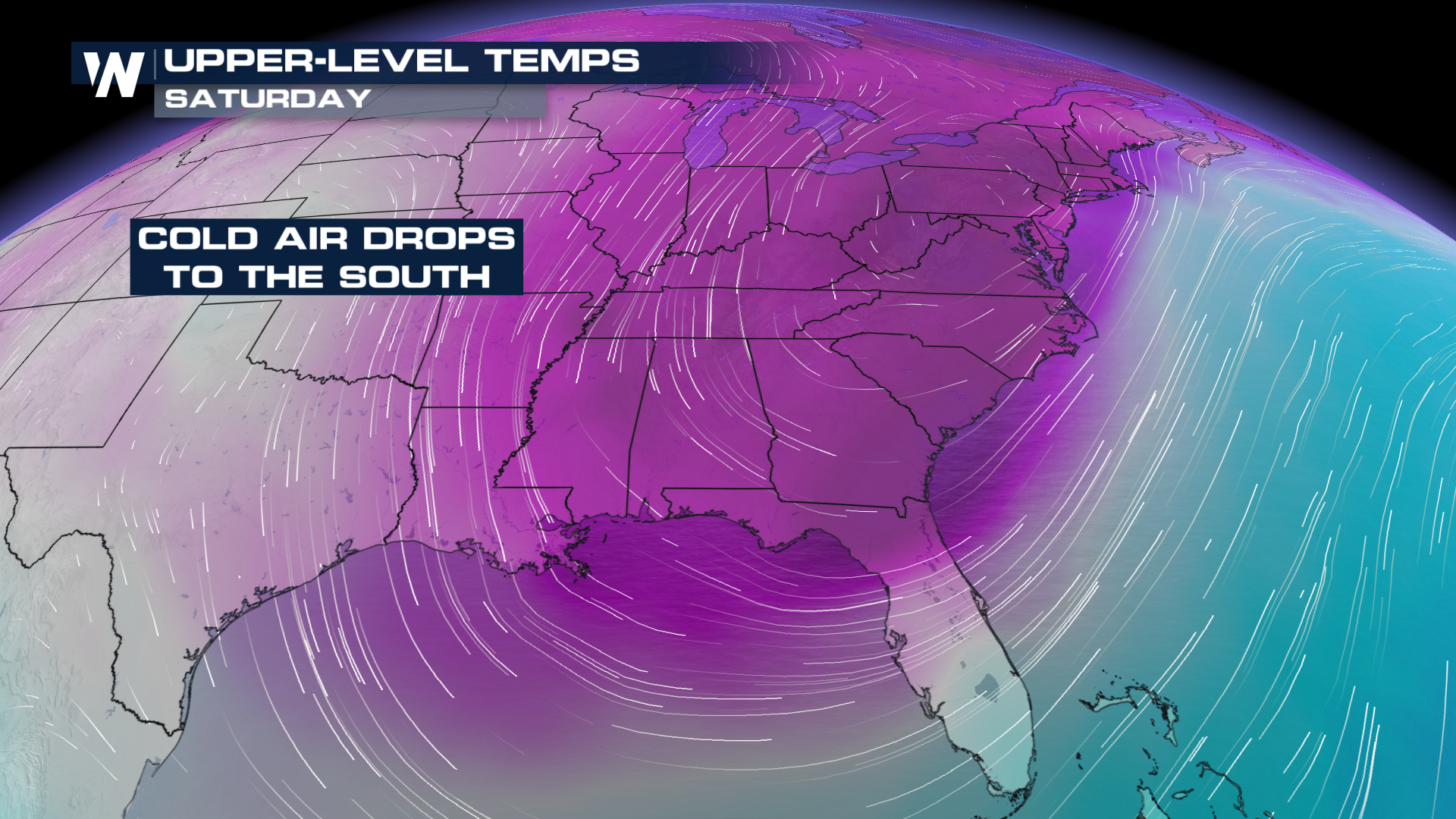
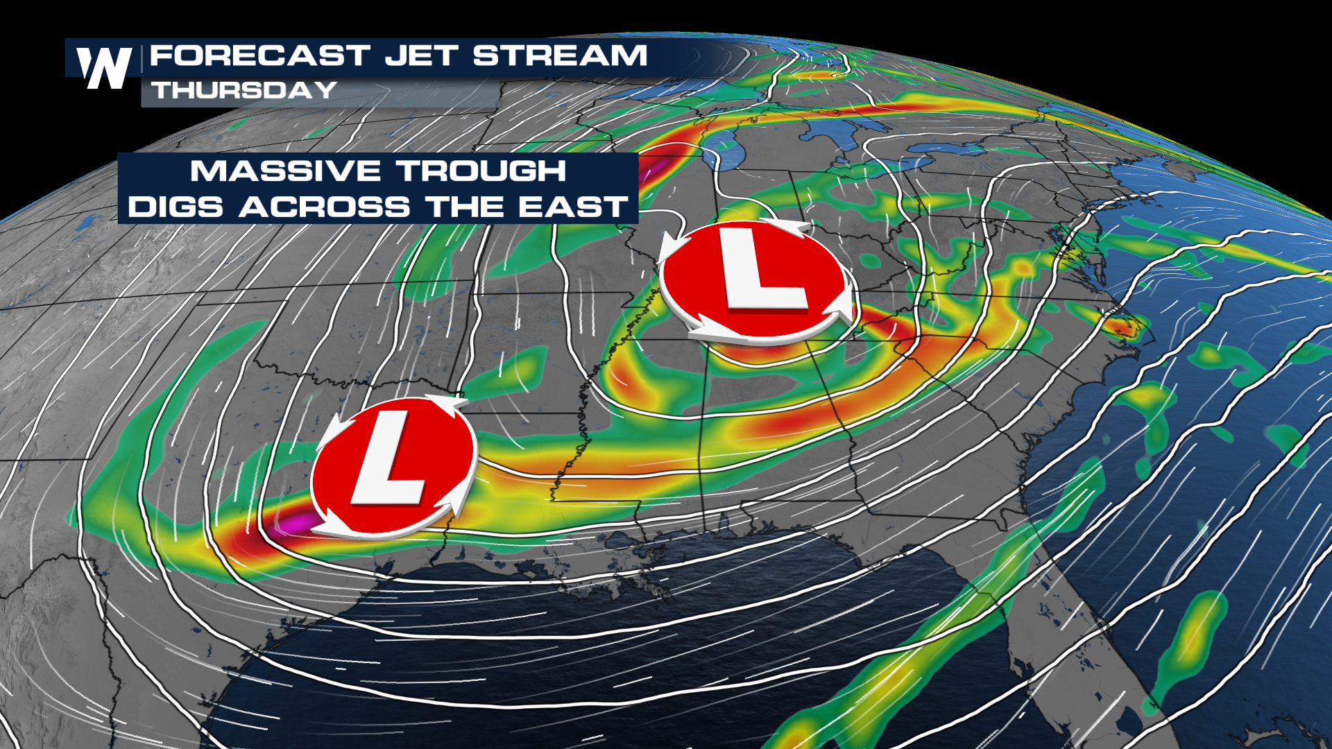
A big trough will dig down the Eastern U.S. - but the exact placement of the trough and it's cold air still need to be worked out. Forecast model ensembles all show a cold low pressure system, but vary with timing and strength.
 A larger trough will help several shortwaves swing through the Eastern half of the country, providing extra lift for heavy rain and snow. The timing and placement of these shortwaves could have a big impact on snow and heavy rain, as they provide an extra burst of energy that could pull Atlantic moisture into the cold air.
 What We Don't Know
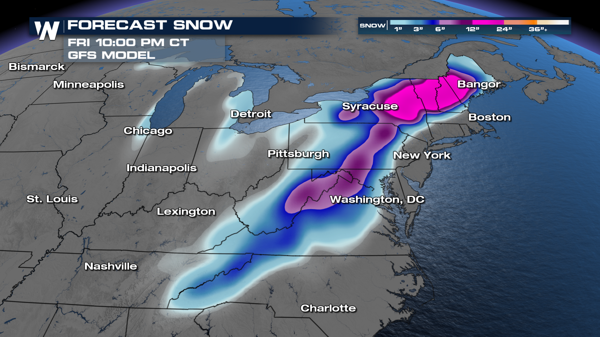
Snow Totals
The WPC (Weather Prediction Center) is highlighting a chance for winter impacts Friday into Saturday, with higher confidence in the mountains of New England and West Virginia. This shows low confidence in snow occurring, but this will change significantly throughout the week as models hone in on this system.
-1794073714705.png)
The ECMWF (Euro model) shows some solid snow chances for similar areas highlighted by the WPC (top of page), while the GFS is also showing potential for snowfall. The GFS tends to overestimate snow, as it turns icy conditions into snowfall more than it should, so take this with a grain of salt.
 Rain Totals
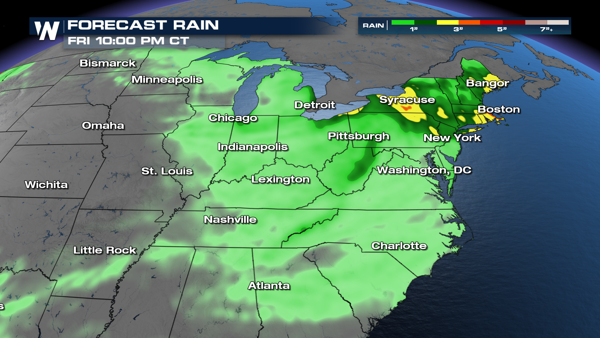
As the trough begins to bring Atlantic moisture into the Northeast, the potential increases for heavy rain and snow. The ECMWF is showing rainfall totals between 1-4 inches for parts of the Northeast, with the heaviest rain from Thursday into Friday. These totals could change significantly with the timing and placement of the lows.
 Bottom line: there is increasing confidence an impactful cold system will cruise the the East toward the end of next week, but details remain fuzzy. We'll keep you updated with changes and a fine tuned forecast as the event draws near. Sometimes models can completely bust in the 5-10 day window, so don't run to get bread and milk just yet.


