Major Storm System Winds Down in California

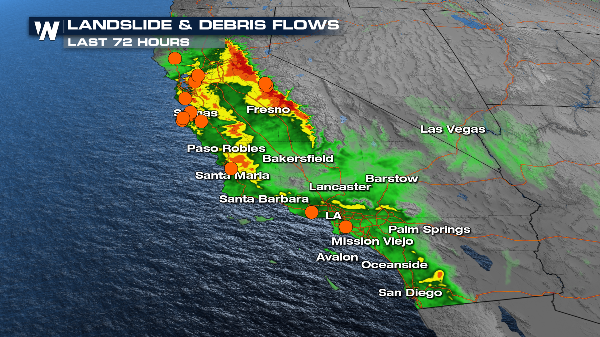
CALIFORNIA - After almost a week of relentless rain and snow, skies in California are finally clearing into the weekend. Despite the system exiting the region, impacts will linger for some time, especially in the mountains, where feet of snow await clearing. As of Friday morning, I-80 and the Donner Pass are back open after hundreds of cars became stranded from the intense snowfall.
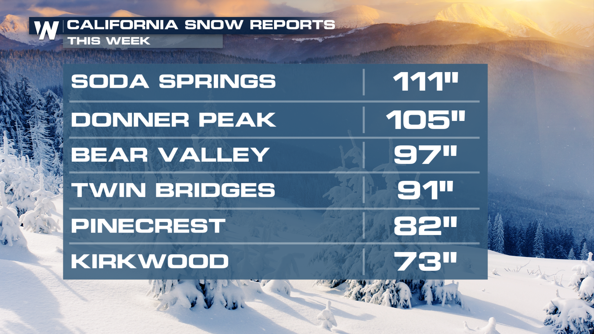
Snow totals surpassed 100" in a few localized areas, with 4-6 feet widespread across the Sierra. Even the mountains in Southern California saw 2-4 feet of snow on the peaks!
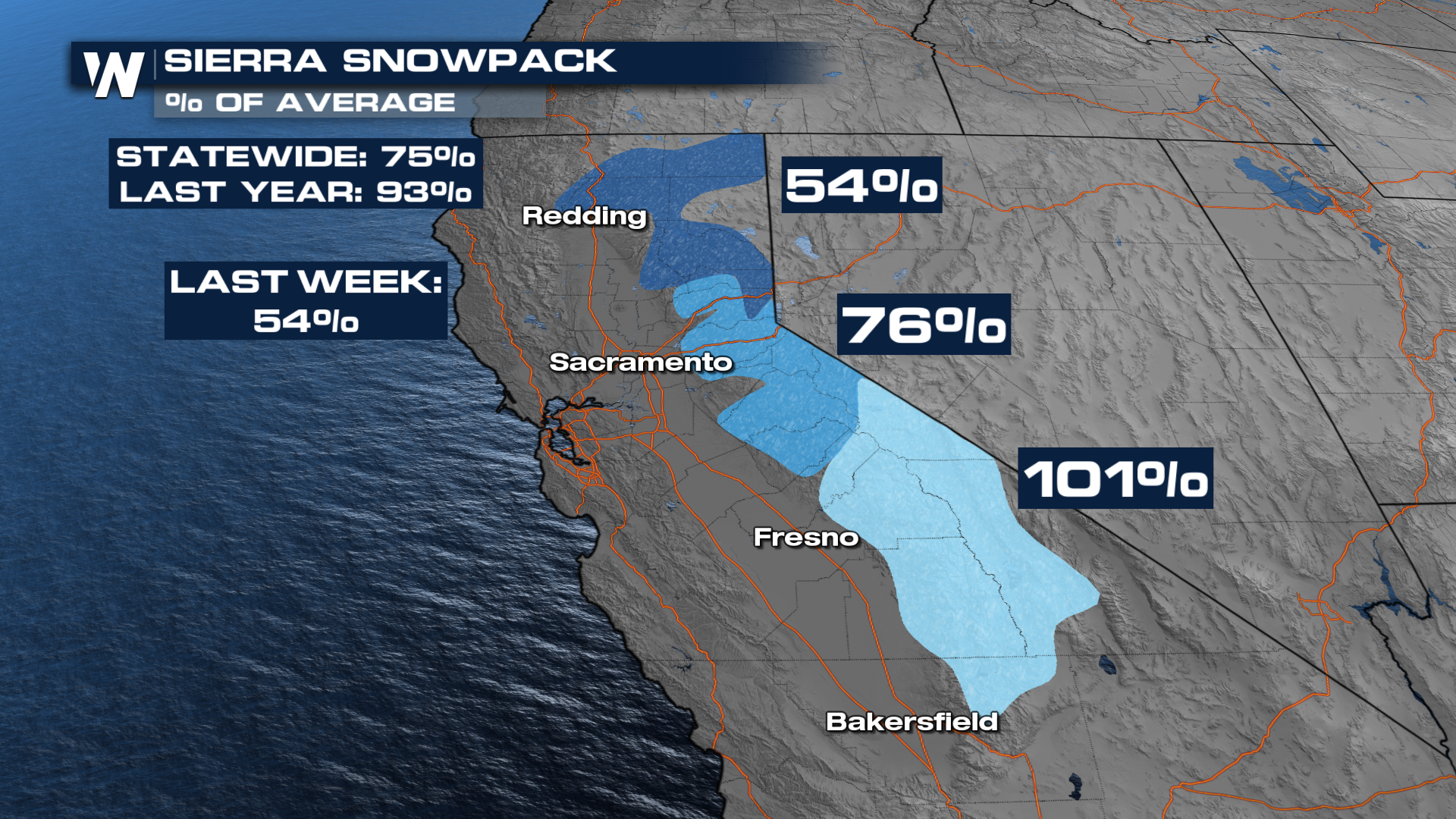
Those numbers, despite being incredibly high, did not bring California's snowpack back to average, but they did see a massive jump from 54% at the start of the week to 75% as of Friday evening!
Unfortunately, the heavy snow led to multiple deaths. A large avalanche killed 8 people on a backcountry ski tour, while another man failed to return to his vehicle after parking at a ski resort.
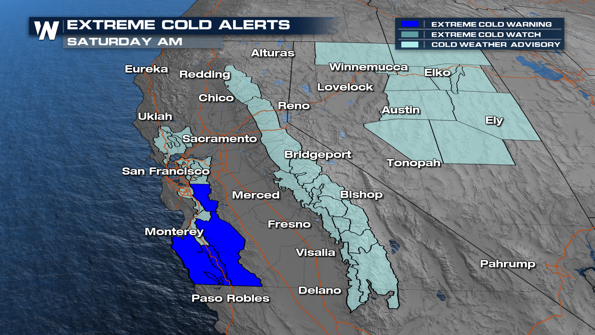
Lingering Cold
Cold air will linger behind the low into Saturday morning, and cold alerts remain in place for portions of the Bay Area, coastal valleys, and higher elevation locations.
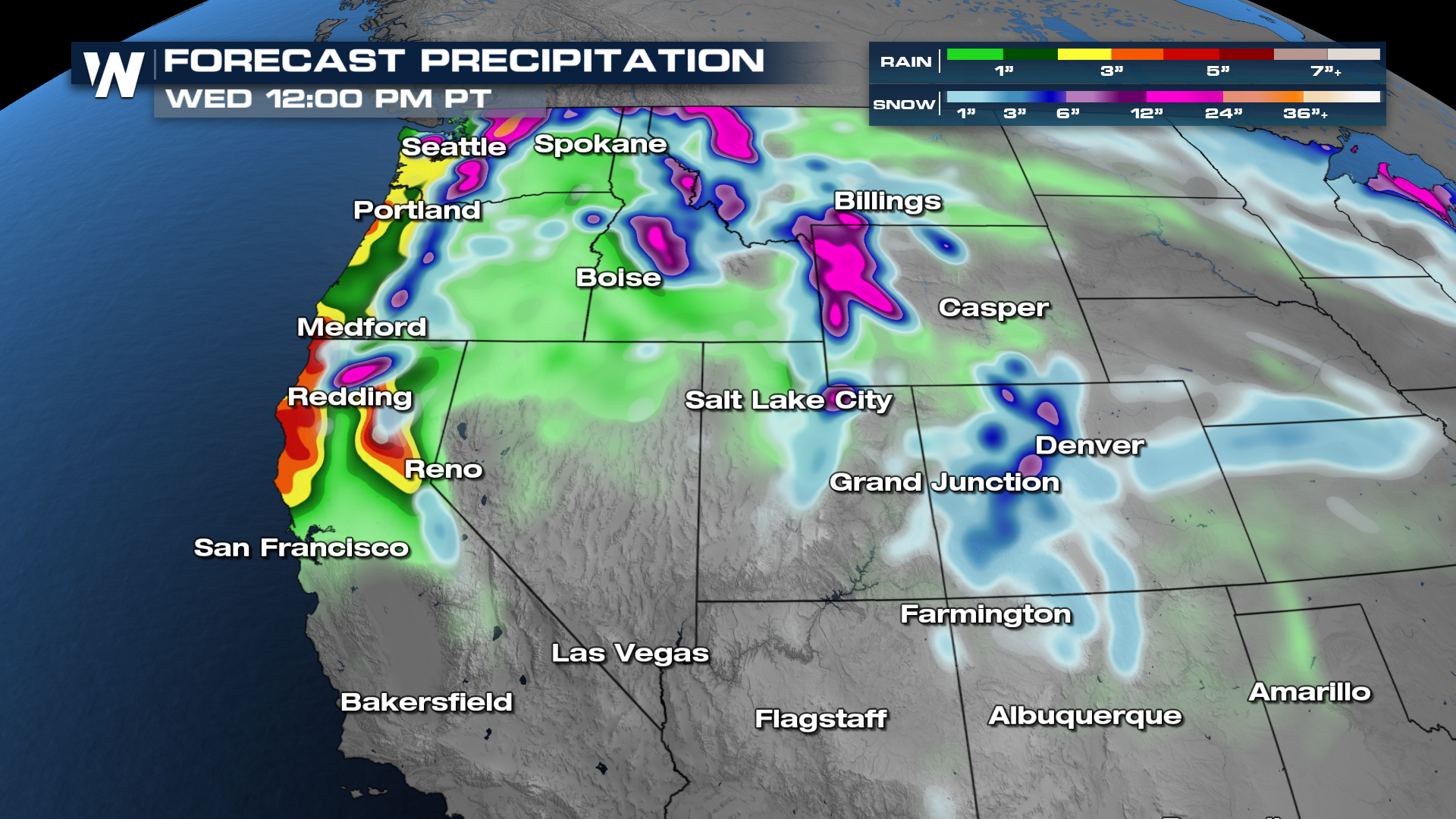
Next Round
Another series of storm systems is expected to move in around the ridge of high pressure in the Four Corners this weekend. This will focus the next round of heavy rain and snow farther north, with impacts expected in Northern California into Central Oregon. Warming temperatures will mean some areas that received intense snow could see nothing but rain next week. This could lead to flooding issues, especially with runoff in the mountains.
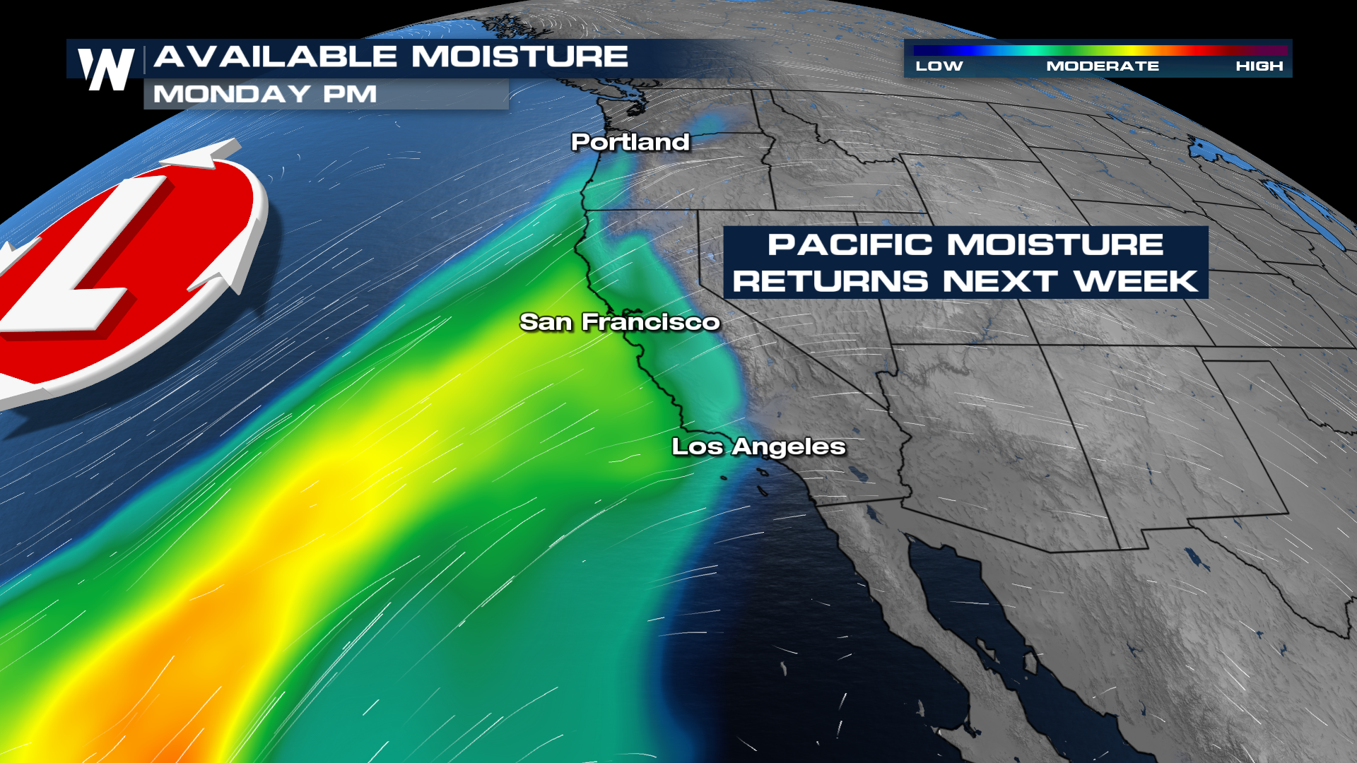
The heaviest rain is expected from the Northern Sierra near Lake Tahoe up to the coastal mountains in California and Oregon. Flash flooding is a concern on Monday and Tuesday in these areas.