Another Round of Storms Targets the Northeast

Another cold front is dropping east and will plow into warm and humid air. That will be the focus for severe chances Tuesday and Wednesday. This comes only a few days after storms raged through the area to kick off the weekend.
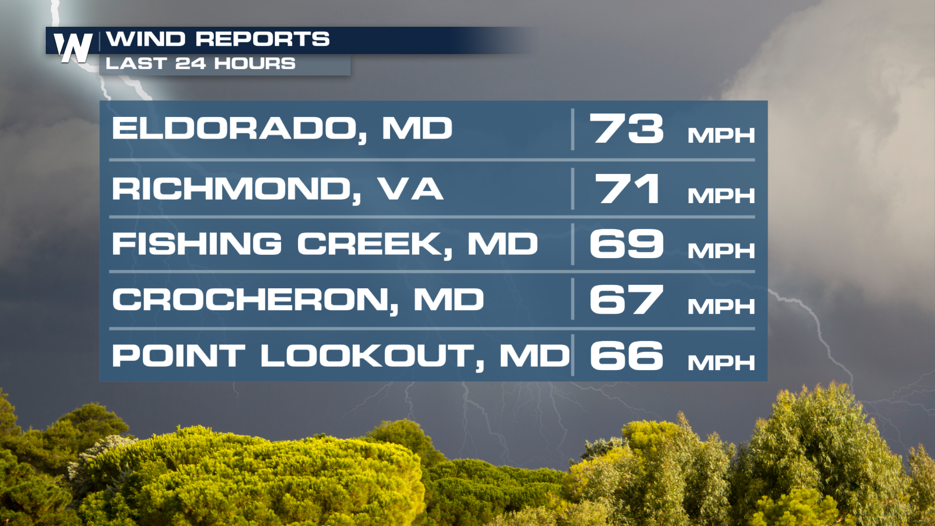 As the heat continues to build, any storms that enters will tap into that energy. Tuesday, the Storm Prediction Center has already issued an Enhanced risk for severe weather. All modes of severe storms look to be on the table, including a few tornadoes. Damaging winds will be the most widespread issue, however.
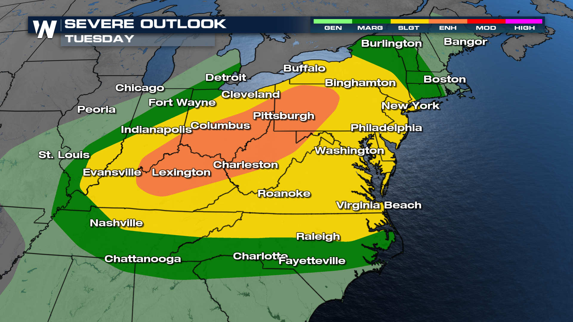 Timing will favor the afternoon and evening, but a few storms could maintain their severity overnight Tuesday into Wednesday.
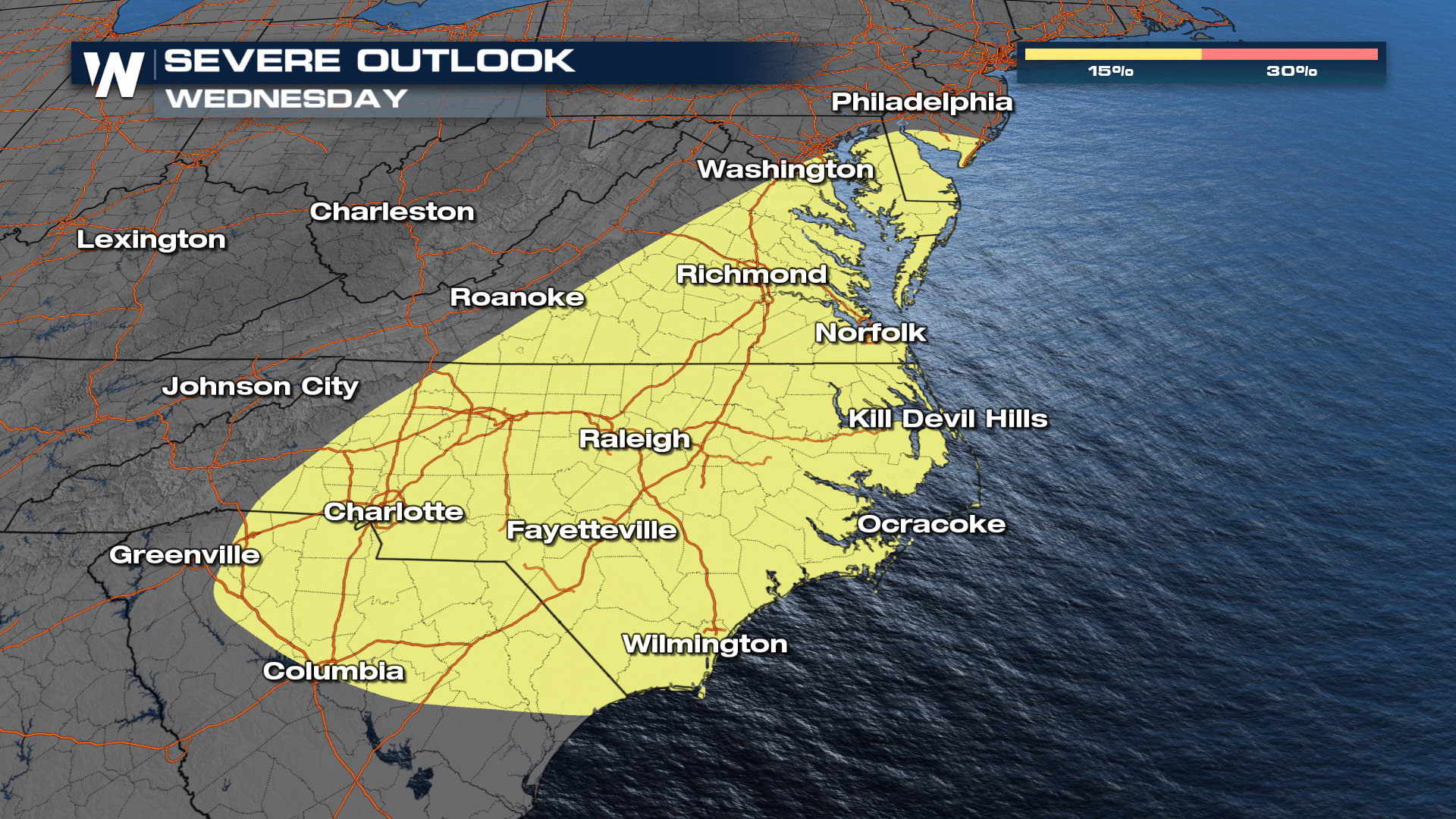
The SPC has also issued a risk for Wednesday for severe thunderstorms. Since Wednesday is "Day 4" of SPC outlooks, it has a different look compared to Tuesday.
A growing concern is the amount of rainfall coming down after record amounts in the northeast. With multiple opportunities for storms, some could see too much too fast, leading to a flooding threat as well. Look at where the bull's eye is showing up on the most recent model run. 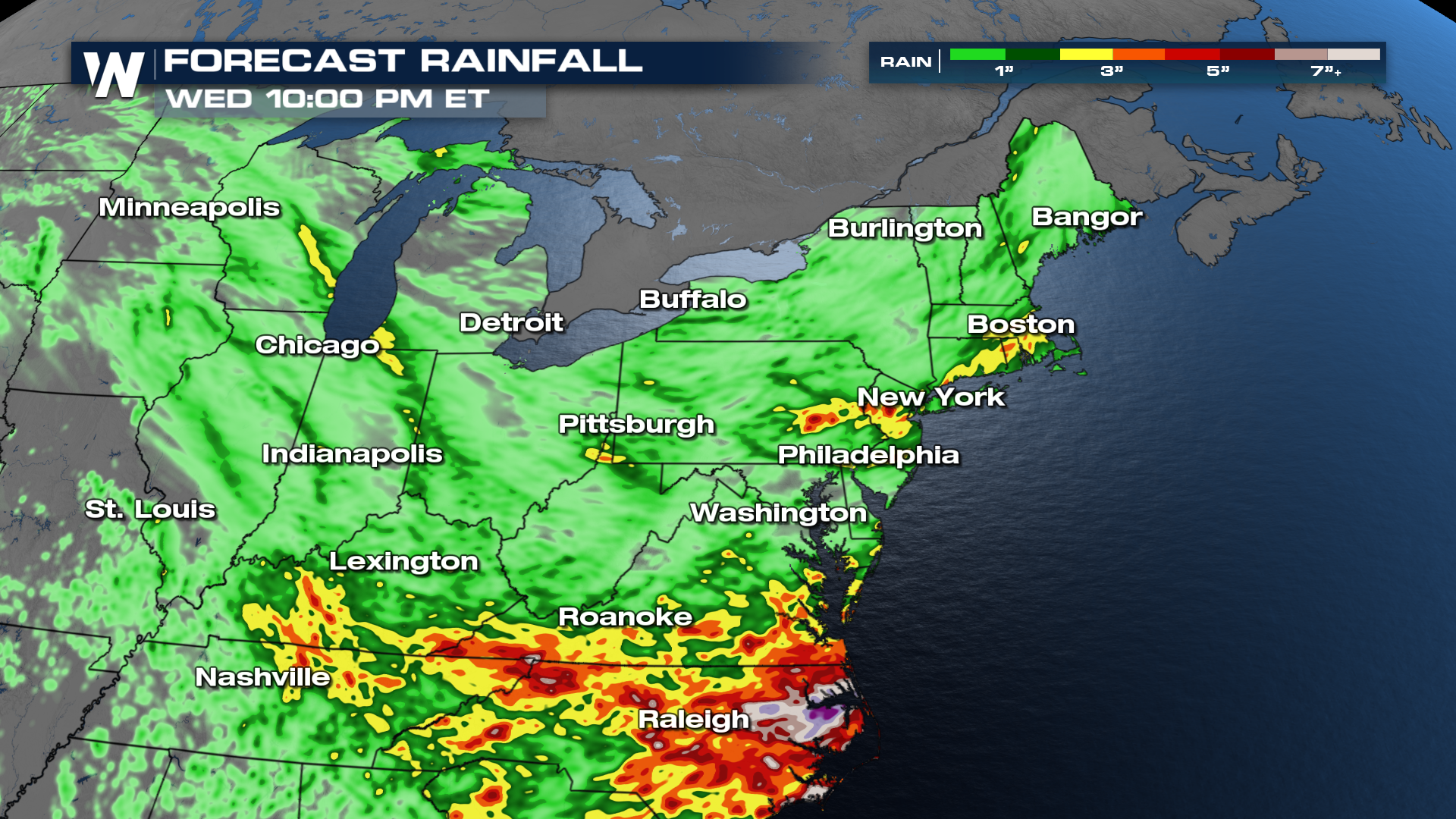 Check back with the forecast getting into the workweek, as details like timing and intensity could change.


