Flooding Threat Continues as Leftover Helene Spins Towards the East Coast
Roads washed out. Whole towns were destroyed. Two feet of rain. This all occurred across parts of the southern Appalachians as Helene dissipated on Friday.
Related Article: Helene Makes Landfall as a Category 4 Hurricane
Water levels remain high in parts of Florida, Georgia, the Carolinas, and Virginia. Please seek additional information, preferably from at least two sources, about evacuations, flood warnings, safety messages, and news alerts regarding this actively changing situation. Also, it's important to double-check information. On Friday, incorrect information was given regarding a catastrophic dam failure in Tennessee, when it didn't happen.

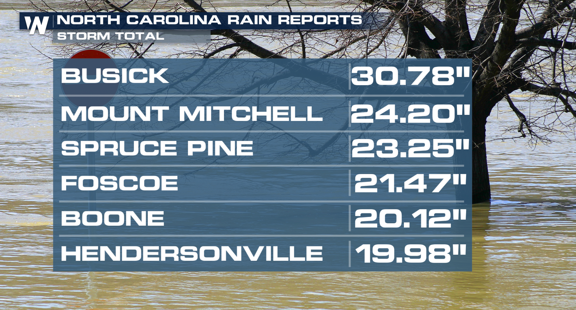
Storm total rainfall has been as high as 30" across parts of North Carolina. It's important to note, this includes rain before Hurricane Helene arrived. The rainfall listed above is from Wednesday, September 25, and beyond. A separate weather system was already dumping heavy rain in North Carolina and nearby areas well before Helene arrived, which did not help the flooding situation at all.
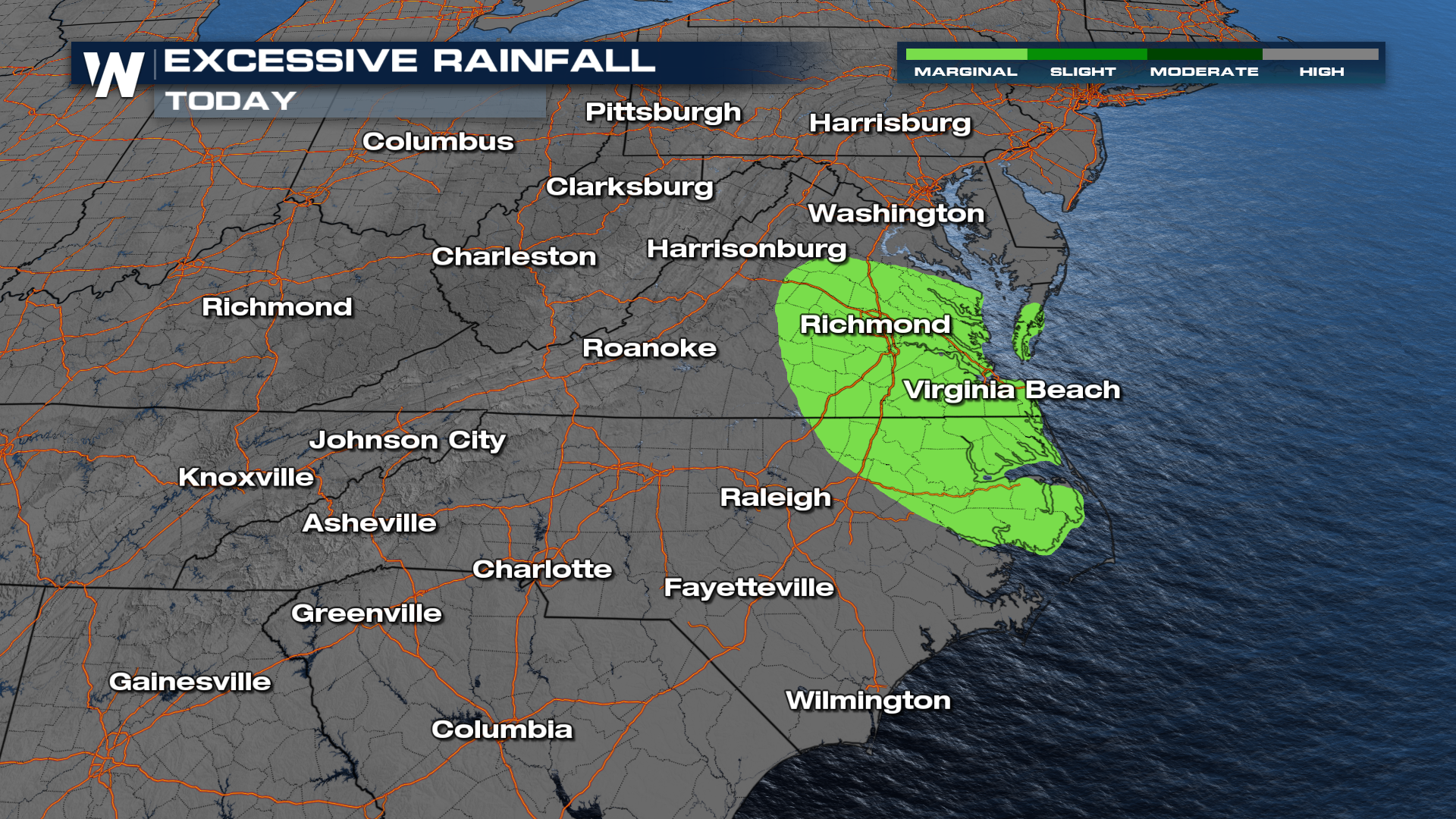
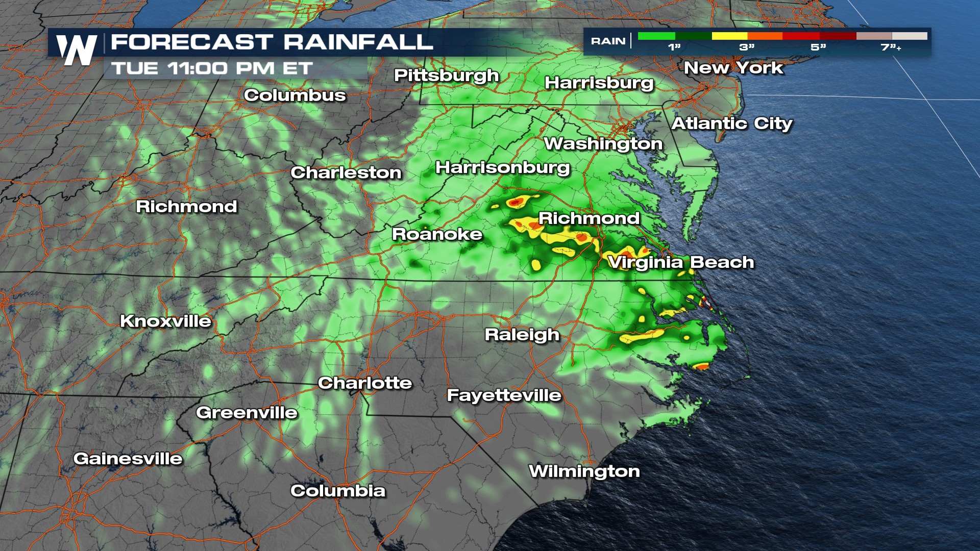
Rain will continue to fall through Tuesday across portions of the middle-Atlantic. While Helene moved quickly previously, the storm merged with an upper low, a slower-moving storm system, and has been moving much more sluggishly into central Appalachia through Virginia.


Most of the rain will not be super heavy but any light to moderate rain in some of these saturated soils of the Appalachians will lead to more flooding!
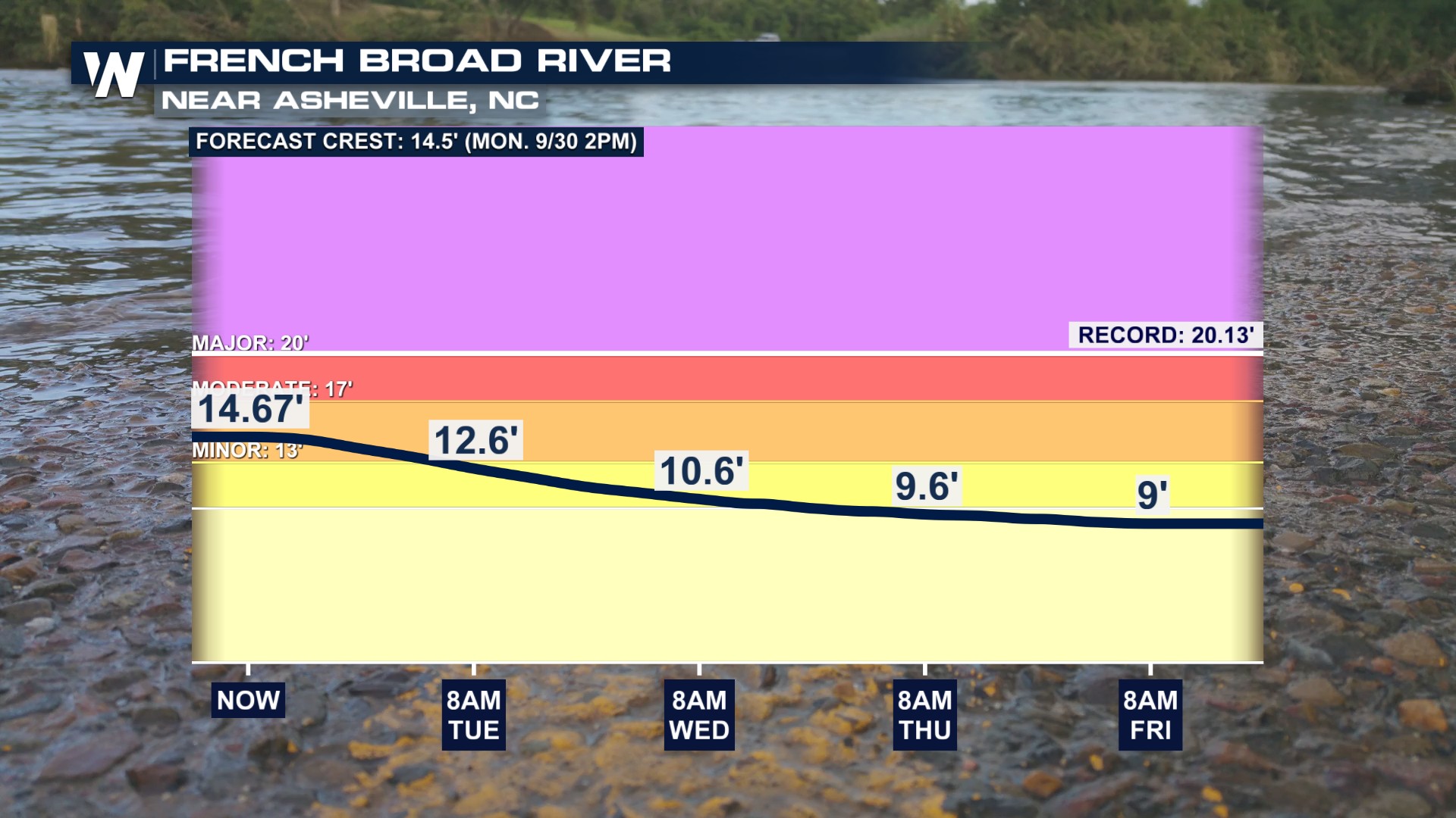
For perspective on the severity of this weather event, we look to one river in particular; the French Broad River near Asheville, North Carolina. At this river location, the French Broad reached 30 feet, which surpassed the previous record river level of 20 feet! Flooding is forecast to finally dissipate through the upcoming week.
 We will continue to recap Hurricane Helene and forecast any lingering impacts that may occur from the remnants of the storm this weekend.