Major Hurricane Helene Devastates the Southeast

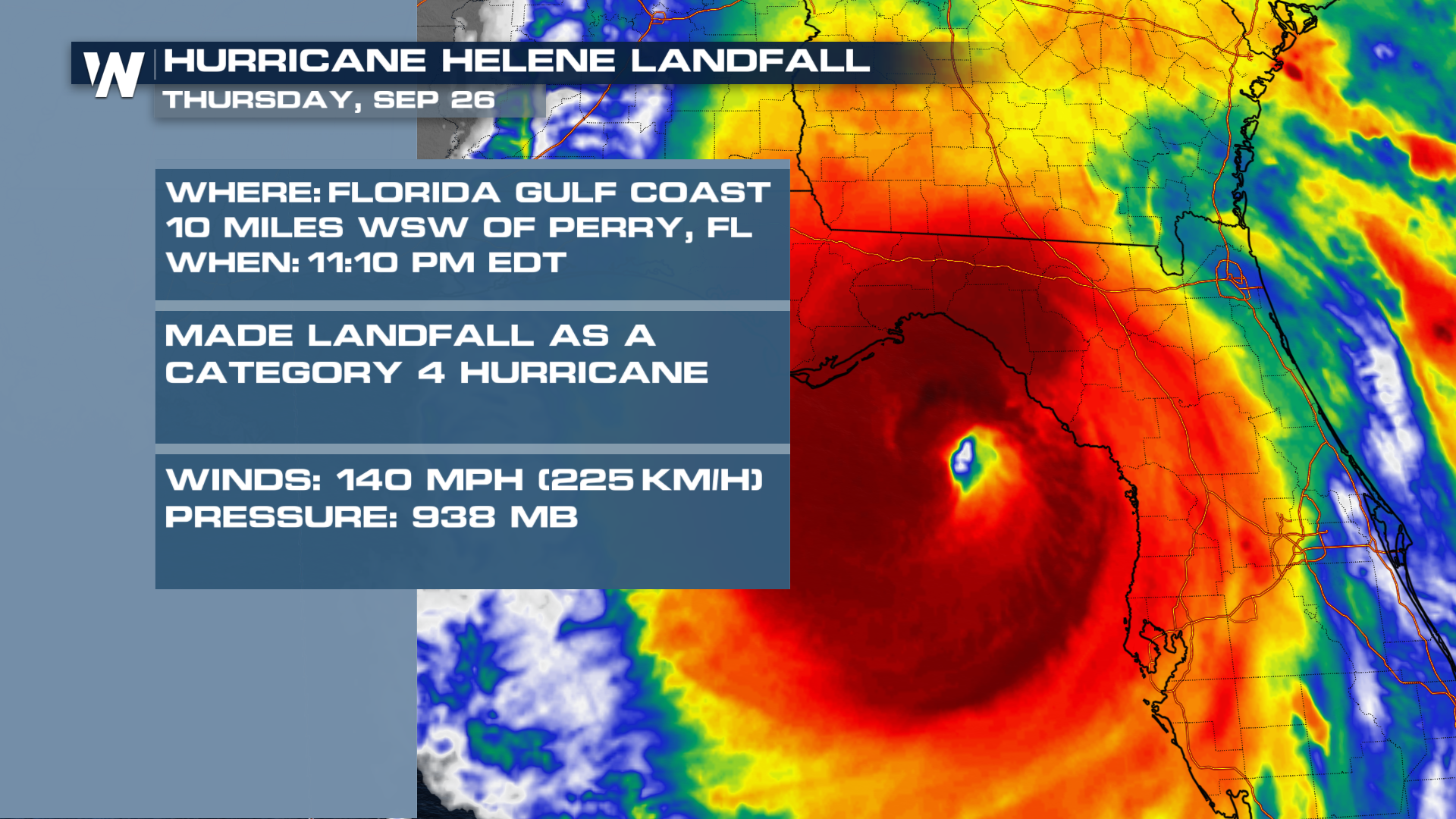
HURRICANE HELENE - Helene made landfall Thursday, September 26, 2024, as a powerful category 4 hurricane with sustained winds of 140 mph and pressure of 938 MB. Helene's eyewall passed about 10 miles west-southwest of Perry, Florida at 11:10 p.m. ET on Florida's Gulf Coast.
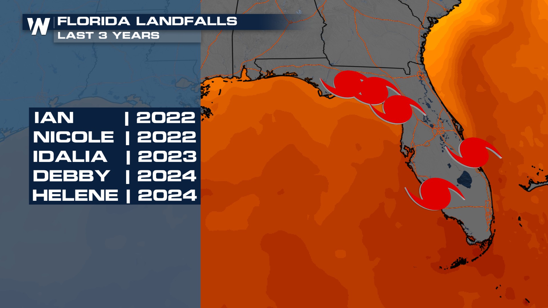
In the last three years, there have been five landfalling hurricanes in Florida, now including Helene. In the previous 10 years, three major hurricanes have made landfall in Florida's Big Bend: Michael (CAT 5 | 155 mph) in 2018, Idalia (CAT 3 | 115 mph) in 2023, and now Helene (CAT 4 | 140 mph) in 2024.
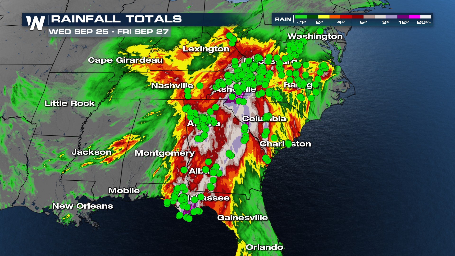
 The remnants of Helene brought catastrophic flooding, which prompted a record amount of flash flood emergencies across portions of Appalachia and Mid-South. Hundreds of water rescues have occurred from Florida to Georgia since Thursday.
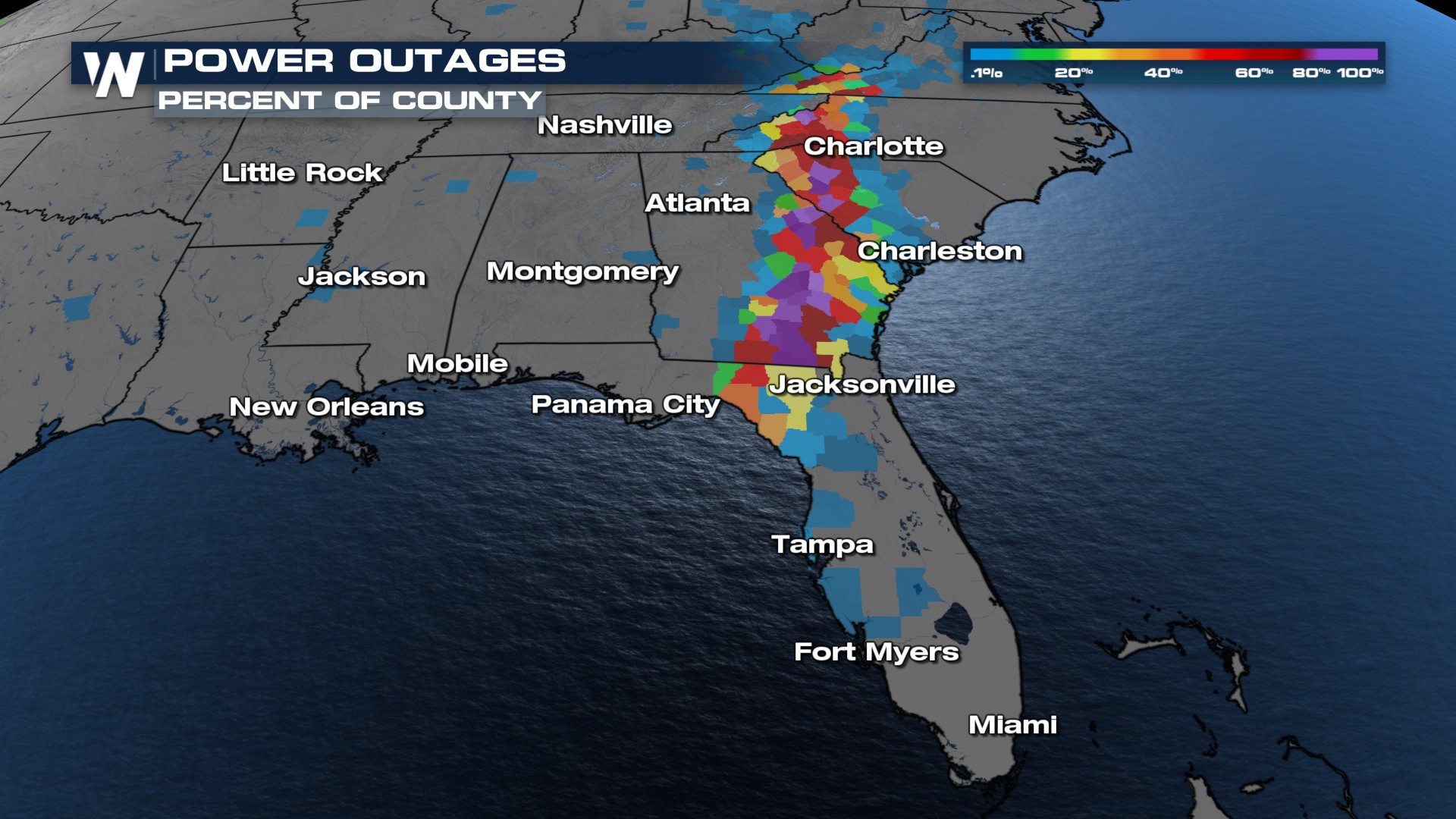
Over 1 million households remain without power as of Tuesday evening
According to poweroutage.us, power outages are slowly coming down but millions of folks are still without power across the Southeast and Mid-South.
15 feet of storm surge
According to the National Hurricane Center Storm Surge Unit, preliminary post-landfall storm surge heights for the Big Bend region of Florida near Keaton Beach, Steinhatchee, and Horseshoe Beach had water levels reach more than 15 feet above ground level.
The worst of the storm surge happened in the Big Bend area of Florida, here are some of the preliminary surge reports so far.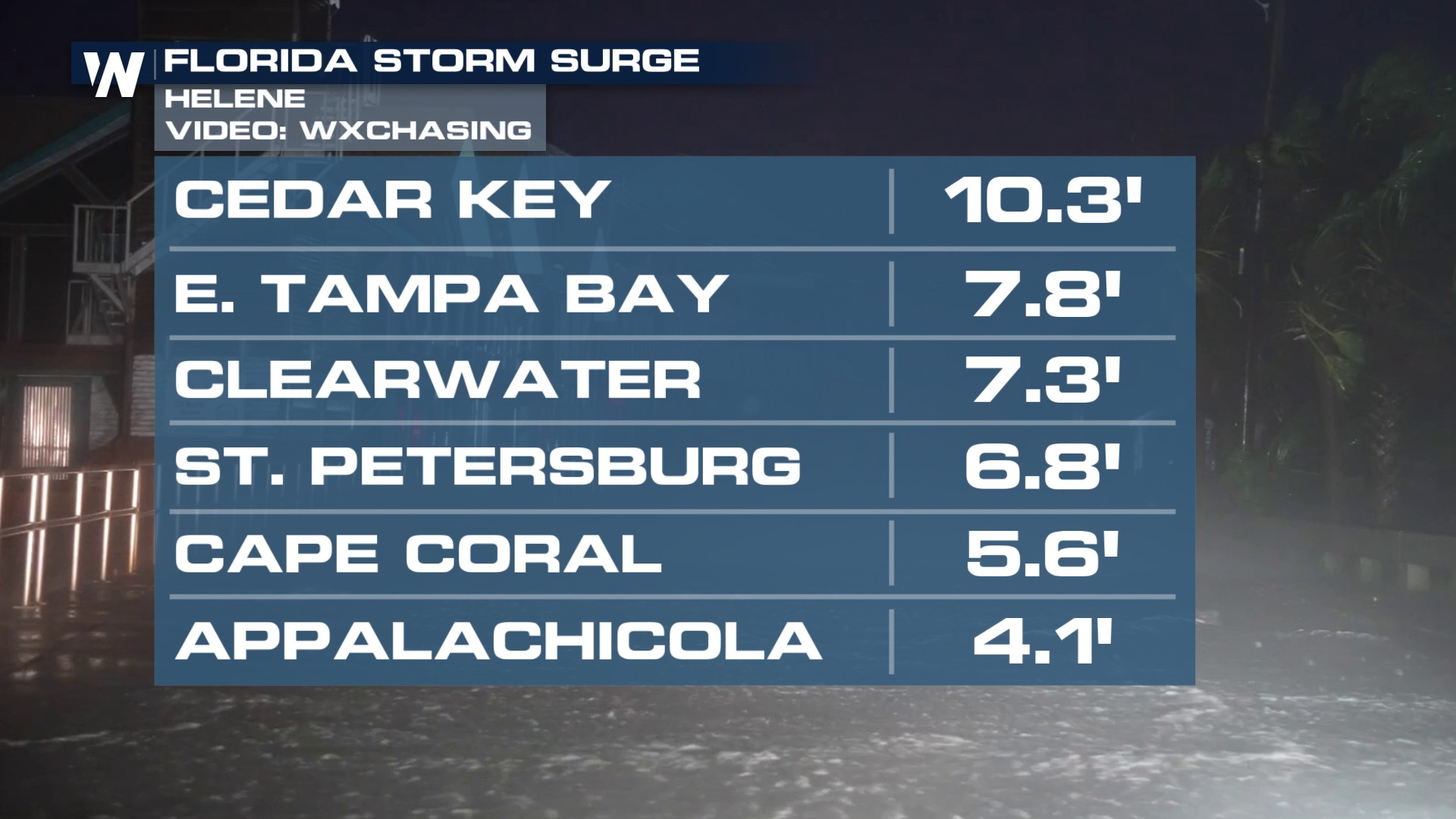
Even places like Tampa, Florida saw storm surge rise to nearly 8 feet on Thursday night.
The aftermath of Hurricane Helene has unfortunately left scenes of devastation from Florida's Big Bend, the southeast, and Appalachia. Search and rescue efforts continue across the southeast, please keep those impacted in your thoughts.
For ways to help people affected by Hurricane Helene, you can visit the American Red Cross's website: https://www.redcross.org/. to support.


