Repeated Severe Threat for the High Plains

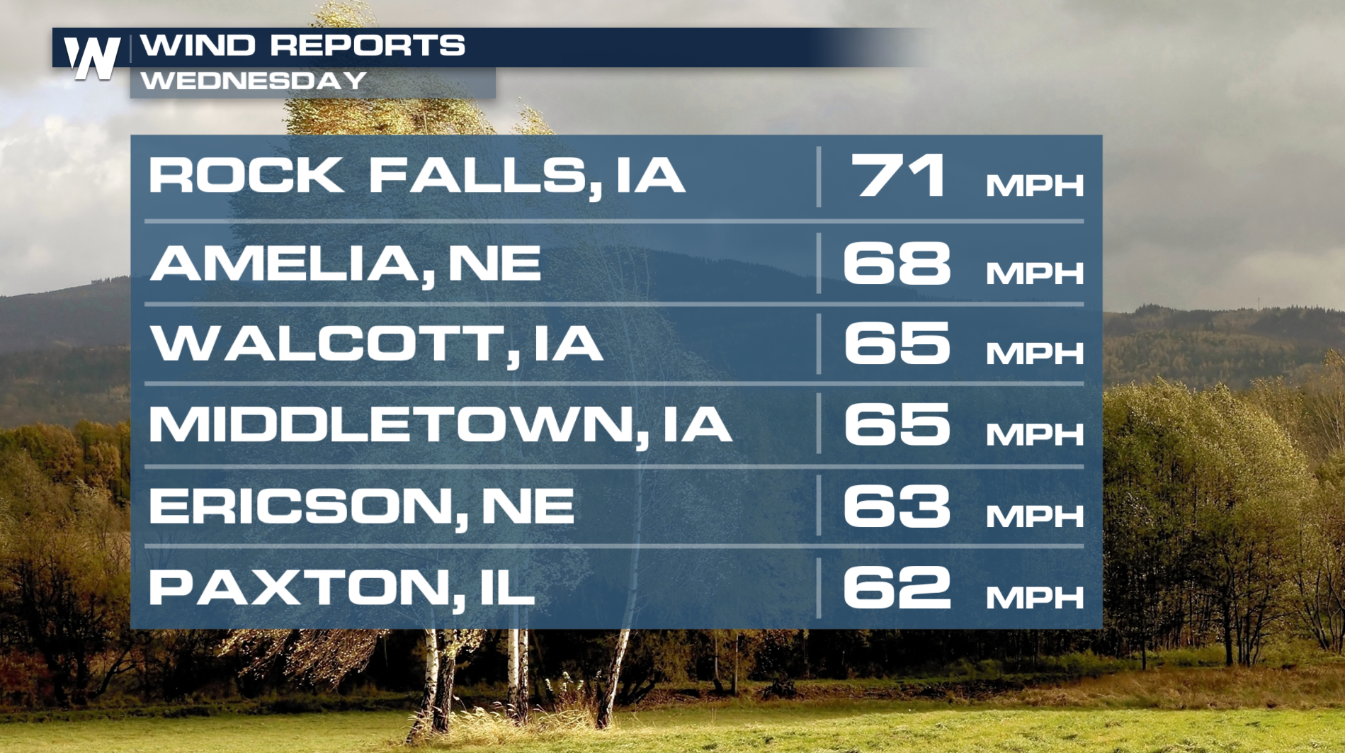
HIGH PLAINS - Tuesday proved to be an incredibly active day across the Central and High Plains. Storms in these parts had updrafts that exceeded 100 mph! Therefore, we were seeing hailstones that were 4.5" in diameter! That's about the size of a grapefruit. Once again, strong storms fired up Wednesday afternoon, bringing large hail and damaging winds. Wind gusts reached over 70 mph for portions of Iowa.
Overnight
The severe threat will continue through Thursday morning. The threats we'll be tracking out here will be very similar to yesterday: damaging winds and some hail.
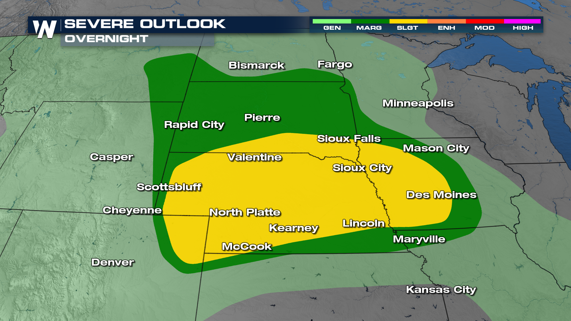
Some storms will hold together into the overnight hours. Expect more rounds of rain and storms again on Thursday!
Rainfall totals
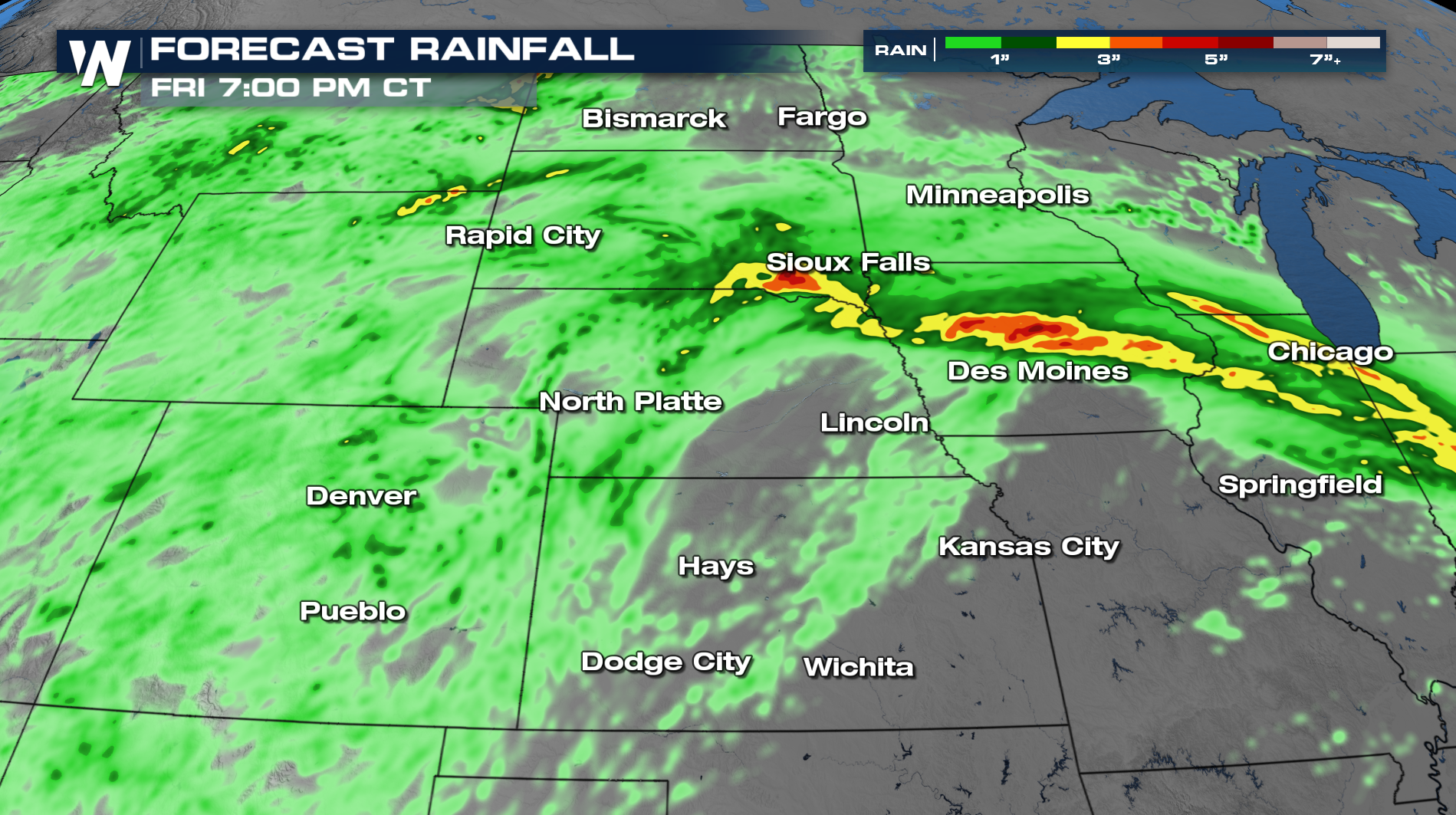
Not only will severe weather be a threat, but heavy rainfall will be embedded in some of these storms. Our model data shows some areas through South Dakota and Iowa receiving upwards of 4 inches of rain through Friday!
Be sure to join us on WeatherNation for this story during:30 past the hour on your Central Regional Forecast.


