Tropical Update: EPAC Active; Atlantic clears September with no Hurricanes

Pacific Basin
The Pacific Ocean has been incredibly active so far this hurricane season, and it shows no sign of slowing down.
Polo
Hurricane Polo became yet another category 5 hurricane after undergoing extremely rapid intensification. Shortly after formation, it added 115 mph to its sustained wind speed in about 36 hours.
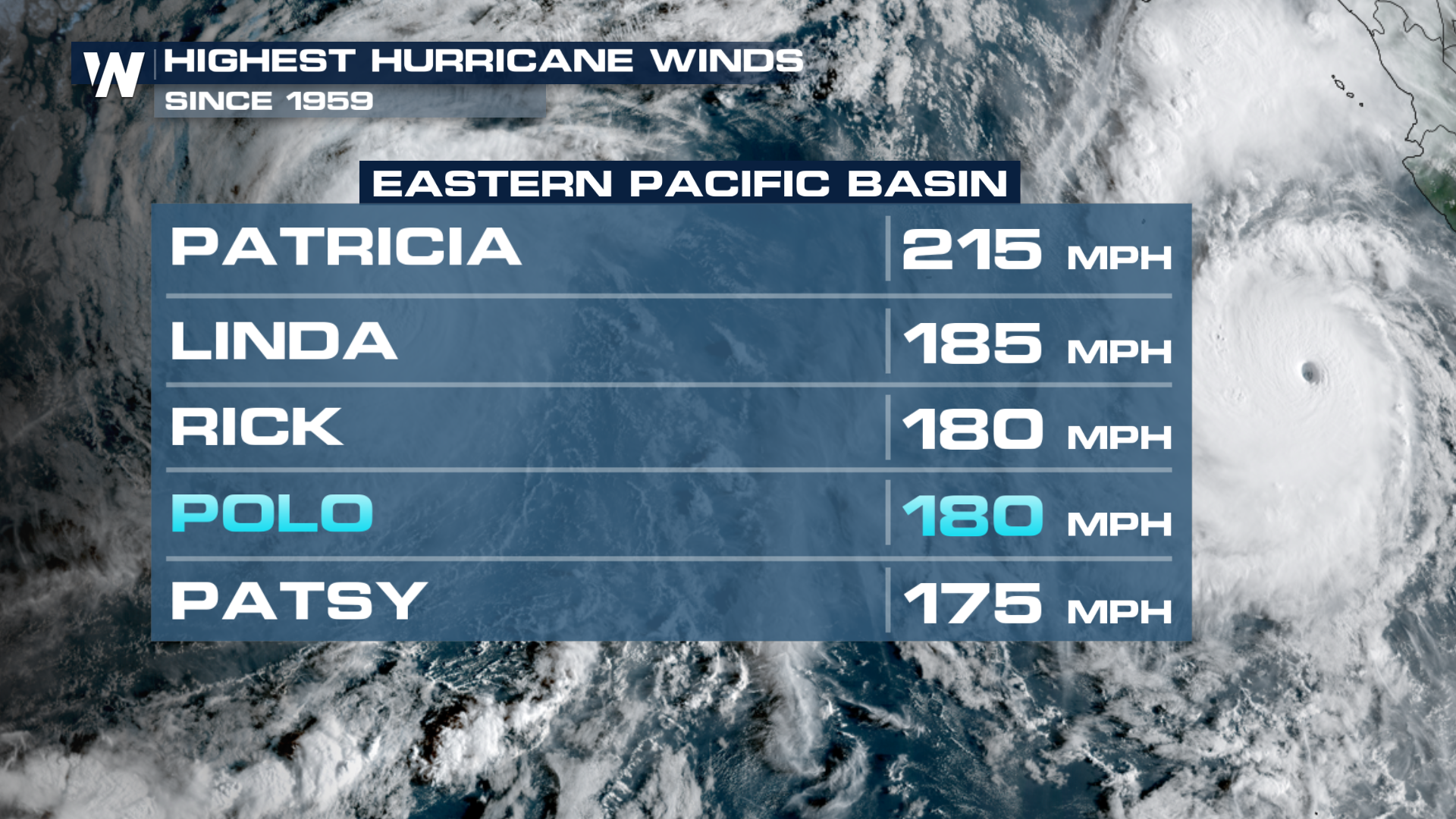
Polo once had a central pressure of 892 mb, the second-lowest on record (behind Patricia's insane 872 mb) in the satellite era in the Eastern Pacific. At the same time, its 180 mph sustained winds tie for third-strongest in the Basin.
 Polo made landfall twice in Mexico.
Rachel
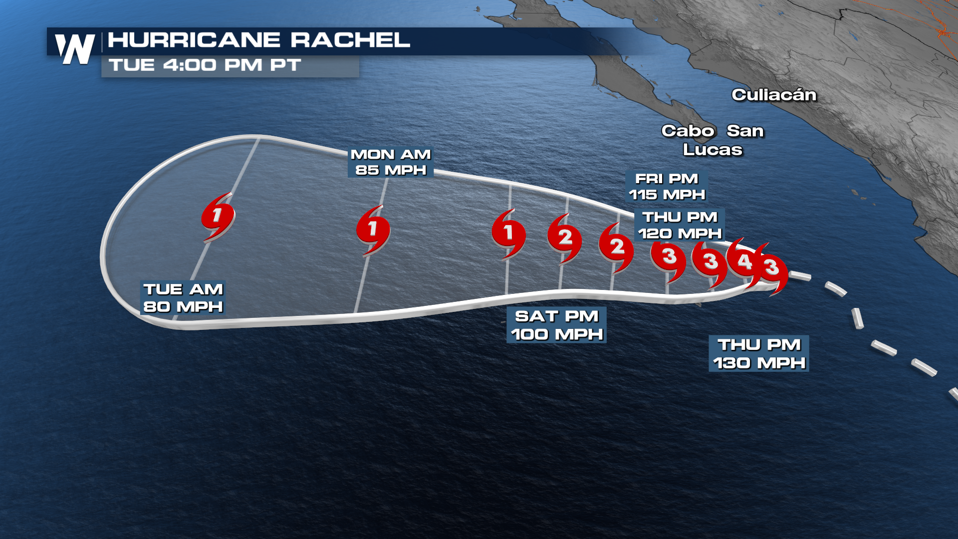
Rachel continues to trace the Mexico coastline, moving northwest through the week. It will strengthen to at least a Category 3 storm by Thursday, but will not have any direct impacts on land. It will likely make a left turn before the weekend south of the Baja California.
 Atlantic Basin
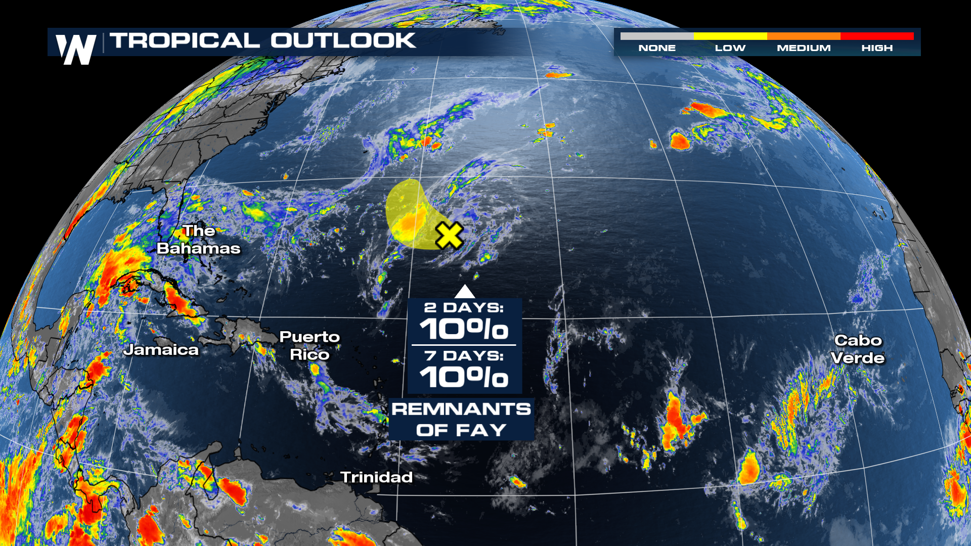
Meanwhile, the Atlantic remains very quiet, as record wind shear continues to tear apart tropical waves moving off Africa. In fact, there is now a new record for the year since there has not been a hurricane formation. This is the first time in 60 years the Atlantic Basin has not seen a hurricane since the satellite era in 1966. Interestingly, the remnants of Fay are talking again and there is now a low chance for some tropical redevelopment.
El Niño Fueling Pacific Activity
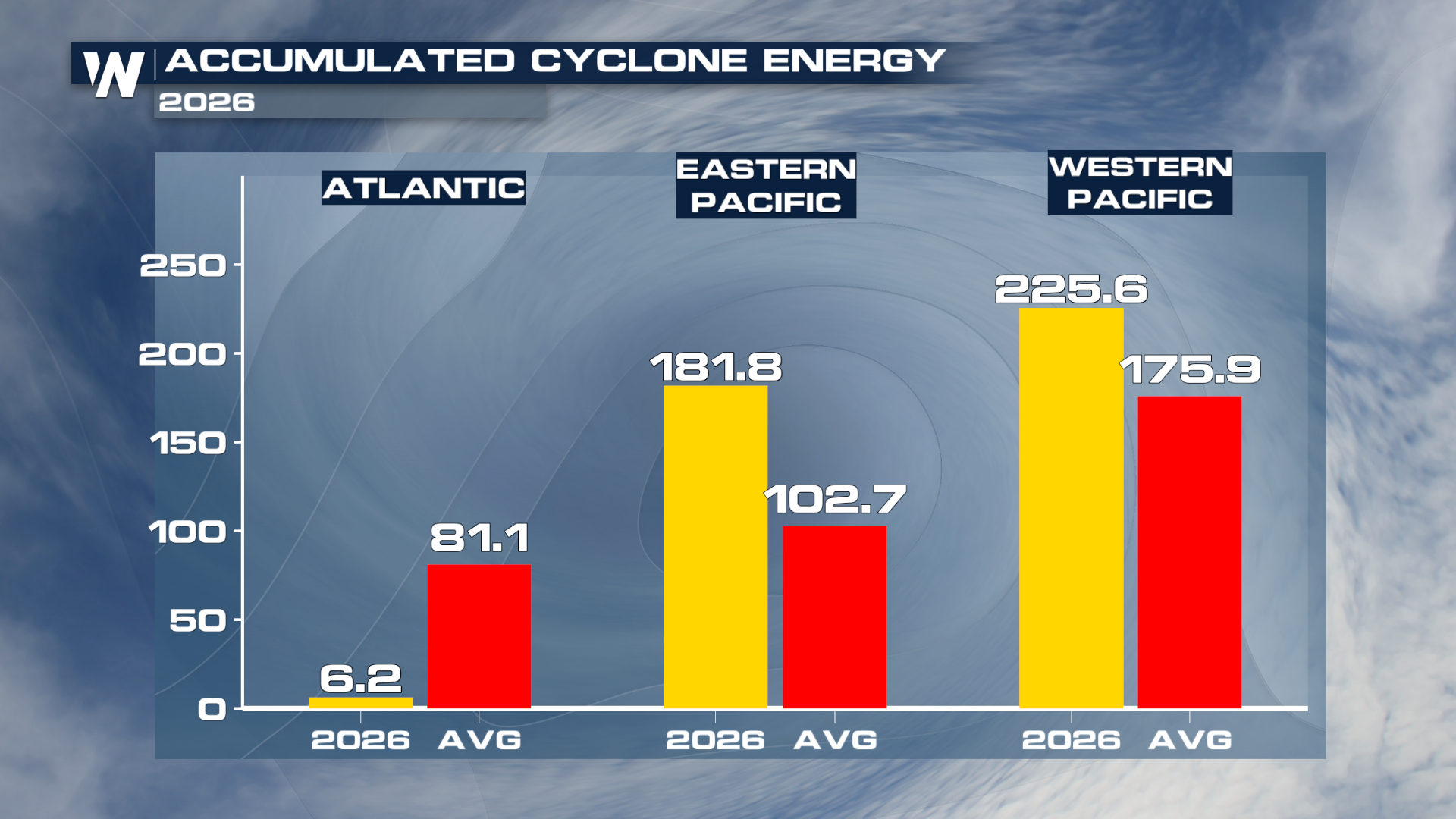
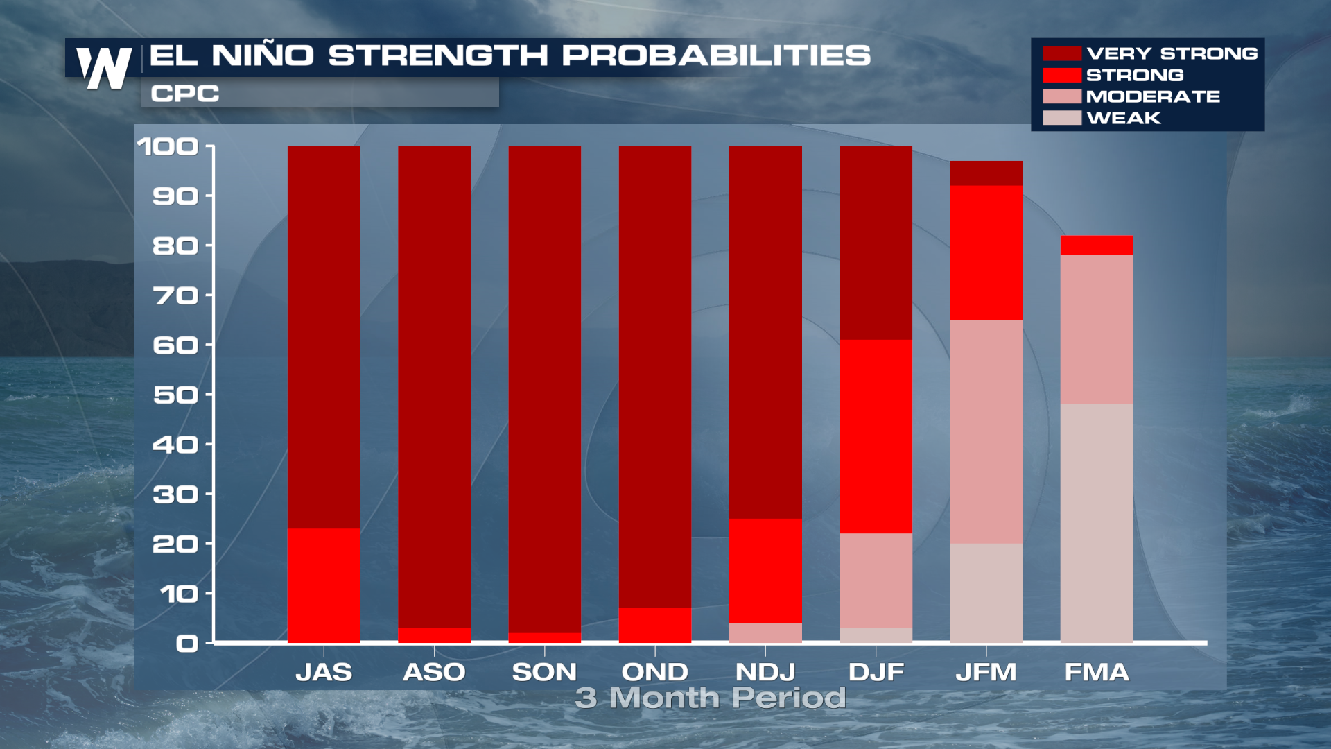
The surge in tropical activity comes as El Niño continues to strengthen across the equatorial Pacific. El Niño is characterized by warmer-than-average ocean temperatures across portions of the central and eastern equatorial Pacific. Those unusually warm waters can influence weather patterns around the globe while also creating an environment that can favor tropical cyclone activity in the Pacific.
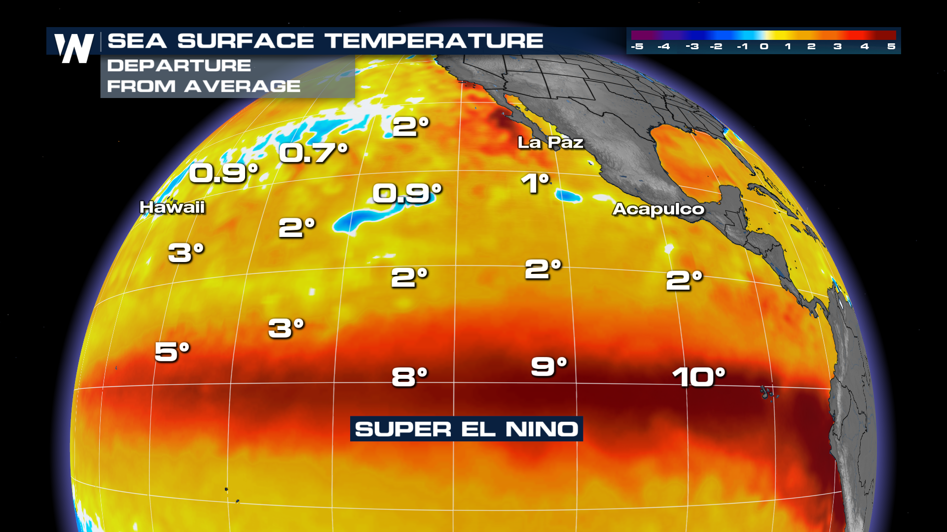 This year’s El Niño has already strengthened considerably, and forecasts indicate it could become exceptionally strong later this year.