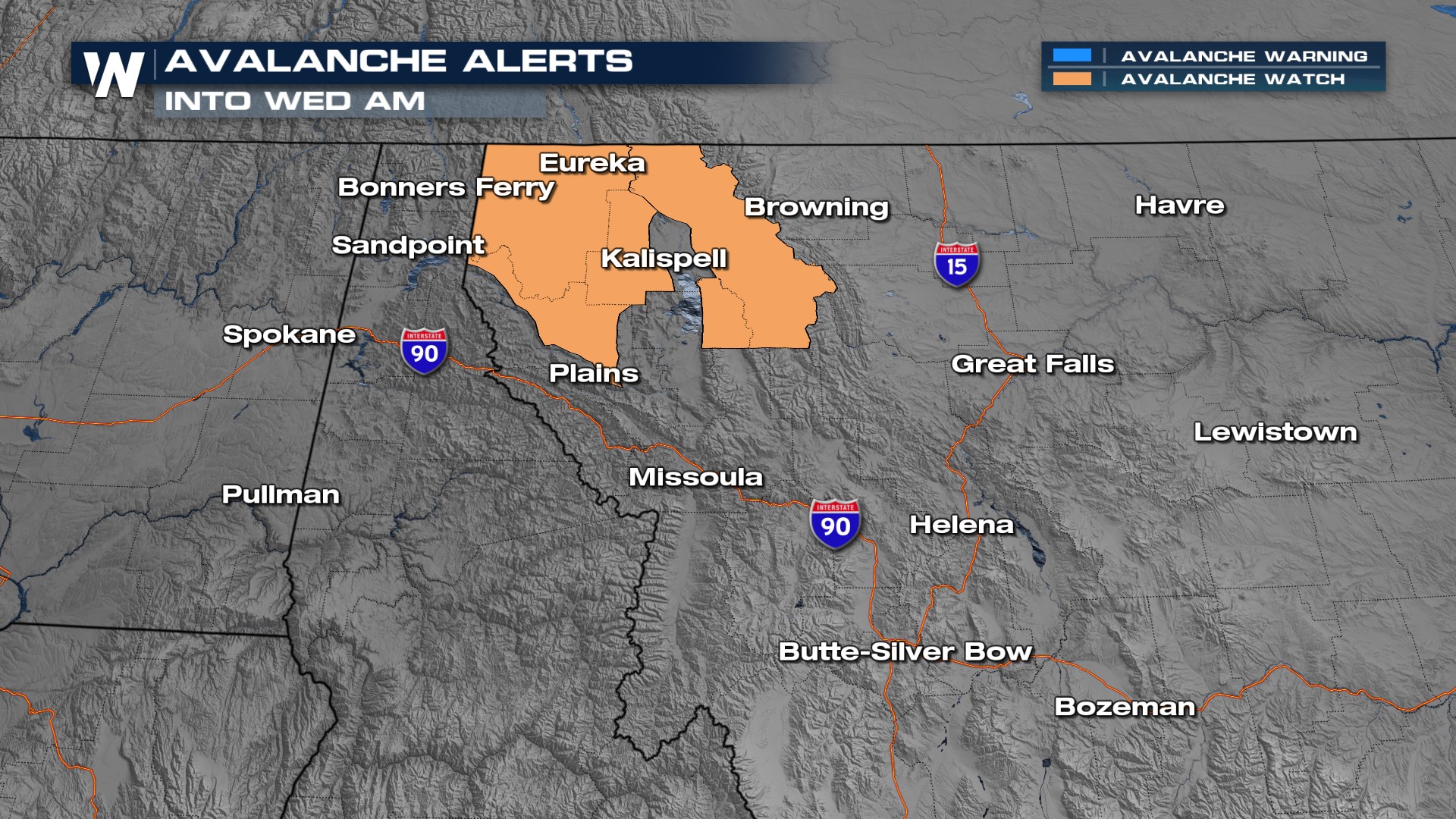
Avalanche Danger Increases Out West

NORTHWEST - Warmer air is forcing the rain/snow line (freezing level) in the Pacific Northwest and Northern Tier up to higher elevations. Rain and melting snow will increase the avalanche risk in the High Cascades, volcanoes, and mountains of British Columbia, Idaho, and Montana. These are sometimes referred to as 'wet avalanches'.
Forecast maximum daily freezing levels in the Cascades:
3/26: 10,000ft
3/27: 6,000ft
3/28: 4,500ft
3/29: 4,000ft
Forecast maximum daily freezing levels in NW Montana:
3/26: 10,000ft
3/27: 10,000ft
3/28: 6,000ft
3/29: 6,000ft
What Causes Avalanches?
Meteorologist Rob Bradley explains the dangers of avalanches:
Forecast Timeline
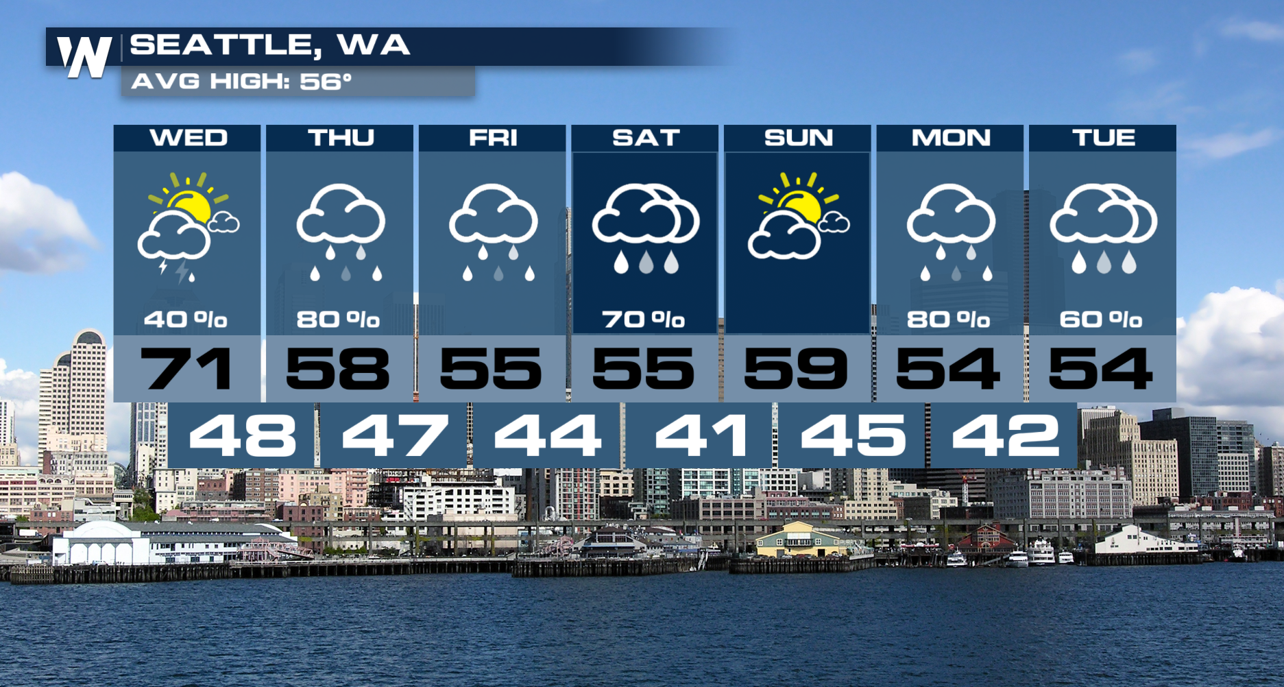
The next storm system arrives Wednesday afternoon and continues through Friday.
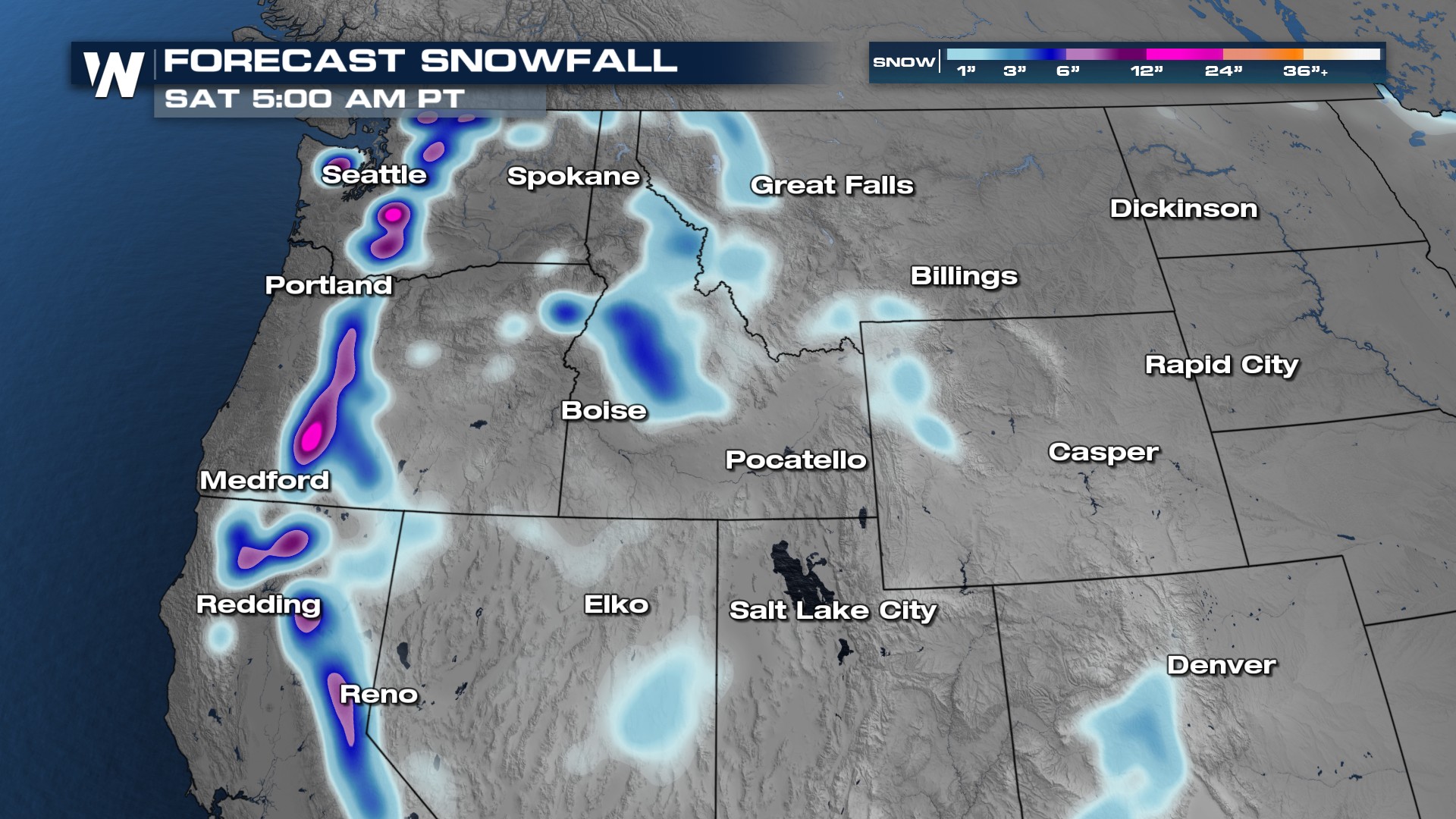
Forecast snowfall through Saturday with the heaviest accumulations at the higher elevations and rain at lower elevations.
 The next storm system will deliver rain to Seattle between Wednesday through Sunday.