Hot and Stormy in the Northeast

While the heat builds into the Northeast, rounds of thunderstorms are possible through the rest of the week. Through the rest of Wednesday evening, a Marginal Risk has been issued across portions of the Ohio Valley, Northeast, and western North Carolina (above).
Several boundaries, including a surface trough and cold front, will be the focus for thunderstorm development, particularly during the afternoon hours when the atmosphere reaches peak instability.
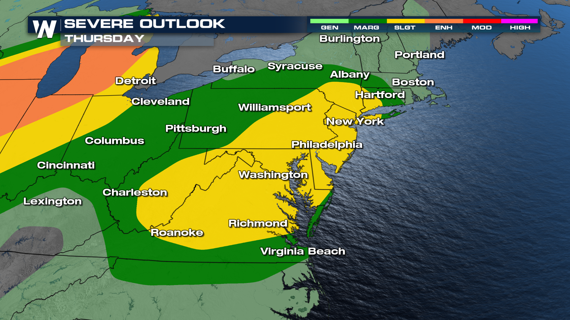
A level 2 Slight Risk has been highlighted for Thursday. This includes the New York City area and down the I-95 corridor through Richmond, VA. The risk area extends west into the Appalachian Mountains of West Virginia.
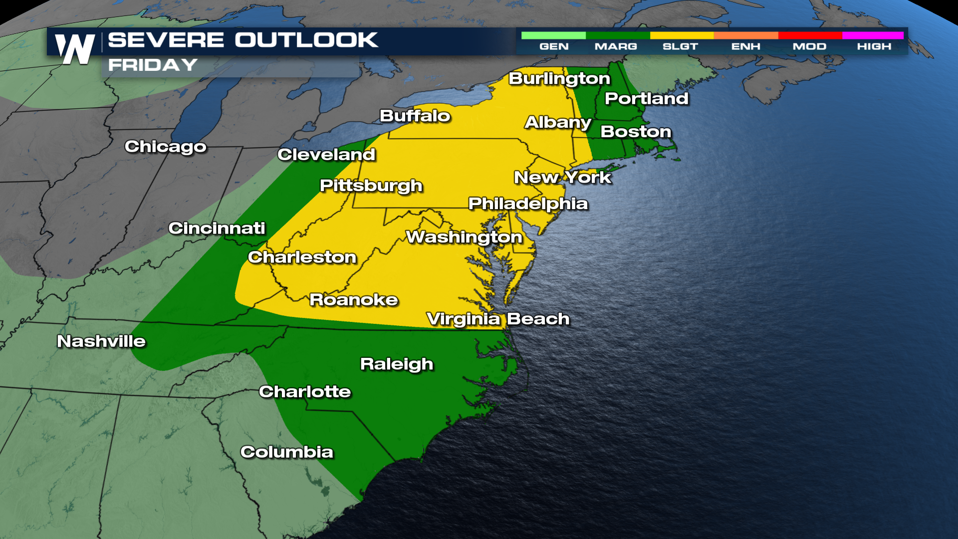
Many of the same areas will be under the threat of severe thunderstorms again on Friday, as the cold front finally sweeps across the entire region.
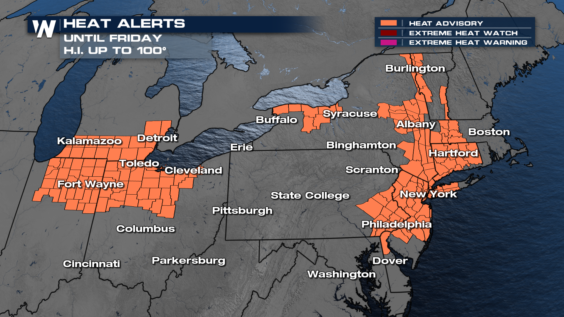
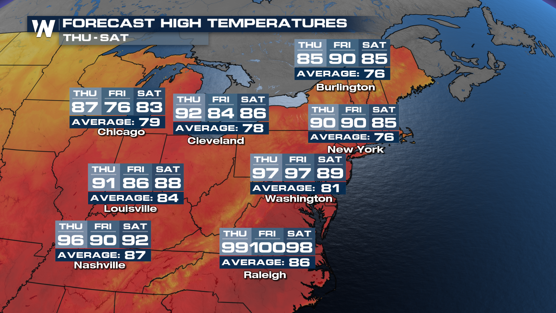
Hot and humid afternoons, with daytime highs reaching temperatures 15°+ above-average, will help to fuel the severe thunderstorm potential. Heat Advisories are in place across portions of Indiana, Michigan, and Ohio, as well as the Northeast.


