Avalanche Risk Remains Considerable Through the Rockies With More Snow This Week
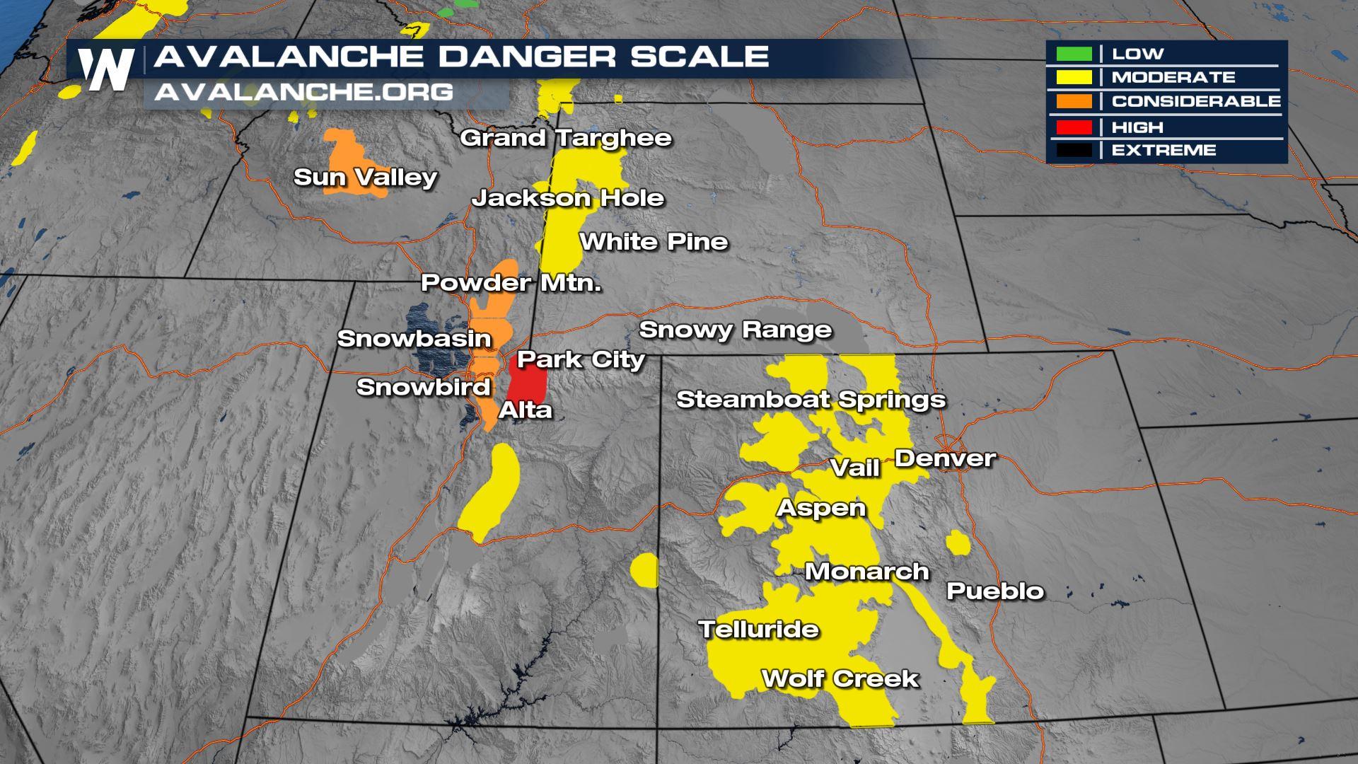
Are you headed into the High Country over the next few days? Be aware that the avalanche danger is considerable due to snowpack, melting, and weak slopes. Sadly, an avalanche in Utah, SW of Salt Lake City killed a snowmobiler on Monday. He was wearing an avalanche backpack and beacon that deployed an air bubble around him during the avalanche, but the snow and power of the slide were incredibly deep. With more snow on the way this week, the avalanche threat continues. Our next round of snow is headed into the Rockies tonight, with the potential for mountain snowfall on Thursday in both Utah and Colorado.
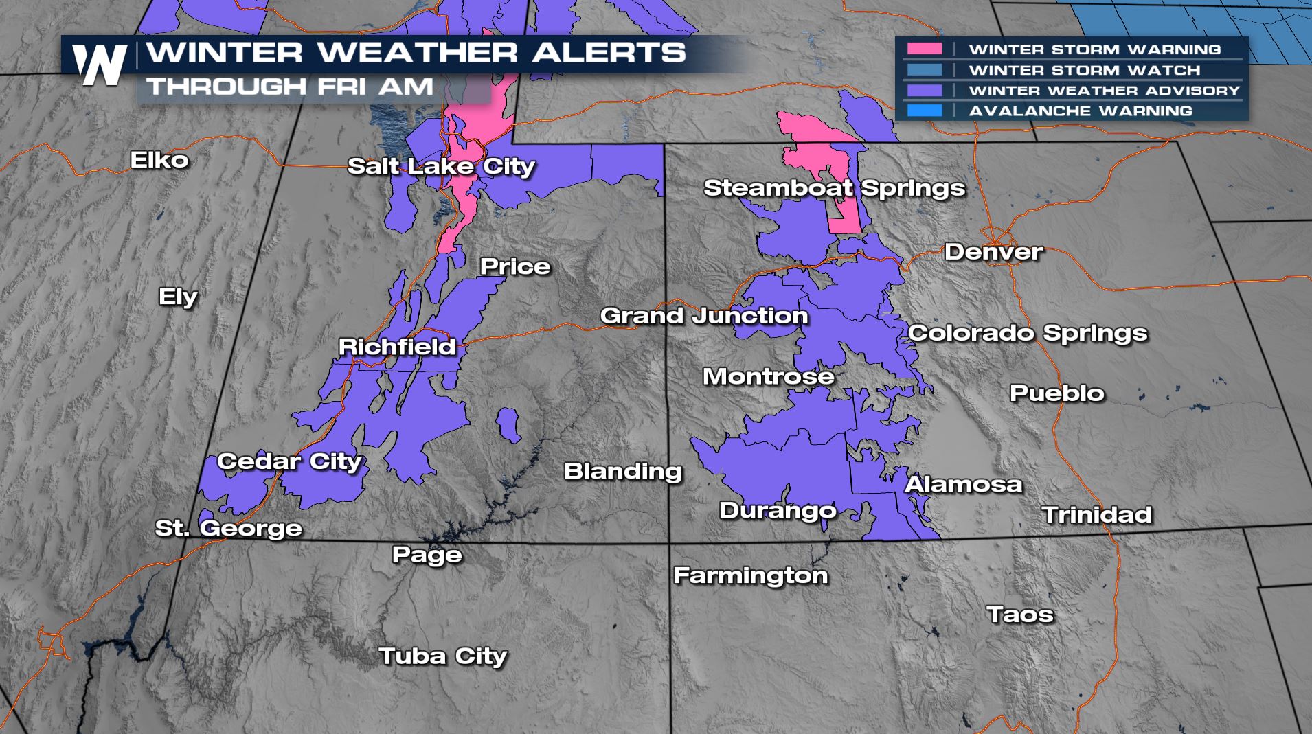 Snow has begun with a weak system through Utah and becomes more widespread into Colorado overnight and into the first part of Thursday. A lot will depend on the timing of the system out of California, but we expect difficult travel on I-70 and I-80 starting Wednesday. Most snow showers will wind down by midday Thursday with just a few showers lingering into the overnight and first part of Friday in Colorado.
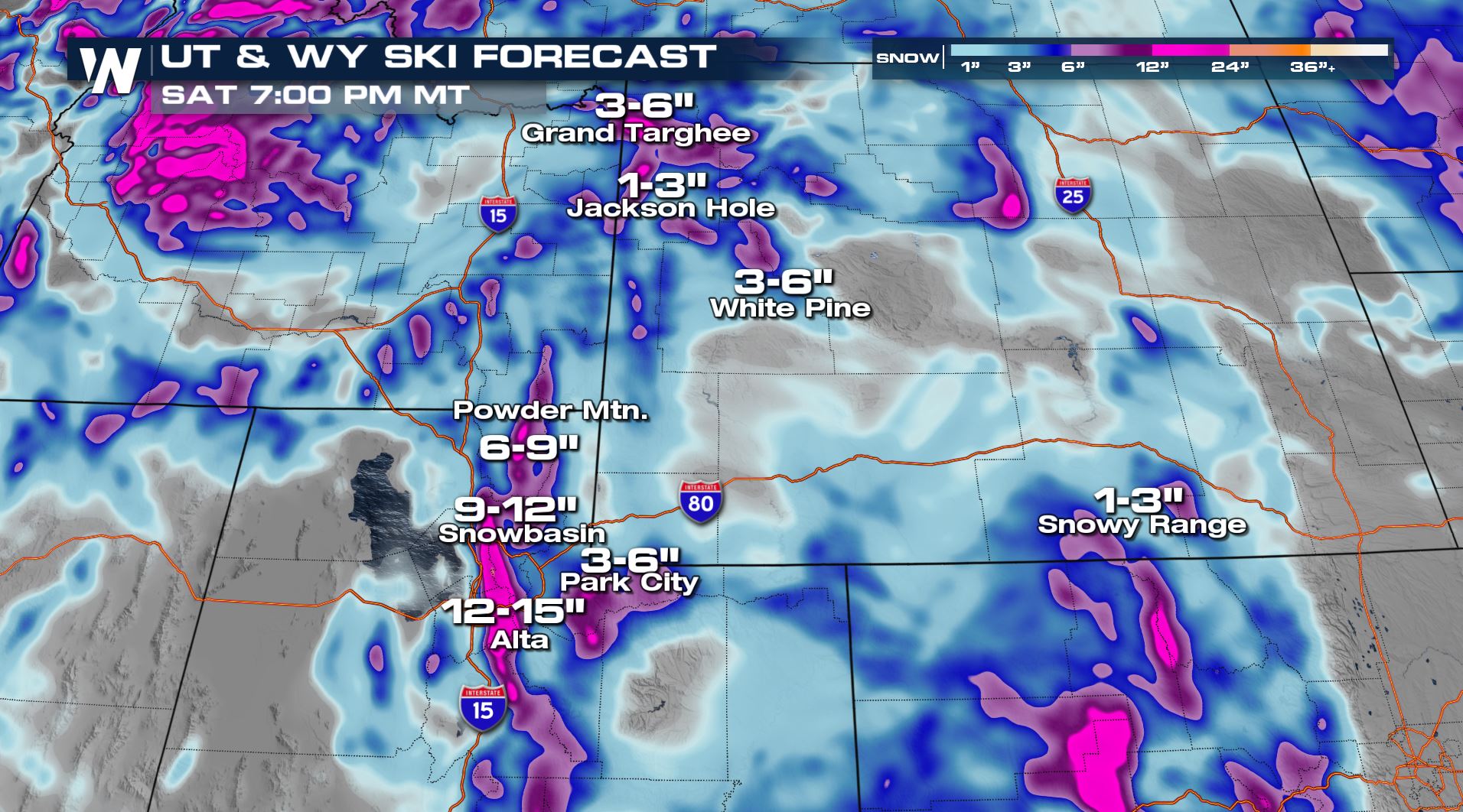
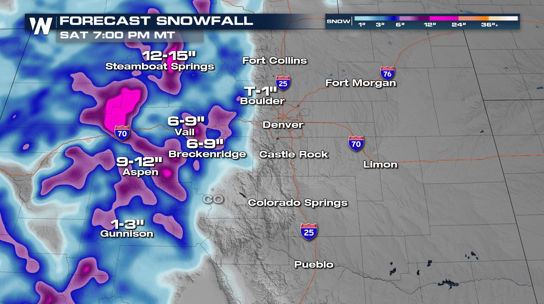
Snowfall totals in the high country will be in the range of 3-6" with locally higher amounts based on elevation and our heaviest snow showers. Stay weather aware if you are traveling or headed into the mountains to ski as snow will reduce visibility and make roadways slick.
Stay with WeatherNation for the latest system to impact the Rockies!


