Beryl's Remnants Bring Tornadoes, Flooding to Northeast

On the final day of (what was once) Hurricane Beryl, tornadoes and flooding ravaged parts of the Northeast as remnant moisture and energy pushed its way through the region. It came about two weeks after Beryl first formed in the middle of the Atlantic Ocean.
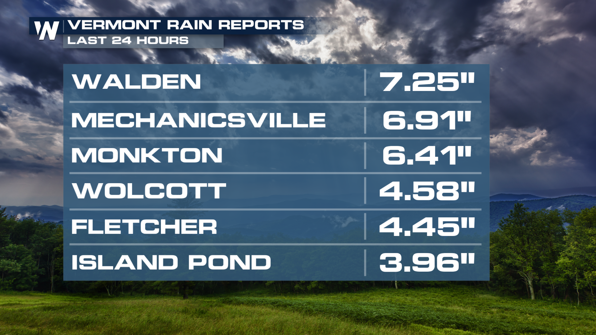 Northern Vermont, New Hampshire, Maine, and New York (state) received a widespread 2-4" rain accumulation, with some towns receiving up to 7". For the hilly terrain of northern New England, this was a huge deal because it led to flash flooding and washed out roads.
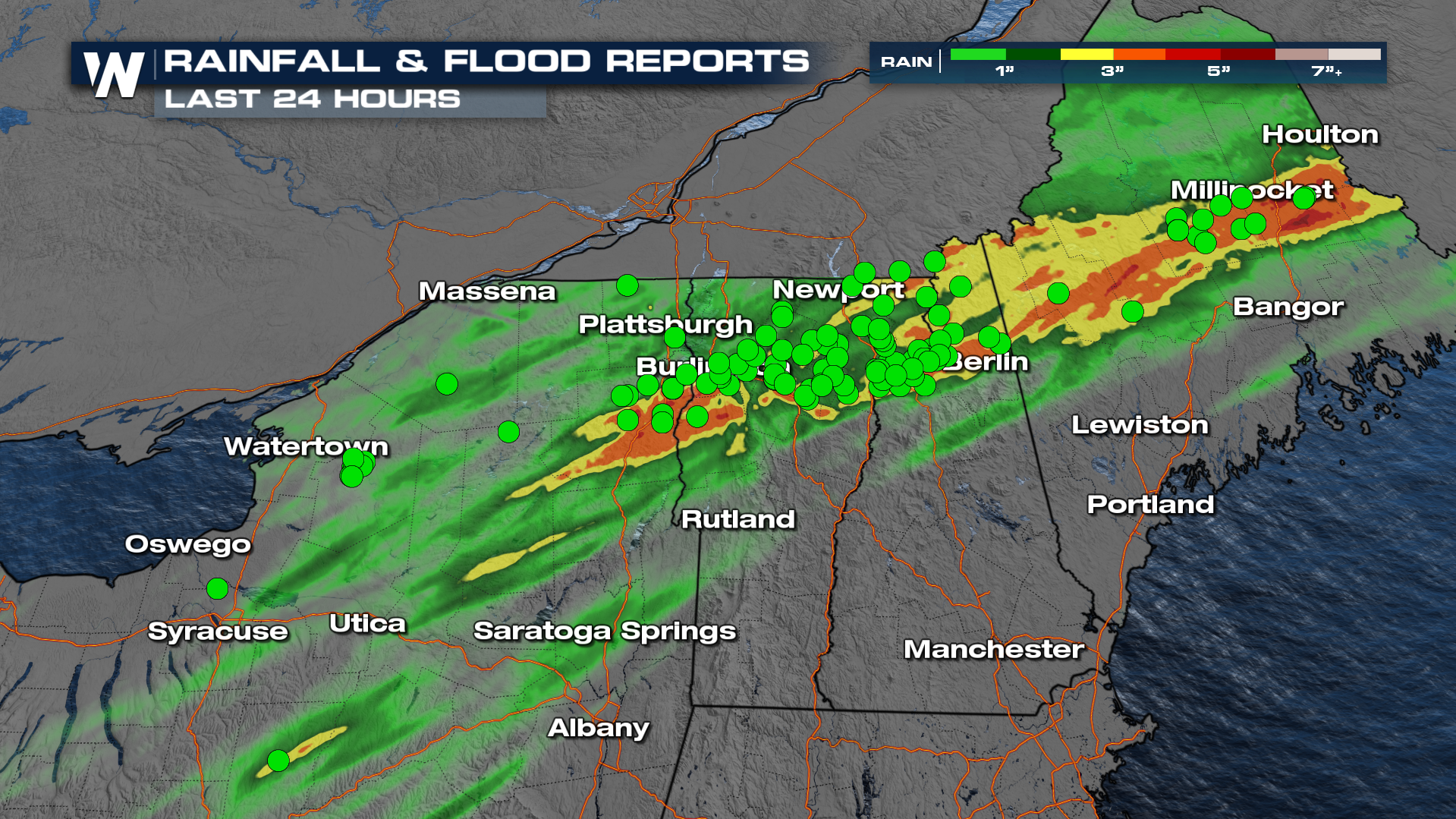 Showers and embedded thunderstorms were moving from the west-southwest to the east-northeast over the same area. These showers and storms were associated with the remnants of Beryl, once a category 5 hurricane in the Caribbean. Even though Beryl dissipated, it brought spin in the atmosphere and copious amounts of moisture and helped enable this severe weather outbreak.
Rivers in this region rose rapidly, some reaching moderate and major flood stage. The water had nowhere to go, except into the low levels of homes and businesses. Before the flooding occurred in northern New England late Wednesday into Thursday, tornadoes were ripping across New York state.
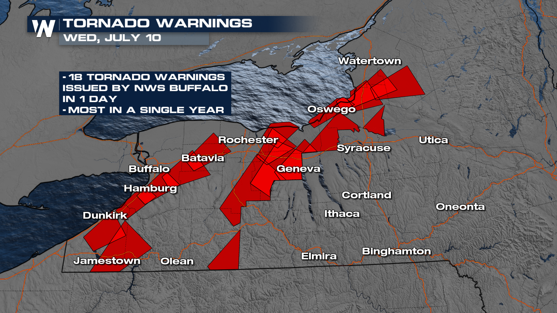 The National Weather Service (NWS) in Buffalo, NY says it issued 18 tornado warnings on Wednesday, July 10. According to their records, this is the highest number of tornado warnings NWS Buffalo has issued in a single year, let alone it happening in just one day! Out of these 18 warnings, at least 7 tornadoes have been reported as of this writing.
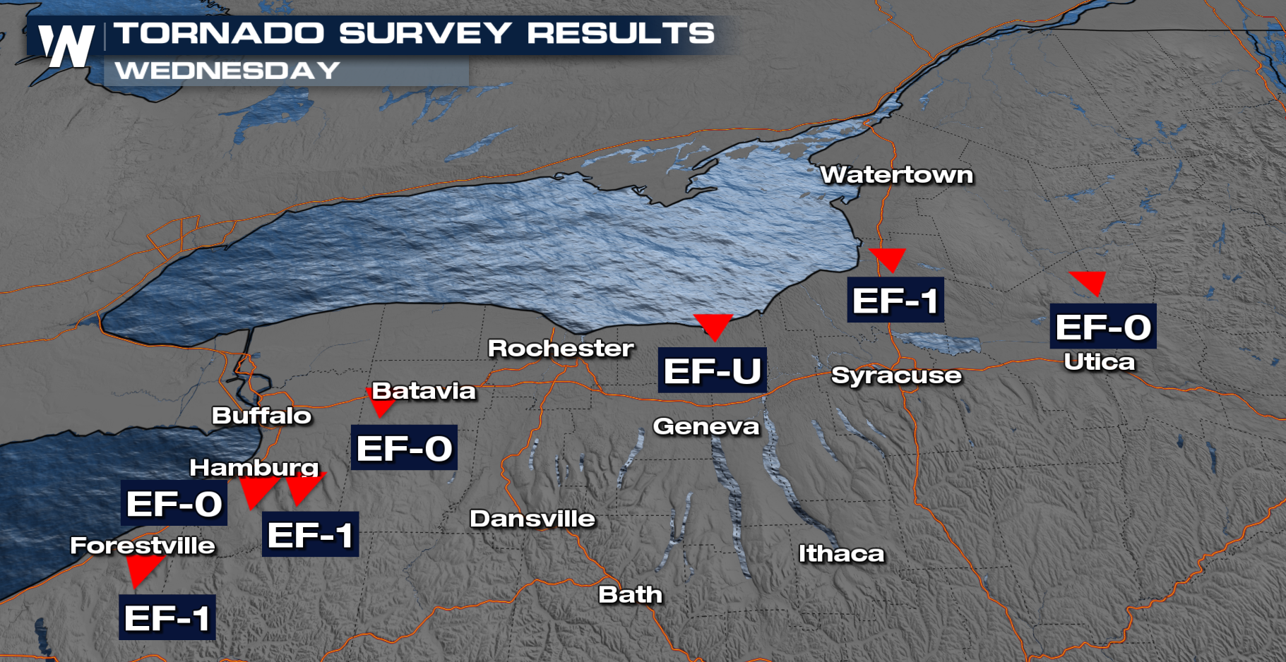
This goes to show that while tropical systems weaken and dissipate, we can never underestimate its remnants until the weather system has completely cleared a region. Inland threats usually include tornadoes and flooding after we watch hurricanes move onshore, even multiple days after they move onshore too.


